Bridge Rehabilitation of Central (US 101) and Bayshore (I-80) Viaducts

WB I-80 Full Weekend Closure
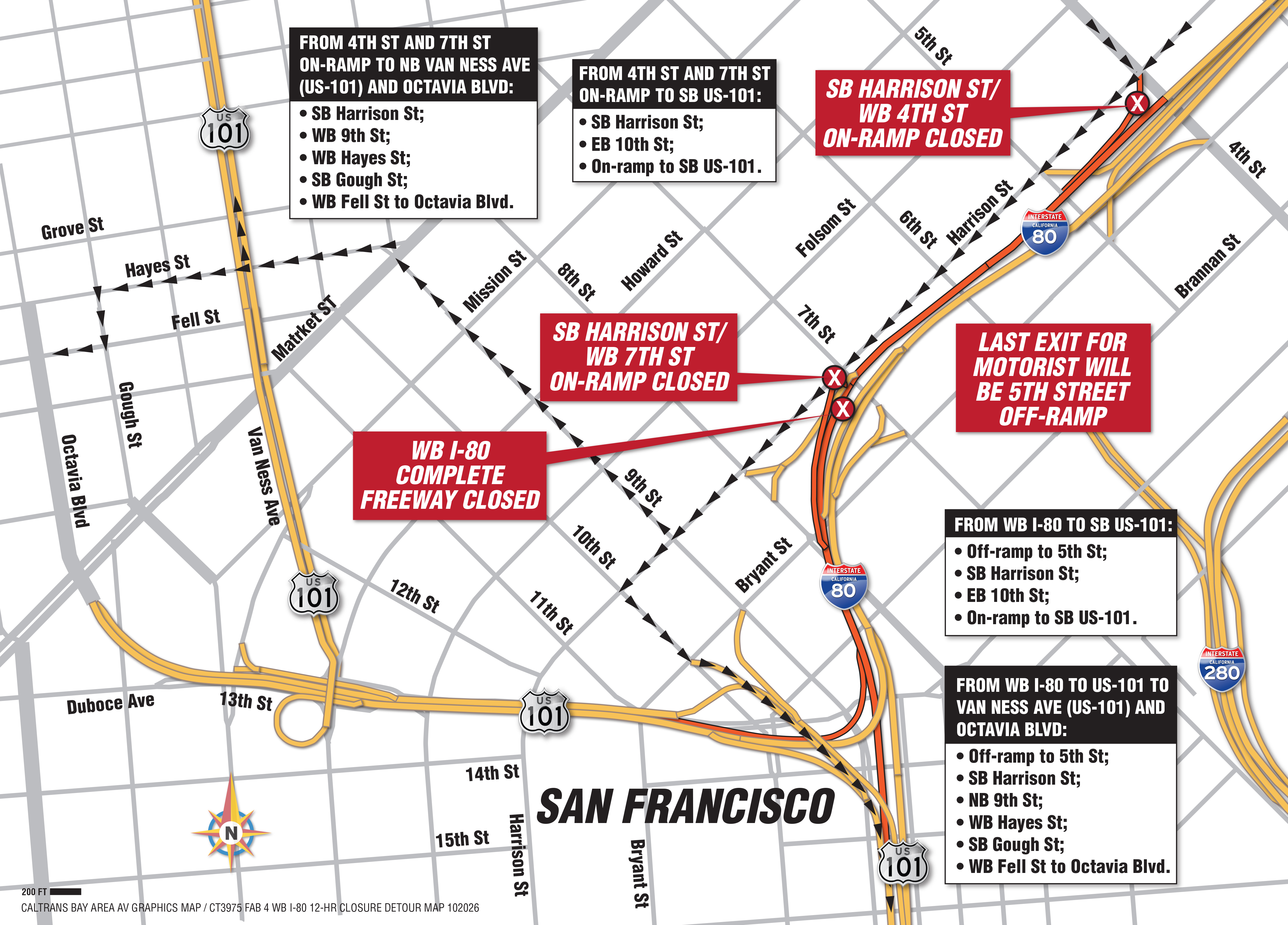
All lanes of westbound I 80 between 5th St. and 15th St. will be closed from October 23 to October 26 for joint construction work. During this closure, traffic will be diverted off the Fremont Street exit as well as the 5th Street exit, which will serve as the final exit before the closure limits. Once work is completed, Caltrans will reopen all lanes and continue scheduled improvements in the corridor.
Caltrans appreciates the public’s patience as crews work to maintain and improve Bay Area highways.
Advisories
- October 20, 2026
Update: WB I-80 Bayshore Freeway Weekend Closure Between 5th St. & 15th St.- Filipino and Spanish Language Traffic Advisories
- September 25, 2026
U.S. 101 SB Central Freeway to U.S. SB 101 Freeway Connector Ramp Weekend Closure - September 23, 2026
WB I-80 Bayshore Freeway Weekend Closure Between 5th St. & 15th St.- Filipino and Spanish Language Traffic Advisories
- September 3, 2026
Full Weekend Closures on Northbound U.S. 101 Bayshore Freeway (Hospital Curve) Planned September 4 –7 and September 18–21
What’s New?
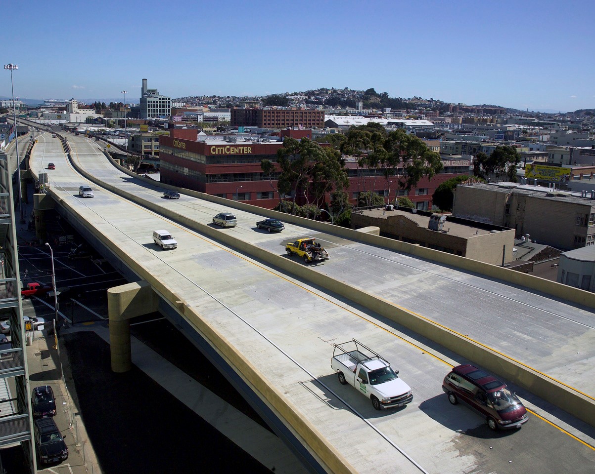
Rehabilitation of the Central (US-101) and Bayshore (1-80) Viaducts is a vital project to strengthen and rehabilitate the viaducts which are 71-years old. The project is complex, involving crews placing polyester overlays and joints and repairing bridge barrier rails and deck. Project duration is two years.
This project is located near the San Francisco-Oakland Bay Bridge. Commuters can expect traffic delays, lane reductions, and several full closures over the course of the two years. Updates and work schedules will be posted here as the project details are confirmed. Please check back regularly for the latest updates.
When is it Happening?
This project is expected to begin by the end of January 2026. Project duration is approximately two years.
Why is this Necessary?
It has been 71 years since the viaducts were constructed. With thousands of cars using the freeway daily, the structures will continue to wear. Repairing them now allows Caltrans to make crucial repairs and ensure the safety of the structures and the safety of the motorists and commuters who use them.
Traffic Impacts:
Throughout the rehabilitation, intermittent use of limited and full freeway closures will be necessary to ensure the safest working conditions for motorists and construction crews. During lane reductions, motorists and commuters can expect extreme traffic delays during nighttime work hours. During full weekend closures, motorists must entirely avoid impacted areas and use detours. Ideally, motorists should use public transportation when the freeways require lane reductions and full closures. Please check back to this page for the latest updates and work schedules.
Driver Benefits:
With the rehabilitation of the viaducts, this project will preserve and extend the life of the existing viaduct structures and improve ride quality. Additionally, the safety of drivers will be enhanced as well as the driving experience. Pedestrians and cyclists who walk or cycle nearby will also benefit from safer structures to traverse under and around.
Project Media Gallery
Additional project resources including downloadable maps, image galleries, and video clips can be found on the media resources page.
Contact
For real-time traffic, click on Caltrans QuickMap: https://quickmap.dot.ca.gov/
For 24/7 traffic updates, follow 511.org: https://x.com/511SFBay
For more information contact:
Lori Shepherd
Public Information Officer
San Francisco County CALTRANS - District 4
Thank you for your patience as we work to improve our roads and infrastructure.
Connect With Caltrans District 4 On Social Media




#CaltransLovestheBay