
Caltrans District 4 San Mateo County Newsletter
Winter 2026
Situated between the San Francisco Bay to the east and the Pacific Ocean to the west, San Mateo
County boasts some of the most scenic roadways in the state. Hundreds of thousands of motorists,
pedestrians, and cyclists depend on our highways and state routes every day.
HELPFUL LINKS:
- Customer Service Request
Online Maintenance Requests - Public Affairs
Who to contact if you have questions - Public Records Request
Submit a Public Information Request Form - Claims Department
File a Claim - Right Of Way & Surveys
Maps and Surveys of Caltrans Properties and Highways - Encroachment Permits
Working with Caltrans - Lane Closures
Planned Lane Closures - Job Opportunities
Work for Caltrans - Contractor's Corner
Work with Caltrans - QuickMap
Roadway Conditions
Visit our project website for additional updates.
For project questions & to sign up for our weekly newsletter, please contact us at EMAIL.
.png)
Caltrans, together with local elected officials, celebrate the El Camino Real Renewal Project groundbreaking.
Giant Eucalyptus Coming Down in Burlingame
As part of the El Camino Real Roadway Renewal Project, Caltrans District 4 is removing several large, aging trees along El Camino Real in Burlingame. While these trees have long contributed to the corridor’s historic character, many have reached the end of their lifespan. Their extensive root systems have damaged sidewalks, curbs, and pavement, creating uneven walking surfaces and accessibility challenges for pedestrians, including those using wheelchairs, strollers, and bicycles. In addition, decades of growth have interfered with drainage systems, accelerating roadway deterioration and increasing long-term maintenance needs.
In all 182 trees will be removed from the northbound side of the road in phase one of the project. Later in the project, 236 trees on the southside will come down. A comprehensive replanting plan is a core component of the project. Trees removed during construction will be replaced with saplings such as Emerald Elm, Lemon-scented Gum, Triumph Elm, and Mountain Gum trees. The replacement trees are being carefully selected to maintain the historic character of El Camino Real while reducing future conflicts with sidewalks and roadways. Over time, these new plantings will restore and refresh the corridor’s tree canopy, supporting healthier growth and improved longevity.
Once construction is complete, El Camino Real will continue to reflect Burlingame’s identity as a tree-lined boulevard, while also providing safer sidewalks, smoother pavement, improved drainage, and better access for all users.>/p>
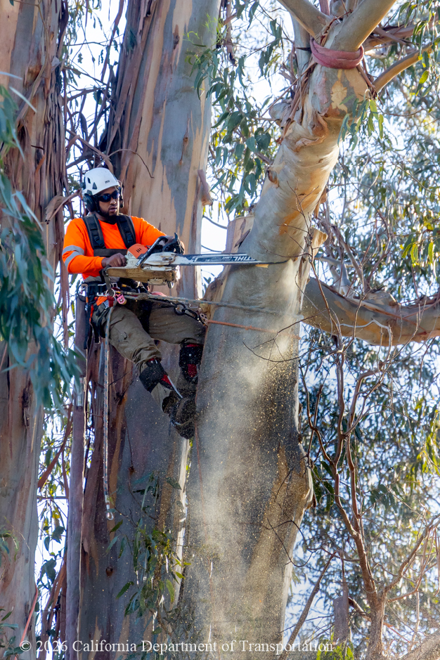
A tree specialist removes part of a large trunk of a eucalyptus tree..
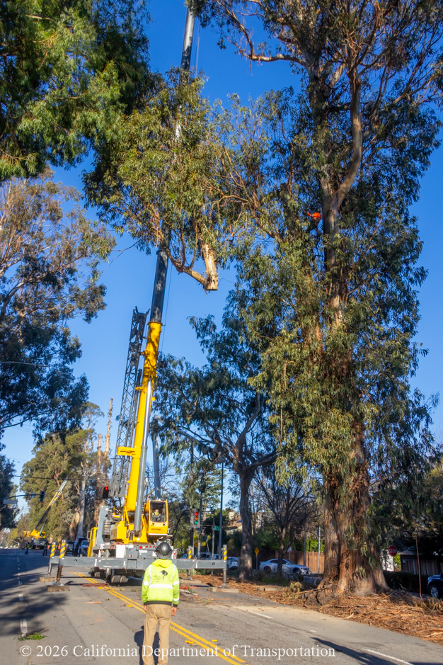
Tree removal equipment, including this large crane, necessitates full closures of El Camino Real.
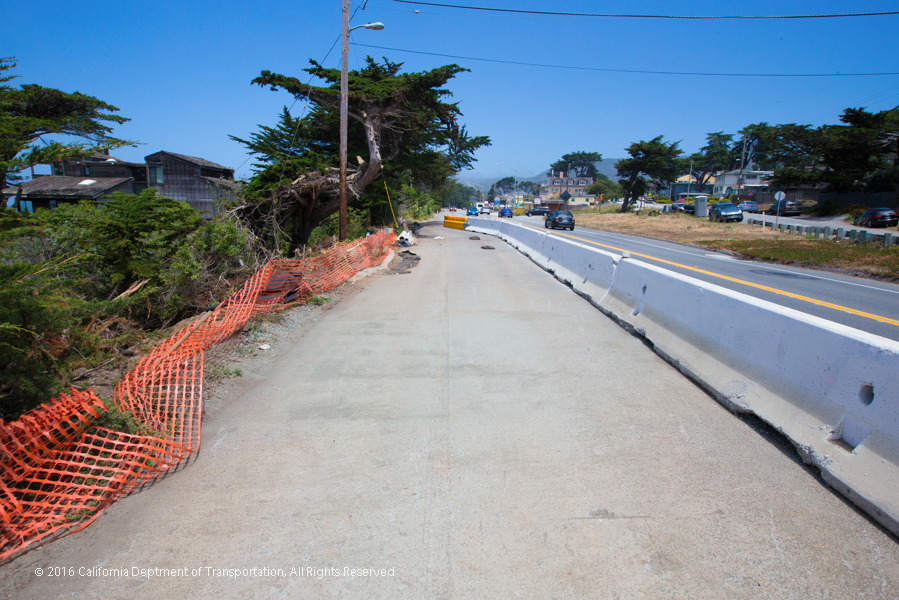
Highway 1 Multi Asset Project Utilizing K-Rail for Safety
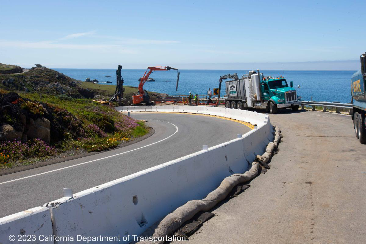
The Highway 1 Multi-Asset Roadway Rehabilitation Project, led by Caltrans District 4,is a major infrastructure effort to renew and improve a critical stretch of State Route 1between Moss Beach and Half Moon Bay. Continuing through the summer of 2027, the project will repave approximately 7.3 miles of the coastal highway in both directions and upgrade aging roadway systems. In addition to pavement work, the project aligns with Caltrans’ Complete Streets policy by incorporating new safety features that better serve people walking, biking, driving, and using transit. This includes installation of buffered bike lanes, high-visibility crosswalks, ADA-compliant curb ramps, improved bus stops, upgraded guardrails, drainage rehabilitation, and enhancements to traffic operations along the corridor.
To protect construction crews and pedestrians from traffic while working in the roadway, Caltrans employs heavy concrete barriers known as "K-Rail".
What are the primary functions of K-Rail?
K-Rail acts as a robust barrier that shields construction workers from the dangers posed by active traffic. This ensures that the workforce can operate in a secure environment, minimizing the risk of accidents and injuries. The barriers also serve to protect motorists and pedestrians from the potential dangers that arise from construction activities. By clearly demarcating construction zones, K-Rail helps prevent accidental entry into hazardous areas.
Where and when will K-Rail be placed during this project?
K-Rail is strategically placed and picked up at multiple locations to minimize traffic disruptions and reduce lane closures. K-Rail will be in place for various durations depending on the specific location and type of work being performed. In areas where only concrete work is required, the barriers will be removed once the walkways are complete and safe. However, in locations near signalized intersections, K-Rail is expected to remain on-site until late 2026.
Wheel Talk Podcast: Untangling the 101 - 92 Interchange
The U.S. 101 / SR-92 Interchange is one of the busiest and most complex transportation hubs in the Bay Area. It's also the focus of several major projects that often get confused with one another.
In a recent episode of the San Mateo County Transit District's Wheel Talk podcast, host Randol White and Caltrans public information officer Jeneane Crawford discuss the 101-92Short-Term Improvements project as well as other transportation efforts connected to the interchange and surrounding communities, each with its own purpose and timeline.
Setting the PACE: Public Affairs Customer Engagement Site is Now Live!
District 4 is proud to announce the launch of our new Customer Service Request (CSR) platform. PACE, the Public Affairs Customer Engagement site, provides a regularly updated breakdown of services requested and rendered across the district.
- The CSR dashboard aims to provide an overview of the responsiveness to maintenance services requested across the nine Bay Area counties.
- The data represented as month-to-date falls within a rolling 30-day Service Level Agreement (SLA) and is updated weekly.
- We strive to close 60% (or more) of all monthly service requests received via the CSR website portal.
- For more information or to leave comments/suggestions, please contact D4CSLTEAM@dot.ca.gov.
- To report a highway issue/problem, please submit a CSR ticket through the Customer Service Request Form.
Stay Connected with Caltrans
The San Mateo County newsletter will be distributed on a regular schedule.
🚗For 24/7 Traffic Updates
511.org or follow @511SFBay on X
🌉Real-Time Highway Information
Caltrans QuickMap: quickmap.dot.ca.gov
📞 General Information
(510) 286-4444
👤 Jeneane Crawford
Caltrans San Mateo County Public Information Officer
👤 Pedro Quintana
Caltrans South Bay Branch Chief

Representatives from Caltrans show local transportation leaders the 101-92 Short-term Improvements project site.
| CleanCA.com | CleanWaterCA | #BeWorkZoneAlert | X | Facebook | YouTube |
###