
Shoring was added to trenches at the Cholame project in order to better protect workers. District 5 photo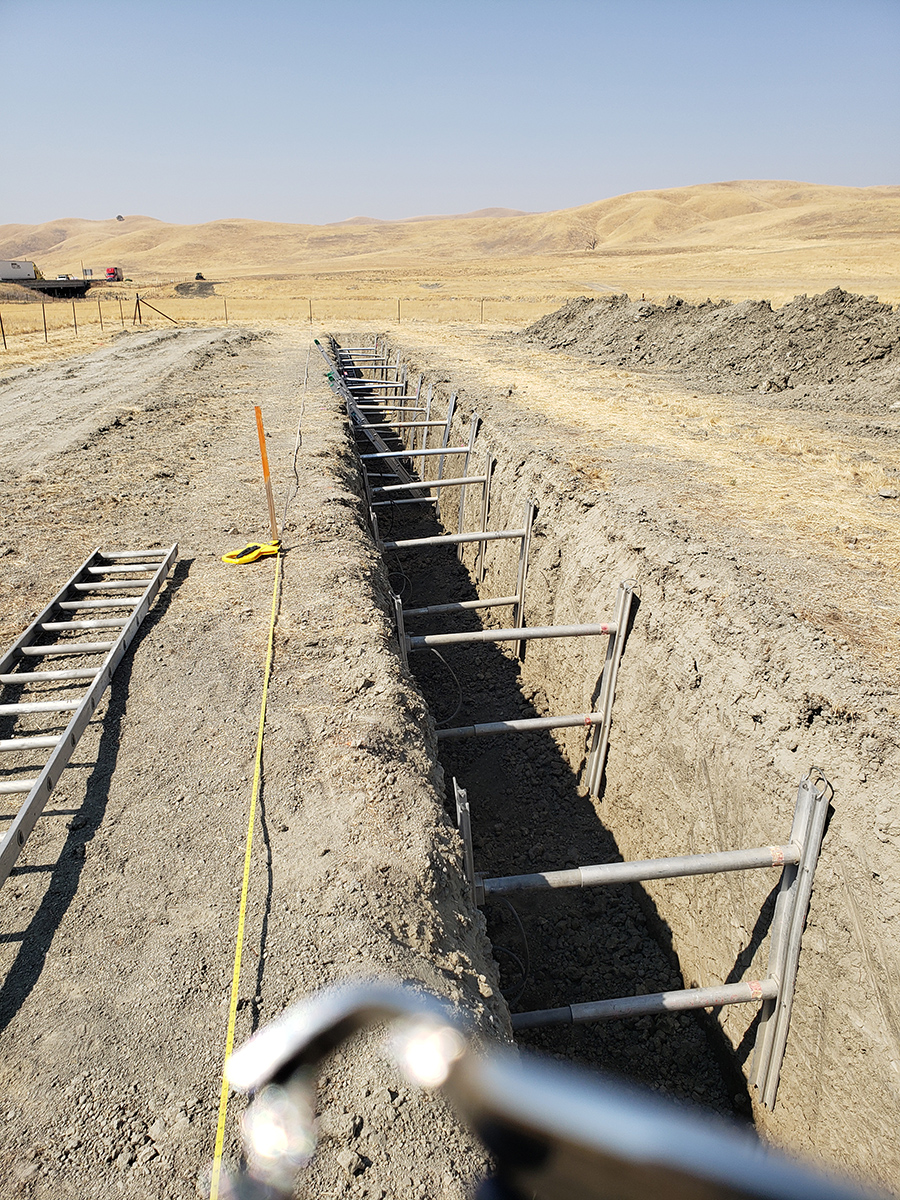
By Jim Shivers
District 5 public information officer
It has been said that you need to dig deep to get to the bottom of what you are looking for. This is exactly what Caltrans District 5 geologists and engineers, with the cooperation of the California Geological Survey and academic researchers, have done near a section of State Route 46 East in Cholame in northern San Luis Obispo County.
This effort to investigate the paleoseismology of the Parkfield/Cholame San Andreas Fault area, referred to during this study as the James Dean Paleoseismic Site (Dean died in a traffic collision nearby in September 1955) included excavating two trenches across the fault zone that are located within an abandoned floodplain.
Historically there have been six recorded earthquakes along the Cholame/Parkfield segment of the San Andres Fault that have measured about magnitude 6.0, with the most recent earthquake in 2004. The most recent surface rupture at the site in 1966 produced about 4 inches of offset in the pavement of State Route 46, with the potential of up to 11 feet of surface offset from a larger earthquake in this area.
This investigative work took place where a new bridge will be built, as part of the next phases of widening State Route 46 East from a two-lane highway to a four-lane expressway from the Shandon Roadside Rest Area to the Kern County line. Construction on this $55 million project is expected to begin in early 2021.
The information gathered during this trenching effort was to determine if the new bridge could be sited without crossing the active fault splays and will be shared with Caltrans design engineers who will strive to create a structure that can withstand both strong shaking and ground ruptures from future earthquakes similar to those that have hit the region over the course of time. In order to gather this data, a pair of 300-foot-long trenches were excavated, approximately 8 feet deep. These trenches show evidence of numerous earthquakes and the near surface presence of groundwater in this area which was once a marshy wetlands area thousands of years before drainage channels could capture and re-direct the water coming from the north.
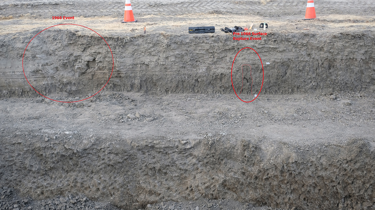
This photo shows evidence of earth movement during the 1857 earthquake and earlier seismic events, as well as evidence of flooding in the Cholame area during the 1861 storm season.
District 5 photo
A closer look at the layers of soil deep within the trench shows evidence of the surface rupture during the 1857 Fort Tejon earthquake, perhaps the largest historical quake in California, a massive event estimated at magnitude 7.9 with an epicenter, approximately near the Cholame area, rupturing some 20 miles northwest and 160 miles to the southeast with up to 30 feet of surface offset. The impacts from this earthquake in this region were strong and are easily visible to the team of geologists performing this investigation.
Recognizing evidence today from the 1966 earthquake has more challenging with the topographic surface slightly raised with visible evidence of fault cracking limited to the pavement of State Route 46. This investigation also showed evidence of flooding in this region during the Great Flood of 1861, which followed weeks of heavy rain and snow in California.
Caltrans District 5 Geologist Douglas Cook and his colleagues from the California Geological Survey, Arizona State University and San Diego State University are already sharing their findings with the academic community. The next step of this research will focus on determining the ages of the earthquakes recognized in the trenches with samples taken for laboratory testing.
“This process of looking back into time will help ensure the traveling public will encounter a reliable infrastructure as Caltrans looks ahead to the future,” said Cook as he completed his detailed tour of this soon to be construction site.