
California State Scenic Highways

Introduction
The Department of Transportation (Caltrans) manages the State Scenic Highway Program. Caltrans provides guidance to local government agencies, community organizations and citizens that are pursuing the official designation of a State Scenic Highway.
Scenic Highway Program History
In 1963, the State Legislature established the California Scenic Highway Program through Senate Bill 1467 (Farr). The bill declared:
"The development of scenic highways will not only add to the pleasure of the residents of this State, but will also play an important role in encouraging the growth of the recreation and tourist industries upon which the economy of many areas of this State depend."
Senate Bill 1467 added Sections 260 through 263 to the Streets and Highways Code. In these statutes the State proclaims intent to:
“establish the State's responsibility for the protection and enhancement of California's natural scenic beauty by identifying those portions of the State highway system which, together with adjacent scenic corridors, require special conservation treatment." (Scenic corridors consist of land that is visible from, adjacent to, and outside the highway right-of-way, and is comprised primarily of scenic and natural features. Topography, vegetation, viewing distance, and/or jurisdictional lines determine the corridor boundaries.)
Existing law provides Caltrans with full possession and control of all State highways. This legislation places the Scenic Highway Program under the stewardship of Caltrans.
The legislation further declares the intent of the State to assign responsibility for the regulation of land use and development along scenic highways to the appropriate State and local governmental agencies. A county highway component was later added to the Scenic Highway Program in Section 154 of the Streets and Highways Code.
Scenic Highways Guidelines
- Provides guidance on the process for officially designating a California State Scenic Highway (PDF is undergoing an update for ADA compatibility)
Example of Scenic Highway Proposal and Corridor Protection Program
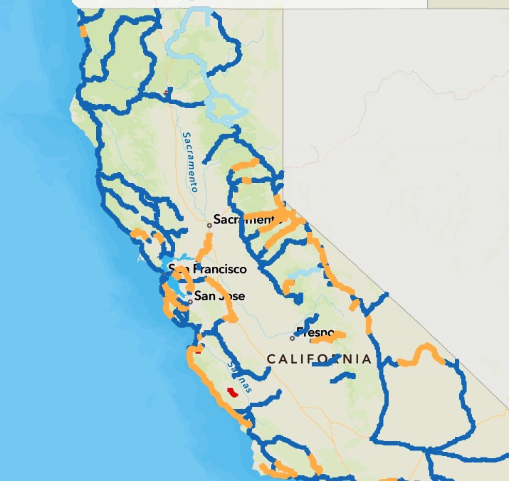
State Scenic Highway Map
Scenic Highway System Lists
The State Scenic Highway System list is codified in the California Streets and Highways Code (SHC). The spreadsheet and the GIS map contain postmiles which correspond to the locations listed in the SHC. If any discrepancies are found between postmiles and the text, the SHC text prevails.
- List of eligible and officially designated State Scenic Highways (XLSX)
- List of Officially Designated County Scenic Highways* (PDF)
*Obtaining State recognition as an officially designated County Scenic Highway requires following the same Scenic Highway Program process that applies to State Routes. See the Scenic Highway Guidelines (PDF) *for more information.
Scenic Resource Evaluation Guidance for Officially Designated State Scenic Highways
- The Standard Environmental Reference, Environmental Handbook, Volume I: Chapter 27-Visual & Aesthetics Review provides guidelines for conducting scenic resource evaluations on State Scenic Highways.
- The template for SREs is on the Caltrans VIA webpage.
- The Project Development Procedures Manual (PDPM) covers Scenic Resource Evaluation topics in Chapters 3, 8 and 29