The Big Picture
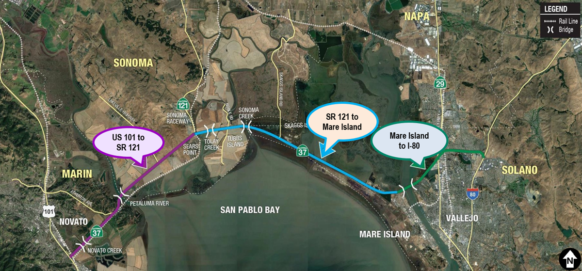
State Route 37 is an important regional connection linking the north, east and west SF Bay Region following along the northern shore of San Pablo Bay. This 21-mile long roadway from US 101 to I-80 connects job markets and housing within Marin, Sonoma, Napa and Solano counties.
The future of the State Route 37 Corridor requires finding solutions to traffic congestion, periodic flooding, and rising sea levels. But it will also require balancing transportation needs with protecting and enhancing sensitive marshland habitats. Planning a long-term solution presents an opportunity to provide bicycle, pedestrian, transit, and carpool options for all travelers, and enhance the quality of life for residents and build stronger local and regional economy for all. Caltrans is working with its partner agencies, The Metropolitan Transportation Commission and the four North Bay County Transportation Agencies to develop a more resilient corridor.
Planning & Environmental Linkages