
Previous EIT Winners
Each year, Caltrans highlights the best of its work and the work of its partners through the annual Caltrans Excellence in Transportation Awards Program. Caltrans received entries from within Caltrans, public agencies, private contractors and consultants across the state. Congratulations to those of you who have worked hard to make these projects a reality and providing positive and measurable improvements in transportation, resulting in a lasting benefit to the state of California.
Category 1 – Multimodal Transportation
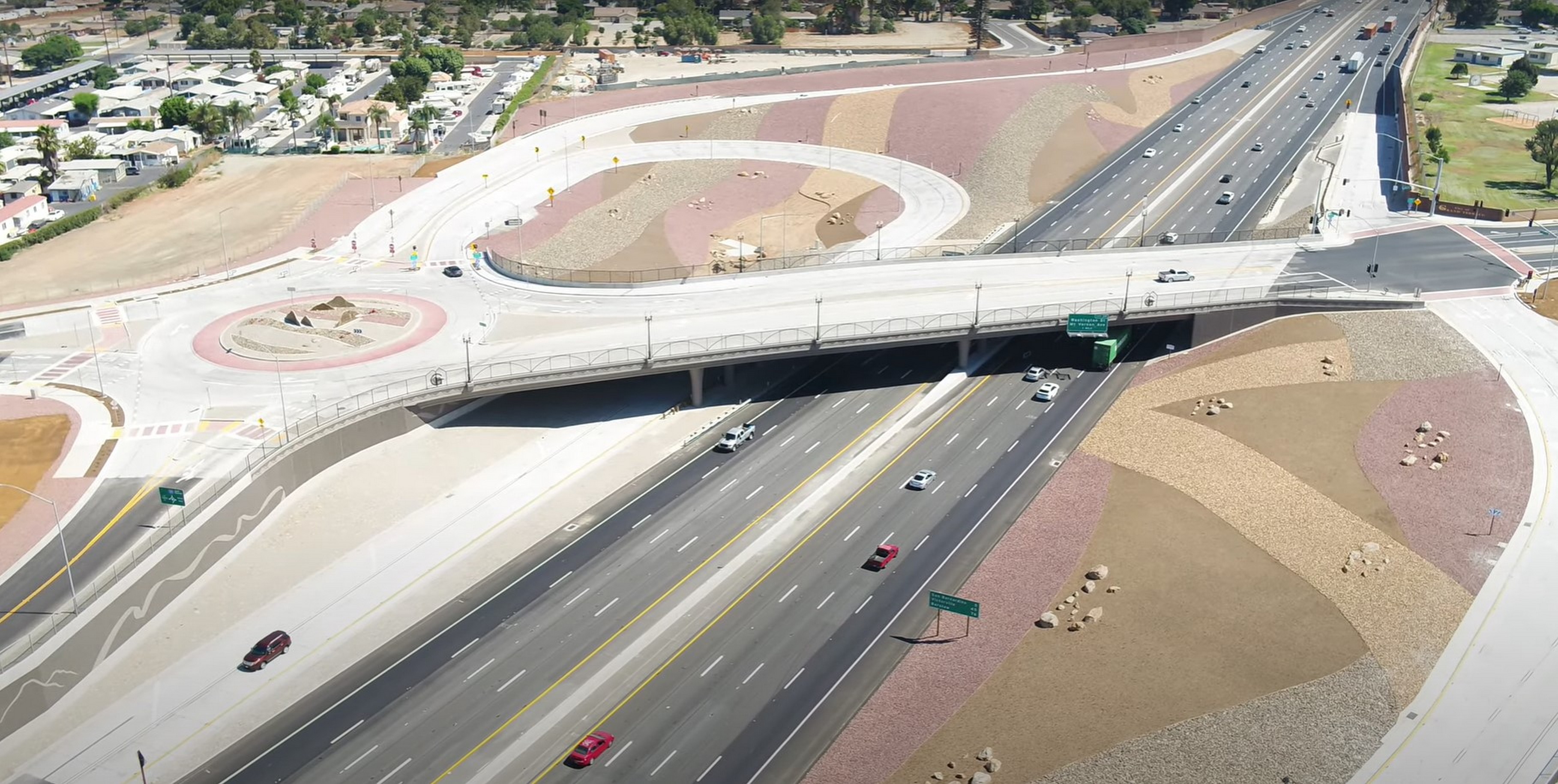
Bardin Road Safe Routes to School Improvements
- Kimley-Horn
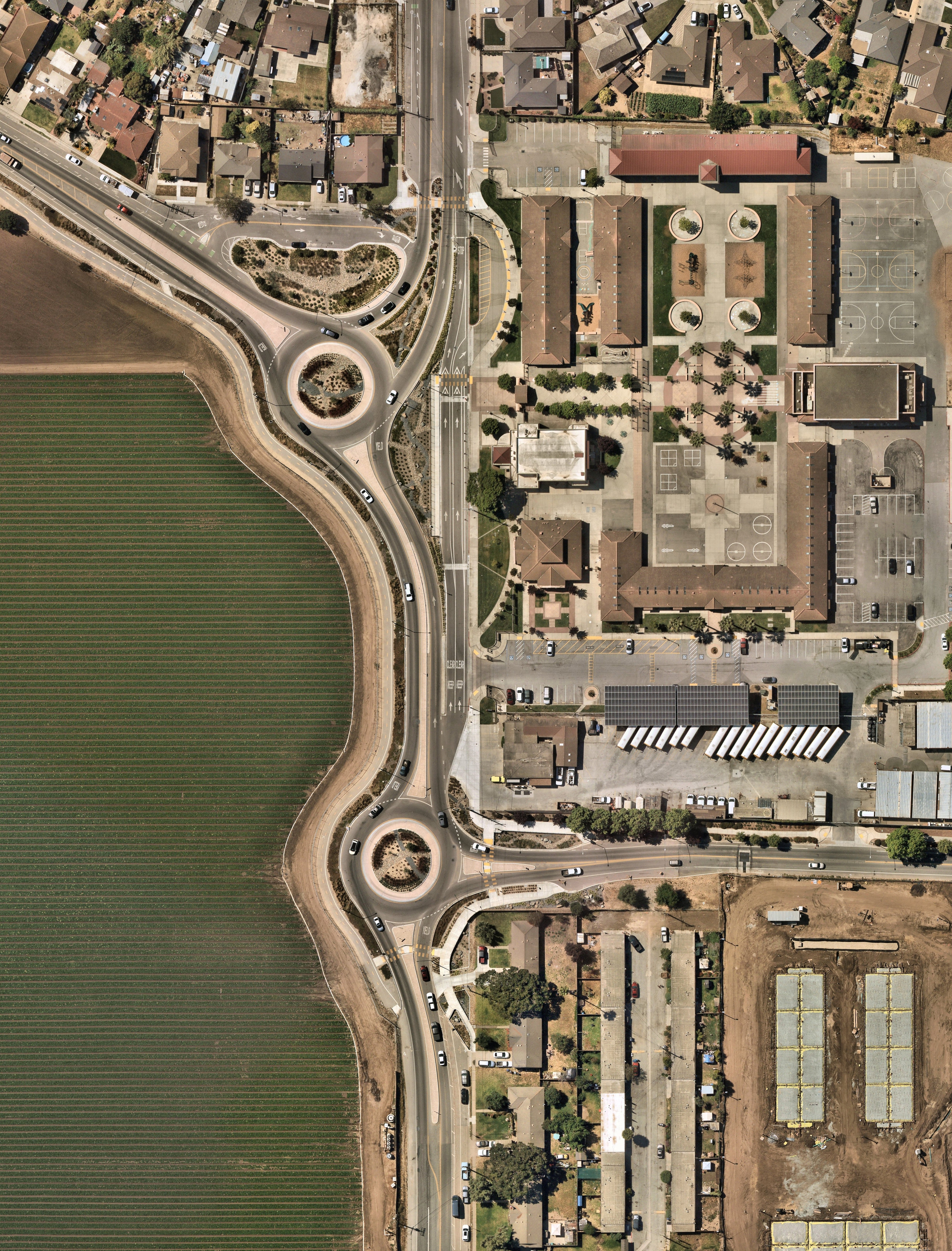

The Bardin Road Safe Routes to School Improvements Project is a road-reconfiguration and safety-enhancement project designed to improve vehicular, pedestrian and bicycle access to Bardin Elementary School. The work required construction of two contiguous roundabouts to maintain vehicular flow while providing safe access to the school’s drop-off and pick-up zone. The size of the drop-off zones was nearly doubled, and student safety enhanced exponentially by fully separating the student drop-off area from through-traffic.
The project was a partnership between the City of Salinas and the Alisal Union School District, which serves a student population that has 85% enrolled in the Free and Reduced Lunch Program. The dual roundabout alternative was considered the most effective for addressing the needs of non-motorized modes of transportation while maintaining vehicle connectivity to the school.
Category 2 – Climate Action
I-5 San Elijo HOV and Double Track Project
- Caltrans District 11
- San Diego Association of Governments (SANDAG)

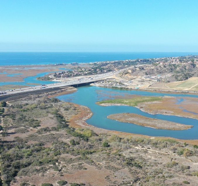
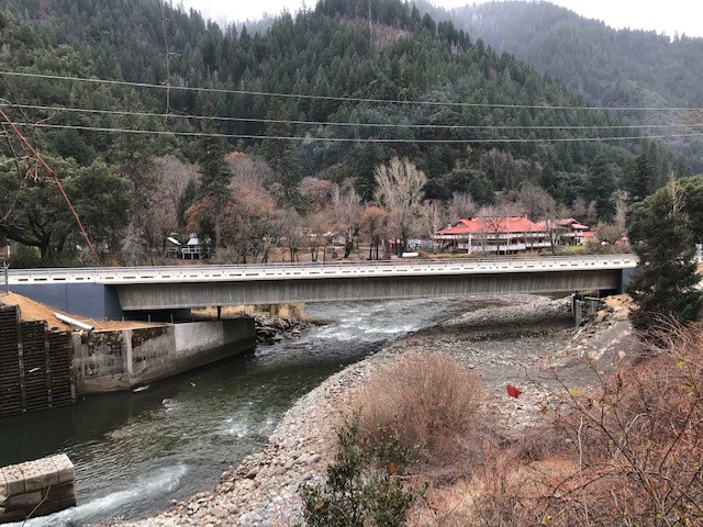
The San Elijo High-Occupancy Vehicle (HOV) and Double Track Project will improve highway and railway facilities and reduce carbon emissions. The work included replacing and lengthening both the San Elijo Lagoon highway and rail bridges; extending the two HOV lanes from Lomas Santa Fe Drive to Birmingham Drive; and double tracking the LOSSAN rail line from Cardiff-by-the-Sea to the southern border of the San Elijo Lagoon.
Because the San Elijo Lagoon is home to many endangered species, the San Diego Association of Governments (SANDAG) and Caltrans acquired more than 250 acres of sensitive coastal habitat to preserve and enhance the lagoon’s wetland and upland areas, improve tidal flushing and naturally replenish beach sand. The project also constructed a retaining wall north of the lagoon, a multi-use facility at Manchester Avenue, and a new pedestrian/bike undercrossing for increased access to the San Elijo Pedestrian Bridge and other scenic trails.
Category 3 – Equity and Livability
Montalvo Safe Routes to School Project
- City of Ventura
- LIN Consulting, Inc.
- Design Studios Landscape Development
- Montalvo Area Community Council
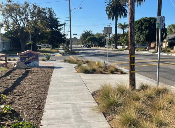
The Montalvo Safe Routes to School Project delivers transformative improvements to an underserved community by addressing critical transportation gaps, improving accessibility, and enhancing overall quality of life. Home to a high percentage of low-income retirees and former agricultural and industrial workers, the community of Montalvo was annexed by the City of Ventura in 2012 but had lacked funds for sidewalks and other accessibility features. The $2.4 million project is helping address this and included $1.38 million from a Caltrans Active Transportation Program (ATP) grant.
The project featured construction of more than 2 miles of continuous sidewalk, 1 mile of new bike lanes, 12 new curb ramps, 26 reconstructed curb ramps, 27 pedestrian and bicycle crossings and new landmark signs. These enhancements have significantly improved mobility and safety of residents by better connecting residents to parks, employment centers, and the nearby Metrolink station.
Category 4 – Cultivating Excellence
San Mateo 101 Express Lanes
- Caltrans, District 4
- San Mateo County Transportation Authority
- City/County Association of Governments of San Mateo County
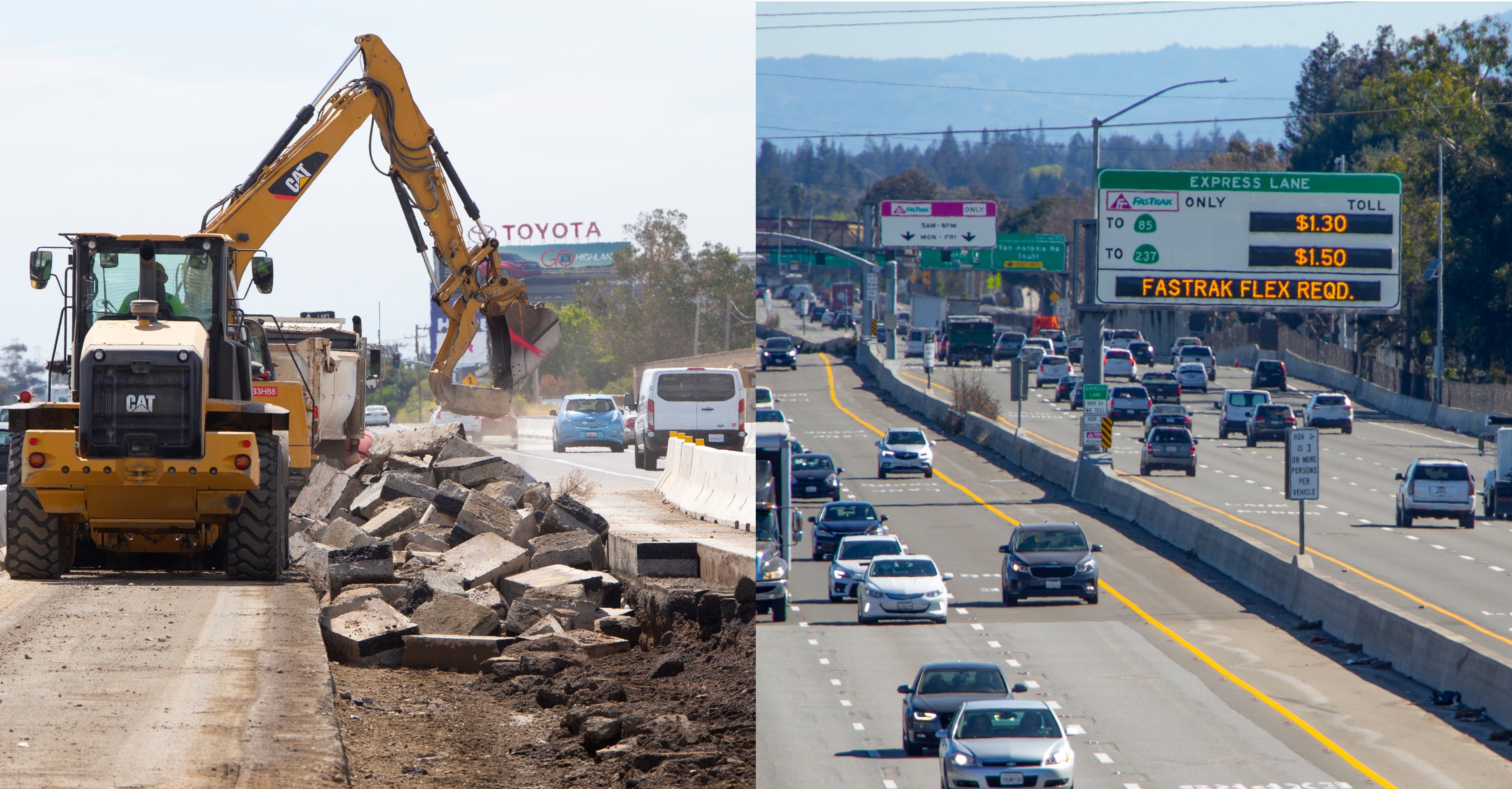
Caltrans, District 4, in partnership with the San Mateo County Transportation Authority (SMCTA) and the City/County Association of Governments of San Mateo County (C/CAG), constructed 22 miles of express lanes in both directions on U.S. 101 in San Mateo County. High-occupancy vehicles lanes were converted into express lanes from the Santa Clara County/San Mateo County line to Whipple Avenue in Redwood City. Caltrans also added an additional lane to northbound and southbound US 101 from Whipple Avenue to I-380 in San Bruno.
This project was also awarded the Envision Silver Award in recognition for its comprehensive sustainability, resilience and equity. This includes reducing greenhouse emissions by 37,000 tons per year, reducing water use by 25% through use of native drought-tolerant landscape, recycling 100% of asphalt, and installing 82 stormwater treatment areas to keep trash and other pollutants out of the Bay. Revenue from the express lanes will also help fund operations and a new transportation program for low-income San Mateo County residents.
Category 5 – Safety First
State Route 22 Horseshoe Safety Improvements Project
- Caltrans District 12
Before the project, eastbound traffic on the Garden Grove Freeway (SR-22) connecting to southbound I-5 and a shared two-lane horseshoe connector to northbound I-5 and SR-57 were restricted to a two-lane Collector-Distributor (CD) road separated by a concrete barrier. The 1-mile CD stretch included two local interchanges with closely spaced on and off ramps near major freeway connectors, resulting in regular 3- to 4-mile backups, sudden slowdowns, aggressive merging, and frequent collisions.
To address these challenges, the project shortened the CD barrier by half a mile, widened the horseshoe connector to three lanes, and modified the CD barrier to allow access from both sides. The design of relocated and added overhead signs complemented the placement of pavement route shield markers to guide drivers on lane usage. These improvements, along with the enhanced signs, help ensure safer and more efficient traffic flow. The project is expected to reduce collisions by an estimated 1,125 over a 15-year period, making it one of the largest safety improvements statewide.
Category 6 – Highway Urban - No Entries Received
Category 7 – The Highway Rural
Timbuctoo Roadway Project
- Caltrans District 3
Despite multiple engineering challenges, this project along SR-20 in eastern Yuba County was completed in less than two construction seasons. Safety is always the number one priority, and the new bridge and highway alignment has improved the safety and mobility of commuters. The project realigned an abrupt S-curve, constructed standard 12-foot traffic lanes and widened the shoulders to 8 feet to provide safer facilities for exiting the roadway during emergencies.
The project also greatly improved drainage to help maintain the natural drainage patterns, and a new Historic Plaza was built along Timbuctoo Place near the Parks Bar Bridge on the Yuba River. This includes a seating area and historical marker about Timbuctoo, which in 1855 was the largest city in eastern Yuba County.
Category 8 – Major Structures
Sacramento River Bridge Seismic
- Caltrans District 2
- Golden State Bridge Inc.
Interstate 5 is the Primary Highway Freight System of the West Coast from Canada to Mexico This project aimed to address seismic vulnerabilities, scour issues and the load-carrying capacity of two parallel structures of the 50-year-old Sacramento River Bridges on Interstate 5 in Red Bluff. The bridges carry more than 37,000 vehicles daily, but concerns about the bridges forced 30,100 trucks annually to detour two miles onto local streets. These detours increased local congestion, contributed to road damage and adding time to freight travel. This project resolved those issues.
The project featured unique challenges. For instance, a custom-built hydraulic jacking system was created to lift the bridge and maintain stability. Despite such challenges, the project significantly improved the load capacity of the nearly 1,000-foot-long bridge. In addition, “Return On Partnership” with local agencies was improved by eliminating an overload detour, reducing congestion, and reducing impacts on the local transportation infrastructure that was not designed for overloaded trucks.
Category 9 – Public Awareness Campaigns
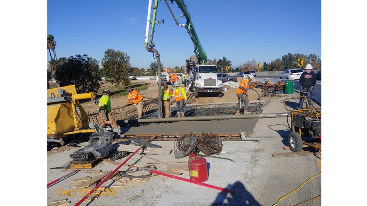
Interstate 10 Fire Emergency Repairs and Reopening
- Caltrans District 7
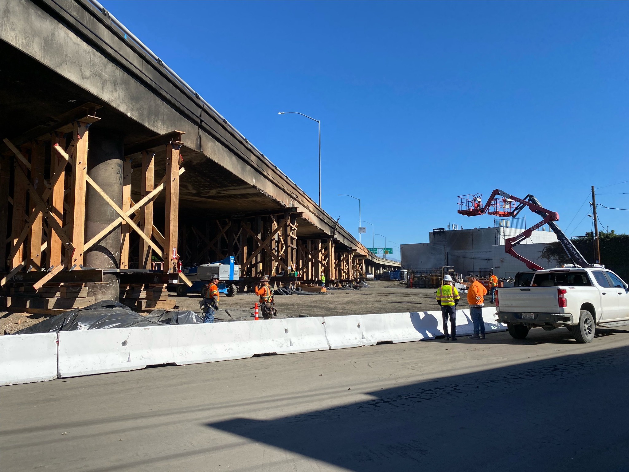
On Nov. 11, 2023, a devastating fire severely damaged the Interstate 10 viaduct near downtown Los Angeles and closed a 1½-mile segment used by 300,000 vehicles daily between Alameda Street and the East Los Angeles interchange. The closure significantly impacted the region’s economy by causing major delays and congestion in freight movement, commuting and other business and personal travel for millions of people.
Caltrans initiated an emergency contract to clean, stabilize, repair and open the closed portion of I-10 as soon as possible. Expanded crews and engineers worked around-the-clock. Caltrans coordinated with local transportation, government and elected officials to provide consistent, accurate and timely information to the public during the emergency repairs and reopening process. This outreach included 14 news conferences, 21 news releases and 3.59 million views of social media posts. Repairs were initially estimated to take weeks or possibly months, but thanks to hard work and some unexpected good fortune, all lanes on I-10 were reopened eight days later on Nov. 19, 2023.
Category 1 – Multimodal Transportation
Greenway Trail East Extension
- City of Whittier
- RRM Design Group


For over twenty years, in order to significantly increase the City of Whittier’s residents’ and visitors’ active transportation options, the City made the extension of its four and a half mile, urban Greenway Trail a high priority. Following years of negotiations with Union Pacific Railroad, in 2013, the City signed a perpetual railroad easement, and in 2016, formed an advisory task force of key stakeholders, including Caltrans, to design and build the Greenway Trail East Extension, which was completed in 2023.
The Greenway Trail East Extension Project created a new, 15-foot wide, 2.8 mile long corridor in the City of Whittier’s existing Greenway Trail that expands the community’s equitable access to schools, parks, and transit services and ― by encouraging walking and biking ― increases safety and shrinks the City’s carbon footprint by reducing the number of cars on the roadways. The Trail also enhances the community’s local and regional connectivity to greater Los Angeles by linking the City to transit networks via Norwalk Transit, Montebello Transit, Foothill Transit, Sunshine Shuttle, and Los Angeles Metro lines.
The Project’s design specifically advances public safety by improving how pedestrians and cyclists interact with trains and vehicle traffic at seven different rail crossings along the route. This was accomplished by incorporating two new bridges, swathes of drought tolerant vegetation, many stormwater retention features, and, in collaboration with Union Pacific Railroad operations, updates to pre-signals in the Greenway Trail.
In addition to Caltrans’ praise, the U.S. National Park Service selected the Greenway Trail East Extension as one of its outstanding planning projects.
Category 2 – Climate Action - No Entries Received
Category 3 – Equity and Livability
Los Molinos ADA
- Caltrans District 2
- Tullis Inc.
- Tehama County Public Works


The Los Molinos ADA (Americans with Disabilities Act) project was the final phase in a series of well-considered improvements to the stretch of State Route 99 that runs through the heart of the eponymous community in Tehama County. The work was planned, designed, and built in close collaboration with residents, stakeholders, and local businesses in order to promote equity by creating a “Complete Streets” network that encourages active transportation and eliminates transportation disparities in safety, access, and health outcomes.
The project featured new sidewalks, curb ramps, marked crosswalks, a colored textured concrete bike lane, additional street lighting, and the planting of new trees, upgrades that provide tangible benefits to the historically underserved and improve the quality of life for all residents and visitors.
Importantly, the design specifically and successfully addressed the priority of business owners that, in addition to expanded sidewalks and new planters, the completed Los Molinos ADA Project would ensure adequate parking in the city’s business hub.
Category 4 – Cultivating Excellence
Partnerships Pave the Way - Innovative public-private partnerships result in construction of the Laurel Curve Wildlife Crossing on California Highway 17
- Caltrans District 5
- Land Trust of Santa Cruz County
- Santa Cruz County Regional Transportation Commission
- Pathways for Wildlife


California’s State Highway System has been designed with people in mind, and as an unintended consequence has isolated and fragmented the habitats of many of the types of wildlife that live in the Golden State, often making simply crossing from one side of the road to the other not only difficult but ― as in the case of State Route 17 that connects Santa Cruz to the San Francisco Bay Area and sees 68,000 vehicles daily ― life threatening due to insurmountable obstacles such as dense traffic, concrete median barriers, and the lack of large culverts.
To nurture and protect both the human and wildlife communities that traverse State Route 17, Caltrans’ District 5 took proactive measures by constructing a wildlife crossing structure at Laurel Curve on State Route 17 in partnership with the Santa Cruz County Regional Transportation Commission, the Land Trust of Santa Cruz County, the Department of Fish and Wildlife, Pathways for Wildlife, and UC Santa Cruz to allow wildlife to travel safely under the highway, thereby decreasing wildlife-vehicle collisions and improving traffic safety.
The State Route 17 Wildlife crossings at Laurel Curve and others like them make highways safer by reducing the number of vehicle-wildlife collisions at the intersections of their travel corridors and California’s roadways, supporting the long-term sustainability of native wildlife populations, and promoting climate change resiliency by allowing species to move in response to changes in the environment.
Category 5 – Safety First
Roadway Departure Prevention Guidance
- Caltrans District 11, 3 and 6
- Caltrans Headquarters Division of Safety Programs


The inability of many motorists to consistently remain in their designated lanes ― a phenomenon called roadway departure ― has been identified in Caltrans’ Strategic Highway Safety Plan Crash Data Dashboard as a priority challenge and a deadly concern. According to 2009-18 data from the California Highway Patrol’s Statewide Integrated Traffic Records System (SWITRS), 54 percent of fatal crashes and 52 percent of serious injury crashes are the result of lane departures on the State Highway System (SHS).
In collaboration with Caltrans Headquarters Division of Safety Programs as well as the Design and Traffic Safety divisions of Districts 3 and 6 ― and based on the Federal Highway Administration Proven Safety Countermeasures for roadway departure ― Caltrans District 11 led the statewide effort to develop guidelines in order to reduce fixed object crashes that typically result from roadway departure incidents The team reached out to stakeholders and underserved communities and developed five categories of proven safety countermeasures to address roadway departure crashes: Signing and Channelization, Clear Recovery Zone, Pavement Treatments, Roadside Barriers, and Curve Improvements.
Thanks to the new guidelines, the Department is another step closer to realizing its goal of eliminating fatalities and serious injuries on the SHS by 2050, guidelines that can also be adopted by local agencies and tribal government.
Category 6 – Highway Urban
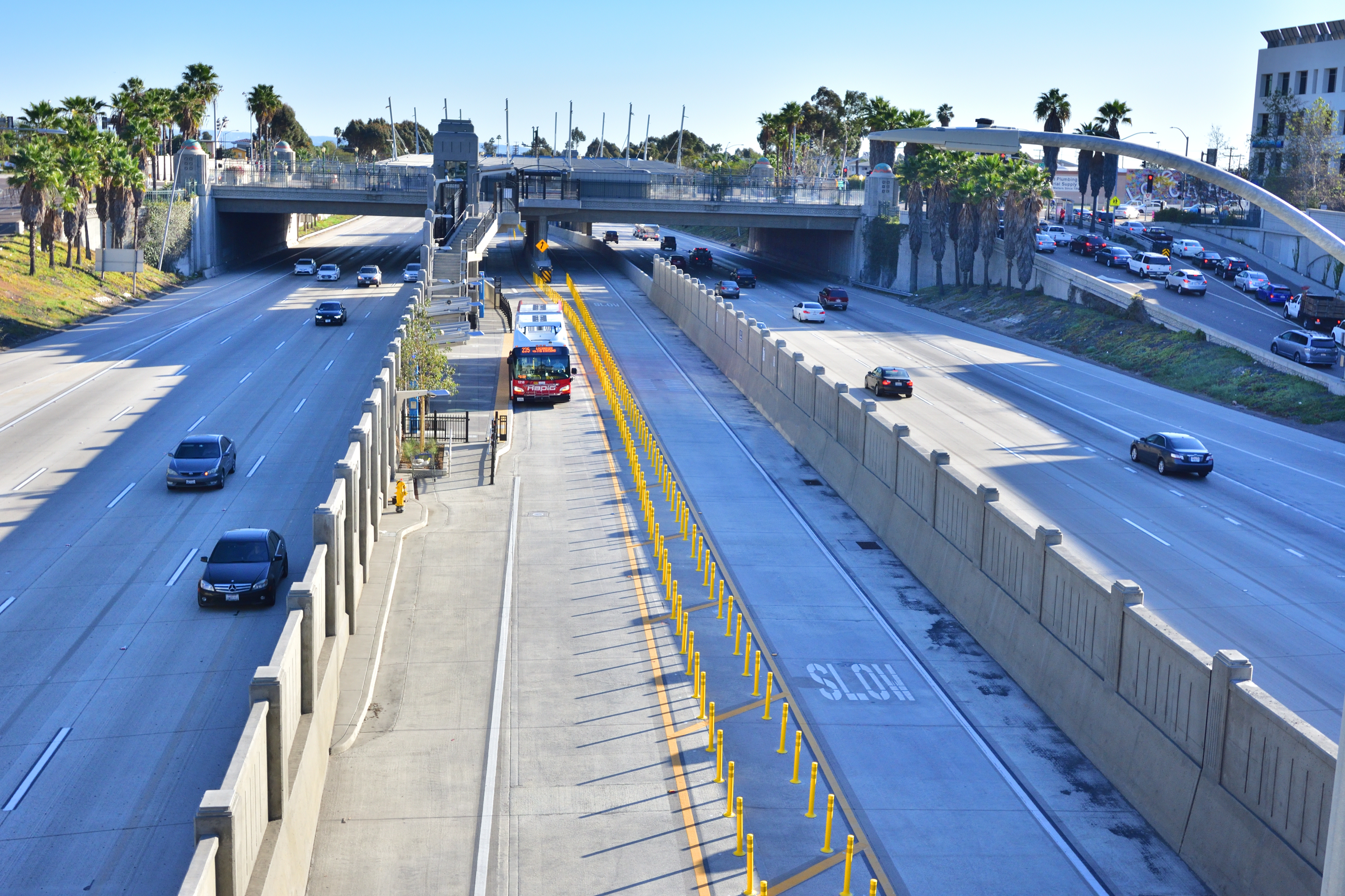
Build NCC Carpool/HOV Lanes and the San Elijo Activity Hub Park & Ride
- Caltrans District 11
- San Diego Association of Governments


Because San Diego County’s I-5 North Coast Corridor hosts over 700,000 vehicles every day, both resident- and visitor-motorists frequently have found themselves idling in standstill traffic, a problem that wastes time and money, exacerbates global warming through the emission of greenhouse gases, and increases the size of the transportation industry’s carbon footprint.
To address the situation, Caltrans and the San Diego Association of Governments (SANDAG) Build North Coast Corridor (NCC) Program created a comprehensive set of transportation, environmental, and coastal access projects, among which are its two final and completed major components: 13 miles of new Carpool/High Occupancy Vehicle (HOV) Lanes on Interstate 5 (I-5) and the addition of the San Elijo Activity Hub Park and Ride.
The new Carpool/HOV Lanes provide an alternative for vehicles with 2 or more persons to travel long distances on I-5 with fewer traffic disruptions and remove them from the other 4 lanes, providing relief to single occupancy vehicle travelers as well. In fact, a Caltrans traffic study shows that the Carpool/HOV Lanes created by Build NCC in Encinitas have produced a 50% reduction in travel time for HOV Lane users during peak traffic hours. Similarly, the park and ride site directly reduces the number of single occupant cars on the highway.
As part of the project, Caltrans and SANDAG also launched a new safety pilot program in which temporary orange lane striping was applied to the road surfaces in I-5’s active work zones to create distinct lane lines in order to ensure that motorists know when they are entering work zones and must reduce their driving speeds. The team received over 1,000 responses from local residents who expressed overwhelmingly positive support for the new orange lane striping.
Category 7 – The Highway Rural
Kings Canyon Expressway Seg. 3
- Caltrans District 6
- Fresno County Transportation Authority

The Kings Canyon Expressway Segment 3 project not only realigned and upgraded to expressway status the 4.5-mile stretch of State Route 180 that links the rural communities of Centerville and Minkler in eastern Fresno County, but also improved the communities’ connectivity to Fresno city and elevated the area’s aesthetics by improving the visibility of the scenic mountains that encircle the area and the Sequoia National Park’s Pine Flats.
This transformational project required the creation of new bridges over several waterways, including the Centerville-Kingsburg Canal, China Slough, Collins Creek, Kings River, Cameron Slough, Byrd Slough, Carmelita Ditch, and Mt. Campbell Ditch, and called for the construction of intersections for major local roadways, improved drainage systems, enhanced signage, and widened shoulders, all while preserving and enhancing access to the local road network and the surrounding community.
The preservation and celebration of the Historical Centerville Fruit Station ― an iconic structure with particular historical significance to the residents of the quaint town ― was a key concern in the project’s design. Accordingly, the project design team painstakingly collaborated with the local residents to avoid potential conflicts and ensure that the preservation of the historical gem seamlessly blended with the project's broader goals. In this way, the project not only improved the area’s transportation infrastructure but also harmoniously integrated the changes with the local community's identity and heritage.
Category 8 – Bridges, tunnels, overpasses, interchanges, etc.
SR-125/SR-905/SR-11 Connector San Diego
- Caltrans District 11
- Otay Mesa Chamber of Commerce
- San Diego Association of Governments (SANDAG)


Caltrans and the San Diego Association of Governments (SANDAG), along with the United States and Mexican federal governments as well as dozens of stakeholders and partners, have invested more than a billion dollars and countless hours over 20 years to steadily create the transportation system that is assuming its role as the principal route of U.S.-Mexico trade and commerce through the U.S. Otay Mesa Port of Entry.
A project of this magnitude had many stakeholders and partners on both sides of the international border, so constant cooperation and collaboration were needed, as showcased by the successful completion of the State Routes 125, 905, and 11 Connector Project. The project was one of the last, critically essential links in the international border infrastructure system and was designed specifically to help ease congestion, facilitate the movement of goods, reduce greenhouse gas emissions to improve overall air quality, and bolster binational trade between the U.S. and Mexico.
Throughout the project and consistent with the overall border system’s design, Caltrans worked to enhance and highlight the area’s esthetics by using elevated structures that provide views overlooking the Otay Mesa region and portions of the city of Tijuana, Baja California. Similarly, native drought-resistant landscaping was utilized and rock cobble slope paving treatment were applied to both adjacent bridges over Otay Mesa Road.
Category 9 – Public Awareness CampaignsSafer Streets Together
- City of Carlsbad
- City of Carlsbad Public Works
- City of Carlsbad Police Department


In March 2022, following the steady increase of bicycle and e-bike collisions on its streets, the Carlsbad City Council passed the region’s first e-bike safety law. When the number of collisions continued to rise ― including two cyclists who were killed that August ― the City declared a local traffic safety emergency and launched a Safer Streets Together public education campaign with Caltrans’ support.
To design its campaign for maximum impact, Carlsbad’s Communication & Engagement team elicited the public’s input to identify their top traffic safety concerns and desired outcomes; reviewed injury collision data from the previous five years to identify trends, locations, causes, and travel modes most associated with collisions; and reviewed completed quantitative studies of traffic safety behavior as well as evaluations of other traffic safety campaigns nationwide. The team also analyzed social media data to determine which platforms and kinds of content would best engage the public and specific demographic groups, such as the ADA (Americans with Disabilities Act) community and teenagers. To ensure the project was on budget and deliverables were executed on time, the city invested $60,000 during the first phase of the program’s development and implementation on consultant support to help develop overall themes and messages, reach out to potential community partners, and create informational materials.
Based on its research, Carlsbad’s Communication & Engagement team developed a one-year, intensive public awareness program designed to foster a sense of shared responsibility for traffic safety by all users of its local roads. The campaign saturated the Carlsbad media market with a wide array of traffic safety messages by placing 9 digital banners and 17 vinyl banners at high collision areas; securing more than 10 times the originally targeted number of news stories (220 total); sending traffic safety emails to the city’s list of stakeholders (and achieving an average 60% email open rate); producing 12 Public Service Announcement videos; and averaging four social media stories weekly.
As a result, bicycle and e-bike injury collisions in Carlsbad decreased by 26 percent, from a high of 108 during the summer quarter down to 80 in the last quarter of calendar year 2022. The emergency formally ended on September 8, 2023, but the city's focus on traffic safety continues.
Category 1 – Multimodal Transportation
MOVE Culver City
- Culver City Transportation Department
- Sam Schwartz Engineering
- StreetPlans
- TYLin
MOVE Culver City reimagines Culver City streets as public spaces and prioritizes moving people over cars in the design of the street. The project encompasses 2.6 directional miles of Culver Blvd. and Washington Blvd. in downtown Culver City.
The key components of the MOVE Culver City project include protected bus and bike lanes, bus stop improvements, expansion of micro-mobility options, a new circulator service, and pedestrian improvements, all implemented in a tactical urbanist framework using a quick-build model.
The combination of infrastructure, mobility services, and better customer experience empower residents and visitors to Culver City to reconsider their travel behavior. MOVE Culver City represents a paradigm shift in transportation planning by providing travelers with the ability to choose a variety of mobility options without being limited by safety, access, or environmental hazards.
Category 2 – Climate Action
San Elijo Lagoon Restoration
- The Nature Collective
- Caltrans District 11
- Flatiron-Skanska-Stacy and Witbeck, a Joint Venture
- Moffat & Nichol
The San Elijo Lagoon Restoration project is a model for both the San Diego region and state on how future, large-scale infrastructure and capital improvements projects administered by state transportation and regional planning agencies can be designed to mitigate impacts and improve surrounding environmental resources and ecosystems.
The completed San Elijo Lagoon Restoration Project accounts for projected future sea level rise and will ensure San Elijo Lagoon wetland wildlife and vegetation flourish in the decades to come.
The project widened, deepened, and straightened lagoon channels to improve tidal flow, circulation, and the overall health of the San Elijo Lagoon. Restoration crews created new mudflat habitats for a variety of wetland flora and fauna specific to the lagoon ecosystem. Additionally, approximately 444,000 cubic yards of sand were relocated to nearby Cardiff State Beach, Moonlight State Beach, and Fletcher Cove to replenish beaches impacted by rising sea levels and coastal erosion.
Through these priorities and actions, the San Elijo Lagoon Restoration Project serves as a model for future environmental rehabilitation efforts that seek to reduce or mitigate climate change impacts to the environment.
Category 3 – Equity and Livability
City of Clovis Transit DSS Bus Stop
- City of Clovis – Clovis Transit
- Cook Land Company
- City of Fresno – Fresno Area Express
- Fresno County Rural Transit Agency
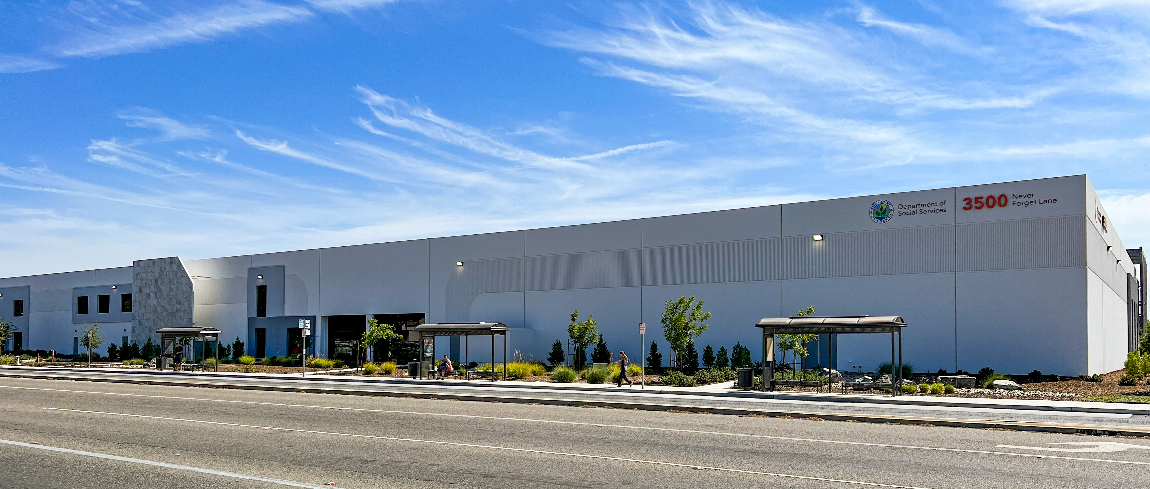
The 250-foot City of Clovis Bus Stop at the corner of Peach Avenue and Dakota Avenue serves all of the County of Fresno’s Department of Social Services Client Services departments. These buildings house 750 employees and are visited by 2,000 community clients every day. The project was a collaboration led by City of Clovis and included both private and public entities - City of Fresno, Fresno County Rural Transit Agency, County of Fresno, and Cook Land Company.
The bus stop has three large bus stop shelters to provide a safe environment for passengers, including those using mobility devices. The stop, the largest in the region, was built to accommodate three 40-foot buses at the same time, providing an efficient transfer point for passengers.
Bus stop furniture and roadway fortification were funded through the Low Carbon Transit Operations Program and Fresno County Transportation Authority’s Transit Oriented Development Grant.
The Clovis DSS bus stop provides equitable and safe access to social services for our entire community through efficient transit routes and transfers, clean and safe vehicles, and well-maintained bus stop with solar lights and amenities
Category 4 – Cultivating Excellence
Equity in Contactless Transit Payments
- Caltrans California Integrated Travel Program
- Capitol Corridor Joint Powers Authority
- Monterey-Salinas Transit
- Sacramento Regional Transit District
Caltrans’ California Integrated Travel Project (Cal-ITP) works to bring global standards for fare payment and real-time data to California’s public transit agencies while ensuring that all Californians have a contactless open-loop way to pay—whether that’s their bus fare or their groceries.
In 2021, Cal-ITP launched demonstration projects with four transit operators across the state to demonstrate the equity impacts of contactless fare payments on transit-dependent riders. These demonstrations occurred on buses and light rail in Sacramento, and on buses in Monterey and Santa Barbara counties.
With partners from the payments industry, Cal-ITP outfitted more than 100 transit vehicles with contactless payment acceptance devices, immediately giving riders more payment options. Cal-ITP and payment partners issued prepaid debit cards to directly assist under- and unbanked passengers with fare payment. Once instituted, operators adopted distance-based fares and established fare capping to give passengers discounts up front, without requiring the full payment amount.
Category 5 – Safety First
Wrong Way Driving Prevention
- Caltrans District 11
- California Highway Patrol
- Office of Traffic Safety
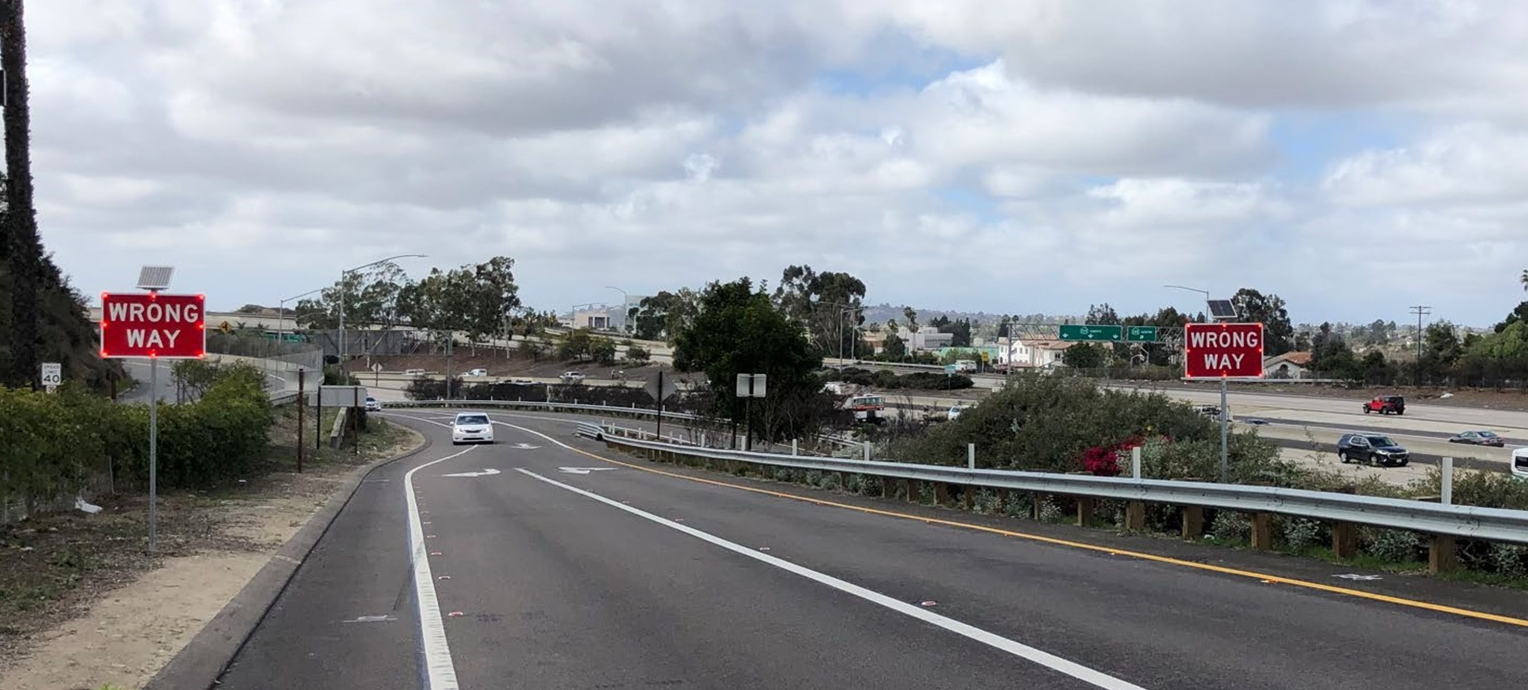
Wrong way driving collisions are rare, but often result in fatalities and serious injuries. District 11 prioritized public and worker’s safety by proactively implementing proven wrong way countermeasures on various routes throughout San Diego County. The countermeasures include enhanced exit ramp markings consisting of two-way retroreflective markers along the right and left edge lines, lane lines, limit lines, and through arrows.
The District also installed Light-Emitting Diode (LED) wrong way prevention signs at high priority locations. These countermeasures were piloted by the District in 2016 and were proven to be effective in reducing wrong way events by 60-64%. As a result of the success of the pilot project, the District led the effort to update the statewide standards for exit ramp markings to reflect these enhancements. Safety is and will always be Caltrans’ priority, and District 11 is proud to lead the statewide effort to prevent wrong way driving.
This Project is a result of the District implementing the safe system approach by proactively upgrading exit ramp markings standards and installing wrong way driving countermeasures to eliminate fatal and serious injuries.
Category 6 – Highway Urban
Interstate 5 Corridor Improvement Project
- Caltrans District 7
- City of Santa Fe Springs
- City of Norwalk
- Security Paving Company, Inc.
The Interstate 5 (I-5) Corridor Improvement project implemented a cost effective, transportation improvement strategy that will substantially increase roadway capacity, improve safety and efficiency along the I-5. The project reconstructed the entire I-5 roadway and widen the I-5 to add one High Occupancy Vehicle (HOV) lane and one mixed-flow lane in each direction and upgraded the inside and outside shoulders to standard widths.
The reconstruction of interchanges, ramps, adjacent streets, frontage roads, and intersections improved operation and safety of the increased traffic needs of the corridor. The project reconstructed several Over and Under Crossings and one Pedestrian Over Crossing (POC) to accommodate the corridor widening and to upgrade design features to Caltrans and the Federal Highway Administration (FHWA) standards.
Many of the crossings serve as an important connectivity for the local communities to their workplaces, schools, transit hubs, park and ride, and other facilities. The upgraded structures provide continuous facility for motorists and pedestrians.
Category 7 – Highway Rural
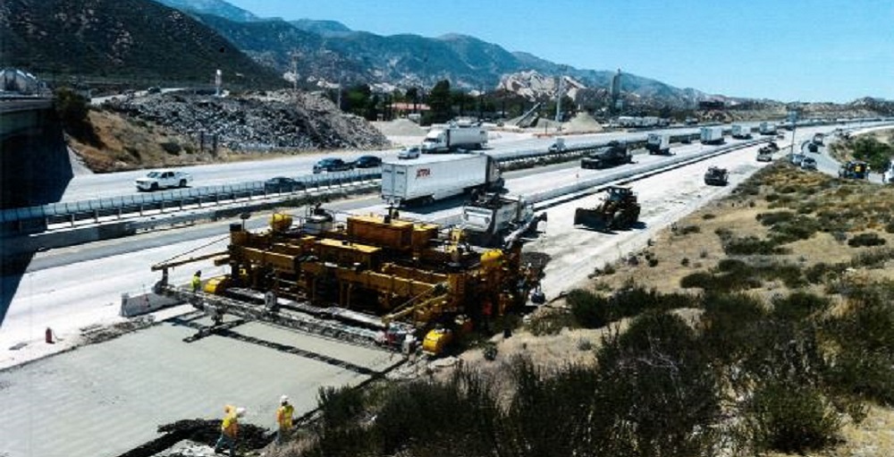
San Bernardino, State Route 58, Kramer Junction CMGC
- Caltrans District 8
- Kiewit
The Kramer Junction Gap Project is a nationally significant project and was the final gap in an otherwise uninterrupted 4-lane expressway that begins at SR-99 in Bakersfield in the Central Valley, intersecting I 5, and ending at its junction with I-15 and I-40 in the city of Barstow, California. The Central California region provides half of all produce to the country, generating $10 billion in annual revenue. SR-58 is the vital goods movement link that connects the Central Valley to the rest of the country.
Since the completion of construction, traffic delays have disappeared as traffic flows freely on the new expressway. SR-58 is now a seamless expressway from SR-99 in Bakersfield, passing by I-5 on its way to I-15 (Las Vegas, Canada, etc.) and I-40 to the east coast. Goods movement is no longer restricted by the traffic backup caused by the previous at-grade signalized intersection. The benefit from this project cannot be overstated. The congestion reduction and route continuity will yield a return multiple times the initial $170 million investment for years to come.
Category 8 – Major Structures
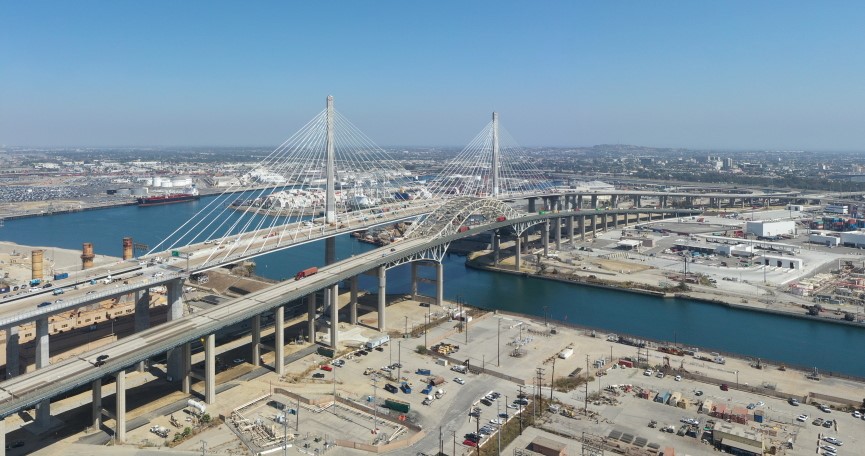
Gerald Desmond Bridge Replacement
- Caltrans District 7
- Port of Long Beach
The Gerald Desmond Bridge Replacement, now the Long Beach International Gateway, provides a vital, seamless connection between the ports of Long Beach and Los Angeles, Terminal Island, and downtown Long Beach. Nicknamed the “Bridge to Everywhere,” the bridge carries 15 percent of the country’s waterborne cargo across six lanes of Interstate 710 (I-710).
The project, delivered via the Design-Build method, features a 2,000-foot-long cable-stayed span and 205 feet of vertical clearance, the highest of all cable-stayed bridges in the United States, to accommodate some of the world’s largest cargo ships.
The new bridge carries a bike and pedestrian facility (Mark Bixby Memorial Bicycle-Pedestrian Path) that includes three scenic overlooks across the new bridge. The project supports a multi-model transportation network with state-of-the-art facilities for pedestrians, bicyclists, truckers, drivers, and cargo ships.
Category 9 – Public Awareness Campaigns
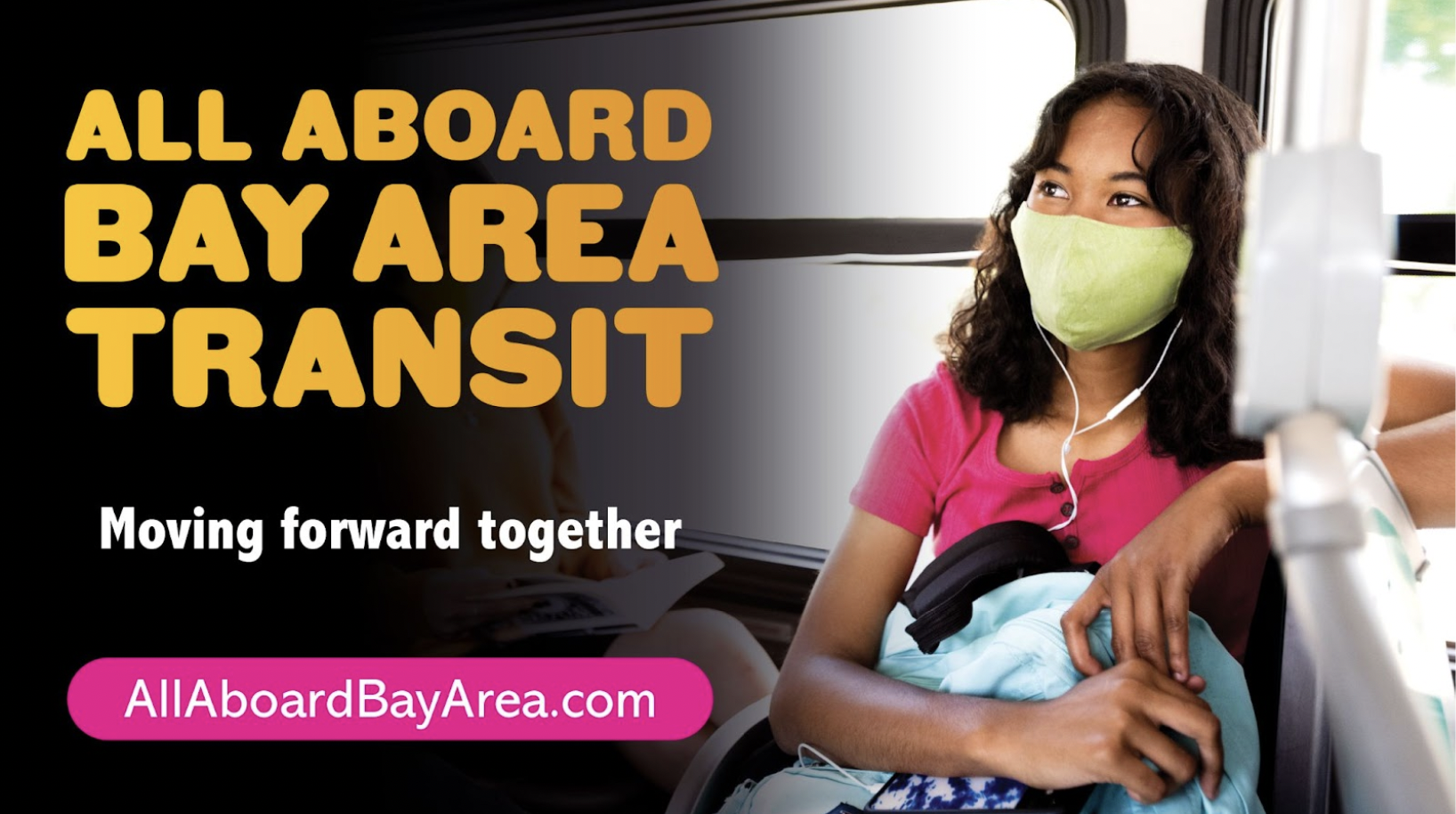
All Aboard Bay Area Transit
- Metropolitan Transportation Commission
- Craft & Commerce
In response to the precipitous drop in transit ridership as a result of COVID-19, the Metropolitan Transportation Commission launched a coordinated Return to Transit public awareness campaign in partnership with the Bay Area’s 27 transit agencies.
The campaign’s goal was to accelerate the growth in transit ridership with a campaign informed by research, representative of the diversity of the San Francisco Bay Area’s residents, and demonstrating a unified message across the region’s transit agencies.
The campaign was launched in five languages in the summer of 2021 via an integrated media buy across out of home, digital, radio, and social media, and with support from key regional stakeholders, such as the San Francisco Giants, Facebook and others.
The ultimate campaign outcomes far surpassed goals for ad impressions and drove significant gains in ridership during the time in market, equivalent to an additional 1.7 million rides versus the surrounding time period.
Category 1 Intermodal Transportation
Coastal Rail Trail Segment 7/Phase I
- City of Santa Cruz Public Works
- RRM Design Group
- Graniterock Construction
- Santa Cruz County Regional Transportation Commission
The Coastal Rail Trail Segment 7/Phase I project broke ground in January 2020 and concluded nearly one year later. This paved multi-use trail in the City of Santa Cruz was the second segment of the Monterey Bay Sanctuary Scenic Trail — envisioned 20 years ago by then-U.S. Senator Sam Farr.
The trail is a 12-16 feet wide Class I facility that is ADA compliant and runs 1.2 miles from Natural Bridges Drive to Bay/California streets along the coastal side of the existing rail line. It includes 10 green crossbikes, a 60-foot long steel truss bridge, a 70-foot long soldier pile retaining wall and new vehicle and bike parking,
Coastal Rail Trail Segment 7/Phase I has greatly increased active transportation in Santa Cruz while reducing carbon emissions. Serving over 600 active transportation users per day, it is helping to increase walking, biking and safety. Testimonials reflect enthusiastic community appreciation in this ribbon-cutting Rail Trail Segment 7/Phase I Ribbon-Cutting - YouTube
Category 2 Highway Rural
Yellow Creek Bridge
- Caltrans District 2
- Stewart Engineering Inc.
- Pacific Gas & Electric
The Yellow Creek Bridge project serves as a testament to exceptional planning, design, and construction of a facility that meets the needs of all users and continues to serve as a critical crossroad for many uncommon transportation modes.
Through careful consideration and stakeholder involvement, bridge users of every imaginable type were accommodated, including long distance hikers, equestrians, vehicles, kayakers, and rafters, along with the needs of the immediately adjacent Belden powerhouse hydropower facility.
The design process considered each user and planned for the final structure to serve all users without detracting from the functionality of the bridge, nor the rugged beauty of the surrounding Feather River National Scenic Byway. Construction operations were conducted to ensure all users could continue to use the bridge safely and efficiently during construction, resulting in a simple, yet elegant and highly functional bridge.
Category 3 Highway Urban
I-5/Genesee Avenue Interchange Project
- Caltrans District 11
- Flatiron Construction
- City of San Diego
- Kimley-Horn and Associates
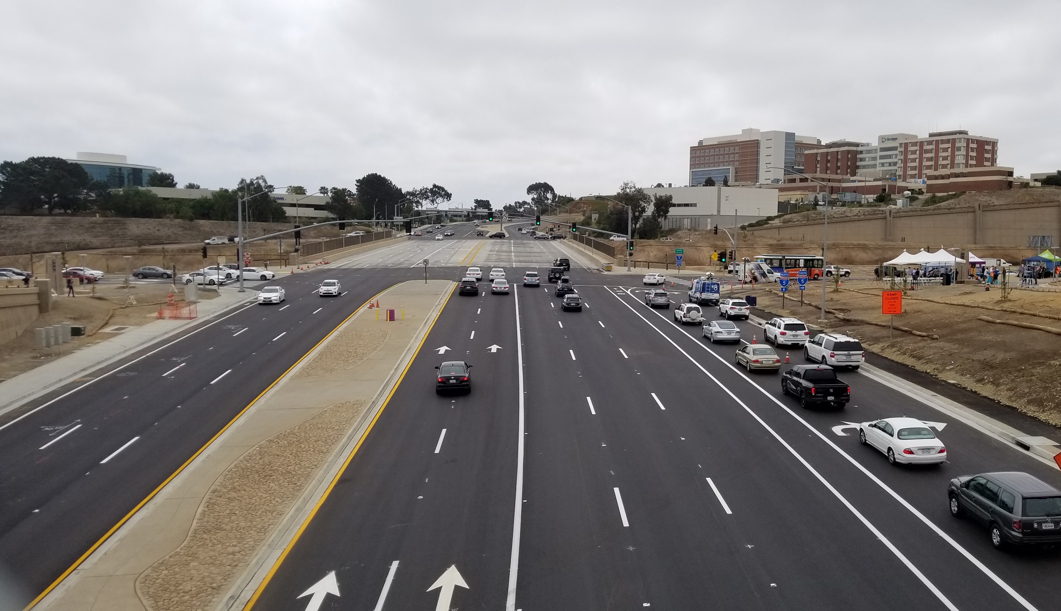
The I-5/Genesee Avenue Interchange Project features a new multi-modal interchange, a 1.5-mile Class-1 multi-use path with a Pedestrian/Bicycle Over Crossing (POC) at Genesee Avenue, a new, wider bridge deck with new sidewalk and bike lanes, freeway improvements and improvements to on/off-ramps at Roselle Street. This project is a model of regional collaboration between the City of San Diego, Caltrans, San Diego Association of Governments and additional local stakeholders (such as MTS, UCSD, and Scripps Hospital) who came together to provide freeway, active transportation, and complete street elements that solved a regional and national mobility challenge, addressed competing demands of the area’s various users, and met the changing needs of the region.
By providing links to transportation and improving the operations of the existing facilities, the project has greatly improved access to major employment centers, hospitals, and UC San Diego and has also greatly improved the movement of people and goods throughout the area.
Category 4 Major Structures
Echo Summit Sidehill Viaduct Replacement Project
- Caltrans District 3
- City of South Lake Tahoe
- Tahoe Chamber
- El Dorado County
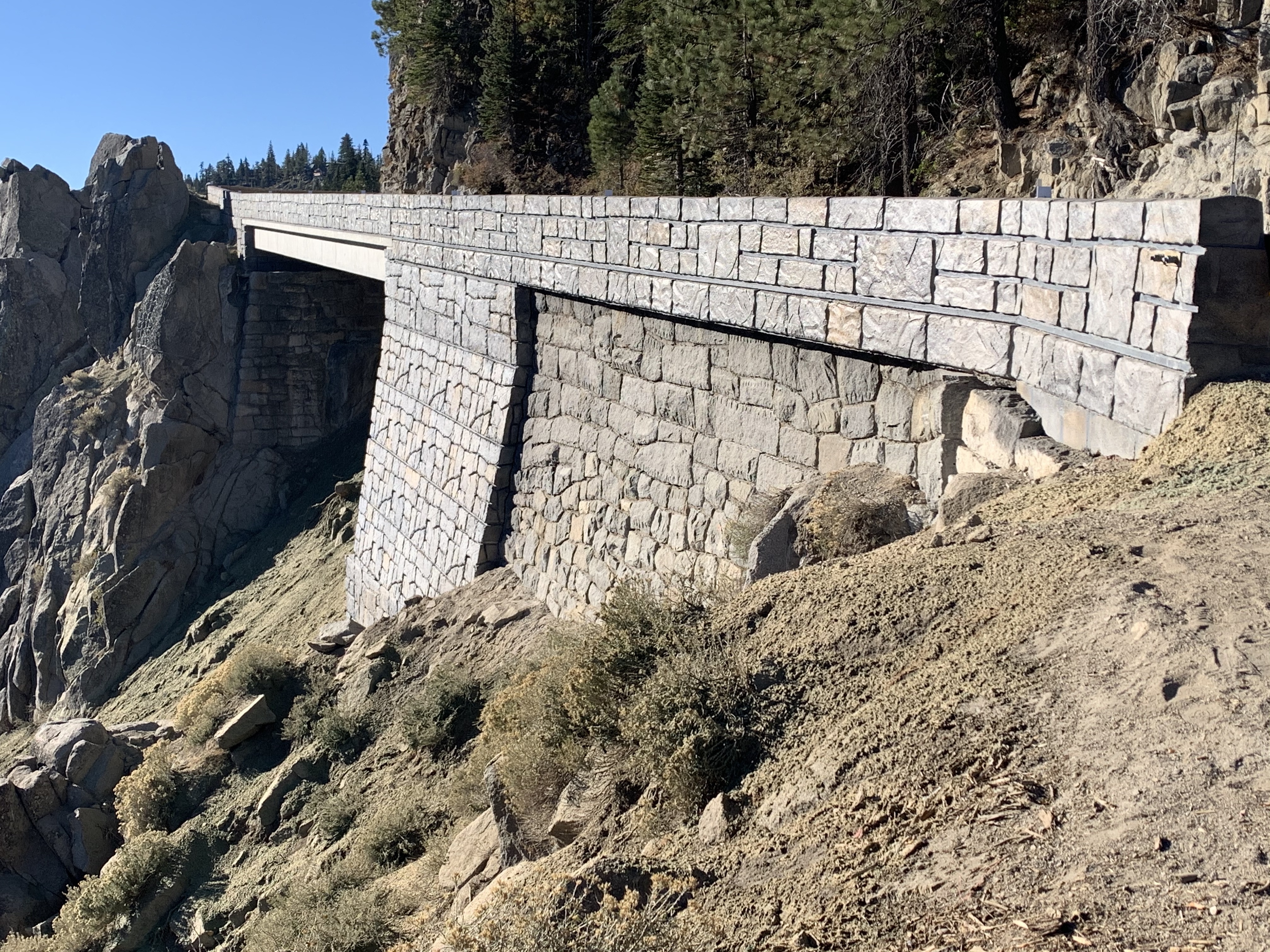
Precariously perched on a steep mountainside with Lake Tahoe in the background, this side-hill viaduct, located in a very narrow stretch of US Highway 50, could not be replaced using conventional methods without closing the highway for up to 3 months. The solution was to build around and behind the existing foundation: building a bridge around the existing bridge - all done while traffic was running above!
Accelerated Bridge Construction was then used to complete the remaining work faster and more efficiently to reduce the economic impact to the tourist-dependent Tahoe Basin. A first for Caltrans at high elevation, Ultra High-Performance Concrete was used to lock together the specially designed, 96-foot long, precast box girders which also served as the bridge deck.
This approach resulted in a reduced full highway closure, and the roadway was opened to traffic in only 9 days!
Category 5 Stewardship of the Environment
Coastal Rail Trail – Encinitas
- Caltrans District 11
- San Diego Association of Governments
- City of Encinitas
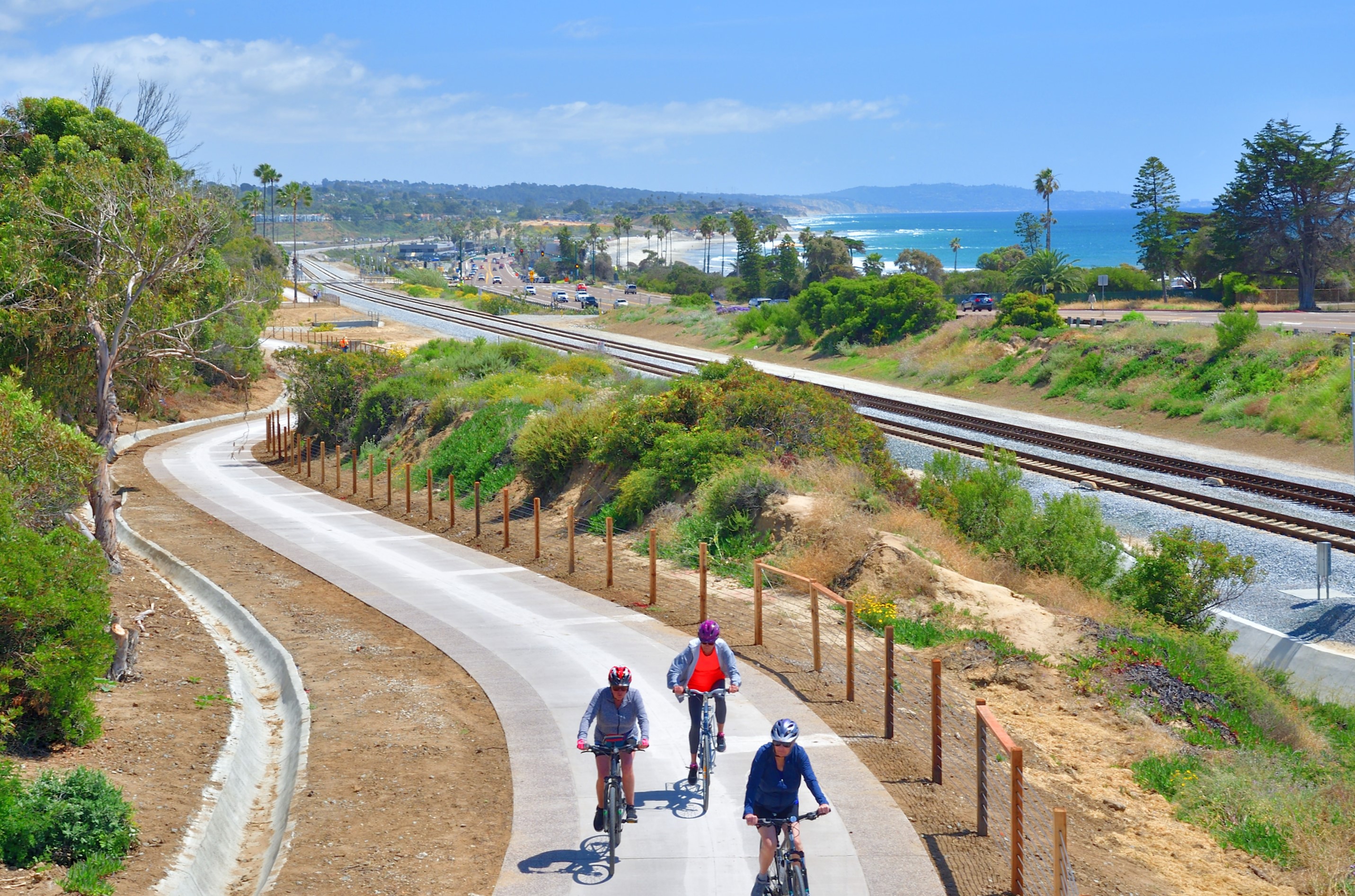
As part of the I-5 North Coast Corridor (NCC) program and the North Coast Corridor Public Works Plan/Transportation and Resource Enhancement Program, the Encinitas segment of the 44-mile Coastal Rail Trail improves biking and walking connections to several destinations in the Encinitas community, including local parks, businesses, beaches, and schools.
A safe environment for all ages and abilities has been provided to improve the mobility of non-motorized users to bus and rail facilities, community and employment centers, and other local and regional destinations. Bicyclists and pedestrians, including young students, do not have to interact with motor vehicle traffic for the project’s entire length, significantly increasing safety throughout the project corridor.
The project will help fulfill the vision laid out in the San Diego Regional Bike Plan to make riding a bike a useful form of transportation for everyday travel, reduce greenhouse gas emissions, and provide transportation alternatives to driving a vehicle.
Category 6 Transportation-Related Facilities
I-215/Barton Road Interchange Improvements
- Caltrans District 8
- San Bernardino County Transportation Authority
In addition to the roundabout, the I-215/Barton Road Interchange Improvement project included local circulation system improvements such as new roadway connections, realigned facilities and new signals. This resulted in improved safety and traffic operations and reduction in traffic conflicts. The project also improved pedestrian, bicycle and vehicular access to facilities served by the interchange and provided a context sensitive design.
Due to the location of Grand Terrace Elementary at the northeast quadrant of the interchange, extensive coordination with the city, school, parents, and school district was done to ensure safe and reliable access to the school during construction.
The project provided equitable access to a predominantly disadvantaged community from both east and west sides of the freeway. Introducing the roundabout configuration has accommodated access to multiple roadways with enhanced operation and safety.
Category 7 Transportation System Operations Improvements
Exclusive Pedestrian Crossing Cycle by Time of Day
- City of Santa Clarita
- Kimley Horn and Associates, Inc.
- McCain Traffic Supply
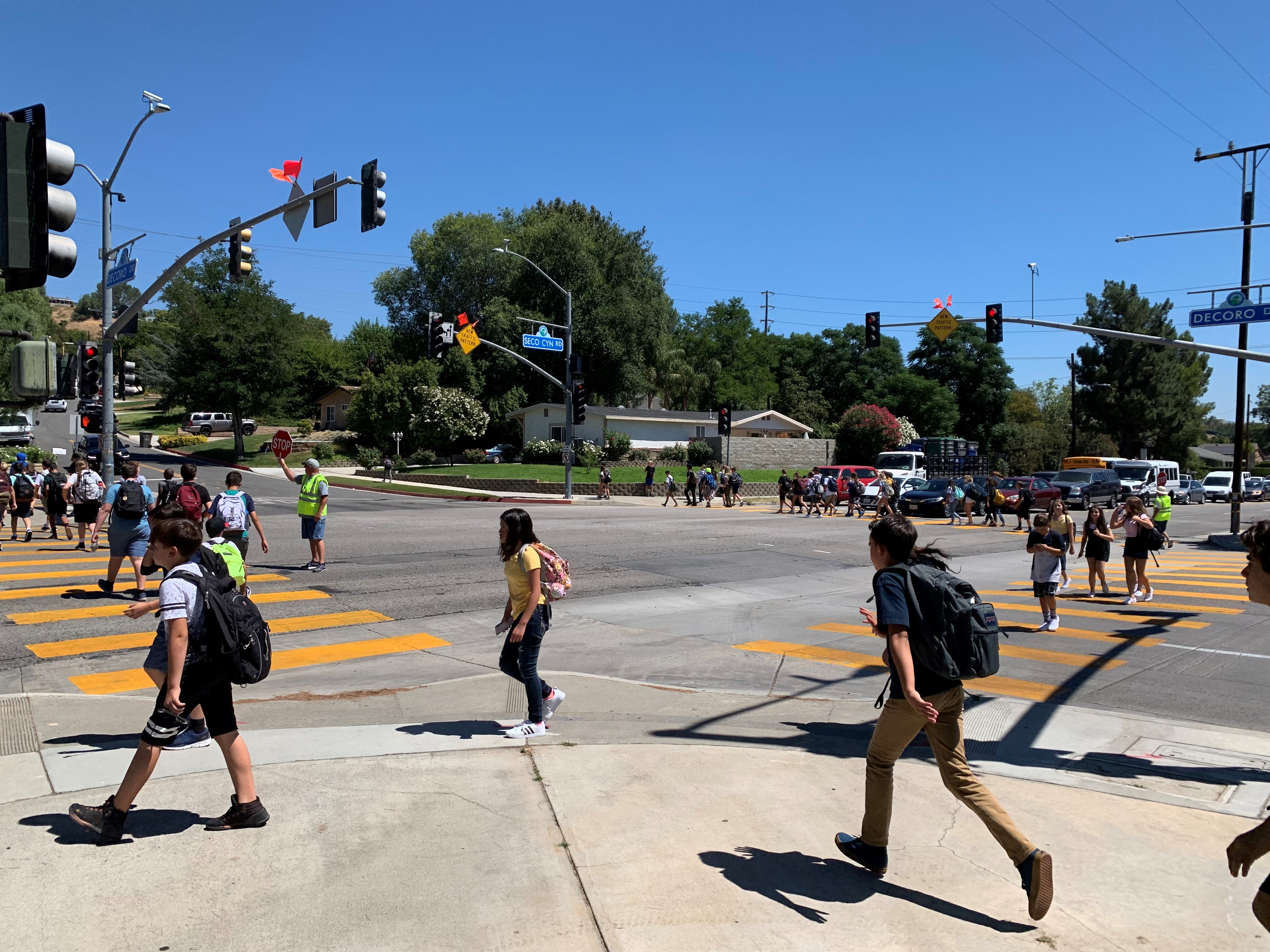
Safety is always the number one priority, especially near schools. Seco Canyon Road and Decoro Drive are adjacent to two schools. During school hours, this intersection becomes heavily congested due to the high volume of students and vehicular traffic.
To improve pedestrian safety and reduce traffic congestion, the City of Santa Clarita developed a modified Exclusive Pedestrian Crossing by Time of Day, known as a “Pedestrian Scramble,” that included special timing during school hours. This phase enables all pedestrians to cross the intersection simultaneously while all vehicular traffic is stopped.
This timing eliminates vehicular-pedestrian conflicts. Additionally, traffic circulation is greatly improved because vehicles will no longer need to wait for high volumes of pedestrians to cross the street during a green light before they can make a turn.
The new traffic pattern is also supplemented by “blank-out signs,” which instruct drivers on when they safely can make right-hand turns at the intersection.
The project resulted in reduced congestion and shorter travel times for motorists, and pedestrian safety was enhanced for students and parents who use the crosswalks daily at this intersection.
Category 8 Worker and Traveler Safety
Wildlife Passage Modifications on State Route 118 in Las Posas Valley
- Caltrans District 7
- National Park Service
- California Natural Resources Agency
- S. Department of Transportation
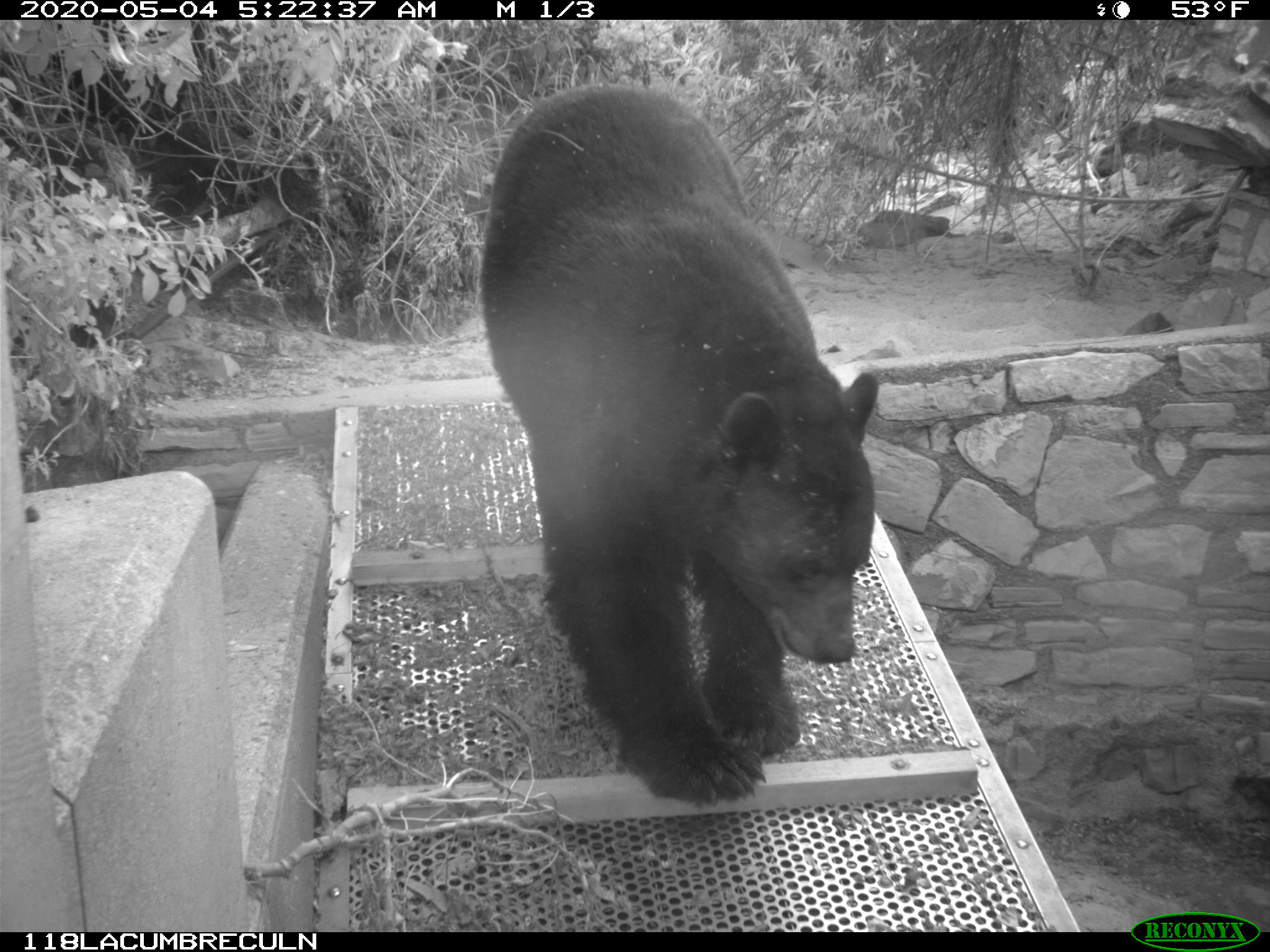
Existing highways act as barriers to wildlife movement, and as a result, have caused habitat loss/fragmentation and reduced population size and genetic diversity for various wildlife species. Wildlife-Vehicle Collisions (WVCs) are another aspect that can affect species directly via mortality.
Prior to the Wildlife Passage Modifications on State Route 118 in Las Posas Valley (SR 118) project, a wildlife study was completed to determine the most effective approach to minimize these negative effects. The study resulted in new fencing and wildlife ramps to improve five key undercrossings, four culverts and one bridge.
Each modification was designed to improve wildlife crossing within an essential wildlife linkage, reduce fragmentation within wildlife populations, and reduce the number of WVCs. This improved safety for both local motorists and wildlife movement within the Santa Monica-Sierra Madre Connection wildlife corridor, while simultaneously increasing habitat connectivity for wildlife across one of the largest obstacles (SR 118) affecting wildlife movement in the corridor.
The Improvements also protect ecosystems and their wildlife populations via increased access to resources as well as increased genetic diversity of populations. This project serves as a model for traveler and wildlife safety within the region.
Category 9 Community Enhancement
Go Human Program – From Pop Up to Permanent: A Model for Community-Centered Public Engagement
- Southern California Association of Governments
Go Human was created to reduce the number of injuries and fatalities involving people walking and biking, increase rates of active transportation, and support local community engagement. The program fosters champions across the region to support active transportation safety at the local level through a variety of strategies.
One key strategy is Go Human’s Kit of Parts, an engagement tool for jurisdictions to temporarily demonstrate potential and planned street design treatments and safety infrastructure that encourage the use of streets as public space. Go Human supports and prioritizes community-led engagement and aims to meet the regions’ health, equity, and greenhouse gas emissions reduction goals, while supporting healthy and connected communities.
Category 10 Transportation Innovations
360 Tours
- Caltrans District 4
Transformative projects require developing a shared vision among stakeholders before actual construction, and 360 Tours can bring that vision to life. These interactive, web-based models offer a virtual experience allowing diverse stakeholders to navigate and explore future transportation projects in 360 degrees.
With the simple interface, even novice users can zoom into specific areas of interest, click links to see various project alternatives, and view video simulations from a driver’s perspective or from the air. These Tours have made project outreach, communication, and engagement more effective, equitable and approachable than ever. By integrating geographic information system mapping, state-of-the-art rendering tools and a web-based platform, this team has created an experience with an intuitive interface that is both flexible and scalable for various project types and user groups.
Category 11 Public Awareness Campaigns
SunLine Refueled
- SunLine Transit Agency
- FIND Food Bank
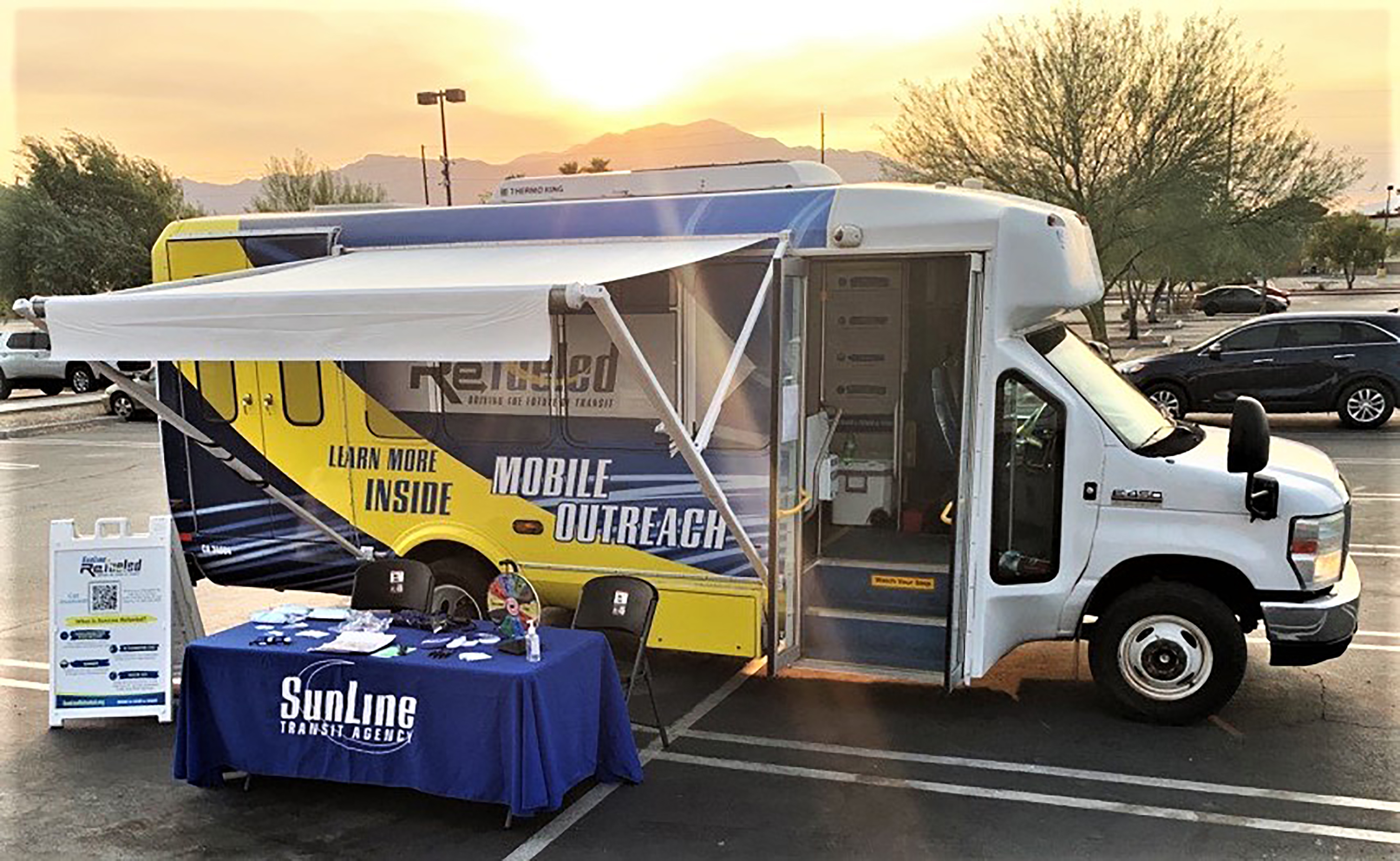
Even before the pandemic, 2020 was set to be a pivotal year for SunLine as they began outreach on the largest system redesign in SunLine’s 43-year history.
The work the SunLine Transit Agency was able to do in the three years leading up to the launch of the SunLine Refueled initiative was remarkable. In addition to pivoting to incorporate COVID-19 safety messaging SunLine embodied innovative ideas for outreach when extemporaneous circumstances prevented in-person outreach.
The SunLine Transit Agency had to develop new ways to put information about SunLine Refueled where people already were. This task proved complicated with multiple stay-at-home orders, county tier restructuring, and numerous regulations. Despite these challenges, the Agency’s level of engagement for a project this size is noteworthy, and the innovative approaches bringing information to the community have fundamentally enhanced what public awareness looks like not only for SunLine, but other agencies in our community.
SunLine was successful in rebranding and reinventing the Agency’s transit network while simultaneously balancing COVID-19 solutions with a small marketing team to keep item production in house and remain good stewards of public funds.
Intermodal Transportation System & Stewardship of the Environment
SR-15 Mid-City Centerline Rapid Transit Station
-
Caltrans District 11
-
San Diego Association of Governments
-
Jacobs Engineering Group Inc.
-
Granite Construction Company
The State Route 15 (SR-15) Mid-City Centerline Rapid Transit Station project includes San Diego’s first freeway‐level transit stations along SR-15 at El Cajon Boulevard and University Avenue. The project constructed transit-only lanes within the existing SR-15 median from Interstate 805 to Interstate 8.
As part of an integrated Rapid network that provides high-frequency transit service, seven days a week, this project exemplifies regional strategies to reduce travel times and expand transportation choices. This project was a collaborative effort by Caltrans, San Diego Association of Governments, Metropolitan Transit System, and local stakeholders to provide innovative and sustainable transportation alternatives to San Diego County.
The project design includes many innovative features, including outdoor elevators at platform levels, four unique pedestrian bridges with changeable lighting colors, bike channels along the staircase, integrated lighting, and stairs with sound panels. The project includes the first Earthen Berm Austin Sand Filter in the region as one of the Best Management Practices
The Highway (Rural)
Piedras Blancas Realignment Project
-
Caltrans District 5
-
Papich Construction Co., Inc.
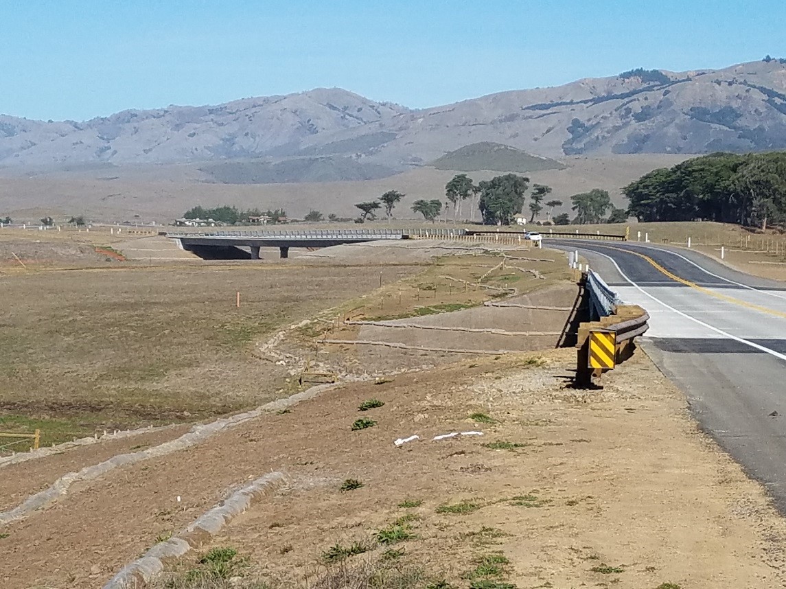
To protect State Route 1 (SR-1) from bluff erosion, the highway was realigned up to 475 feet inland. SR-1 is an important link between San Luis Obispo and points north, including recreational areas along the central coast, Big Sur and Monterey. The highway is subject to wind, waves, storms and tidal action that eroded the bluff up to the roadway at several locations. The new highway lays lightly on the land along the natural ground surface to the extent possible. Three bridges constructed over creeks reduce the permanent impacts to wetlands and riparian areas.
Coordination with the County of San Luis Obispo, five State and four Federal government agencies, as well as the Hearst Corporation, utility companies and several interest groups contributed to the success of the project. Mitigation includes restoration of wetlands and coastal prairie, native planting and screening of roadside development. The project also provided funding for the development of the California Coastal Trail.
The Highway (Urban)
Marin-Sonoma Narrows – MSN B3 & B2 Ph-II
-
Caltrans District 4
-
Transportation Authority of Marin
-
Sonoma County Transportation Authority

The Marin-Sonoma Narrows B3 and B2 Phase II project celebrated the grand opening of the upgraded section of US-101 that converted an expressway to an access-controlled freeway with 4.5 miles of new HOV lanes from the Marin/Sonoma border to State Route 116 in Petaluma. The project also celebrated the completion of a bicycle path connecting Novato and Petaluma.
The project prioritized partnerships, safety, sustainability, multi-modal connections and environmental stewardship. In addition to HOV lanes and bike connections, the project realigned US 101 for improved sightlines, to be above the flood plain and eliminated driveways and at-grade crossings for improved safety.
Major Structures
Lake Almanor Bridge Replacement
-
Caltrans District 2
-
Q&D Construction, LLC
-
Plumas County
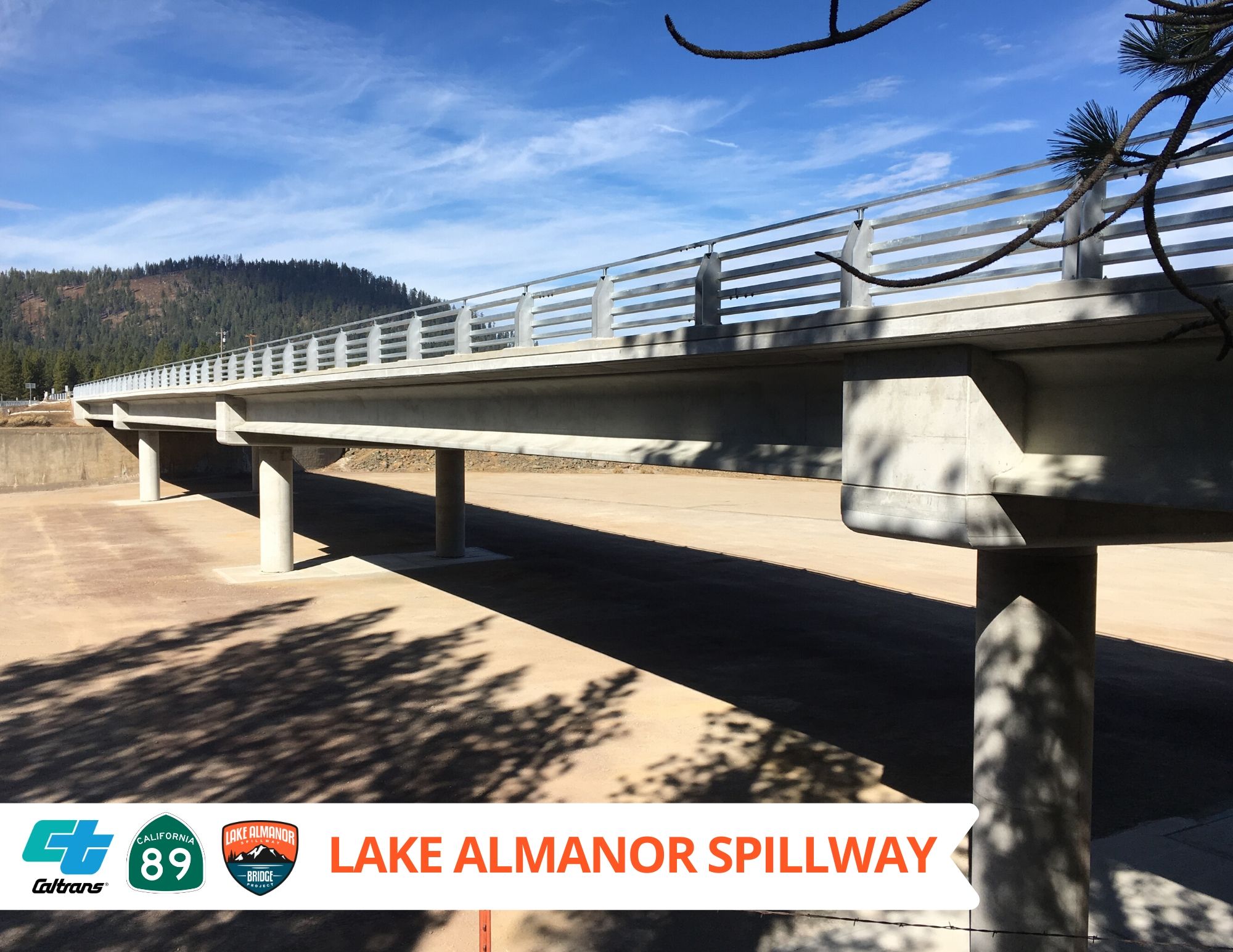
Completed a month ahead of schedule and on-budget, the Lake Almanor Bridge Replacement project replaced a 467-foot long bridge along the shores of beautiful Lake Almanor, over a Pacific Gas and Electric (PG&E) owned dam and spillway.
The new pedestrian-friendly bridge features seismic upgrades, eight-foot shoulders, see-through barrier rails, double-column piers atop spread footings and a deck consisting of fiber-reinforced concrete with epoxy-coated reinforcement for durability. Traffic was accommodated during construction via a one-lane paved detour on the spillway floor. Significant coordination was the challenge to get this one-of-a-kind project completed to the satisfaction of the governing entities.
Stewardship of the Environment
Clinton Keith Road Extension Project
-
County of Riverside Transportation Department
-
City of Murrieta
-
Jacobs Engineering
-
Sukut Construction
The Clinton Keith Road Extension Project supports the communities of Murrieta, French Valley and Riverside County by providing a transportation corridor for the residents that is designed in harmony with the natural environment. The six-lane arterial road not only introduced bike lanes, transit facilities and a pedestrian friendly environment, it also includes specialized features to protect the natural environment. Features include culverts that have ledges and skylights to encourage wildlife movement, specialized fencing to direct wildlife to safe locations, solar lighting, and Riverside County’s first wildlife overcrossing.
The success of the project was developed through the involvement of the project stakeholders who insisted on safety, function and conservation of the environment. Not only is the Clinton Keith Road extension project an urban arterial road that will eventually carry 35,000 vehicles per day, it is also is a project that integrates with the natural environment and improves the quality of life.
Transportation-Related Facilities
The North Fremont Bike and Pedestrian Access and Safety Improvements Project
-
City of Monterey
-
Kimley-Horn & Associates
-
Harris & Associates
-
Granite Construction
The North Fremont Bike and Pedestrian Access and Safety Improvements Project transformed North Fremont Street in the City of Monterey into a true multi-modal corridor, providing safe access to bicyclists and pedestrians on a vital link between residential, commercial, educational, and community facilities. The project promotes the active transportation component of the North Fremont Specific Plan, the goal of which is improve mobility and revitalize business activity along the corridor.
This project is the first major transportation project to occur along North Fremont Street in over 50 years and includes the first signalized Class IV median bike lane in the state of California. The design included stormwater improvements, traffic signal improvements, ADA curb ramps, shorter crosswalks, bulb outs, and Class IV bicycle lanes from Casa Verde Way to Casanova Avenue.
Transportation System Operations Improvements
Stillwater Interchange
-
Caltrans District 2
-
Tullis, Inc.
-
RNR Construction
-
Shasta Regional Transportation Agency
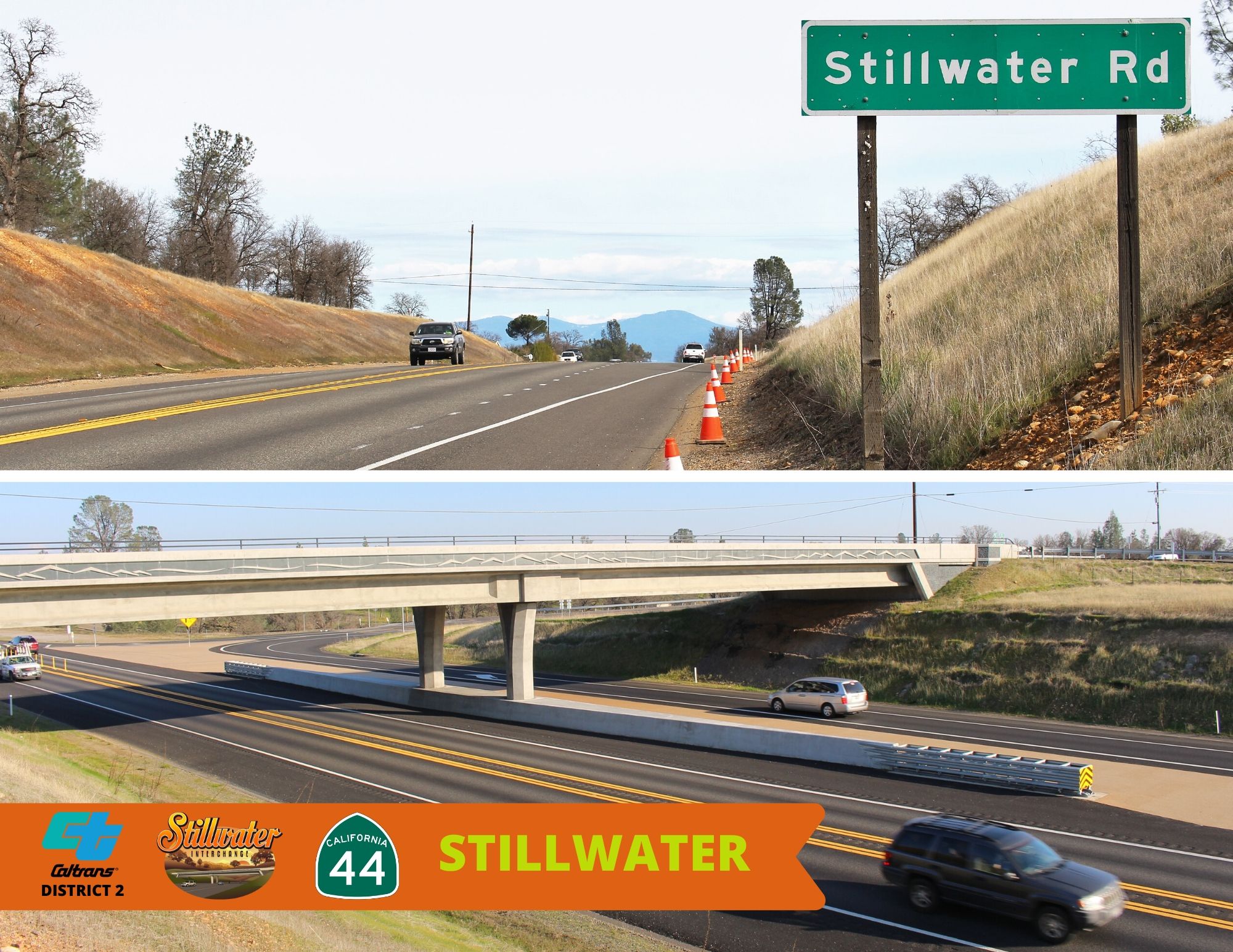
Communities become very excited when long term transportation projects come to fruition. The long-awaited $6.5M operational improvement of an interchange at Stillwater Road and State Route 44 was finally constructed in 2018. The project development team collaborated with the community and local schools and developed a hybrid interchange design that met the community’s needs while keeping within a lower budget.
As planned, the construction took one season - to lessen the disruption to the community and schools. The interchange includes aesthetic mountain motifs as part the poured concrete deck, and an innovative and unique pavement contrast treatment in the north state – a “porous resin-bound aggregate” to help delineate the through traffic lanes under the interchange. Besides beautifying the interchange, this contrast treatment eliminates maintenances efforts and worker exposure to traffic – no restriping needed nor repeated gore sweepings. The project received many positive remarks from the community.
Traveler and Worker Safety
PREPARE Program
-
Caltrans District 10 - Maintenance
-
National Weather Service
-
California Highway Patrol
-
United States Forest Service
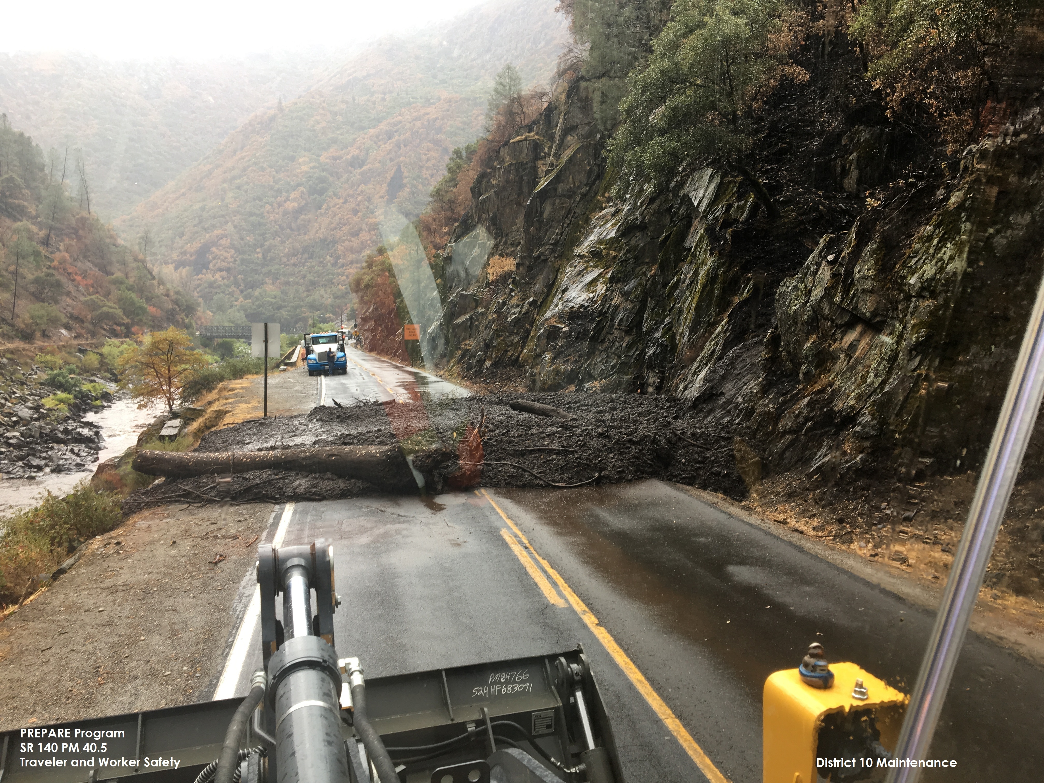
The PREPARE program utilizes Weather Decision Tiers (weather matrix) to lessen the potential impacts for the Ferguson Fire burn scar area to State Route 140 (SR-140). The weather matrix is part of an innovative preparedness plan created in the Fall of 2018 and was piloted in District 10 with successful results in the winter of 2018/2019. It predicted 14 rainfall events that had a potential to trigger debris falls. Six of those rain events were high risk and SR-140 was closed in advance keeping people out of harm’s way. A second wildfire occurred near the Ferguson Fire area in the summer of 2019. The program has been used successfully in the winter 2019/2020 in the Ferguson Briceburg Fire burn scar area.
Community Enhancement
Masonic Streetscape Improvement Project
-
San Francisco Public Works
-
San Francisco Municipal Transportation Agency
-
San Francisco Planning Department
The Masonic Streetscape Improvement Project exemplifies the commitment San Francisco Public
Works has to enhancing public realm and increasing community safety. The Masonic Streetscape Improvement Project offers transformative safety upgrades for pedestrians, cyclists, transit riders and motorists, along with new infrastructure, landscaping, street trees and public art. Guided by Vision Zero, the City’s transportation safety policy, upgrades include improved pedestrian access to transit and new bus bulb-outs, plus new cycle tracks, widened portions of sidewalk, water and sewer upgrades, new lighting in medians, pedestrian-scale lighting on sidewalks, new trees and plantings and the conversion of the southwest corner of Geary Boulevard and Masonic Avenue into a dynamic public plaza.
The two-year, $26 million project began taking root more than a decade ago with a community petition signed by more than 500 people and represents a community-initiated neighborhood enhancement that increased the safety and vitality of the public realm.
Transportation Innovations to Improve Mobility Across California
Westside Mobility Improvement Project
-
STC Traffic, Inc.
-
National City Engineering & Public Works
National City’s Westside Mobility Improvement Project enhanced bicycling and pedestrian
connections in the Downtown and Westside Specific Plan areas. The project improved pedestrian and bicycle access to regional transit facilities, local commercial businesses, and other places of interest such as the Education Village, Chamber of Commerce, Civic Center areas including City Hall, the public library, Kimball Park, Morgan Square, and Casa De Salud Community Center.
Improvements include a traffic calming roundabout at the intersection of Harding Avenue and West 14th Street, conversion of West Avenue to a one-way street northbound, enhanced crosswalks with high intensity signing and striping, new ADA-compliant sidewalks and pedestrian curb ramps, Class II bike lanes with signage on Civic Center Drive, Wilson Avenue and West 22nd Street; and other amenities such as new LED lighting, landscaping, benches, bicycle racks and public art. Enhanced pedestrian environment and bicycle facilities improved safety and connectivity, thus promoting alternate transportation methods to residents and visitors.
Public Awareness Campaigns
SacRT Forward
-
Sacramento Regional Transit
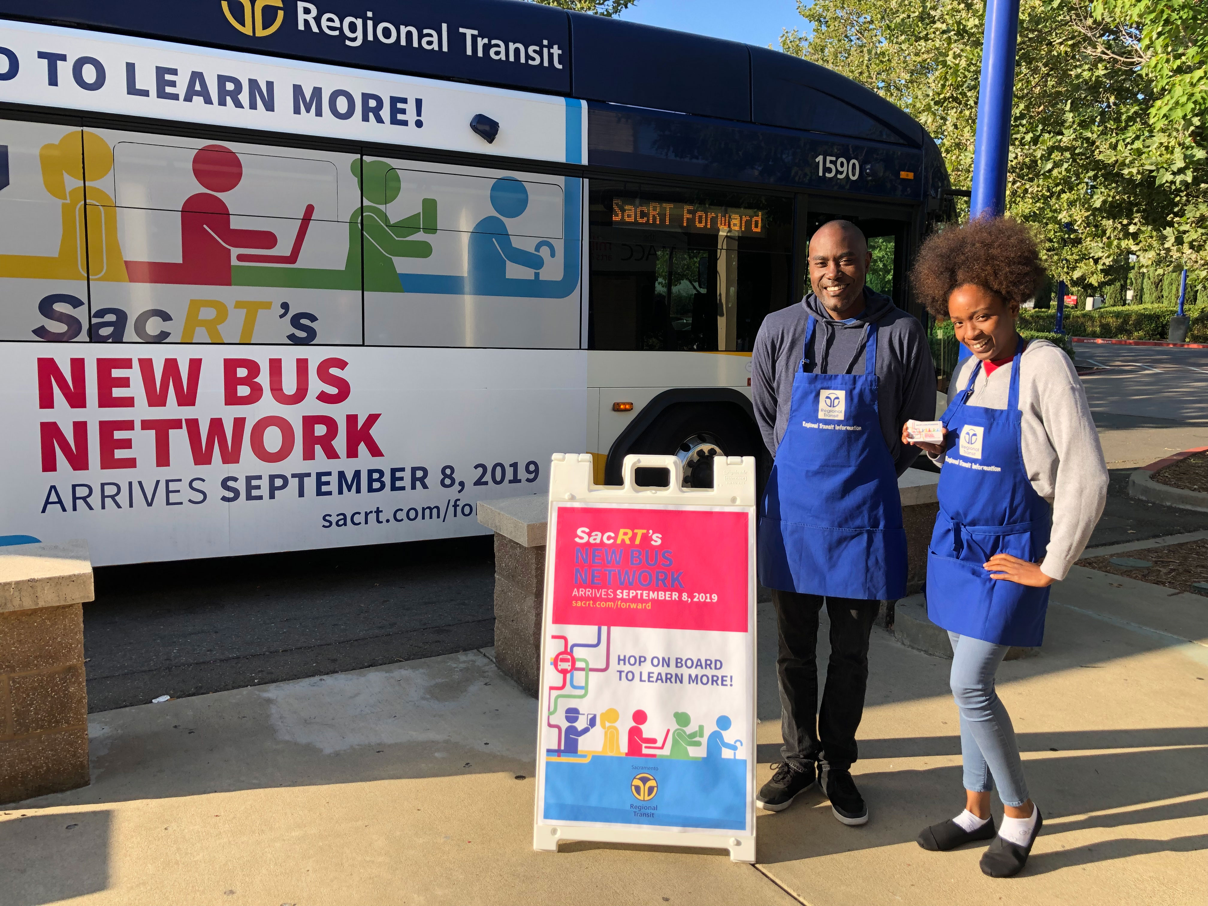
Economic growth and congestion have changed travel patterns in the Sacramento region and caused the Sacramento Regional Transit District (SacRT) to rethink its bus network. The challenge was informing a diverse population of over one million people, scattered in four cities, within 400 square miles of all the changes. For a change of this magnitude, it was to be expected not all customers would be completely happy about changes in their routes; however, not a single complaint was received from a customer not knowing about service changes.
SacRT Forward’s comprehensive campaign applied several innovative strategies to successfully educate current customers and the public about major service changes – ensuring a smooth transition, building brand recognition, and increasing ridership. Not only was almost every bus route adjusted to improve frequency, scheduling, and weekend service, SacRT Forward also raised the standards for safety, cleanliness, and system-wide improvements while lowering fares.
Intermodal Transportation System
SMART Pathway and Rail Project
-
Sonoma-Marin Area Rail Transit District (SMART) Partner
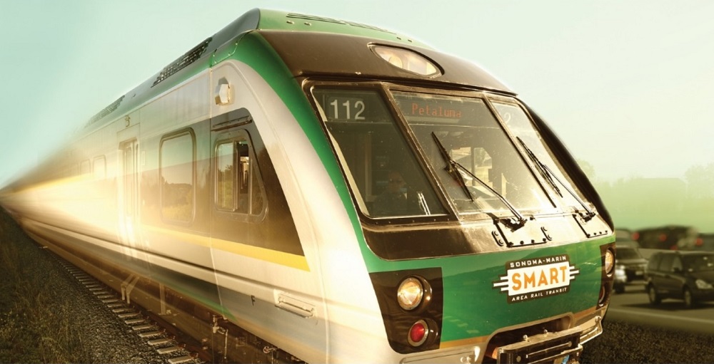
SMART built an integrated system of rail and Class 1 pathway to place the railroad corridor into the highest and most effective transportation use possible.
Photo courtesy of SMART Partner.
SMART is a transit district in Marin and Sonoma counties, formed in 2002 to manage a publicly owned rail right-of-way. Supported by a voter approved ¼ cent sales tax in 2008, SMART has built an integrated system of rail and Class 1 pathway to place the railroad corridor into the highest and most effective transportation use possible, maximizing the public investment. Rail service started in late 2017 on a 43-mile first segment. SMART and local/state partners have completed 18.2-miles of SMART Pathway. An additional 14.5-miles of SMART Pathway are funded for construction. SMART has carried 1.2 million passengers and 105,000 bicycles.
The Highway (Rural)
State Route 76 and Valley Center Road Roundabout
-
Caltrans District 11
-
LB Civil
-
Kleinfelder
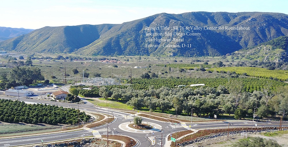
Aerial view, looking southwest, of State Route 76 and Valley Center Roundabout in San Diego County.
Photo by RJ Colunmna, LB Civil.
The State Route 76 and Valley Center Road Roundabout project reduces the severity of collisions at the intersection of SR-76 and Valley Center Road. This portion of the route is designated as a conventional highway and is located at a rural portion of the county. The intersection was flagged as experiencing a higher-than-average number of collisions. This was attributed to limited sight distance and a high-speed differential at the intersection. Sight distance was improved by increasing the radius of the curve at approach and realigning the intersection. The project development team concluded that installing a roundabout at the intersection was the best alternative for this location. With the proposed roundabout improvements, the approaching speed differential at the intersection was eliminated, and conflict points were greatly reduced. Roundabouts have demonstrated to reduce fatalities by 90 percent and injuries by 76 percent. Additional improvements included complete streets elements such as sidewalks, ADA ramps, and improved public transit facilities.
The Highway (Urban)
SR-99 CM/GC Freeway Realignment
-
Caltrans District 6
-
Granite Construction Company
-
California High-Speed Rail Authority
-
City of Fresno
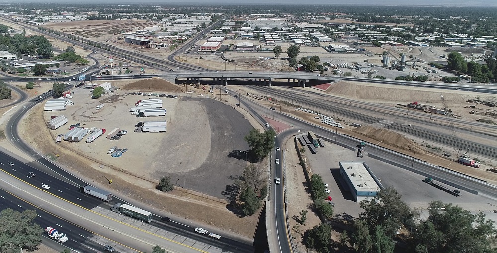
SR-99 CM/GC Freeway Realignment Ashlan Ave. Interchange.
Photo by Randy Lucchesi, Granite Construction Company
Realigning State Route 99, the Central Valley’s transportation backbone and one of California’s busiest truck routes, was no simple task. It took a committed team, strategic planning, and extensive coordination with multiple stakeholders. Working closely with the construction manager/general contractor, local stakeholders, and public, Caltrans successfully realigned two miles of SR-99, demolished and reconstructed the Clinton Avenue Interchange, rebuilt structures over SR-99 and Union Pacific Railroad tracks, installed long-life pavement, and constructed 17 retaining walls, while maintaining all through lanes on SR-99. Extensive outreach and continued interaction with property owners were key to minimizing the project’s effects on the local business community. This created a sense of ownership among all stakeholders and the traveling public. This project is a testament of what can be achieved when the owner, contractor, local stakeholders, and public come together to solve a transportation problem.
Major Structures
Gilman Drive Bridge
-
Caltrans District 11
-
San Diego Association of Governments
-
University of California San Diego
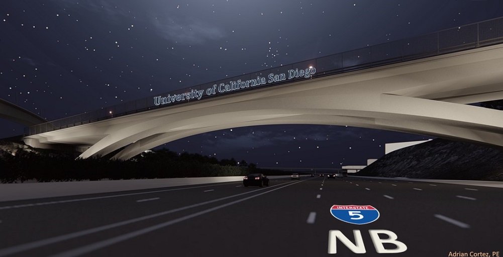
The Gilman Drive Bridge accommodates pedestrians, bicyclists, buses, passenger vehicles, and future expansion of the Interstate 5 North Coast Corridor.
Photo by Adrian Cortez, Caltrans District 11.
Linking the east and west ends of the University of California San Diego campus, the 400-foot-long, 65-foot-wide Gilman Drive Bridge, arching over the Interstate 5 North Coast Corridor (I-5 NCC), accommodates pedestrians, bicyclists, buses, passenger vehicles, and future expansion of the I-5 NCC, completing the long-awaited UC San Diego “Campus Loop” and alleviating traffic congestion from Voigt Drive, La Jolla Village Drive, and Genesee Avenue. In coordination with UC San Diego and San Diego Association of Governments, Caltrans delivered a project that not only provides congestion relief and connectivity but beautifies the community and the I-5 NCC with its “…graceful arch and elegant massing,” as eloquently stated by Mark Armao from the Daily Transcript. The Gilman Drive Bridge will live for many years past our time as an iconic structure to be used and enjoyed by generations to come.
Stewardship of the Environment
Collier Safety Road Side Rest Area Wastewater Improvements
-
Caltrans District 2
-
Timberworks
Collier Rest Area.
Photo courtesy of Caltrans District 2.
The Randolph Collier Safety Roadside Rest Area located on Interstate 5 in rural Siskiyou County had been experiencing problems with the wastewater system because of increased usage. The system required frequent pumping and had sewage backups on three occasions. If the system could not be upgraded, then the rest area would have to be closed. In addition, new environmental requirements required a 95 percent reduction in the amount of nitrogen allowed in the discharged effluent, since the rest area was located along the banks of the Klamath River. Caltrans responded by designing and installing one of the first Advanced Onsite Wastewater Treatment Systems at a California roadside rest area. Along with other improvements, the system uses an engineered wetland with plants to remove the nitrogen from the effluent. These innovative and sustainable technologies help protect groundwater and the surface water resources — improving the environment for fish and other natural resources.
Transportation-Related Facilities
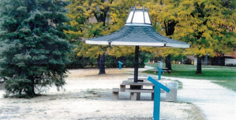
Johnny Cash Trail
-
City of Folsom
-
City of Folsom - Parks and Recreation Department
-
Dokken Engineering
-
Westcon Construction
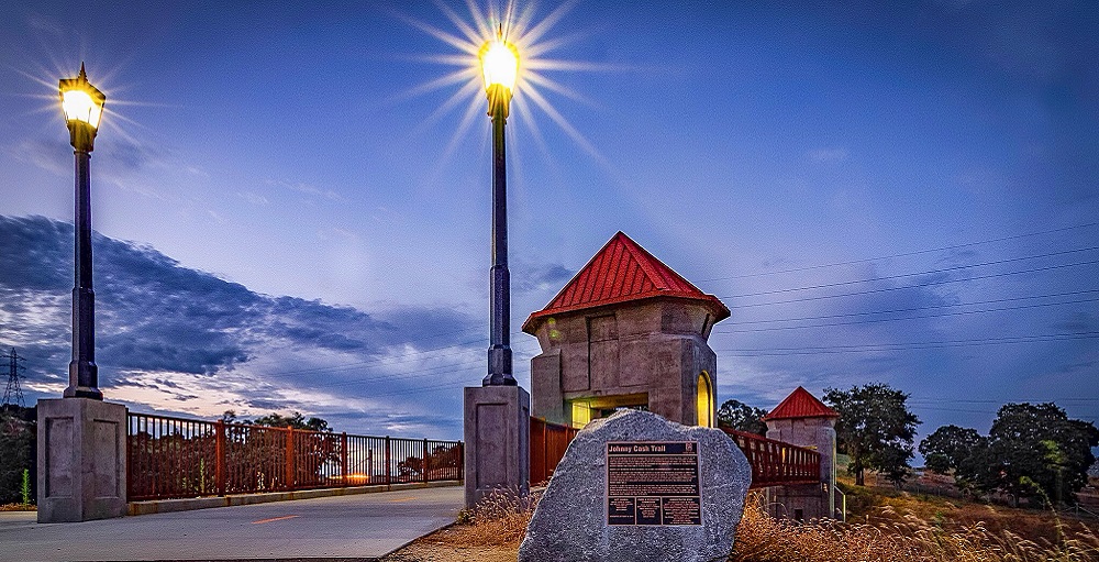
Johnny Cash Trail Bridge Overcrossing.
Photo by Brett Bollinger, City of Folsom.
The Johnny Cash Trail is a 2.5-mile trail located within the city of Folsom and Folsom State Prison property. The new trail also included construction of two bike/pedestrian bridges, Robbers’ Ravine Bridge and the Johnny Cash Trail Overcrossing Bridge, and a bike/pedestrian tunnel undercrossing at the Prison Road intersection with the trail. The Johnny Cash Trail links two adjoining counties and adjacent communities with Folsom's Historic Sutter Street corridor and its Regional Transit Folsom Sutter Street light rail station. The Johnny Cash Trail provided the city of Folsom with an opportunity to unify two distinctive elements that make the Folsom community unique. First, it expanded upon the existing Folsom trail system, providing a multicounty and communitywide trail network that makes connections within the region. Second, it offers the community an unmistakable civic gateway into Folsom that forever preserves the linkage between the city of Folsom, Folsom Prison and Johnny Cash’s legacy.
Transportation System Operations Improvements
Cajon Pass Design-Build
-
Caltrans District 8 Project Management Program
-
Parsons Transportation Group
-
California Highway Patrol, San Bernardino Area
-
Coffman Specialties
Cajon Pass Design-Build Project.
Photo by Caltrans District 8.
Caltrans District 8 used the design-build process to reconstruct a 15.6-mile section of Interstate 15. The project restored the structural integrity and ride quality for the mainline and ramps by replacing the deteriorating Portland Concrete Cement Pavement. The new lanes were constructed to provide 40 years of service life. This means reduced maintenance in frequency and in cost. This is very good news for the traveling public, as this stretch is highly used for recreation destinations such as Las Vegas and is vital for goods movement from the ports of Los Angeles and Long Beach to the rest of the nation. The contractor developed an alternative technical concept using innovations to manage traffic while providing safety. The design-build approach allowed a lower cost of $122 million compared to the $158 million engineer's estimate. Ultimately, 126.5 lane miles were reconstructed/rehabilitated while maintaining traffic flow.
Traveler and Worker Safety
Route Shield Pavement Markings
-
Caltrans Division of Traffic Operations
Caltrans’ new route shield pavement markings help travelers on complex highway interchanges.
Photo Caltrans Division of Traffic Operations.
Caltrans is helping travelers negotiate unfamiliar or complex freeway interchanges with new pavement markings in the shape of the familiar route shields that the travelers are used to seeing posted as signs on posts along the highways. The route shield pavement markings, placed on highways and local streets around the state, are intended to give another visual aid to travelers who are more accustomed to looking up or to the side of the highway for traditional route shield signs. These route shield pavement markings are large enough to be viewed with a quick glance at the road surface. They are approximately 6-foot-wide reproductions of route shield that identify highway numbers. These are placed in the middle of the traffic lanes.
Community Enhancement
Greenville Combine
-
Caltrans District 2
-
Plumas County Department of Public Works
-
Greenville Streetscape Committee
-
Knife River Construction
The Greenville Combine gave the small community of Greenville in Plumas County transformed the town while preserving the motif of the historic community.
Photo by Caltrans District 2.
The Greenville Combine was the result of many years of community and government planning and partnership. The finished product provided the small community of Greenville in Plumas County with a desired outcome of visual enhancement, improved drainage facilities, new pavement, modified intersections, Americans with Disabilities Act upgrades, improved street lighting, and other context sensitive solutions—all while overcoming significant design challenges to bring the town to current highway and ADA design standards. Safety issues were addressed, and motorists and pedestrians now have improved visibility with safe crossing opportunities. Although the town was transformed, the motif of the historic community was preserved, which is expected to benefit the economic vitality and improve visitor attraction.
Transportation Innovations to Improve Mobility Across California
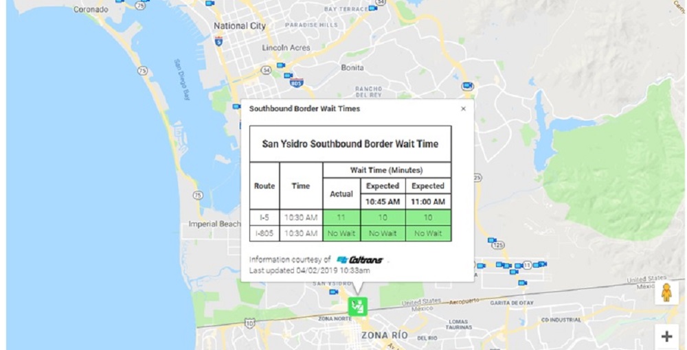
Southbound Border Wait Time Pilot Project
-
Caltrans District 11
Caltrans QuickMap with Southbound Border Wait Pilot Project.
Photo courtesy of Caltrans District 11.
The Southbound Border Wait Time Pilot Project is a critical element in enhancing traffic management capabilities, operations, and functions within the United States and Mexican border region. It is an innovative way of improving mobility within the border region. It improves the border crossing experience in terms of efficiency, reliability, time, and comfort. Using Wi-Fi signature detection from multiple points, the time it will take to cross the border is calculated. This give travelers decision-quality information to make educated choices on when and where to cross the border. The project successfully provides real-time southbound border wait times updated every 15 minutes and a 15- and 30-minutes predictive wait times. The data is currently be provided to the travelling public via Caltrans QuickMap website and the QuickMap mobile application.
Public Awareness Campaigns
Carr Fire Public Awareness Efforts
-
Caltrans District 2
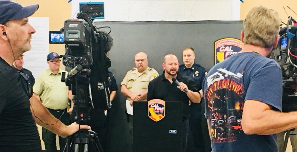
Caltrans District 2 Director Dave Moore participates in a CalFire press conference during the 2018 Carr Fire.
Photo by Caltrans District 2.
When the Carr Fire broke by State Route 299 near Whiskeytown July 23, 2018, nobody expected it would become one of the worst disasters in California. Caltrans’ District 2 Public Information Office responded to the catastrophe while dealing with their own losses, and the public found Caltrans to be a reliable source of information. They also found empathy as staff listened to the public’s despair and reassured them everything was going to be okay. Through social media, community engagement, media relations and outreach, advertising, flyers, a newsletter and plenty of pictures and videos, District 2 public information officers worked tirelessly to provide accurate information to the public. From July through December 2018, District 2 consistently communicated with the public and media, raising awareness about what Caltrans does and how it serves the public—not just during business hours but also during enormous crises, such as the Carr Fire.
Intermodal Transportation System
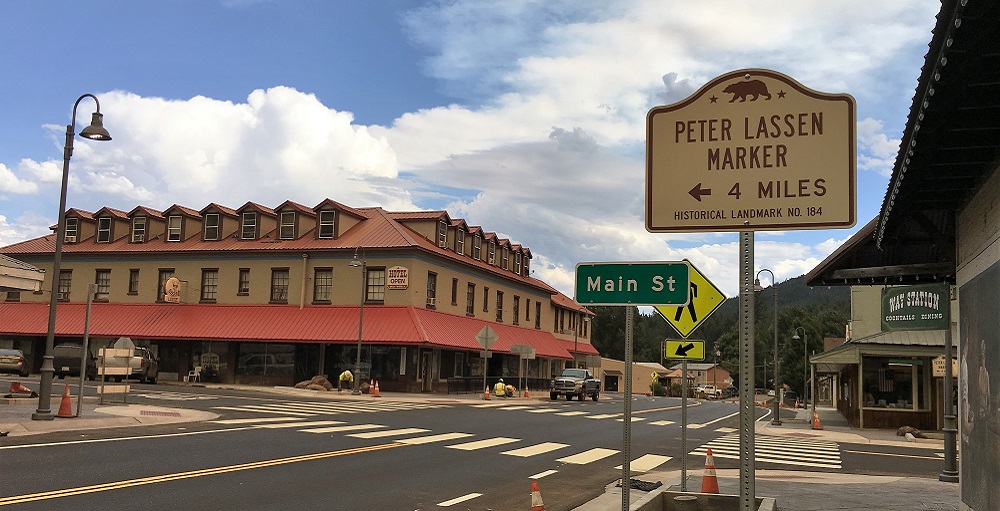
State Route 89 Mousehole Pedestrian and Bicycle Improvement Project
-
Town of Truckee
-
Caltrans District 3
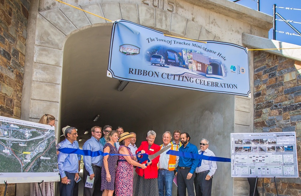
State Route 89 Mousehole Pedestrian and Bicycle Improvement Project Ribbon Cutting Event.
Photo courtesy of Sefan McLeod, Stefan McLeod Photography.
The State Route 89 Mousehole Pedestrian and Bicycle Improvement Project constructed a 12-foot wide pedestrian and bicycle tunnel under the Union Pacific Railroad (UPRR) railway for bicycles and pedestrians who were previously sharing the railroad undercrossing with vehicle traffic. The project is located in the Town of Truckee in Nevada County and is immediately adjacent to the unincorporated portion of Placer County within Caltrans and UPRR right of way. Built in 1928, the existing 24-foot wide concrete vehicle tunnel is locally referred to as the Mousehole because of its arch shape. With two travel lanes of traffic and virtually no roadside shoulders, the absence of any pedestrian or bicycle facility through the Mousehole was of great concern to the community and the region. SR-89 is a heavily used access point connecting Interstate 80 to Lake Tahoe and Truckee.
The Highway (Rural)
Young’s Bar Wall
-
Caltrans District 1
-
Steelhead Constructors, Inc.
-
Yurok Culture Committee
-
Yurok Tribal Chair
-
Riverside County Transportation Commission
-
Caltrans District 5
-
Golden State Bridge, Inc
-
XKT Engineering, Inc.
-
Somerset Engineering
-
Caltrans District 5
-
Elkhorn Slough Foundation
-
Transportation Agency for Monterey County
-
US Fish and Wildlife Service, Ventura Fish and Wildlife Office
-
Caltrans District 2
-
California Highway Patrol, Red Bluff
-
Kimley-Horn and Associates, Inc.
-
Randy Hill Construction, Inc.
-
City of Monterey
-
Omni-Means, a GHD Company
-
Harris & Associates
-
Transportation Agency for Monterey County
-
Myers & Sons Construction
-
Caltrans District 7
-
Caltrans District 4
California Coastal Commission
Golden Gate National Recreation Area
Marin County
Young’s Bar Wall on State Route 169, in Humboldt County, is designed to resemble the outside of a traditional redwood plank house.
Photo courtesy of Phil Frisbie Jr., Caltrans District 1.
In northeastern Humboldt County, approximately 10 miles west of Weitchpec, State Route 169 bisects the Yurok Indian Reservation. At that location, Caltrans worked with the Yurok Culture Committee, the Tribal Heritage Preservation Office, the Yurok Transportation Department, and various tribal members to develop a wall façade. This was a collaborative project intended to educate traveling motorists about the history and culture of the Yurok Tribe and to give a visual sense of the area. The wall is intended to resemble the outside of a traditional redwood plank house and required a safety rail and included a ‘sturgeon back’ design as a runner at the base.
The Highway (Urban)
SR-91 Corridor Improvement Project
State Route 91 Improvement Project has enhanced the quality of life for commuters, local businesses and residents in Riverside County.
Photo courtesy of Steve Jacobs, Jacob’s Media Services.
State Route 91 (“the 91”) in Riverside County ranks among the nation's worst commutes. Its 280,000 daily users and news reporters have dubbed it the “Corona Crawl,” due to its reputation for heavy traffic congestion. The Riverside County Transportation Commission began constructing the $1.4 billion SR-91 Corridor Improvement Project in 2014. Using a first-of-its-kind design-build delivery method authorized by the state legislature, the project added the first express lanes to Riverside County, as well as general purpose lanes, auxiliary lanes and an express lane connector between the 91 and Interstate 15. The 91 Project is more than a transportation infrastructure investment, it has enhanced the quality of life for commuters, local businesses and residents. Since opening day, SR-91 Express Lanes users have been experiencing significant time savings. During fiscal year 2017/18, toll revenue of $24.6 million has far surpassed projected revenue of $9.2 million.
Major Structures
Pfeiffer Canyon Bridge
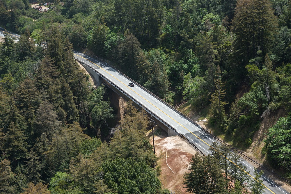
The new Pfeiffer Canyon Bridge on Highway 1 in Monterey County that replaced the original bridge after it was damaged in a landslide during the 2017 storms.
Photo courtesy of Caltrans senior photographer Scott Lorenzo.
State Route 1 (SR-1) in Big Sur is designated an All-American Road under the National Scenic Highways and Byways program. While roads designated within this program are all unique, SR-1 through Big Sur is considered one of the crown jewels of the program. A landslide that followed the heavy January 2017 rains severely damaged the Pfeiffer Canyon Bridge on SR-1 in Monterey County. The original concrete structure, built in 1968, was beyond repair and needed replacement. By February 15, Pfeiffer Canyon Bridge was closed, and SR-1 access to the Big Sur community was cut off from the north. Caltrans quickly determined that a single-span steel girder bridge would replace the structure spanning the 310-foot wide and 100-foot deep canyon. Incredibly, the initial bridge design was completed in just under three weeks, and the seamless partnership between Caltrans and the contractor helped complete processes quickly. To expedite construction, steel girders were pre-fabricated and assembled on site, then “launched” across the canyon. This was California’s first bridge launch on the state highway system. The new $24 million single-span steel girder bridge was opened to the public just eight months after the original concrete structure was condemned, a process that would normally take about 8 years.
Stewardship of the Environment
Elkhorn Highland Reserve Mitigation Site - Prunedale Improvement Project
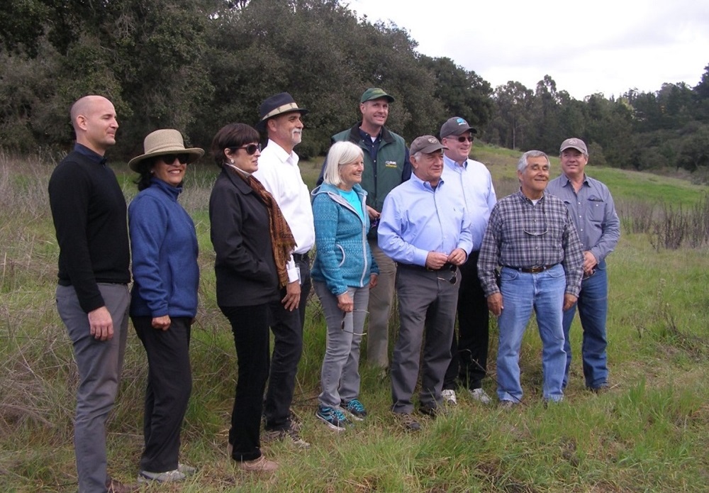
Elkhorn Slough Foundation, Caltrans and Transportation Agency for Monterey County staff Elkhorn Highlands Reserve Mitigation Site, Dedication Ceremony on February 12, 2018.
Photo credit: Nicoletta Lanese with the Monterey Herald (February 12, 2018)
Today’s complex environment frequently requires offsite mitigation to balance environmental effects from transportation projects. The Prunedale Improvement Project improved safety and traffic operations along a highly congested stretch of U.S. Highway 101 in northern Monterey County. The project was years in the making and a welcome improvement for the Prunedale community. It also required offsite mitigation for maritime chaparral, oak woodlands and wetlands that are habitat to several rare and endangered plants and animals. Finding a site that conserves natural resources can be difficult, so can finding partners willing to take on the long-term management responsibilities for a mitigation site. New legislation in 2011 and 2012 allowed Caltrans to transfer to the Elkhorn Slough Foundation land and the endowment for long-term management of the offsite mitigation. Caltrans’ partnership with the foundation resulted in permanent protection of 167 acres of wildlands known as the Elkhorn Highlands Reserve. Conserving the native plants at the reserve benefits the region, by playing an important role in reducing greenhouse gas emissions and protecting water quality by reducing or eliminating soil erosion into the waterways. The Elkhorn Highlands Reserve shows how transportation projects can offer opportunities to expand the conservation value of a site by partnering with community organizations and promoting stewardship of California’s environment.
Transportation Related Facilities
Corning State Roadside Rest Areas
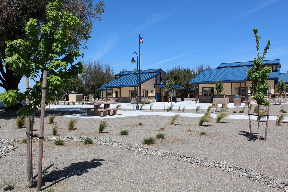
The new Americans with Disabilities Act-compliant Corning State Roadside Rest Areas on Interstate 5 replaced facilities originally constructed in 1971.
Photo courtesy of Caltrans.
The traveling public rightfully expects a place to take care of basic needs, rest, and recharge when traveling California’s highways. Caltrans strives to provide safe, comfortable, convenient, and accessible rest area facilities to meet the ever-growing needs of highway users. The Interstate 5 Corning northbound and southbound rest areas no longer served that purpose and needed to be rehabilitated. Originally built in 1971, these facilities long outlived their expected 20-year design life and were unable to meet the needs of all users. After struggles with funding and awarding a construction contract, the project was finally completed in November 2017. The reconstructed comfort stations should meet drivers’ needs for at least the next 20 years. The areas incorporate recycling and reuse, simplistic cost-effective design, drought tolerant features, low maintenance landscaping, and eye-catching architectural features. Additional lighting and shared office space for the California Highway Patrol further enhance the safety and security of the facilities. Americans with Disabilities Act accessible facilities and compliant walkways make the entire facility accessible to all users.
Transportation System Operations Improvements
Holman Highway 68 Roundabout
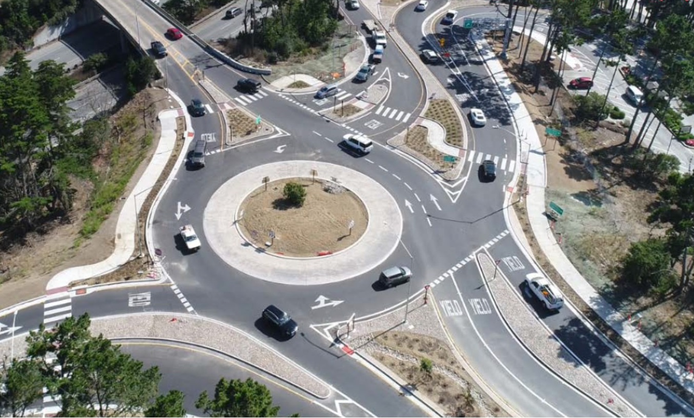
The Holman Highway 68 Roundabout in the city of Monterey.
Photo courtesy of Ronald Boyle, PE, Omni-Means, a GHD Company
The Holman Highway Roundabout represents a new paradigm in transportation design. No longer is it necessary to consider only traffic signals for highly congested intersections. The roundabout solution addressed all of the unique characteristics of the area while relieving congestion, improving emergency response times, and creating a sustainable gateway to the Monterey Peninsula and Pebble Beach Community. The designers maximized roundabout design principles and leveraged the more efficient operations and superior capacity of roundabouts to minimize upstream and downstream roadway improvements. This project cost $8.5 million and replaced a previously approved widening project that had an estimated cost of $21 million and included a bridge replacement, signalized intersection, and a significant visual impact on a scenic corridor. The project was completed in September 2017 within the intended time frame and on-budget with no claims during construction and is a new jewel on the Monterey Peninsula, albeit a much more affordable one.
Traveler and Worker Safety
Route 101 Calabasas Precast Panel Roadway Rehabilitation
On the Scofield Bridge Deck Replacement Project, Myers teams encountered a Honda Civic neatly parked within the falsework.
Photo courtesy of Kurtis Frailey, Myers and Sons.
Wrong-way and impaired drivers are an increasing risk in highway work zones. Nationally, about 355 people die each year in wrong-way crashes. The Federal Highway Administration estimates 96,626 crashes happened in work zones in 2016, an increase of 7.8 percent over 2015. On the Route 101 Calabasas Precast Panel Roadway Rehabilitation project, Myers & Sons focused on using the Early Action Barrier System approach. This system was originally developed by field superintendents and craft workers who witnessed the sharp increase of wrong-way and impaired drivers entering work zones from the end of the barrier. The system is designed to protect people from errant drivers trying to enter the zone. The key elements in protecting workers from a vehicle threat is establishing appropriate distance between workers and vehicles and slowing entering vehicles to give workers more time to react and move from the area. The barrier system approach exceeds standard Caltrans closure guidelines, has no effect on the driver experience within the work zone, and has minimal effects on vehicles exiting a work zone parallel to traffic.
Community Enhancement
Marin County State Route 1 Repair Guidelines
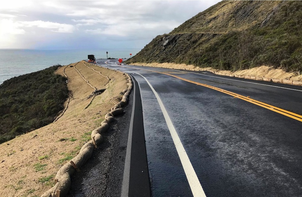
Storm Damage Repair nearing Completion at Marin State Route 1 Showing Buried Retaining Wall and Revegetation in Progress.
Photo courtesy of Caltrans District 4.
State Route 1 draws visitors to state and national parks, natural food farms, and ranches. The natural forces that formed this unique landscape also imperil it. The recurring need for storm and landslide repairs endangers both the beauty and economy of the region. The “Marin County State Routes 1 Guidelines” streamlines repair projects in a complex regulatory environment. State Route 1 serves as a vital corridor along the California coastline for local residents as well as millions of visitors who tour the region. Closure on this highway from frequent storms and landslides threaten residents and businesses, and inconvenience visitors. The Guidelines provide a corridor-centric approach that ensure consistent, accelerated repairs, maintains public safety, and respects the region’s exceptional scenic and environmental qualities.
Maintenance – Operations or Equipment
Swarm Maintenance/GSA 57-Hour Closure
-
Caltrans District 11
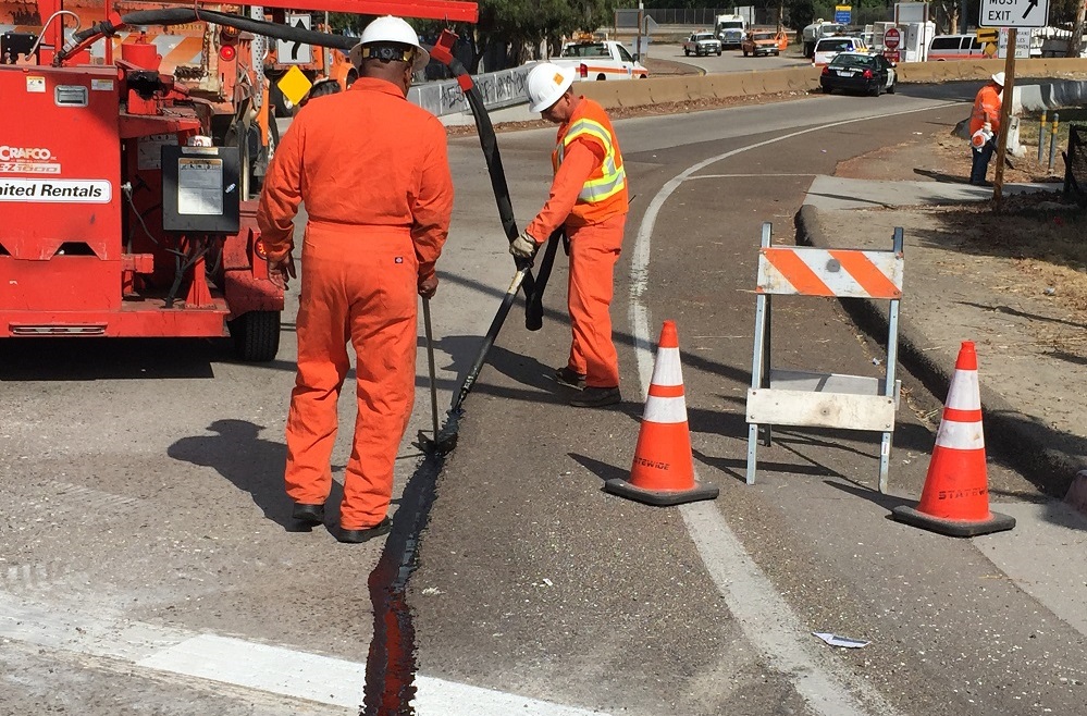
Swarm Maintenance crews in Caltrans District 11 in San Diego.
Photo courtesy of Hayden Manning, District 11
As a result of a planned 57-hour closure of southbound Interstate 5 and southbound I-805 by the U.S. General Services Administration (GSA) in San Ysidro and the international border with Mexico, Caltrans maintenance crews developed and used a swarm maintenance operation to address routine and needed maintenance activities on the closed segments of both interstates on September 23 and 24, 2017. The crews of the south bay area of District 11 San Diego worked closely with internal and external partners to perform swarm maintenance. This effort involved coordination with internal Caltrans partners, as well as external partners, including the GSA, GSA contractor Atkinson-Clark, and the California Highway Patrol. More than 10 maintenance crews helped accomplish maintenance tasks that would have required over 25 separate closures. The super closure was completed ahead of schedule, with no delay to the prime contractor, using over 80 Caltrans maintenance employees and over 40 public service workers.
Highway as a Main Street
Fulton Street Reconstruction Project
-
City of Fresno
Royston, Hanamoto, Alley & Abbey
American Paving Company
Provost & Pritchard
September 29, 2017, Fulton Street is open for business.
Photo courtesy of Randall Morrison, City of Fresno.
The Fulton mall was the historic site of Fresno’s “main street” and the soul of its downtown. In its heyday, Fulton was the central urban destination for a four-county region in California’s San Joaquin Valley that is now home to over 1.6 million people. Closed to vehicle traffic in 1964, these six blocks of Fulton and three cross streets suffered economic decline for over four decades, reaching a state of total decay. Today the Fulton mall no longer exists; in its place is a rejuvenated “main street” with a complete street design using modern technologies and a remarkably nostalgic preservation of the key features and designs of the Fulton mall. The $20 million dollar Fulton street reconstruction project improved the half-mile stretch of the Fulton mall between Tuolumne Street and Inyo Street. The old pedestrian mall was completely removed and reconstructed with a complete streets design that included reintroducing two-way vehicular traffic balanced by pedestrian-oriented amenities.
Transportation Innovations to Improve Mobility Across California
MacArthur 580 On/Off Ramp Reconstruction
-
Caltrans District 4
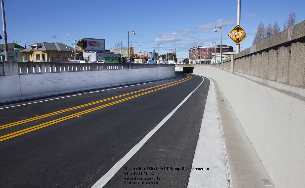
West MacArthur on-ramp/off-ramp reconstruction to Interstate 580 at San Pablo Avenue in Alameda County.
Photo by Caltrans District 4 Photographer John Huseby
The Interstate 580 MacArthur Ramp Structure Trench Section was constructed in 1936 and consists of two concrete retaining walls with a concrete seal slab between them. The 2016 storms caused increased groundwater seepage, and investigations revealed this was likely due to failed water seals and a failed system designed in 1947 to capture groundwater that passed the seals. Caltrans fixed the issues without cutting the seal slab or compromising the structure. An innovative solution used a permeable subsurface fabric to capture water at the slab joints. New horizontal drains were designed to dewater up to 20 feet behind the walls, and a hollow curb section captures groundwater and storm water. District 4 also worked closely with the City of Oakland to improve bicycle safety at the ramp exit by reducing the lanes from two to one in the eastbound direction, allowing for an 8–foot shoulder for maintenance within the trench section. This unique solution created a safer road for motorists, maintenance workers, and bicyclists and greatly reduced cost and time compared with replacing the retaining structure.
Public Awareness Campaigns
91/Perris Valley Line
-
Riverside County Transportation Commission
Through its extensive public awareness campaign, RCTC made the public aware of the new service being offered and educated communities about the dangers around railroad tracks.
Photo courtesy of Ariel Alcon Tapia, Arellano Associates.
The Riverside County Transportation Commission and Metrolink began passenger rail service on the 91/Perris Valley Line, a 24-mile extension from Downtown Riverside to South Perris, on June 6, 2016. The first Metrolink extension since 1994, this new line added four new stations, and commuters in the Perris Valley and Temecula Valley are now connected to the 538-mile network that Metrolink operates in Riverside, Los Angeles, Orange, Ventura, San Bernardino, and northern San Diego counties. Riverside County is one of the nation’s fastest growing areas, and with housing and business booming, the vehicle traffic on local roadways is expected to increase significantly. The 91/Perris Valley Line is helping relieve traffic congestion along its entire route, while offering a new transportation alternative to the community. Since opening the new line, ridership has significantly increased and has introduced communities to a new form of travel. Ridership the first month exceeded expectations and has consistently increased.
Intermodal Transportation System
US-101 HOV Project with Class I Bike Path
-
Caltrans District 7
-
Caltrans District 5
-
Santa Barbara Association of Governments
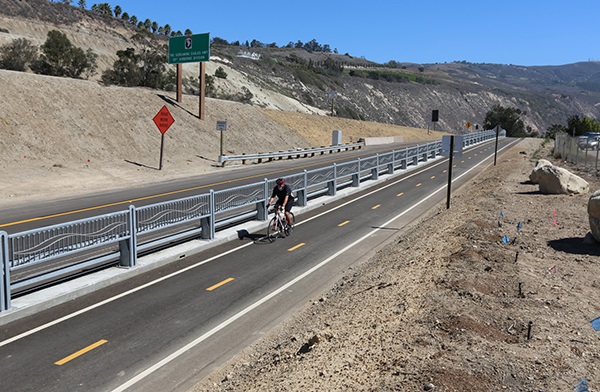
US-101 HOV Project with Class I Bike Path
The first commuter-period, high-occupancy vehicle lane in Ventura County was built in the median in each direction of US-101 to relieve congestion in this growing region. The lane is open to all traffic during off-peak times. A scenic Class I bike path/pedestrian trail with aesthetic design features along the southbound shoulder was also constructed, upgrading the existing Class III bike path. The bike path/trail completes a 4-mile gap in the California Coastal Trail, providing a connection between Ventura and Santa Barbara counties. The path also offers four new vertical accesses to the beach. An ADA-compliant pedestrian undercrossing at La Conchita gives the public access to the beach where none existed. New intelligent transportation system elements such as vehicle detectors, closed-circuit TV camera and changeable message sign have also been added within the project limits.
The Highway (Rural)
Willits Bypass
-
Caltrans District 1
-
Caltrans Division of Engineering Services
-
Caltrans North Region Design
-
Caltrans North Region Environmental
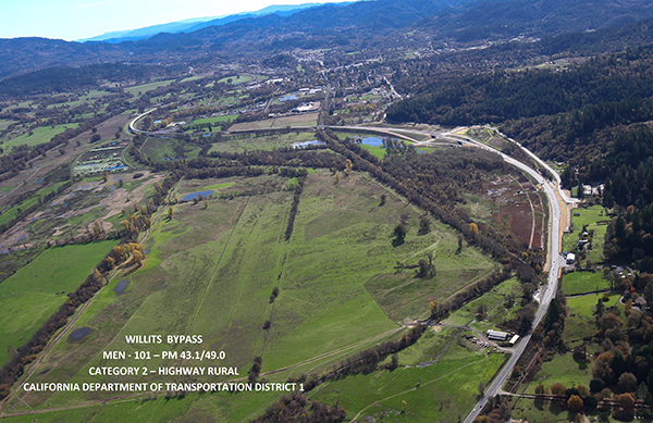
Willits Bypass
The Willits Bypass Project moved US-101 to a new 6-mile alignment on the east side of the city of Willits. It opened to traffic in November 2016 and eliminated the final traffic signals between San Francisco and Eureka. Through partnerships, primarily between Caltrans, Mendocino Council of Governments, the County of Mendocino, and the City of Willits, the project came to fruition—almost 60 years after its conception. The project significantly reduced travel time, improved highway access, and restored downtown Willits from a major highway to the center of a livable rural community. The alignment and design give motorists woodland and pastoral views from start to finish and was chosen to minimize effects to the numerous cultural and natural resources in the Little Lake Valley. A mile-long floodway viaduct significantly minimized wetland impacts and allows exceptional elevated views of the valley. Endangered plant rhizomes were relocated, and over 2,000 adjacent acres of wetland/pasture/woodlands are being restored, enhanced, and protected to mitigate for 80 acres of wetland impacts. This unprecedented effort will help restore the significant hydrologic functions and aquatic habitat of the scenic valley, which for more than a century have been altered by agricultural activities designed to drain it. Many severely degraded stream channels within the project footprint have also been reconstructed and planted with native vegetation to restore historic migratory fish habitat.
The Highway (Urban)
State Route 4 East Widening Project
-
Caltrans District 4
-
Contra Costa Transportation Authority
-
Bay Area Rapid Transit
-
Metropolitan Transportation Commission/Bay Area Toll Authority
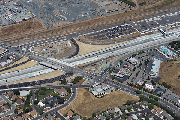
State Route 4 East Widening Project
To address one of the worst commutes in the nation, the Contra Costa Transportation Authority (CCTA), Caltrans, and other project partners completed the State Route 4 East Widening Project, which expanded SR-4 from four to eight lanes along a 7-mile stretch between Loveridge Road in Pittsburg to State Route 160 in Antioch. The project also provided a wide median with bridges, pedestrian overcrossing, station platforms and a tunnel to accommodate a BART extension to Antioch. Designed and developed in five segments, the project included reconstructing five interchanges, one overcrossing and one undercrossing and constructing auxiliary lanes between interchanges. In close partnership with CCTA, Caltrans administered the construction contracts for four of the project’s segments. Through extensive outreach, the team kept about 250,000 residents informed of construction activities and more than 130,000 vehicles moving each day while replacing every inch of pavement along this regionally-significant segment. The project created approximately 13,000 jobs and is expected to stimulate permanent employment – a boon to a local economy that was decimated during the Recession. Successful collaboration among all project partners ensured the project’s on-time and on-budget completion.
Major Structures
Antlers Bridge Replacement
-
Caltrans District 2
-
Tutor Saliba Corp.
-
Lakehead Community Development Association
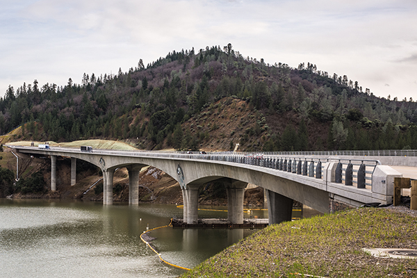
Antlers Bridge Replacement
In northern California, Interstate-5 follows a historic north/south route through the Sacramento River Canyon. For 74 years, a 1,328-foot-long long steel deck truss carried I-5 traffic across the Sacramento River arm of Shasta Lake, the largest reservoir in California. Its active fatigue cracks and degrading deck made the bridge an annual drain on the state’s maintenance resources. It lacked shoulders and had a steep, tightly curved approach roadway that some say resembled a ride down a luge run. In September 2016, the aging structure was retired and traffic was moved to a new 1,942-foot-long cast-in-place, pre-stressed concrete box girder constructed adjacent to the old bridge. The of the bridge, marine environment, recreation, environmental constraints, stakeholders and access constraints created many challenges for the project team and contractor. Once the challenges were overcome and the bridge was complete, it was clear that this $131,000,000 project will, for many years, provide exceptional service for the movement of people and goods in the West.
Stewardship of the Environment
OCTA's Measure M2 Environmental Mitigation Program
-
Orange County Transportation Authority
-
U.S. Fish and Wildlife Service
-
California Department of Fish and Wildlife
-
Environmental Coalition
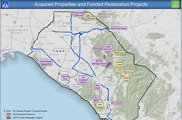
OCTA’s Measure M2 Environmental Mitigation Program
Orange County Transportation Authority’s (OCTA) Measure M2 Environmental Mitigation Program allocates funds to acquire land and fund habitat restoration projects in exchange for streamlined biological permits for 13 freeway improvement projects. The conservation properties, or preserves, are purchased and permanently protected as open space. Funded restoration projects restore open space lands to their native habitat and include removing invasive plant species. To date, OCTA has acquired 1,300 acres of preserves and funded 11 restoration projects (350 acres) throughout Orange County. The mitigation program has provided an opportunity for local and regional stewardship that benefits critical habitats and native species. With early support from regulatory and permitting agencies, as well as engagement with the public, OCTA finalized the M2 Natural Community Conservation Plan/Habitat Conservation Plan along with an environmental impact report/statement in November 2016 by integrating the preserves and restoration projects in exchange for the streamlined approval process.
Transportation Related Facilities
San Diego International Airport Rental Car Center
-
San Diego County Regional Airport Authority
-
Austin-Sundt
-
Kimley-Horn and Associates, Inc.
-
Demattei Wong Architecture
San Diego International Airport Rental Car Center
The new San Diego International Airport Rental Car Center houses rental car companies, including national brands, as well as local, independent and small business rental car companies in one location. The center is designed to enhance the customer experience. The airport-branded shuttle bus system brings rental car customers to and from the airport terminals on an on-airport roadway that bypasses busy city streets. The center is aesthetically pleasing. It features stunning architecture and purposeful, yet playful public art that creates a uniquely San Diego experience that welcomes visitors to the region. The project’s construction was also good for the local economy. Of the total $316 million cost, more than $186 million in construction contracts were awarded to local businesses, with $70 million of that going to small businesses. The project generated about 4,600 jobs, and no local taxes were used to build or operate the center. Construction was completely funded by the Airport Authority using customer facility charges, and the facility’s sustainable design earned it Leadership in Energy and Environmental Design (LEED) Gold certification from the U.S. Green Building Council. The Rental Car Center at San Diego International Airport is a true model for the airport industry. It sets the standard for customer service, intelligent design, environmental sustainability and efficiency. The project was within budget and opened on schedule in January 2016.
Transportation System Operations Improvements
Yellow Pedestrian Border
-
Caltrans District 2
Yellow Pedestrian Border
At thousands of signalized intersections throughout the country, a potential for conflict between pedestrians using a crosswalk and turning vehicles exists when the two moves happen together. This type of encounter occurs when waiting pedestrians go unnoticed by motorists because they are standing off to the side and out of the direct line of sight. Supplementing a standard pedestrian signal head module with an actuated yellow LED border provides the ability to advise both vehicular and pedestrian traffic that the signal has received a call to serve a specific crosswalk. The Yellow Pedestrian Border, or YPB, has been studied at five intersections in the city of Redding as part of Federal Highway Administration Experiment 4(09)-13(E). The YPB was found to be a positive enhancement at signalized intersections, providing useful information to both vehicular traffic and pedestrians. Before and after treatment results for the five intersections showed an overall reduction in conflicts, crossing violations, and repeated pedestrian button pushes. Most importantly, the yellow border is most noticeable to motorists during low light and inclement weather conditions when pedestrians are difficult to see and the potential for conflict is most serious.
Traveler and Worker Safety
Cable Barrier Safety Project
-
Caltrans District 11
Cable Barrier Safety Project
The Interstate 15 High Tension Cable Barrier (HTCB) System Safety Project was constructed on a stretch of I-5 that is a divided eight-lane freeway and is a heavily traveled commuter route that provides access to growing residential communities to the north. This corridor has a rural setting with rolling hillsides and steep slope embankments along the median and outside shoulders. To reduce the frequency and severity of incidents where vehicles leave the traveled way, District 11 installed its first four-strand HTCB systems in the median and along the outside shoulders. The HTCB systems were stained a brown to blend in with the rural setting of this corridor, and a brown-colored concrete vegetation barrier was constructed under the HTCB systems.
Community Enhancement
Healdsburg Bridge over the Russian River
-
Omni Means, Ltd. (A GHD Company)
-
City of Healdsburg
-
Cornerstone Structural Engineering Group
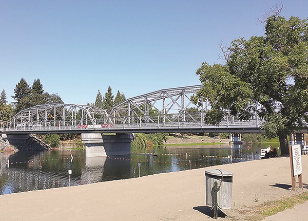
Healdsburg Bridge over the Russian River
The Healdsburg Avenue Bridge over the Russian River project consisted of rehabilitating and seismically retrofitting a historic two-span steel Parker truss bridge in Sonoma County. Constructed in 1921, the bridge is listed on the National Register of Historic Places and holds a special place with the local community. After nearly a century of service, the existing bridge was plagued with several structural and functional issues and complete replacement was initially considered. Through public outreach, it became apparent that the community strongly desired to rehabilitate the bridge in place as a vehicular bridge, even when presented with options of repurposing it as a pedestrian/bicycle bridge alongside a new modern concrete bridge. After hearing the strong public feedback, the city and design team proceeded to preserve, rehabilitate, and seismically retrofit the existing bridge in place. Special design features were required to restore historic elements while strengthening and seismically retrofitting truss members, maintaining pedestrian and bicycle access critical to the local economy, and improving public health and safety during and after the project. Through a collaborative effort with project stakeholders, including local community members, Caltrans, the Federal Highway Administration and the State Historic Preservation Office, the city and its design team successfully delivered the desired project on schedule and within budget.
Maintenance – Operations or Equipment
Campo Creek Bridge (Replace)
-
Caltrans District 11
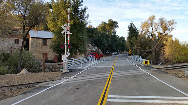
Campo Creek Bridge (Replace)
The Campo Creek Emergency Bridge Replacement Project is located on State Route 94, in San Diego County, about 30 miles east of San Diego and 1-1/4 miles north of the United States/Mexico Border. A Director’s Order was initiated to replace the bridge and ensure the safety and reliability of the principal route in this rural area and the only link to the international border at Tecate, Mexico. The original bridge was a three-span structure constructed in 1942 with a concrete deck on timber stringers and supported by spread footings. Caltrans Structures Maintenance & Investigation engineers recommended immediate replacement of the structure, due to extensive deterioration of the timber stringers and concrete bridge deck, rendering the bridge structurally deficient and in threat of collapse. Water infiltrated through deck cracks on and excessive scour caused the structure to be temporary supported with falsework bents. The bridge replacement was a 58-foot single-span structure over Campo Creek. Accelerated bridge construction methods were used to minimize construction time impacts. Prefabricated bridge deck eliminated the need for falsework, and although this is a small bridge, there were many restrictions the project team had to overcome. They had to be extremely resourceful and innovative to deliver the project within the environmental constraints and community impacts. Caltrans worked closely with all stakeholders to complete the new bridge and reopened the highway in less than 10 weeks.
Highway as a Main Street
Port Access Improvement: Tenth Avenue Terminal
-
Caltrans District 11
-
San Diego Association of Governments
-
Quality Infrastructure Corporation
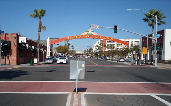
Port Access Improvement: Tenth Avenue Terminal
Caltrans collaborated with the community and multiple agencies to integrate an innovative, “context sensitive” and economical solution to deter truck traffic from Cesar E. Chavez Parkway. In addition to operational improvements, a gateway sign, upgraded decorative sidewalks and crosswalks, and landscaping were added along Cesar E. Chavez Parkway and Harbor Drive, developing a parkway concept. The project will improve air quality, reduce noise, and bring safety benefits to Barrio Logan, an “environmental justice” community. The resulting well-defined truck route from Tenth Avenue Marine Terminal to and from the freeway network minimizes negative effects on the community, improves traffic circulation in Barrio Logan and improves the overall quality of life in the neighborhood.
Transportation Innovations to Improve Mobility Across California
Flying Wedge Bicycle Pavement Marking
-
Caltrans District 2
-
Shasta Wheelmen
-
Shasta Living Streets
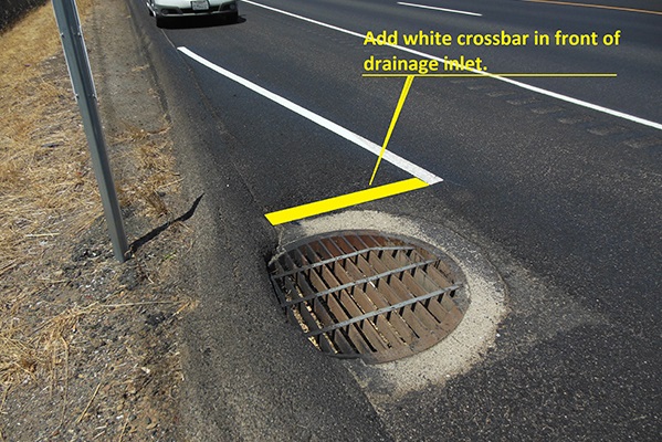
Flying Wedge Bicycle Pavement Marking
One of the challenges for bicyclists traveling along California’s roadways is identifying hazards that can pop a tire or cause a wreck. Drainage inlets, recessed utility box lids, and ground-in rumble strips are common obstacles a cyclist may encounter when riding on a paved highway shoulder. These features are often difficult to see due to shadows, low-light conditions, or the angle of the sun is such that it’s shining in the rider’s eyes. Rumble strips can be hard to distinguish because the depressions tend to blend with the surrounding pavement. These situations create unexpected surprises for cyclists who unknowingly run over them. An easy solution that will help cyclists and improve safety is delineating a path around these hidden obstacles. That is the purpose behind the “Flying Wedge” pavement marking used on State Route 44 between the city of Redding and Palo Cedro. The triangular wedge detail is formed with six-inch white stripes to form a modest taper, starting at the highway edgeline or the outside edge of pavement, to the front edge of the object to be avoided. A perpendicular stripe is placed immediately in front of the hazard to highlight exactly where it is located. This simple striping detail safely guides bicycles away from the hazard, eliminating any guesswork on the part of the rider. The result is improved safety and a better riding experience for the cyclist.
Public Awareness Campaigns
511 Carpool Program
-
Metropolitan Transportation Commission
-
Bay Area Air Quality Management District
-
WSP/Parsons Brinkerhoff
511 Carpool Program
The Metropolitan Transportation Commission (MTC) manages the 511 Carpool Program, which encourages carpooling and vanpooling to shift travel from single occupant vehicles. A key aspect of the 511 Carpool Program is conducting direct-to-consumer marketing to build awareness of carpooling, increase registrations in its carpool matching database, and increase carpooling trips. In 2014, MTC established formal, first-of-its-kind, no-cost partnerships with private sector carpool matching apps to encourage their proliferation and use. These efforts have already increased use of these apps and grown their databases so that they can enable consistent, mid-to-long-distance commute carpooling from origins and destinations outside the urban core. The program developed unique campaigns to build public awareness and increase carpooling behavior, including short-term incentives that award Scoop carpool app users $5 - $500 for scheduling a ride on a randomly selected day, an outreach blitz at an Oakland A's game, wrapped cars promoting carpooling, sarcastic messaging on billboards, and Pandora ads. It has also used targeted emails, phone calls and in-person outreach at employers, coffee shops, and other retail locations to inform people of their carpool options. Recently, the 511 Carpool Program partnered with BART and Scoop to develop a "Carpool to BART" program, where BART provides guaranteed parking spaces until 10 a.m. for people carpooling to Dublin-Pleasanton BART station with the Scoop app. As a result of these and other campaigns, the 511 Carpool Program is responsible for more than 40,000 carpool trips since January 2015.