I-280 Farallones Street Pedestrian Overcrossing and Rehabilitation Project

Public Meeting Information
Future meetings to be scheduled
What’s New?
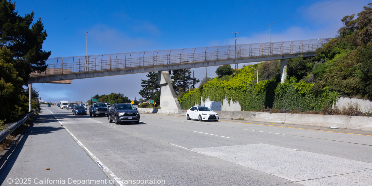
Caltrans is moving forward with the I-280 Farallones Street Pedestrian Overcrossing and Rehabilitation Project, which includes replacing the aging pedestrian Whipple Avenue bridge (pictured above) and performing major upgrades along I 280 between St. Charles Avenue and Brannan Street.
Pedestrian Overcrossing (POC) Replacement
The existing Whipple pedestrian bridge will be replaced with a safer, ADA compliant, seismically upgraded structure featuring improved lighting and wider, more accessible pathways. This new bridge will be renamed Farallones Street Pedestrian Overcrossing, given its proximity to Farallones Street.
I‑280 Freeway Rehabilitation Work
Along the I‑280 corridor, the public will see significant improvements, including:
- New asphalt concrete pavement east of the US‑101 interchange by China Basin, on the double‑deck section, and beyond
- Repaving of all on‑ and off‑ramps
- Polyester concrete overlays on bridge decks
- Upgraded concrete median barriers
- Rehabilitation of drainage systems
- ADA‑compliant curb ramp upgrades
- A new Changeable Message Sign (CMS) at the Chase Center Mariposa off‑ramp
These upgrades will improve pavement life, safety, and overall driving conditions throughout the project limits.
When Is It Happening?
Construction is expected to begin soon, by the end of Summer 2026! This project will take approximately two years to complete.
Why Is This Necessary?
The existing pedestrian overcrossing no longer meets modern safety or accessibility standards. And the heavily traveled sections of I‑280 require pavement, structural, and drainage improvements. Completing these upgrades together supports long‑term safety and mobility for pedestrians, cyclists, and motorists.
Traffic and Construction Impacts
Work on both the bridge and the freeway will require temporary lane reductions, nighttime activities, detours, and occasional full closures. Residents and businesses near the corridor should also expect periods of construction noise, especially during demolition, paving, and overnight work. Caltrans will work to minimize disruptions where possible and will provide updated schedules as they become available.
Community and Driver Benefits
The project will deliver a safer and more accessible pedestrian crossing, smoother pavement, improved infrastructure reliability, better lighting, and reduced long‑term maintenance needs for both the overcrossing and the freeway.
Please visit this page frequently to track the progress of this exciting project. Also, on this page you will find the latest traffic advisories, detours, and freeway and lane closure schedules for this project, as they are finalized.
FAQ
Here’s a copy of our project’s FAQ sheet, created so you can easily save or reference the key information whenever you need it. If you’d like to download or view the full fact sheet, please click the link below.
- I-280 Farallones Street Pedestrian Overcrossing Rehabilitation Project Fact Sheet - EN
- I-280 Proyecto de Rehabilitación del Puente Peatonal de la calle Farallones - ES
- Proyekto sa Rehabilitasyon ng I-280 Farallones Street Pedestrian Overcrossing - FIL
- Dự án Cải tạo Cầu vượt Dành cho Người đi bộ Farallones Street trên tuyến I-280 - VI
- 人行天桥改造项目。- ZH
The Aesthetic Approach
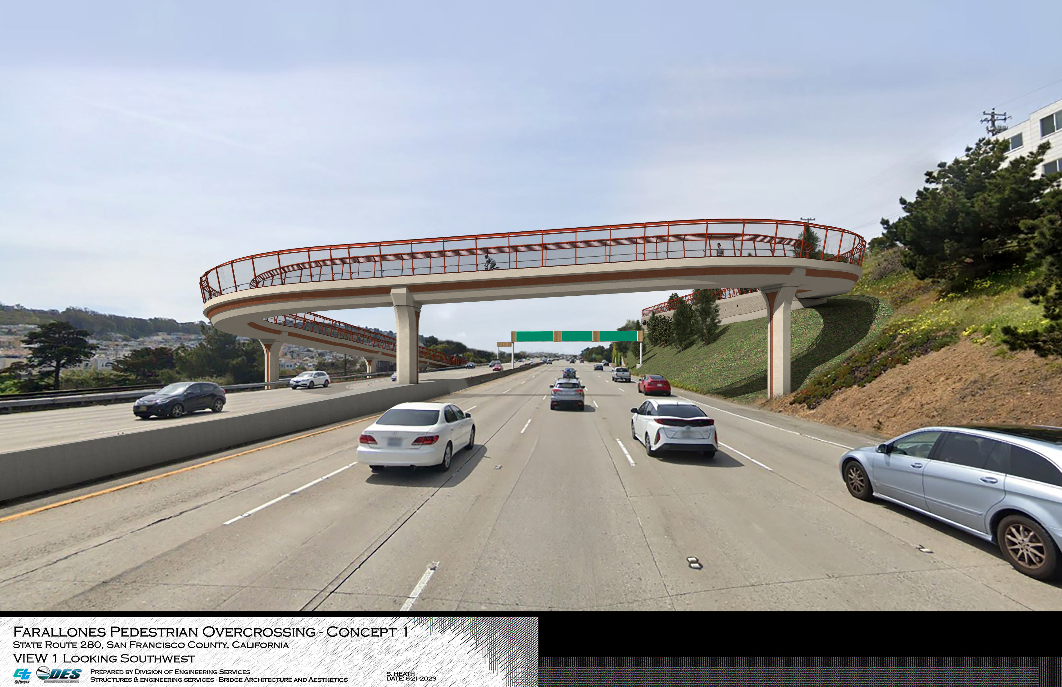
Simulated driver's view looking southwest at the Farallones Street Pedestrian Overcrossing and Rehabilitation Project
Rendered view looking northbound at the Farallones Street Pedestrian Overcrossing.
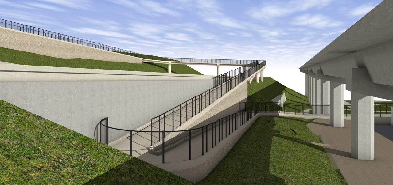
A rendered perspective view looking northeast at the Farallones Street Pedestrian Overcrossing.
Blending Functionality And The Area’s Natural Beauty
Reducing greenhouse gas emissions is a key priority for the state of California. One of the most effective ways to support this goal is by encouraging residents to leave their cars at home and choose alternative modes of transportation. Whether commuting to work or making a quick trip to the local store or park, Californians need attractive, functional options that make walking or biking easier. The new pedestrian overcrossing will help meet this need and provide a valuable solution for the community.
Colors and textures of the project will seek to reference and unify with vegetation and established objects on both sides of the highway including Muni, BART, and Cayuga Park.
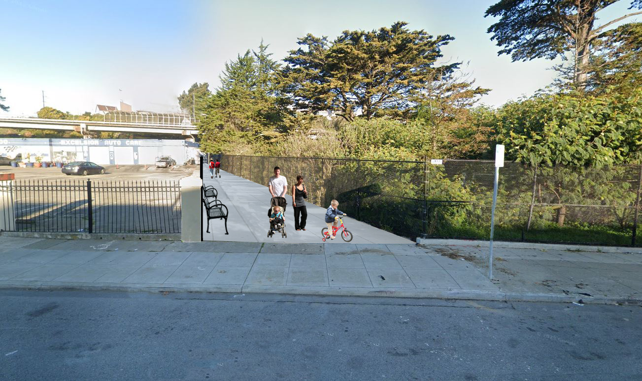
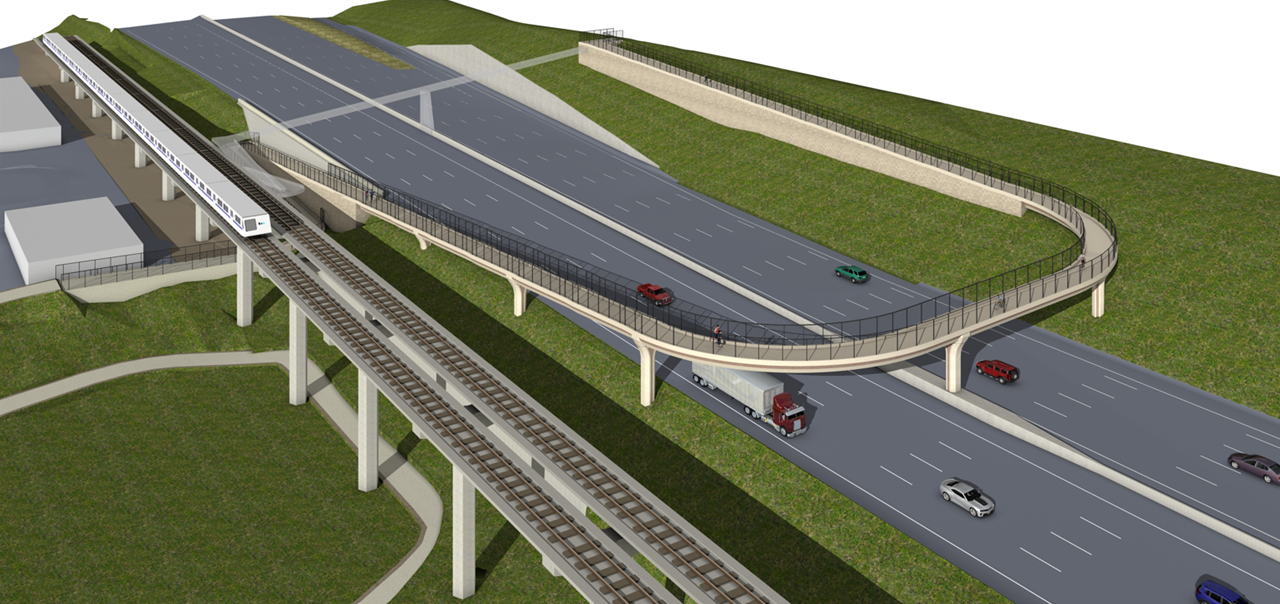
Rendered view of projected results of Alemany Blvd pedestrian overcrossing after the Farallones Street Pedestrian Overcrossing Project.
Cayuga Park is also on the migratory path of the Cliff Swallow, a bird that is known for its synchronized flying displays. Concepts for the large retaining wall facing the freeway below San Jose Avenue convey movement in the form of a murmuration of birds in flight, referencing the migratory Cliff Swallows that pass-through Cayuga Park while evoking the large trees that reside in the area.
Upcoming Lane and Ramp Closures
Week of July 13
NB I-280 Nightly Lane closures at 10:00 p.m. – 5:00 a.m. between Daly City Blvd. and Geneva Ave.
SB I-280 Nightly Lane closures at 11:00 p.m. – 6:00 a.m. between Daly City Blvd. and Geneva Ave.
Current Advisories
Project Media Gallery
Additional project resources including downloadable maps, image galleries, and video clips can be found on the media resources page.
Contact
For real-time traffic, click on Caltrans QuickMap: https://quickmap.dot.ca.gov/
For 24/7 traffic updates, follow 511.org: https://x.com/511SFBay
For more information contact:
Lori Shepherd
Public Information Officer
San Francisco County CALTRANS - District 4
Thank you for your patience as we work to improve our roads and infrastructure.
Connect With Caltrans District 4 On Social Media
![]()
![]()
![]()
![]()
#CaltransLovestheBay