
US-101, State Route 1 Sea-Level Rise Project
Project Overview
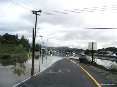
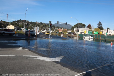
Flooding affects many residential, commercial, and industrial land, and Caltrans is looking for ways to mitigate the issue, especially with sea-level rise expected to affect the region in the next 100 years.
With the US-101, State Route 1 (SR-1) project, Caltrans proposes to enhance access and mobility by addressing recurring flooding and sea-level rise impacts that affect Marin City and the surrounding areas in the Richardson Bay area of Marin County.
Highway flooding occurs in this area due to winter storms as well as high-tide events. Sea-level rise is expected to increase in severity and frequency in future years and will impact the roads even more.
Frequently Asked Questions About the Project
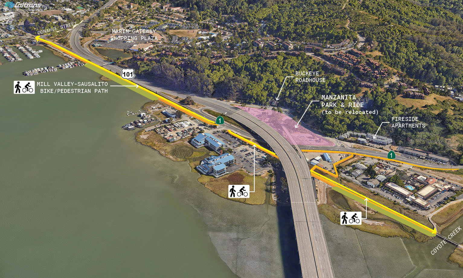
Project Location
The proposed project is located on US 101 adjacent to Richardson Bay and Marin City. The project limits begin in Marin City near Donahue Street and extend to the southern end of the Richardson Bay Bridge. Approximately a third of a mile of SR-1 will also be included.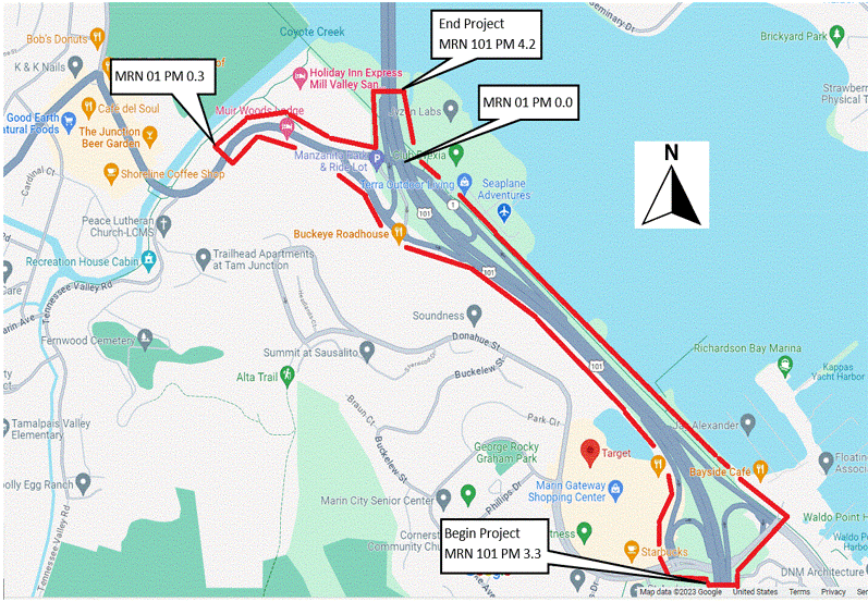
Public Engagement
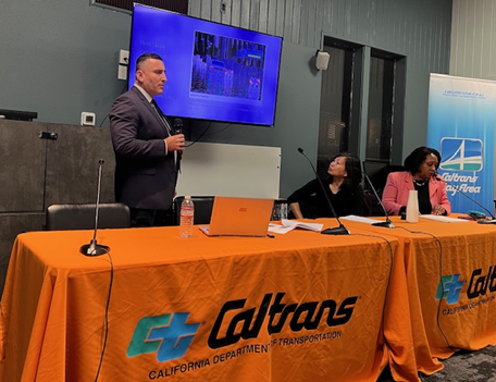
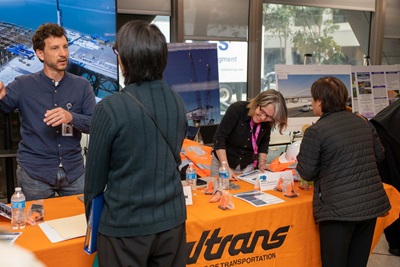
Because this project is so important, Caltrans has held early public engagement sessions to get community feedback on the direction and development the project will take.
In this early stage, Caltrans is defining the scope, cost and schedule while trying to find funds for the project.
The first public meeting was in Marin City on Thursday, Feb. 29. The meeting was well attended with 123 people online and 23 more at the Teen Center in Marin City on a rainy night in Northern California. A second public meeting was held on Thursday, March 28 at the Tam Valley Community Center.
Community Input
The purpose of the meetings were primarily listening sessions for Caltrans as the project team fielded questions and comments. The project team also shared information about the PID stage.
Some of the goals in this stage are to learn from the community, share information and eventually receive funding, so the project can move on to the environmental stage. Public engagement will continue to be a priority throughout the project.
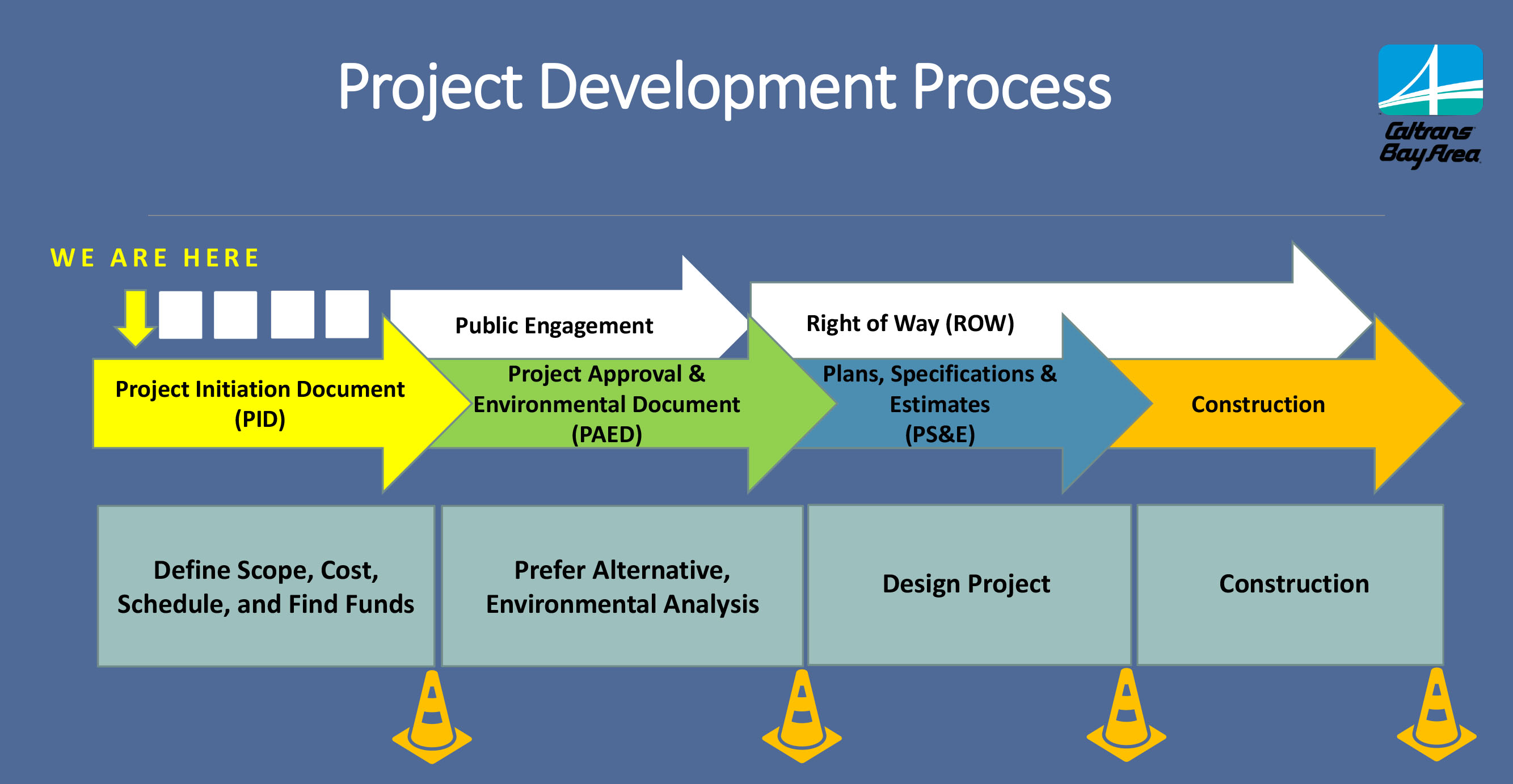
Project Development Process
What does it mean for a project to be in the initial planning phase?
Currently, this project is in the K Phase, where the project's scope, anticipated cost, and schedule are established. Funding sources for the project are also sought out.
Once funds are allocated, Caltrans will move on to the project approval and environmental document phase – the PAED phase.
In that phase, the public will help us determine which alternative they prefer, and environmental analysis will occur.
Caltrans is scheduled to circulate the Draft Environmental Document (DED) externally in the summer of 2027.
Once the project clears that phase, it will advance to the final design phase and eventually the construction phase.
Project Alternatives
The project alternatives were developed based on the three adaptation strategies from the California Coastal Commission Sea Level Rise Policy Guidance, Final Adopted Science Update, November 7, 2018.
Three adaptation strategies: Protect, Accommodate, and Retreat are proposed.
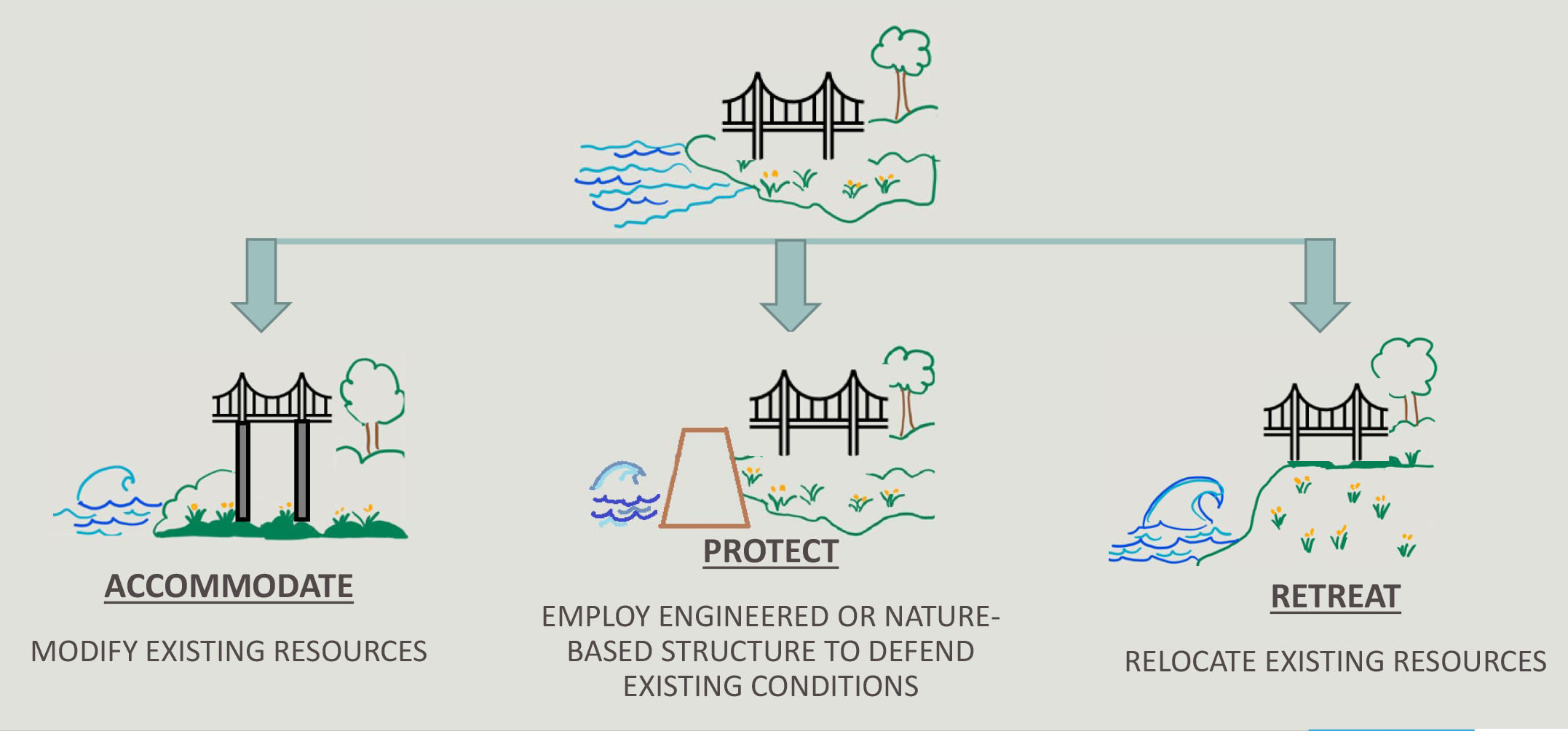
Protect
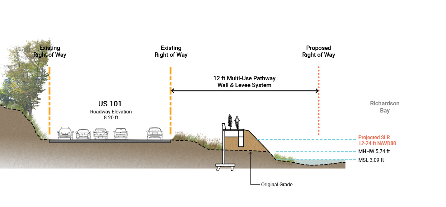
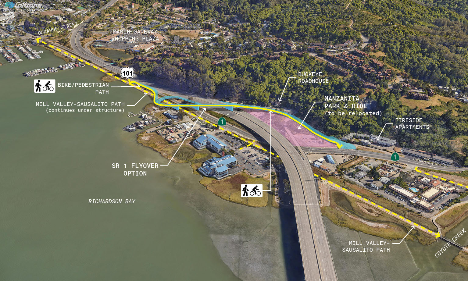
The protective alternative would elevate the Mill Valley - Sausalito path, part of the Bay Trail, using a levee and retaining wall system to safeguard the roadway. This raised pathway would commence at the Waldo UC/Donahue Interchange and conclude at Coyote Creek.
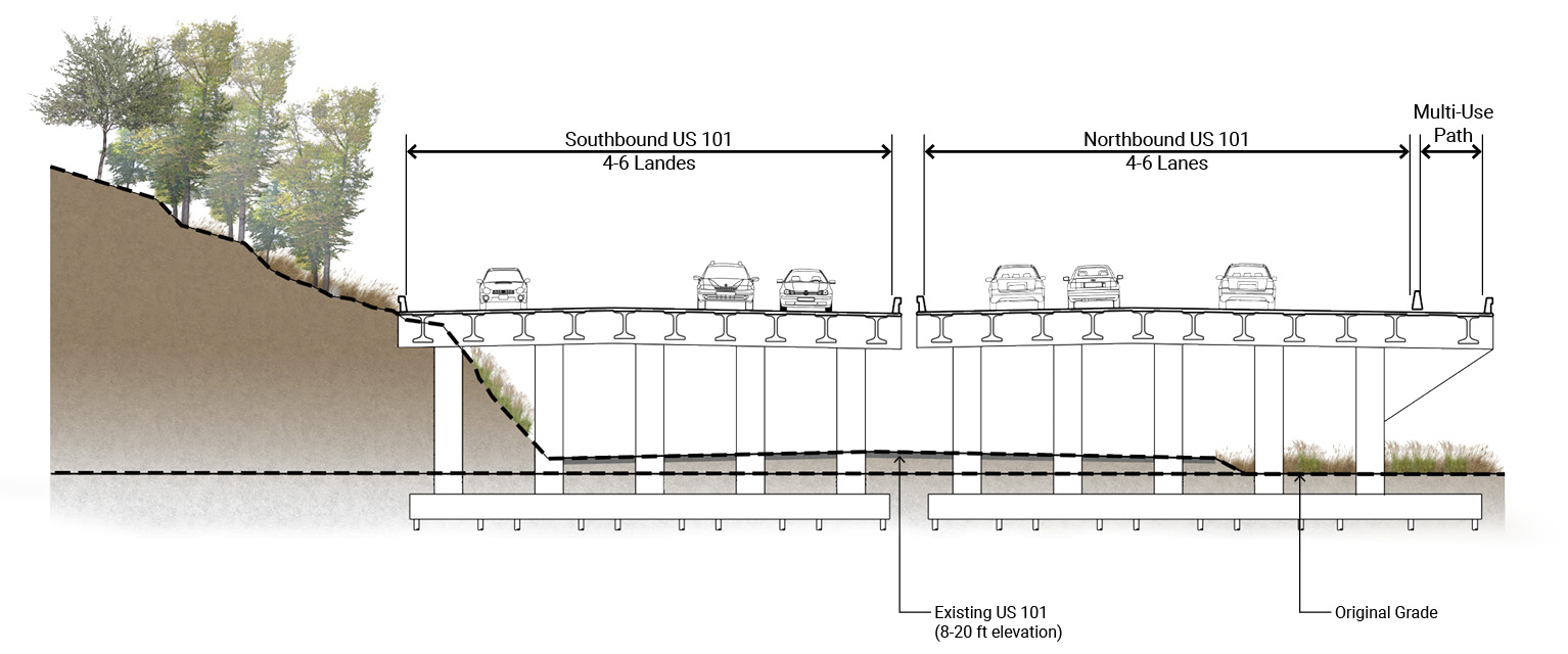
Accommodate
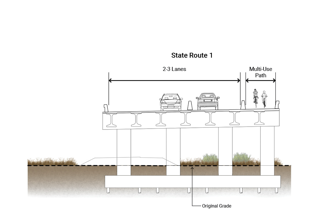
SR-1, US 101, and the Manzanita Park and Ride lot would be elevated to the design sea-level rise (SLR) elevation. US 101 is proposed to be a causeway, allowing flood waters to pass under the structure. SR-1 and the park and ride are proposed on treated fill supported by retaining walls.
Retreat
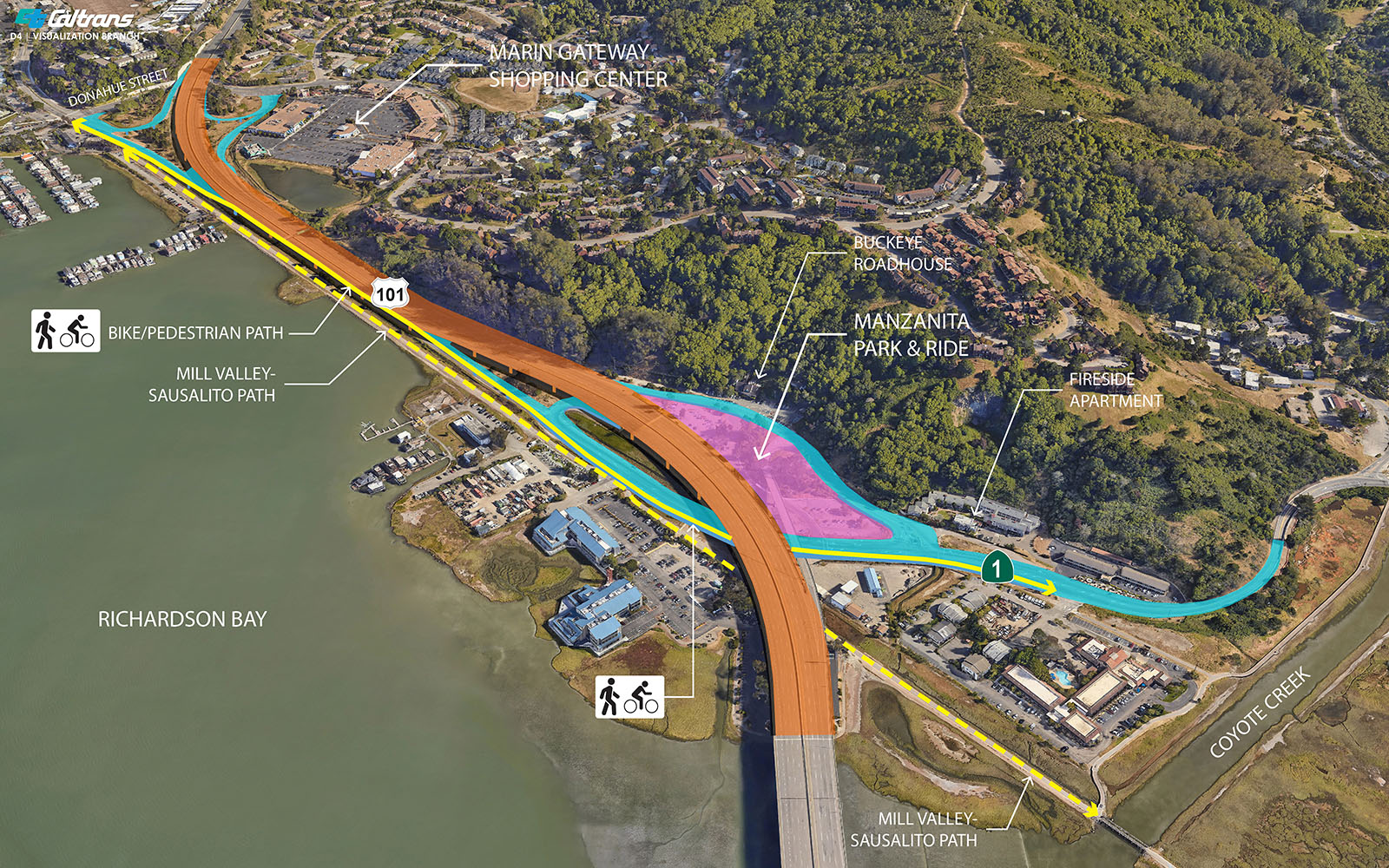
The proposed NB 101 off/on ramps (flyover) would be realigned to the SB 101 off/on ramp location across from the Buckeye Roadhouse restaurant. US 101 would remain at its current elevation while elevating the frequently inundated portion of SR-1, under US 101.
Relocation of the Manzanita Park & Ride is also being studied as part of this alternative.
Next Steps
 The PID stage will conclude in June, 2024. The Project Approval and Environmental Document (PAED) stage will follow once funding is secured. Public engagement meetings will occur in that stage as well.
You can email our project email at ManzanitaProject@dot.ca.gov