
State Route 37 Sea Level Rise project
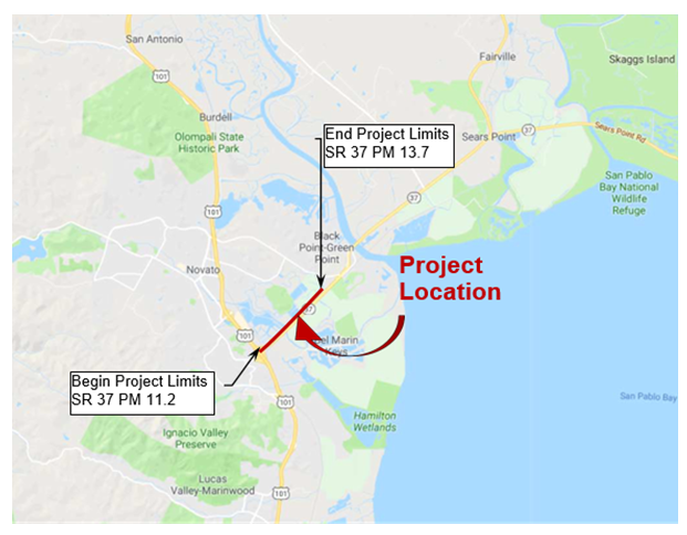
Location Map
Project Description:
The Long Lead project proposes to reconstruct State Route (SR) 37 to address Sea Level Rise (SLR) and recurring flooding, while including Complete Streets features to address multi-modal bicycle and pedestrian use.
Purpose and Need:
The purpose of this project is to address recurring flooding and future SLR impacts to the existing SR 37 in Marin County. Flooding on SR 37 occurs during seasonal rain and high tide events, causing delays and closures. Over time, the existing road could be eroded and inundated permanently, resulting in the loss of a safe, reliable transportation corridor