
Caltrans Releases Bay Area Pedestrian Plan
Pedestrian Plan becomes part of Bay Area’s Active Transportation Plan
OAKLAND - Caltrans Bay Area has released the District 4 Pedestrian Plan for the Bay Area, outlining Bay Area pedestrian needs, and serving as a reference for planners and project designers who aspire to make road projects more pedestrian-friendly.
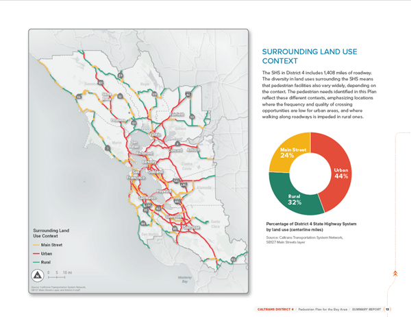
The pedestrian plan complements the bicycle plan released earlier this year. Both documents promote alternatives to driving as a means of reducing congestion, combating greenhouse gases, and encouraging a healthier lifestyle. Full of easy-to-read charts and graphics, the pedestrian plan is a resource not only for transportation planners but for anyone interested in making walking easier and safer on Bay Area roads.
The plan was developed in collaboration with partner agencies, advocates, and members of the public. 
Those interested in pedestrian issues can also access the Pedestrian Story Map, which allows viewers to look at pedestrian conditions on state highways throughout the Bay Area.
Earlier this year, the story map allowed participants click locations on an interactive map to suggest improvements to a particular site. For example, a participant could click on a Market Street crosswalk in San Francisco and suggest a longer walk signal for pedestrians. The data was from the Story Map was used in creating the pedestrian plan.
The information from the Bay Area pedestrian and bicycle plans become part of the Bay Area’s Active Transportation Plan and the state’s Active Transportation Plan.
 Sample Page from the Bay Area Pedestrian Plan