
District: District 3 - Marysville
Amarjeet S. Benipal, District Director
Contact: Jeremy Linder
Phone: (530) 701-5209
FOR IMMEDIATE RELEASE
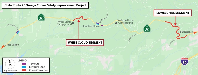
Nevada County – Caltrans is alerting motorists that State Route 20 (SR-20) is now closed 11 miles east of Nevada City in Nevada County as part of the ongoing $54.6 million Omega Curves Safety Project.
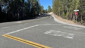
Construction crews moved the closure this morning to the White Cloud segment, between the White Cloud U.S. Forest Service Campground and Washington Road, from the Lowell Hill segment (see map). SR-20 is scheduled to reopen with one-way traffic controls in place at both segments at noon on Friday, October 6.
The California Highway Patrol is on-site during the closure, with access for emergency vehicles only. In the event of an emergency, CHP will communicate with crews on site and take appropriate action.
Motorists traveling between Nevada City and Interstate 80 should use State Route 49 (SR-49) and State Route 174 as alternate routes. Large trucks are directed to only use SR-49.
Crews are grinding and paving the road and constructing tie-in locations to divert the traveling public from the former roadway to the new alignment. The schedule is subject to change or be delayed due to weather, availability of materials or other unexpected events.
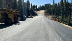
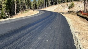
The project will improve safety and reduce collisions on SR-20 by realigning curves on two non-continuous segments near White Cloud and Lowell Hill, widening shoulders, improving the highway’s sight distance, and adding designated left-turn lanes near Conservation Road and Washington Road. In addition, three turnouts are being constructed to so that slow-moving vehicles can allow motorists to safely pass, while also serving as traffic-enforcement locations for the CHP.
Granite Construction, Inc. of Sacramento is the prime contractor for the Omega Curves Safety Project, which is expected to be completed this fall. For project updates, please visit www.OmegaCurves20.com.
Caltrans District 3 is responsible for maintaining and operating 4,385 lane miles in 11 Sacramento Valley and Northern Sierra counties. Caltrans reminds motorists to “Be Work Zone Alert” and slow in construction zones for the safety of travelers and crews performing these improvements. The department will issue construction updates on @CaltransDist3 and on Facebook CaltransDistrict3. For real-time traffic, click on Caltrans’ QuickMap or download the QuickMap app from the App Store or Google Play.
| CleanCA.com | CleanWaterCA.com | #BeWorkZoneAlert | Facebook | YouTube |