Section 5.7 – Coastal Visual Resources
5.7.1 Visual Resources in the Corridor
The North Coast Corridor (NCC) is the primary transportation link between two of the major metropolitan regions in California (Los Angeles and San Diego) and although the corridor has experienced a significant amount of urban growth, its scenic character has managed to persist as a unique coastal resource. Development densities within the NCC have remained low, for the most part, and large groupings of mature trees, large open space areas with significant natural resources, and the coastline are the primary coastal visual resources interspersed in the developed landscape. Much of the NCC's existing rail and highway system parallels the Pacific Ocean's coastline and, in many locations, the transportation facilities offer expansive views of the coastline, river valleys, coastal lagoons, beaches, and other upland scenic resources.
5.7.1.1 LOSSAN Rail Corridor Resources
The Los Angeles-San Diego-San Luis Obispo (LOSSAN) rail corridor provides travelers with a variety of significant coastal views and distinct visual experiences, generally characterized as urban mixed-use, suburban and coastal communities, natural open space areas, and expansive ocean and coastline environments.
Traveler Views
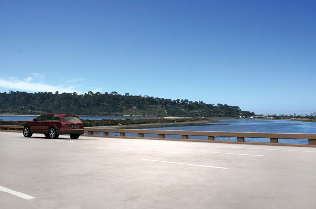
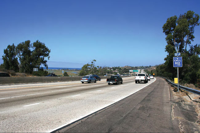
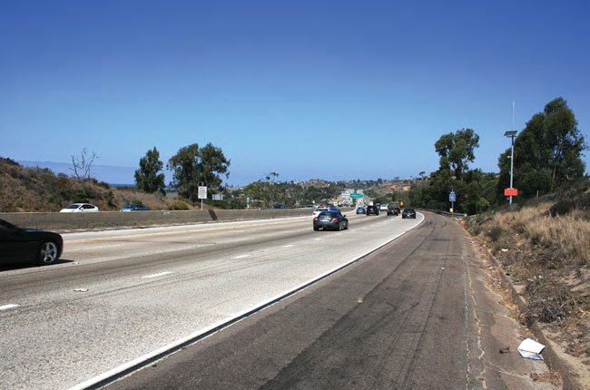
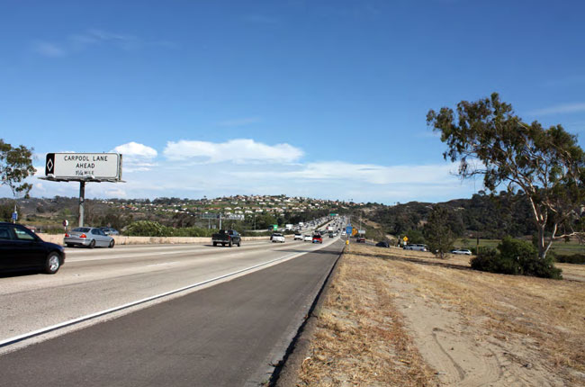
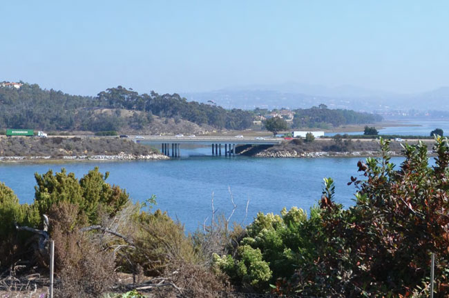
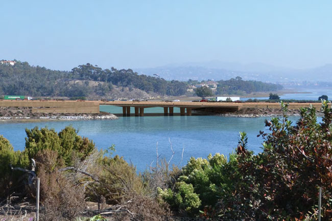
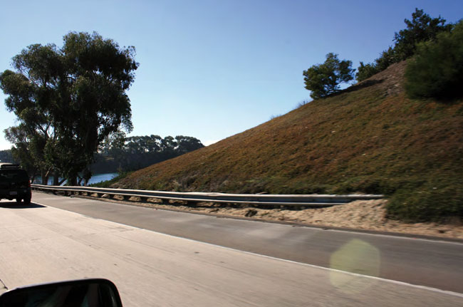
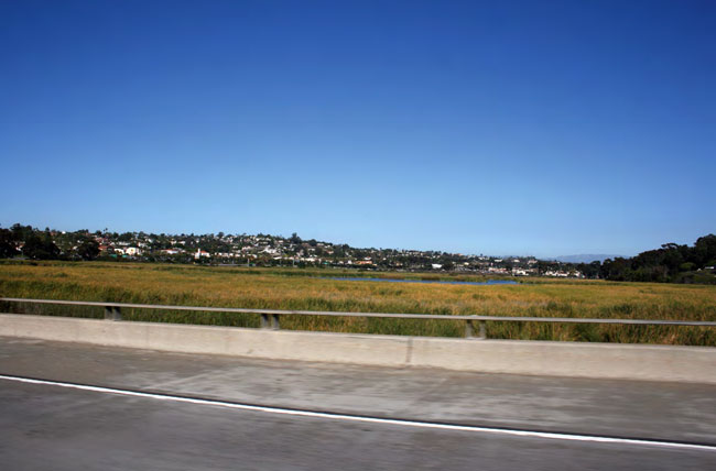
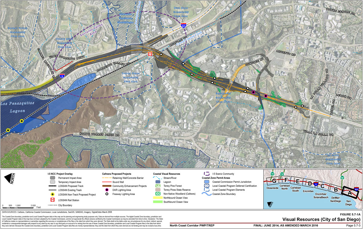
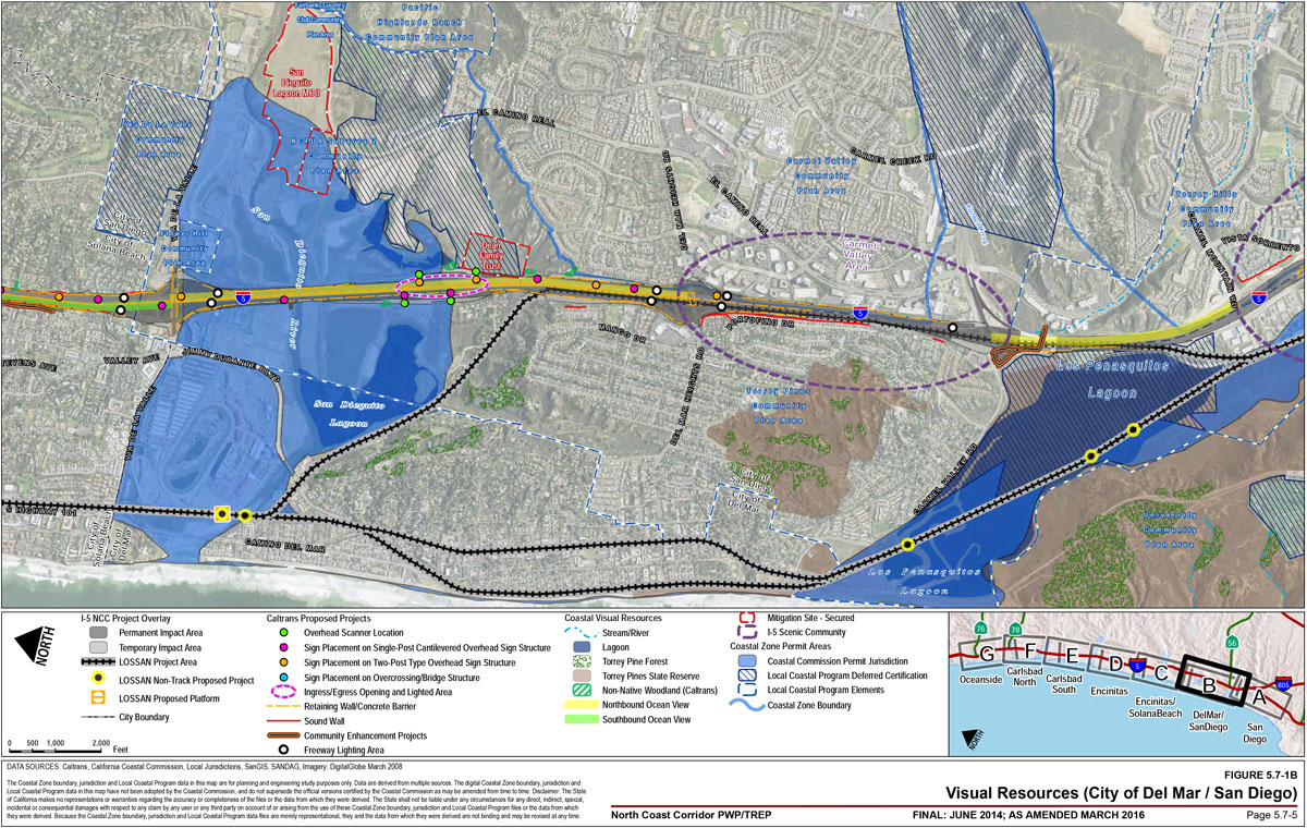
Given the proximity of the rail alignment to the shoreline, expansive views of the ocean and coastline are available along many portions of the NCC. This is particularly true in Del Mar where the rail corridor lies atop a coastal bluff (Figure 5.7-1B).
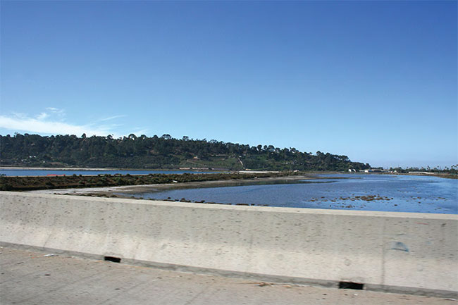
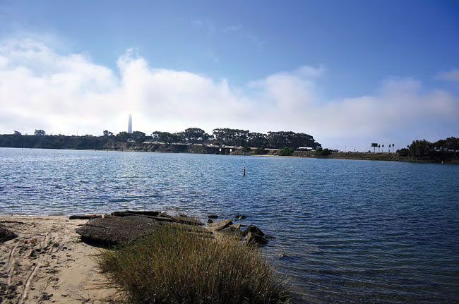
The rail corridor crosses five coastal lagoons and two river valleys, which represent some of the last wetlands of their kind in Southern California. These coastal water bodies are coupled with expansive open space areas that offer visual relief from views of surrounding urban development and also serve as viewsheds, providing visual access to the ocean and inland foothills. These scenic coastal resources exist at the following locations (from south to north):
- Las Peñasquitos Lagoon in San Diego
- San Dieguito Lagoon/River Valley in Del Mar
- San Elijo Lagoon in Solana Beach and Encinitas
- Batiquitos Lagoon in Carlsbad
- Agua Hedionda Lagoon in Carlsbad
- Buena Vista Lagoon in Carlsbad and Oceanside
- San Luis Rey River in Oceanside
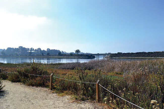
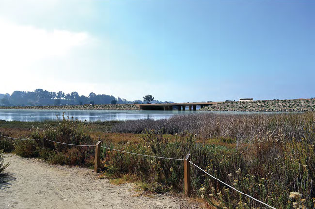
The rail corridor also traverses Torrey Pines State Beach and Reserve, offering travelers extensive views of the shoreline, natural landforms and open space areas, and coastal bluffs (Figure 5.7-1A and Figure 5.7-1B). In addition, along various portions of the rail facility, undeveloped and vegetated hillside terrain sustains the overall visual quality of the corridor.
Along the rail corridor, much of the developed area consists of coastal communities where the ocean and local beaches influence the visual setting of the area. Unlike many of the NCC inland areas east of the I-5 highway corridor, much of the developed areas adjacent to the rail corridor have retained a smaller, village-like character common of older, seaside communities.
Adjoining Views
The railway itself is a noted visual feature in some areas of the rail corridor when viewed from off-site locations, particularly where the railway traverses large open space areas such as the corridor's lagoons and the shoreline. In Del Mar, the railway-located on a narrow portion of the coastal bluffs where the existing tracks are set between the shoreline below and residences above-provides significant views of the coastline and is visible by individuals recreating along this area of the coast.
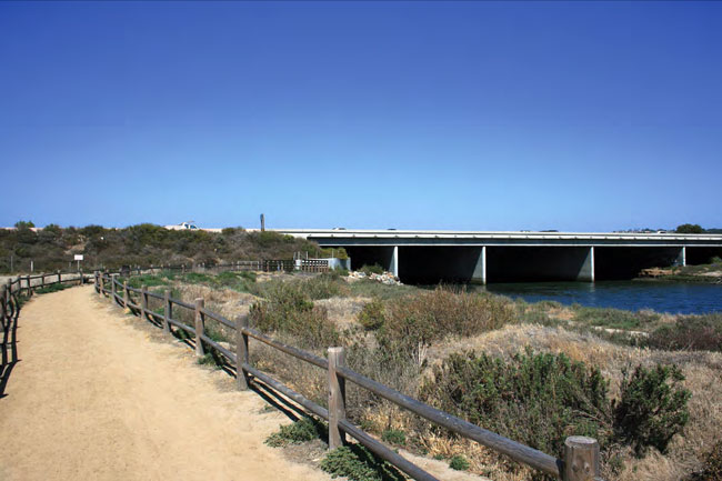
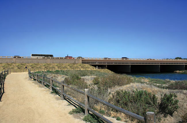
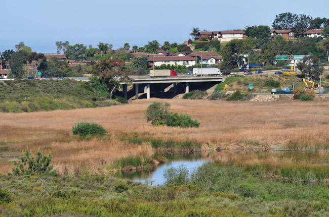
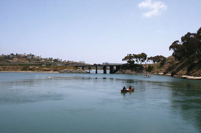
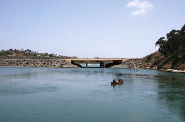
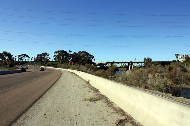
Existing bridges over water bodies tend to be the most notable visual feature of the railway since these structures typically occur in more open, undeveloped areas. The existing wooden trestle bridges restrict views through the bridge structure due to a large number of relatively closely spaced piles needed to support the bridge. As the railway lies adjacent to and crosses over several natural open space and recreation areas, it is visible to hikers, equestrians, and community park users to varying degrees, depending on the proximity of the alignment to open space and recreation areas accessible to the public. The railway is visible from various public areas within developed areas of the rail corridor, most notably at intersections with vehicle-, bike- and/or pedestrian-crossing locations. Stations occur among developed communities in the corridor and are generally compatible with the surrounding environment.
5.7.1.2 I-5 Highway Corridor Resources
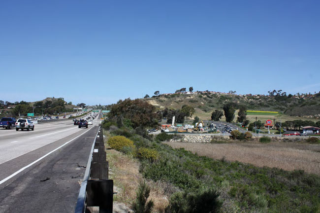
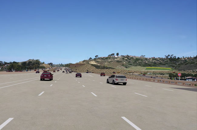
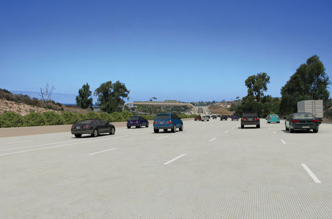
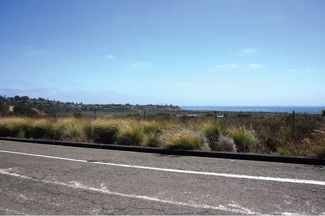
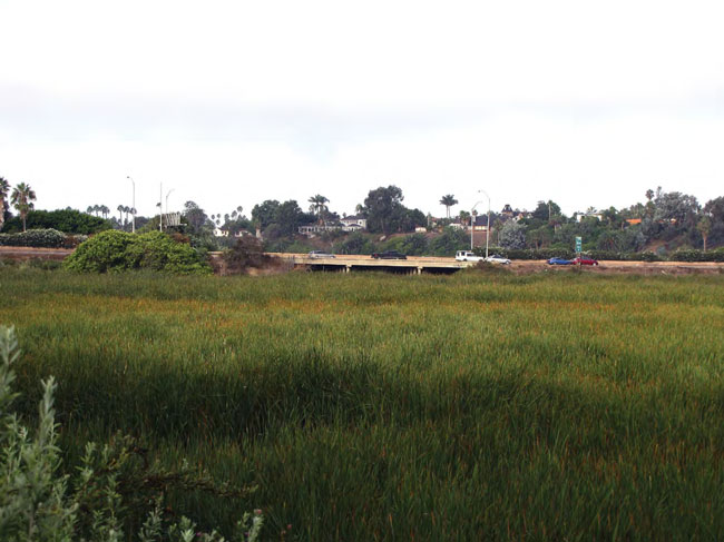
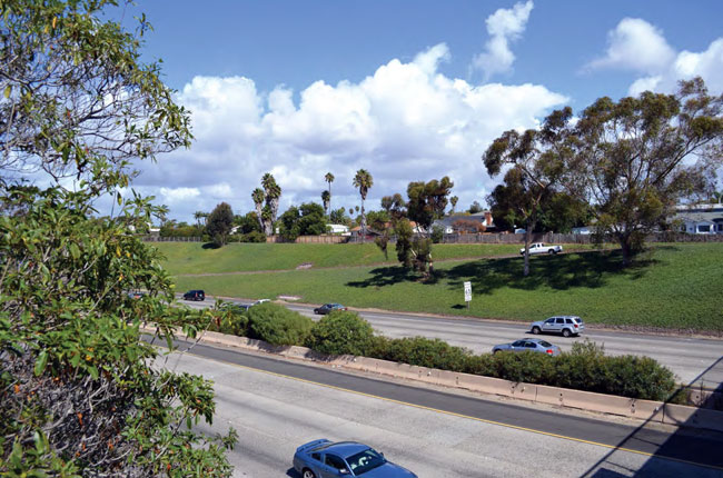
The I-5 highway corridor is part of the California Scenic Highway System and is eligible for designation as an Official Scenic Highway. Though located in a more inland area from the coast than the LOSSAN rail corridor, the I-5 highway corridor similarly provides travelers with a variety of significant coastal views. There are approximately 700,000 travelers per day on the I-5 highway, which serves as the primary northern gateway for visitors to the San Diego coastal area. Within the corridor viewshed, natural features such as the ocean, beaches, lagoons, coastal bluffs, canyons, agricultural fields, and natural upland areas are prominent given the quantity and type of visual resources experienced by traveling on an otherwise urban Southern California freeway.
The I-5 NCC Project Final EIR/EIS (October 2013) and corresponding I-5 NCC Project Design Guidelines (Appendix C of the PWP/TREP) identifies the visual setting and features of the I-5 highway corridor in detail, including the variety of developed, rural, and natural features that occur, as well as the defining characteristics and visual quality of each feature. There are a number of significant and distinct coastal visual resources that occur along the corridor, in addition to the various natural and developed visual elements that contribute to the overall visual quality of I-5 in the NCC and the surrounding area.
Traveler Views
I-5 provides access to the ocean for hundreds of thousands of people each day, a visual resource rarely experienced while traveling on a major urban freeway. Ocean views from I-5 occur at the following locations:
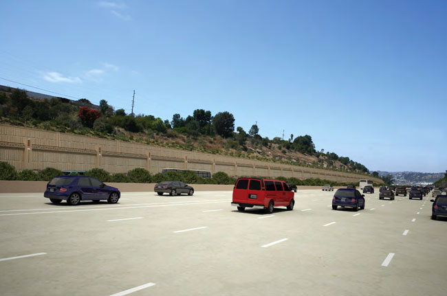
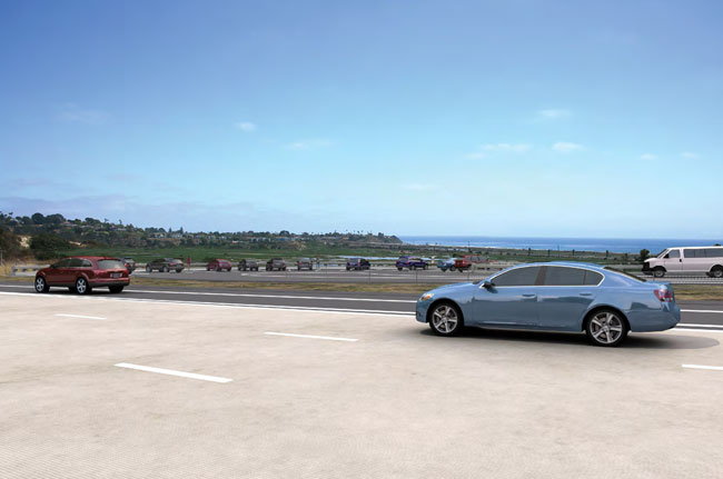
- Northbound lanes between Carmel Mountain Road and SR-56 (Figure 5.7-1A and Figure 5.7-1B)
- Northbound lanes between Del Mar Heights Road and San Dieguito River Bridge (Figure 5.7-1B)
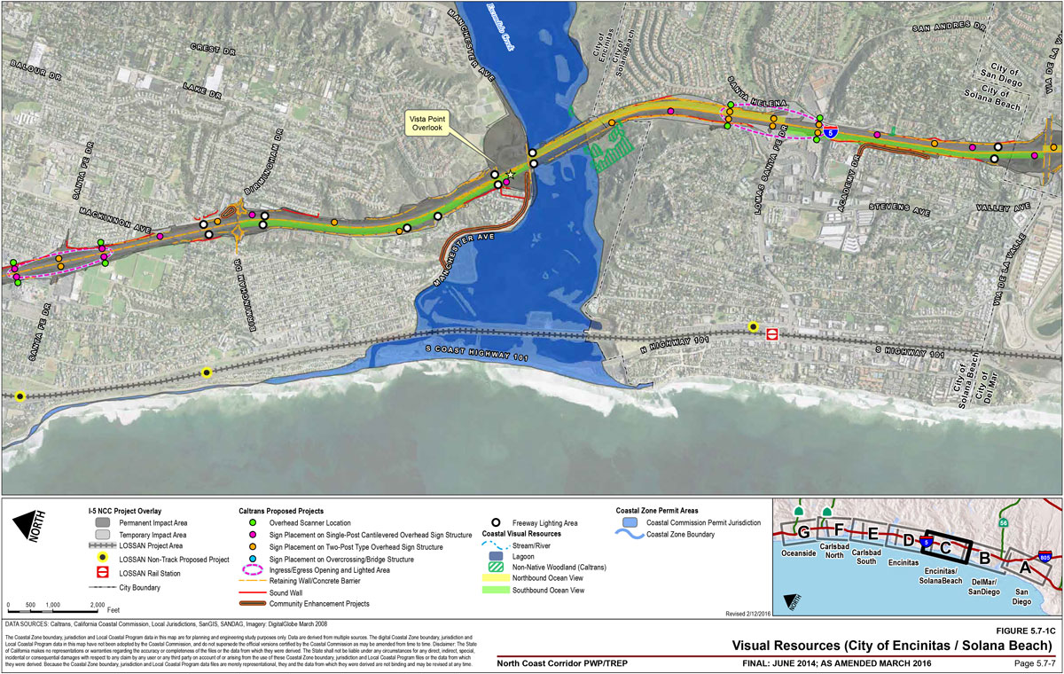
- Southbound lanes between Via de la Valle and Lomas Santa Fe (Figure 5.7-1B and Figure 5.7-1C)
- Northbound lanes between Lomas Santa Fe and Manchester Avenue (Figure 5.7-1C)
- Southbound lanes between Manchester Avenue and Birmingham Drive (Figure 5.7-1C)
- Vista Point adjacent to southbound lanes north of Manchester Avenue (Figure 5.7-1C)
- MacKinnon Avenue overcrossing (Figure 5.7-1C)
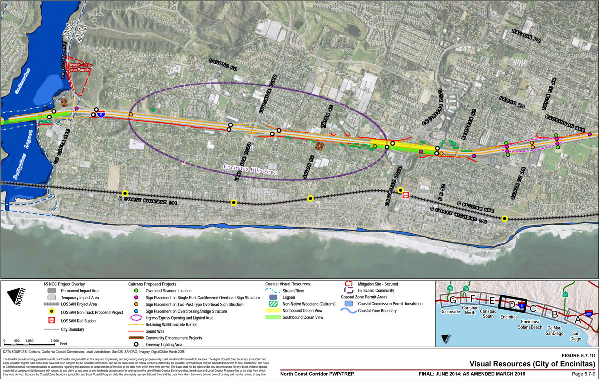
- All lanes at Encinitas Boulevard (Figure 5.7-1D)
- Southbound lanes between La Costa Avenue and Poinsettia Lane (Figure 5.7-1E)
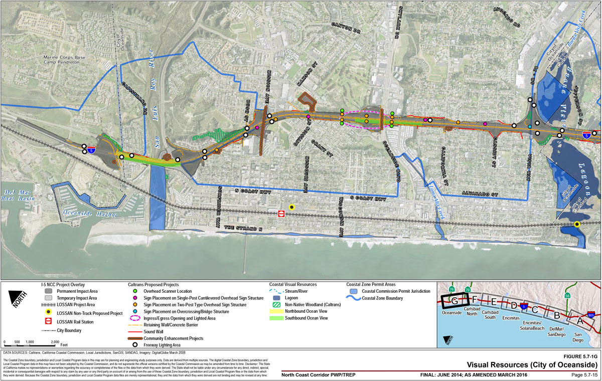
- Southbound lanes at Oceanside Boulevard (Figure 5.7-1G)
- All lanes at the San Luis Rey River bridge (Figure 5.7-1G)
![Figure 5.7-1E: Visual Resources (City of Carlsbad [South]). For more information call (619) 688-6670 or email CT.Public.Information.D11@dot.ca.gov](/-/media/dot-media/district-11/images/pwp/fig5-7-1e-lg.jpg)
![Figure 5.7-1F: Visual Resources (City of Carlsbad [North]). For more information call (619) 688-6670 or email CT.Public.Information.D11@dot.ca.gov](/-/media/dot-media/district-11/images/pwp/fig5-7-1f-lg.jpg)
- Los Peñasquitos Lagoon in San Diego
- San Dieguito Lagoon/ River Valley in San Diego
- San Elijo Lagoon in Solana Beach and Encinitas
- Batiquitos Lagoon in Carlsbad
- Agua Hedionda Lagoon in Carlsbad
- Buena Vista Lagoon in Carlsbad and Oceanside
- San Luis Rey River in Oceanside
Torrey Pines State Reserve is visible from the Sorrento Valley and Carmel Valley areas of I-5 and is a visual resource consisting of varying natural topography and open space areas, including coastal bluffs at the headland of Las Peñasquitos Lagoon (Figure 5.7-1A and Figure 5.7-1B). Coastal bluffs are also found near coastal beaches, lagoons, and rivers at the following locations:
- Torrey Pines State Reserve
- Southern slopes of the San Dieguito River Valley
- Native slopes of the San Elijo Valley
- Native slopes adjacent to the northbound freeway lanes between Manchester Avenue and Birmingham Drive
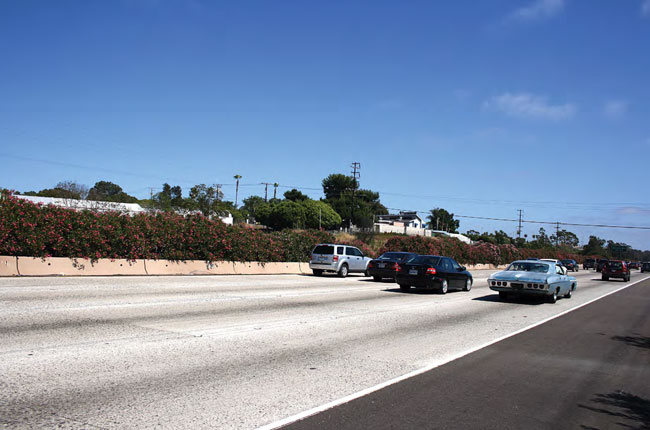
Along various portions of the I-5 highway corridor, immediately adjacent undeveloped and vegetated hillside terrain (natural and manufactured slopes) provide a buffer between I-5 and adjacent land uses and sustain the overall visual quality by softening the appearance of I-5 and blocking or screening views to and from adjacent urban development. On both sides of I-5, mature trees provide vertical relief to the horizontal plane of the highway and also serve as a landscape buffer between the highway and adjacent areas. Additionally, the visual character of I-5 differs from that of standard highways due to the presence of large, flowering oleanders in the median that provides a green parkway in the center of the highway. Oleanders provide visual relief with a natural appearance and reduce the scale of the highway by half as the shrubs screen views of oncoming traffic; however, it is noted that in some areas, the mature oleanders may block potential ocean views for northbound travelers. Median oleanders are an I-5 feature unique to San Diego, extending from the Harbor Drive interchange in Oceanside to the San Dieguito River Bridge in San Diego, and again from the Genesee Drive interchange in San Diego past the southerly project limit.
While developed areas are not typically considered significant coastal visual resources, agricultural fields situated along I-5 (near Manchester Avenue in Encinitas and Cannon Road in Carlsbad) provide views of significant open space areas and combine with adjacent lagoons to provide relief from the visual patterns of urban development along the corridor. In addition, Del Mar Racetrack and Fairgrounds is located adjacent to the ocean and is visible from the highway in the San Dieguito River Valley and Solana Hills area. It is a prominent cultural feature in the corridor viewshed that provides orientation and identity unique to the area.
Development along the I-5 highway corridor consists of new, large-scale suburban development primarily located east of I-5, with older, small-scale beach communities located adjacent to and west of the highway. The I-5 NCC Project Final EIR/EIS notes that the village-like character of the older communities of the Encinitas and Leucadia hillside neighborhoods that border the highway may be considered a scenic resource by local communities. The Encinitas and Leucadia hillside neighborhoods are visible from the highway between Encinitas Boulevard and La Costa Avenue (Figure 5.7-1D). While these developed areas do not present significant natural visual resources, the lower-density, relatively small-scale, and mature landscaping associated with the communities maintain a sense of openness in the developed landscape. The neighborhoods exemplify Encinitas' unique historical identity as a center of exotic horticulture with older homes built early in the 20th century on large parcels used as avocado groves, exotic plant nurseries, or commercial greenhouse space. Despite intense urban development that has occurred elsewhere along the coast, many of the original homes, large stands of tall trees, and some of the avocado groves, nurseries, and greenhouses in the neighborhoods remain.
Adjoining Views
I-5 is a dominant visual feature in some areas of the corridor when viewed from off-site locations, particularly elevated portions of the highway, including over-crossings and bridges over waterbodies. The highway is adjacent to five natural preserves, two open space parks, five community parks, one recreational area, and one golf course. As such, the highway is visible to hikers, equestrians, and community park users depending on the proximity of the highway to these open space and recreation areas. The highway is also visible to drivers, bicyclists, and pedestrians using local streets and sidewalks at interchanges, as well as travelers along residential frontage streets (such as Orpheus Avenue in Encinitas) that have direct views to the highway.
5.7.2 PWP/TREP Concerns
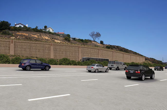
Environmental documentation and analysis prepared for the PWP/TREP highway and rail corridor improvements indicate that there are significant coastal visual resources within the NCC that could be affected by the proposed improvements. The proposed transportation facility improvements would include constructing new tracks and extended paved surfaces; constructing parking structures or lots, new or expanded bridges and bridge railings, direct access ramps (DARs), and rail tunnel portals; and would add new signage, sensors, signals, signal houses, fencing, cameras, and new retaining and sound-walls. New night lighting at proposed stations could also create or increase a visual impact if visible from nearby scenic beaches, scenic roads, parks, and trails.
Proposed improvements could affect public views of natural coastal features such as the Pacific Ocean, coastal river valleys and lagoons, coastal bluffs, open space, and cultural landscapes, and/or could result in a more urban aesthetic in some project areas. Project grading could remove or substantially alter natural landforms, landscaping, trees, and topography (berms, hills, etc.), thus decreasing the visual openness and semirural character of the corridor. In addition, proposed improvements that involve new and extended facilities could increase the visual mass and overall visibility of facilities from adjacent public viewing areas and could result in public view obstruction to visual resources in the corridor. Project appearance has the potential to disrupt the experience of the natural environment as viewed by people visiting the natural preserves and open space areas near the transportation facilities.
In addition, existing, permitted shoreline protection devices for the LOSSAN rail corridor in the Del Mar bluffs area have altered the shoreline; however; previous Coastal Commission review of the shoreline protection system included project conditions to ensure that the structures were designed and treated to minimize alteration of natural landforms, to protect public views, and to be compatible with the surrounding area. Future stabilizing activities, which would expand these shoreline structures for the continued operation of the rail facility, could result in impacts on the visual resource of the coastline if not properly designed and maintained.
5.7.2.1 LOSSAN Rail Corridor Impact Assessment
Proposed LOSSAN rail improvements would occur in areas of the corridor with significant coastal visual resources. Potential visual resource impacts of rail improvements could include long-term operational impacts and short-term construction impacts. Long-term visual impacts could result from constructing new, permanent structures, including track and station additions, such as new parking areas or increased parking structure height, tunnel portals and grade separations, and other appurtenant features such as fencing, signals, and lighting. During construction, visual impacts could include the presence of construction equipment, the dismantling of old structures and erecting of new structures, light and glare impacts from nighttime construction, and visual contrast impacts from newly disturbed soils along the rail corridor.
Traveler Views
Proposed track improvements would include at- or below-grade facility improvements that would be consistent with existing facility improvements and the surrounding environment; however, trench and tunnel alignment options that would replace at-grade facilities could adversely affect passenger views to coastal visual resources since the transportation facility would be depressed or placed entirely below-grade, thus eliminating coastal views currently available on the at-grade facility. However, as discussed further in this section, trench and tunnel alignments would benefit overall visual resources in the corridor, particularly for adjoining views, given that existing at-grade facilities could be removed in some portions of the corridor, thus restoring the visual quality of these areas presently displaced by the at-grade facilities that are visible from surrounding areas. In addition, new replacement bridge structures over the lagoons and/or waterways could require raised soffit elevations to address the potential for flooding or sea-level rise concerns.
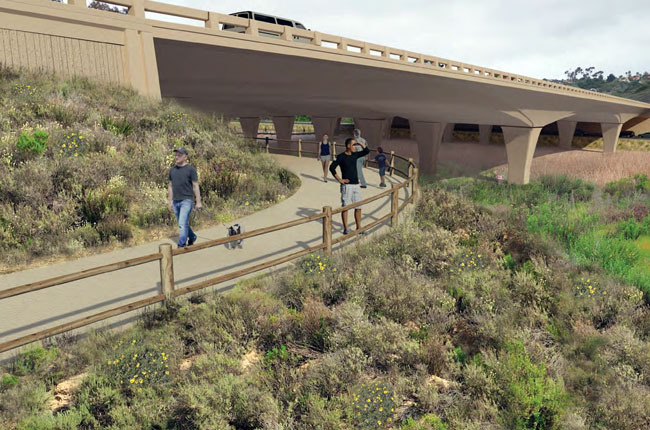
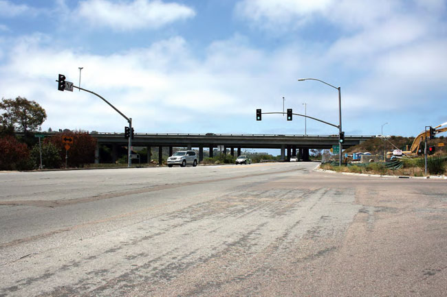
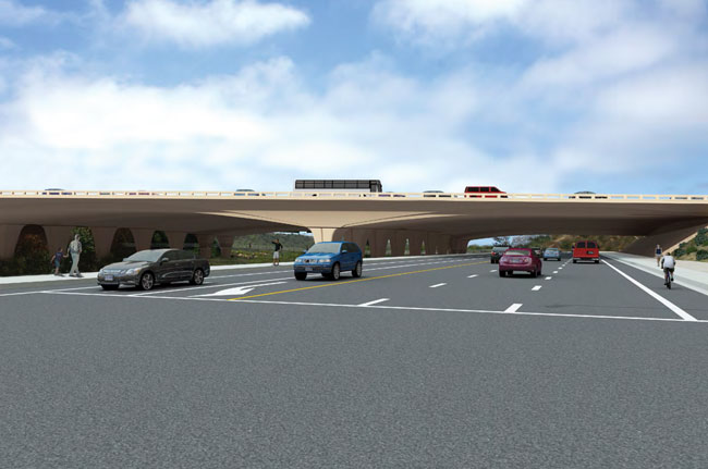
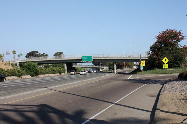
A new pedestrian and/or bicycle grade separation is proposed at Hillcrest Drive (Figure 5.7-1D) in Encinitas; additional grade separations have been approved/permitted outside of the PWP/TREP at Montgomery Avenue, Santa Fe Drive, and El Portal Street in Encinitas. In addition, a new automobile grade separation is proposed at Leucadia Boulevard in Encinitas, and two additional grade separations between surface streets and the LOSSAN corridor are planned in the San Diego Association of Government (SANDAG) 2050 RTP. The locations of those two grade separations have yet to be determined. Grade separations could create additional structural and visual mass where proposed along the corridor; however, these project features would be limited to distinct points within the existing right-of-way and therefore would be visible only momentarily to traveling passengers.
Station parking improvements would include adding new parking spaces and/or new parking structures at, adjacent to, or in close proximity to the Oceanside, Carlsbad Village, Carlsbad Poinsettia, Encinitas, and Solana Beach stations. Parking structure improvements could increase the structural mass of the stations as viewed by passengers. In addition, a new special-event platform at Del Mar Racetrack and Fairgrounds are proposed in the San Dieguito River Valley (Figure 5.7-1B), an area generally characterized by open space and the rural and cultural features of Del Mar Racetrack and Fairgrounds. Depending on the ultimate location and design of the Del Mar platform improvements, the improvements could be visible to rail travelers.
Temporary visual impacts to traveler views associated with construction activities adjacent to and visible from the operating rail line would generally include visual contrast impacts created by active construction sites, grading, and vegetation removal.
Adjoining Views
Throughout the LOSSAN rail corridor, the double-tracking at-grade improvements would have a little visual impact to adjoining views as the facilities would be placed within the existing right-of-way and would be consistent with the existing environment and facility in those locations. Trench alignments would generally be less visible than at-grade alignments; however, where open trench sections would have to be fenced for security purposes, at-grade visual impacts to adjacent views looking to or across the right-of-way could occur absent appropriate fence location and design. Tunnel alignment options would generally have no impact on visual resources or area aesthetics as viewed from surrounding areas, except at portal locations, which would be visible at those distinct locations, and the I-5 highway corridor tunnel option could create new visual impacts along the south edge of San Dieguito Lagoon where an elevated rail structure could be constructed for a portion of the track.
Grade separations in Encinitas could introduce new structural and visual mass, which would be visible from surrounding areas and could obscure public views to near and distant viewsheds; however, the Hillcrest Drive and Leucadia Boulevard grade separations are designed as under-crossings, which would substantially minimize structural mass of the improvements and ensure that views across the facilities would be maintained.
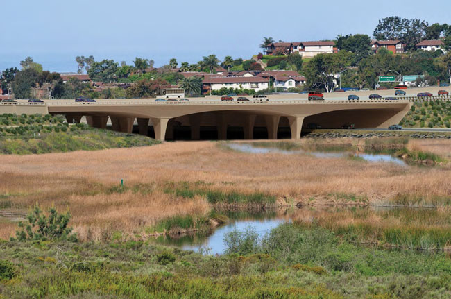
Bridge replacements for the rail alignment would include bridges at San Luis Rey River, and Buena Vista, Batiquitos, San Elijo, San Dieguito, and Los Peñasquitos Lagoons (under some alternatives). All bridges would be double-tracked, and widening of bridge structures for double-tracking could increase the visual mass of the structures as viewed from surrounding areas; however, in some cases, such as at San Elijo Lagoon, bridge spans could be lengthened (depending on restoration plans for the lagoon) and some in-water bridge footprints may be reduced through use of fewer piles and/or further spaced pile bents compared to the current bridges.
Station parking improvements for the Oceanside, Carlsbad Village, Carlsbad Poinsettia, Encinitas, and Solana Beach stations could increase the scale, mass, and overall visibility of stations from surrounding areas. In addition, a new special-event platform at Del Mar Racetrack and Fairgrounds is proposed in the San Dieguito Valley, which would introduce a new facility in an area generally characterized by open space and the rural and cultural features of Del Mar Racetrack and Fairgrounds. These improvements, if not appropriately located and designed, could obscure public views to near or distant views of the coast, inland open space areas and hillsides, or could be incompatible with the aesthetics of surrounding areas.
As the majority of proposed rail improvements would be at- or below-grade and within the existing rightof-way, visual impacts associated with landform alteration of natural terrain as viewed from adjacent areas would generally be minimal; however, grade separations, station parking improvements, the new Del Mar Fairgrounds Special Event Platform, tunnel portals, and the I-5 highway corridor Del Mar tunnel option (which would include an elevated rail structure along the southern edge of San Dieguito Lagoon) would require some grading and removal of vegetation, and could result in landform alteration and associated impacts to scenic views. Furthermore, new replacement bridge structures over the lagoons and/or waterways could require raised soffit elevations to address potential for flooding or sea level rise concerns. In addition, expanding the existing shoreline protection system at Del Mar bluffs necessary to support the existing rail facility operations could result in landform alteration of the shoreline and associated impacts to the visual resource of the coastline.
Temporary visual impacts to adjoining views could also result from construction activities and would generally include visual contrast impacts created by active construction sites, grading, and vegetation removal.
5.7.2.2 I-5 Highway Corridor Impact Assessment
Traveler Views
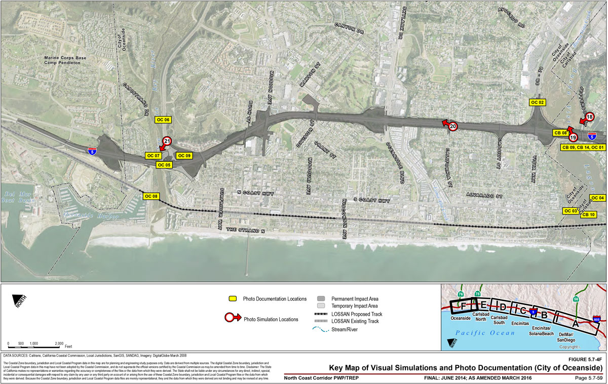
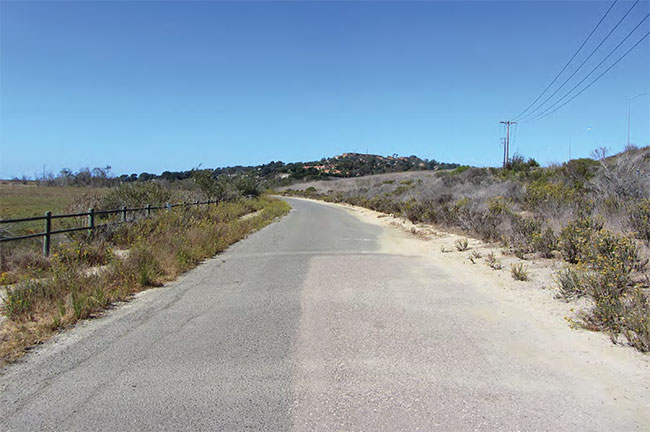
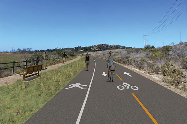
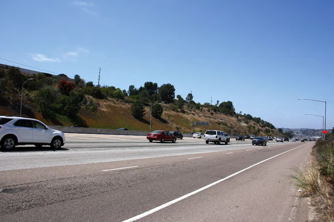
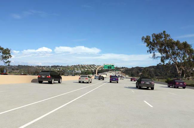
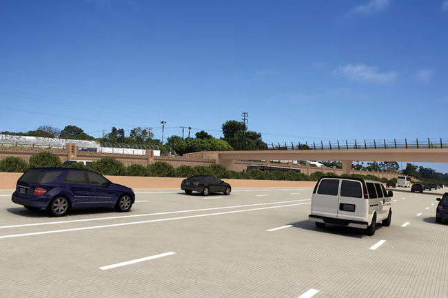
I-5 highway corridor improvements could result in a range of traveler view impacts to distinct, coastal visual resources, and the generally open visual quality of the corridor. Impacts to coastal visual resources would result primarily from constructing extended paved surfaces and additional highway structures (particularly overcrossings and DARs) and new retaining walls necessary to minimize the project footprint and associated grading and resource impacts. A series of visual simulations demonstrating existing conditions and potential changes from project implementation at key viewpoints along the I-5 corridor, which were identified in consultation with the California Coastal Commission, are included in Section 5.7.6. Photo-documentation of additional, existing vantages located throughout the NCC has also been conducted, and is included in Appendix B for further reference.
View impacts to the corridor's most significant coastal visual resources (specifically views to the ocean, coastline, lagoons, and river valleys) would be avoided or given that these resources are typically visible across the corridor's large waterbody crossings, which provide highly scenic coastal view corridors.
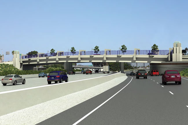
Constructing new DARs at Voigt Drive and Manchester Avenue could also affect coastal visual resources in the corridor as viewed by highway travelers due to introduction of new, large walls, ramp structures, widened local streets, and structural mass to the highway. DAR construction at Manchester Avenue could specifically result in the loss of visual open space associated with coastal agricultural areas adjacent to the highway (approximately 8.4 acres), which is across the roadway from San Elijo Lagoon (Figure 5.7-1C). However, to avoid and minimize visual open space impacts, the Manchester Avenue DAR was redesigned in consideration of the sensitive visual context of the area as a scenic gateway to Encinitas, and is currently proposed as a trenched access ramp and an under-crossing to maintain views of the surrounding hillsides, open spaces, and San Elijo Lagoon, and to reduce the footprint into the adjacent agricultural area associated with the facility and transit center. As a result of the Manchester DAR redesign, which had previously been proposed as a flyover structure, views of the nearby coastal visual resources in the area would not be blocked. As the Voigt Drive DAR would be located in a built environment, where an existing crossover exists, no sensitive coastal views would be affected.
The I-5 NCC Project Final EIR/EIS evaluates, identifies, and depicts several other scenic views, consisting of open hillside terrain and developed areas unique to the corridor at key view sites that would be affected by proposed improvements in a number of locations. Highway travelers in both directions would lose some existing views to the Encinitas hillside neighborhood west of the highway between Encinitas Boulevard and Leucadia Boulevard.
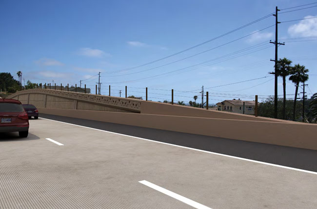
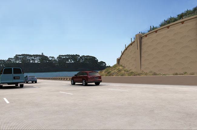
Proposed highway improvements could also result in the I-5 highway corridor becoming a more urban facility in which the various scenic resources now available to the traveling public would become less accessible. Much of proposed highway widening would be contained within the existing right-of-way to minimize the facility's footprint, grading, and associated resource impacts, and therefore would require the use of retaining walls to limit encroachment of facility improvements into adjacent areas. Adding a number of retaining structures would introduce additional urban highway components to the corridor's overall visual character.
Though the proposed design minimizes the facility and grading footprint, the project would nonetheless displace existing terrain and landscaped roadside in some areas. Reduced areas for landscaping (due to space limitations for the widened facility, as well as the limitations of San Diego's coastal native tree palette) could also affect the corridor's visual character by shifting the highway's visual balance from substantial landscaping and greenery to harder surfaces with sparser, native vegetation. The prominence of tall trees and extensive landscaping in the highway landscape would be reduced and could affect the parkway setting of the highway.
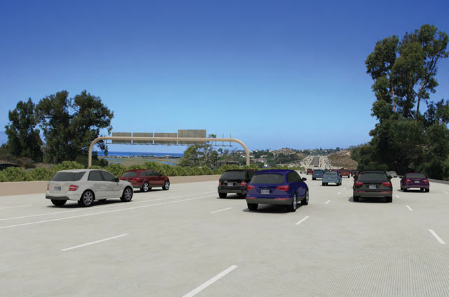
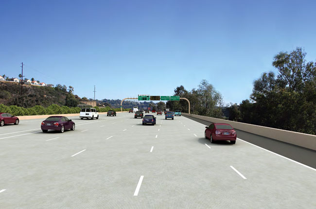
Additional impacts to coastal scenic views from the highway could occur from new highway appurtenances such as the Intelligent Transportation System (ITS) components, which would consist of electronic payment-collection equipment, overhead traffic sensors, changeable message signs to display Express Lane pricing and other relevant information, and between 15 and 20 closed circuit television (CCTV) cameras to view and help manage traffic, which, if not appropriately located, could obstruct or detract from views of coastal visual resources. These types of features would be concentrated at or near the DAR facilities at Voigt Drive and Manchester Avenue, and other major Express Lane ingress/egress points, and would be sited and/or designed to avoid impacts to coastal visual resources to the greatest extent feasible, such as avoidance of overhead signs within the lagoon crossings (Figure 5.7-1A through Figure 5.7-1G). The proposed Express Lanes signage-which includes overhead and pavement regulatory, directional, and guidance signs-are based on policies and directives outlined in the California Manual on Uniform Traffic Control Devices (MUTCD) 2012 Edition, the 2003 High Occupancy Vehicles (HOV) Guidelines for Planning, Design and Operations (amended by the Traffic Operations Policy Directive 11-02, dated April 2011), and the California Highway Design Manual. The proposed sign locations are preliminary and are subject to change during the Design Phase when all of the information for the placement of the signs is available. Every effort has been made to avoid placing signs in a motorist scenic view area, such as at lagoon crossings. Appendix B includes information and a preliminary study of layouts regarding the proposed locations of the required ITS elements. Furthermore, the design of standard overhead signage found throughout California, including on the parallel I-15 corridor, has been modified to reduce visual impacts within the NCC through avoidance of typical closed-box or truss structures. To further minimize the size of the signage elements on bridge overcrossings proposed throughout the corridor, site-specific designs would be provided and new signage and commuter pricing information technologies explored as part of future Notices of Impending Delivery (NOIDs).
Temporary visual impacts to traveler views associated with construction activities adjacent to and visible from the highway would generally include visual contrast impacts created by active construction sites, grading, and vegetation removal.
Adjoining Views
Proposed highway improvements would be contained, in large part, within the existing right-of-way or would be located directly adjacent and contiguous to the existing facility; however, extended and enlarged highway improvements could result in visual resource impacts associated with obstructing public views from adjacent public areas to significant coastal and inland visual resources.
Construction of new DARs at Voigt Drive and Manchester Avenue would add visual mass to the highway facility in those locations and, as discussed above, would result in expanding transportation structures into an agricultural area at Manchester Avenue that could affect public views of open space areas across from San Elijo Lagoon. To reduce potential impacts to views of open space at the Manchester Avenue DAR and transit center, the proposed DAR was redesigned from a large, flyover structure to a trenched access ramp and an under-crossing, and the transit center parking reduced to 150 spaces, thereby limiting the footprint extent into the adjacent agricultural fields. Additionally, landscape screening would be provided to reduce the expanse of built structure and for visual continuity to the surrounding hillsides and open space areas.
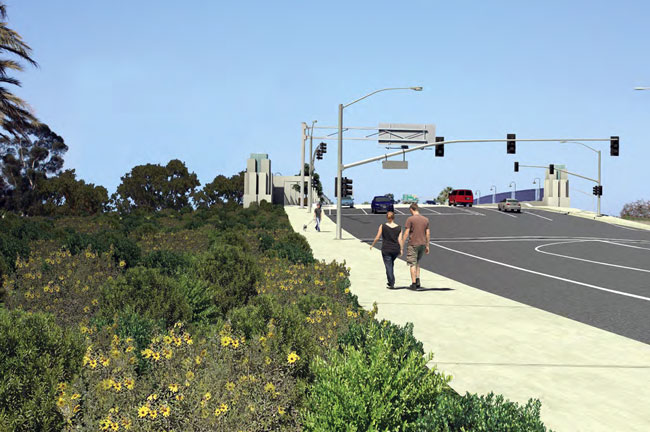
The highway's visual character from surrounding areas could be adversely affected at right-of-way edges where the project would bring the highway closer to recreational areas and community viewers. Existing landscaped buffers between the highway and adjacent land uses would be reduced in size (or removed altogether) and replaced with retaining walls and/or soundwalls in some locations. At highway interchanges, overcrossing and under-crossing structures (and some local streets) would be enlarged and could create an increased urban visual character. In particular, the visual experience of pedestrians and bicyclists could be affected with the introduction of walls and wider roadways; however, community enhancements (discussed further below and detailed in Section 5.3) such as the I-5 North Coast Bike Trail, widened sidewalks, street trees, pedestrian overcrossings, and other pedestrian amenities are proposed in coordination with the affected corridor cities to avoid or minimize these visual impacts. In many instances, the visual experience for pedestrians would be enhanced not only through provision of wider sidewalks and new amenities but also through provision of new access where there currently is none. Proposed stormwater detention basins and bioswales located within available highway right-of-way throughout the corridor may also introduce standard features such as maintenance vehicle roads, rock rip-rap slopes, concrete aprons and headwalls, standpipes, and chainlink fencing that could be incompatible with area aesthetics and could further reduce available landscape screen area.
Highway improvements could potentially result in visual impacts associated with landform alteration of natural terrain as viewed from adjacent areas. While the majority of proposed facility improvements would be contained within the existing right-of-way to minimize the facility and grading footprint and associated resource impacts, improvements would require adding retaining walls to limit encroachment of facility improvements to adjacent areas, thus displacing existing terrain and landscaped roadside areas visible from the surrounding area. Highway bridge improvements would not involve altering bluffs or cliffs but could require continued use of protective structures at piles and/or abutments.
Temporary visual impacts to adjoining views could also result from construction activities and would generally include visual contrast impacts created by active construction sites, grading and vegetation removal.
5.7.3 PWP/TREP Opportunities, Policies, Design/Development Strategies and Implementation Measures
While the proposed rail and highway improvements could affect coastal visual resources in the corridor, the majority of program improvements would occur within previously disturbed and developed areas of existing rail and highway right-of-way and adjacent urban land uses. The proposed rail and highway improvements would primarily consist of expansions and/or reconfigurations of existing facilities that minimize substantial encroachment into adjacent undeveloped, open space areas. The improvements, through appropriate application of site-sensitive design themes and concepts, as well as landscaping would be consistent with the visual character of the existing facilities and surrounding land uses.
5.7.3.1 Corridor Opportunities
Visual resource enhancement opportunities provided by the proposed rail improvements could include rail improvement options for trenching and tunneling through portions of the corridor that could allow for restoring open space areas presently displaced by portions of the existing facility, with an option of removing the rail service from the coastal bluffs in Del Mar and Los Peñasquitos Lagoon, which could reduce overall visibility of the rail facility and result in a beneficial impact to these coastal viewsheds. Removing the existing rail facility from Del Mar bluffs would further provide an opportunity to remove and restore the shoreline area currently occupied by shoreline protection devices, which were permitted and are maintained to ensure stability of the bluff and support continued operation of the existing rail facility.
Additional opportunities for coastal visual resource enhancements include replacement of existing rail and highway bridge structures, which, due to their age, are relatively dense in form and mass and presently obscure views to the ocean and/or inland areas through the bridge support structures. Improvements that would replace and update bridge structures could open the viewshed in some of the lagoon areas with new bridge designs that would reduce support structures and, thus, reduce the visual mass of the structure and provide a more visually permeable design.
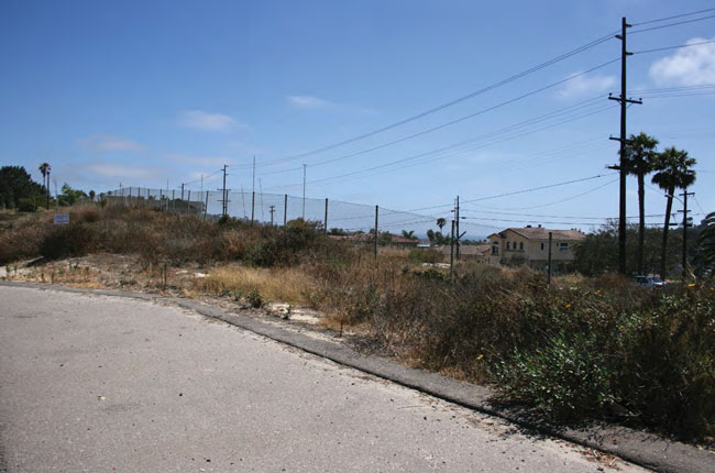
Opportunities to move existing aboveground utilities underground would occur in two areas directly impacted by the freeway widening; at Ida Avenue and Union Street, which would further restore and enhance visual resources and reduce urbanized landscape/features in these portions of the corridor. Enhancement opportunities would also involve replacing existing facility lighting with updated, energy efficient lighting that is better directed to avoid/minimize visual impacts and nighttime glare.
In addition, the PWP/TREP includes a Resource Enhancement and Mitigation Program (discussed in more detail in Sections 5.4, 5.5, and Chapter 6B), which would involve acquisition and habitat preservation and enhancement of properties in the corridor that would be maintained as natural open space areas, thereby enhancing natural open space areas that would be visually accessible from travelers in the corridor and from surrounding areas.
Furthermore, PWP/TREP highway improvements have been evaluated and designed in conjunction with the I-5 North Coast Community Enhancement Plan, which includes community enhancement projects that could improve how the highway project interfaces with adjacent communities. These projects would also enhance communities along the I-5 highway corridor by incorporating contextsensitive design and public amenities, where feasible. The proposed community enhancement projects were identified and developed in close coordination with affected communities and included coordinating project development team meetings, developing preliminary design concepts, meeting with city officials and their staff, and developing the I-5 NCC Project Design Guidelines (Appendix C of the PWP/TREP).
Implementing community enhancement projects would depend on cooperation between members of the community, City officials, and the Caltrans design team. Pursuant to a cooperative agreement between Caltrans and the affected cities, Caltrans would construct the community enhancement projects throughout the I-5 corridor as part of highway construction, and maintenance agreements would be organized with each city, allowing future maintenance to become the responsibility of the local jurisdiction.
In addition to various improvements intended to improve public access and recreation, community enhancement projects include design elements that would directly improve visual resources along the corridor and integrate the multi-modal transportation improvements to minimize visual resource impacts. These design elements include, where proposed, enhanced landscape buffers between the highway, trails, parking areas and community streets; new and widened sidewalks; street tree plantings; slope and parkway plantings; the creation of pocket parks; and enhanced fencing, paving, and lighting. Community enhancement design concepts are discussed in more detail in Sections 4.4 and 5.3, and are described and depicted in the I-5 North Coast Community Enhancement Plan.
5.7.3.2 PWP/TREP Policies
Caltrans and SANDAG shall implement the following policy to ensure that proposed improvements are sited and designed to protect public views to significant coastal resources:
Policy 5.7.1
Development of NCC transportation facility and community enhancement projects shall be sited and designed in a manner that protects, to the maximum extent feasible, public views to significant coastal resources, including views of the ocean and coastline, coastal lagoons and river valleys, and significant open space areas. New development shall be sited and designed to be compatible with existing development and surrounding areas such that the impacts of grading, operational activities and direct lighting on public views outside of the transportation facilities and community enhancement improvements are limited to the maximum extent feasible.
5.7.3.3 PWP/TREP Design/Development Strategies
The following design and development strategies provide guidance for siting and designing specific PWP/TREP rail projects, and Caltrans/SANDAG shall utilize the following design and development strategies for all projects subject to NOID procedures, consistent with the coastal visual resources protection policies of PWP/TREP Policy 5.7.1, amended local coastal programs (LCPs), and the Coastal Act.
- 1. Development of transportation facility projects shall be sited and designed such that the impacts of grading, operational activities and direct light on public views outside of the transportation facilities are limited to the maximum extent feasible.
- 2. Project-level analysis for potential visual resource impacts of transportation improvements shall confirm that proposed improvements will minimize substantial impacts to coastal visual resources including public view corridors, community, and environmental aesthetics. Should project-level analysis find that previously unidentified, substantial permanent or temporary impacts to visual resources will result from proposed improvements, additional avoidance and mitigation measures to ensure project consistency with applicable Coastal Act visual resource policies shall be identified during future, project-specific federal consistency review.
- 3. NOID and/or project-specific federal consistency review submittals for individual highway, rail, transit, and community enhancement projects shall identify all potential visual resource impacts of project implementation, as addressed by Policy 5.7.1, and detail the type and location of visual mitigation elements included in the project. NOID submittals for highway projects shall include architectural and landscape mitigation requirements, as provided in Implementation Measure 5.7.1, as applicable, which avoid and/or minimize potential coastal visual resource impacts. NOID submittals including community enhancement projects shall include the cooperative maintenance agreement with the affected city.
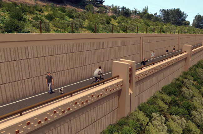
- 4. Appropriate types of fencing shall be considered in the development of the final project designs and shall include use of see-through bridge rails and visually permeable fencing, where appropriate, including consideration of noise impacts on wildlife, and low-profile safety barriers between pedestrian and transportation uses, where necessary and feasible.
- 5. Design solutions shall be considered in the development of the final project designs to integrate transportation infrastructure into existing landscapes and enhance project appearance to minimize visual impacts. Where feasible, design solutions may include, but not be limited to:
- Grading shall be designed to minimize landform alteration and removal of significant vegetation. Grading and ground disturbance shall be the minimum necessary to construct proposed improvements.
- The design of proposed replacement bridges across the lagoons shall be carefully evaluated for its mitigation potential for visual impacts, by providing reduced support structures as compared to the existing bridges.
- Where at-grade or depressed route segments pass through or along the edge of residential areas or heavily traveled roadways, landscape treatments such as trees, shrubs, and groundcover could be installed along the edge of the right-of-way to provide partial screening and to visually integrate the right-of-way into the surrounding context provided that the subject landscaping does not block existing public coastal views.
- Night lighting shall be the minimum required for operations and safety and shall be excluded from viewsheds containing scenic resources, including at lagoon crossings, wherever feasible. All lights shall be shielded and directed downward to the target area to minimize spill-over. All lights shall be of appropriate Kelvin temperatures that will minimize biological impacts in adjacent natural areas. New and replacement facility lighting shall use updated, energy efficient lighting that is better directed to avoid or minimize visual impacts and nighttime glare.
- Areas that are disturbed by cut, fill or grading shall be seeded or planted, such that these areas will blend with the surrounding vegetated areas. Landscaping plans shall include only species native to Southern California such that the proposed planted areas will be compatible with surrounding natural and manmade areas. Native vegetation shall be placed in appropriate locations and densities consistent with adjacent natural settings. Appropriate native species shall also be used adjacent to developed and landscaped areas; however, steep areas of cut in rock may not be able to support plants.
- Review of local urban design plans and policies shall be conducted to take into account local design objectives. The analyses shall provide a basis for considering specific design measures that would modify the impacts of the project in ways that would make the project design more consistent with local urban design goals.
5.7.3.4 Implementation Measures
Caltrans/SANDAG shall utilize the following implementation measures for all projects subject to NOID procedures:
Implementation Measure 5.7.1: Visual resource mitigation elements for highway and community enhancement project impacts shall incorporate the following visual design features, as appropriate, for specific project features to ensure substantial visual resource impacts from project construction are avoided or minimized to the extent possible. NOID submittals shall detail the type and location of visual mitigation elements included in the project design in accordance with the approved I-5 NCC Project Design Guidelines (Appendix C of the PWP/TREP) and the information contained therein as a compilation of allowable design templates and landscaping for associated improvements including, but not limited to bridges, interchanges, retaining walls, etc., and shall include, as appropriate:
- Sound Barriers
- Soundwall setbacks, landscape buffers and/or planting pockets
- Soundwall articulated layout/varied profile
- Transparent soundwalls on private property
- Translucent soundwall panels on Caltrans property
- Architectural detailing
- Retaining Walls
- Retaining wall setbacks, landscape buffers and/or planting pockets
- Terrain-contoured retaining walls in cut sections
- Terraced retaining walls
- Mid-Slope retaining walls in cut sections
- Top-of-Slope retaining walls in fill sections
- Viaduct retaining walls
- Enhanced safety railings
- Architectural surface treatment
- Low Profile and See-Through Safety Barriers
- Overcrossings, Bridges, Under-crossings and Direct Access Ramps
- Terrain-contoured walls with landscaped buffers and/or architectural treatment, where appropriate and feasible.
- Enhanced slope paving (color, texture, materials, etc.).
- See-through bridge rails, where appropriate including consideration of noise impacts on wildlife.
- Enhanced sidewalks (patterns, color, textures, etc.).
- Low profile safety barriers between pedestrian and vehicular traffic, where necessary and feasible.
- Enhanced pedestrian lighting, fencing, railing, container trees, and other urban amenities, designed consistent with local design guidelines, where feasible and where the responsible local agency has requested them and agreed to maintain them in perpetuity.
- Highway Interchanges
- Street trees, pedestrian lighting, landscaped parkways, enhanced sidewalk paving where feasible and where the responsible local agency has requested them and agreed to maintain them in perpetuity.
- Urban design features such as benches, bollards, directional signage, and trash receptacles where feasible and where the responsible local agency has requested them and agreed to maintain them in perpetuity.
- Bicycle facilities designed consistent with the San Diego Regional Bike Plan, applicable local standards, and local jurisdiction circulation element goals, wherever possible.
- Enhanced interchange landscaping and entry features where feasible and where the responsible local agency has agreed to maintain them in perpetuity. Entry features shall be included as transitional visual elements into local communities where appropriate.
- Highway Landscape - Corridor landscaping designed consistent within the corridor and with the character of adjacent community landscape. At community gateway locations that are currently characterized by ornamental landscaping, highway landscaping with enhanced, native noninvasive, drought-tolerant trees, shrubs, and groundcover shall be installed. Throughout the remainder of the corridor, landscaping with native non-invasive, drought-tolerant trees and shrubs shall be planted.
- Native landscaping provided in all areas adjacent to native habitat, designed in consultation with the district biologist, and irrigated utilizing reclaimed water wherever possible.
- Highway planters for replacement planting within the highway facility at the edge of shoulder, between concrete median and separator barriers, or between barriers and walls wherever the available width allows.
- Median oleander preservation, replacement planting and maintenance. A median oleander replacement pilot project would be assessed concurrent with initial Express Lane construction to determine feasibility of use of native non-invasive trees and/or shrubs for maintenance and visual screening purposes.
- Manufactured slopes designed to support planting and irrigation (including grading techniques such as slope rounding, slope sculpting, and variable gradients to approximate the appearance of natural topography).
- The specific design of gateway features including height, size and color will be determined in consultation with the local agency and Coastal Commission during the design phase and preconsultation meetings. Gateway features shall be of low scale and visually unobtrusive while communicating the local character of the gateway.
- Local Frontage Roads - In locations where highway widening brings traffic in close proximity to parallel local streets such as Ida Avenue in Solana Beach, Villa Cardiff Drive, Devonshire Drive, Orpheus Avenue, and Piraeus Street in Encinitas, Avenida Encinas in Carlsbad, and Brooks Street, Garfield Street, and Buena Street in Oceanside, landscape buffers shall be created between the highway and street, which may include elements such as street trees and shrubs, sidewalks, and solid screen walls with vines for access and graffiti control. Including some buffers may require local street widths to be adjusted. Implementing this measure is contingent on local agency approval and commitment to irrigate and maintain the landscape buffer in perpetuity. Landscaping plans shall include only species native to Southern California such that the proposed planted areas will be compatible with surrounding natural and manmade areas. The use of non-native plants, or plants not native to southern California (vines and street trees) would require concurrence with the Coastal Commission.
- Lighting, Signage, and Miscellaneous Highway Appurtenances - Typical lighting and signage standards (e.g., type, height, dimension, intensity and location, as applicable) are identified in Appendix B. Throughout the corridor, the following measures shall be applied and identified in project-specific NOID submittals:
- Lighting and signage pedestals placed at pilasters or incorporated in other architectural features, where possible. Any metal poles shall be galvanized.
- Concrete lighting and signage pedestals designed such that vertical barrier transitions are not required.
- Overhead sign structures shall be a visually unobtrusive color.
- Signage with movable elements or self-illuminated features such as changeable message signs and freeway lighting shall be excluded from viewsheds containing scenic resources, including at lagoon crossings, wherever feasible.
- Bridge signage designed to be visually integrated with bridge architecture. Where the sign panel is attached to the bridge, the framing and back of the sign shall be an unobtrusive color or similar to the bridge color.
- Electrical and signal equipment at ramp termini placed in visually unobtrusive locations.
- Enhanced median barriers (color, texture, etc.).
- Enhanced gore paving (color, materials, etc.).
- Access control fencing placed in visually unobtrusive locations of interchanges and bridges where possible. It is recommended that the fencing be of special design and consist of enhanced materials where appropriate and maintained by the responsible local agency in perpetuity.
- Future technologies related to lighting, signage, and miscellaneous highway appurtenances (e.g., ITS and CCTV elements) shall be co-located wherever feasible, and shall be reviewed and incorporated within future project-specific NOID submittals.
- Drainage and Water Quality Facilities
- Landscape screening of detention basins, where feasible.
- Detention basins and bioswales designed to appear as natural landscape features such as dry streambeds or riparian pools.
- Subterranean drainage or planted geo-reinforced drainage surfaces alternatives to concrete drainages adjacent to residential areas, where appropriate and feasible.
- Concrete drainages, ditches and aprons located, designed, and colored to be unobtrusive in appearance.
- Rock slope protection consisting of aesthetically pleasing whole material of various sizes.
- Standpipes and other vertical appurtenances placed in unobtrusive locations, wherever feasible, and painted or stained an unobtrusive color.
- Plantable soft-surface or segmented hard-surface alternatives to concrete ditches and rock slope protection in all project areas visible to the public, where feasible.
- Pervious concrete used for interceptor ditches, inlet aprons, gutters, maintenance access roads, maintenance vehicle pullouts, and parking lots, where feasible.
- Maintenance access drives for drainage and water quality facilities located in unobtrusive areas away from local streets and consisting of inert materials or herbaceous groundcover that is visually compatible with the surrounding landscape.
Implementation Measure 5.7.2
Affected local jurisdiction(s) shall be provided the opportunity to participate in the review of final design plans for project-specific improvements located within their jurisdiction as part of future NOID submittals in accordance with the process and procedures specified in Chapter 6A of the PWP/TREP.
Implementation Measure 5.7.3: Early pre-consultation with the Coastal Commission, and affected local jurisdictions upon request, shall occur at the earliest feasible time when an adequate level of design detail is available (generally at 30% Design) to provide for adequate review and comment periods to identify and incorporate appropriate visual mitigation elements identified in Implementation Measure 5.7.1 and pursuant to the adopted I-5 NCC Project Design Guidelines (Appendix C of the PWP/TREP). Design of freeway project features shall be done in consultation with affected local agencies with the understanding that Caltrans policy and procedures regarding issues such as safety, operations, maintenance and cost will prevail.
5.7.4 Coastal Act Consistency
Coastal Act Section 30251 provides for the protection of scenic and visual resources of the Coastal Zone:
The scenic and visual qualities of coastal areas shall be considered and protected as a resource of public importance. Permitted development shall be sited and designed to protect views to and along the ocean and scenic coastal areas, to minimize the alteration of natural land forms, to be visually compatible with the character of surrounding areas, and, where feasible, to restore and enhance visual quality in visually degraded areas. New development in highly scenic areas such as those designated in the California Coastline Preservation and Recreation Plan prepared by the Department of Parks and Recreation and by local government shall be subordinate to the character of its setting.
Coastal Act Section 30253(b) further provides that new development shall not require constructing protective devices that substantially alter natural landforms along bluffs and cliffs: New development shall do all of the following:
- (b) Assure stability and structural integrity, and neither create nor contribute significantly to erosion, geologic instability, or destruction of the site or surrounding area or in any way require the construction of protective devices that would substantially alter natural landforms along bluffs and cliffs.
The proposed PWP/TREP improvements would consist primarily of improvements to existing transportation facilities located in previously developed and disturbed areas within existing rail and highway right-of-way. Improvements or changes to the existing rail and highway facilities would generally be expansions or reconfigurations of existing facilities involving limited expansion of vertical mass beyond what currently exists. As such, the majority of PWP/TREP facility improvements would not result in substantial visual contrasts or changes to the dominant, overall form characterizing the existing visual condition of the transportation corridors as viewed throughout the corridor. Where the program improvements could result in impacts to sensitive or key coastal visual resources, the PWP/TREP includes various policies, guidance strategies, and implementation measures to avoid or minimize potential impacts to significant coastal visual resources. Strategies and policies generally include evaluating and incorporating site-sensitive design and landscaping treatments into highway projects consistent with the proposed I-5 NCC Project Design Guidelines (Appendix C of the PWP/TREP), and minimizing grading, landform alteration, and vegetation removal, wherever feasible, to avoid or minimize visual resource impacts.
With the exception of potential tunnel alignments, all rail improvements would remain within or along the existing transportation corridor, which would substantially minimize the potential for adverse impacts to visual resources resulting from implementing the proposed track improvements. At-grade track improvements, including those requiring track raises, would have minimal to no impacts on public views to and along the ocean and shoreline, or to scenic inland areas for both traveler and adjoining views.
Proposed highway improvements would also be located, in large part, within the existing right-of-way directly adjacent and contiguous to the existing facility. Highway improvements are not expected to result in substantial visual resource impacts associated with obstructing public views from adjacent public areas to significant coastal and inland visual resources. The highway is located some distance from the shoreline where views of the ocean and coastline from surrounding public areas are already very distant. While the highway is an existing visual feature within the viewsheds of the lagoons and river valleys it crosses, improvements to the highway, which are linear, would not be significant enough to substantially affect public views through these viewsheds to the coastline or inland foothills.
View impacts from proposed at-grade highway improvements to the corridor's most significant coastal visual resources, specifically views to the ocean, coastline, lagoons, and river valleys, would also be avoided or minimized. These resources are typically visible across or below the corridor's large lagoon and river bridges that provide visual access to these highly scenic view corridors. These view corridors would continue to be bridged and generally would not require large soundwalls or retaining walls that could obstruct existing views.
While at-grade rail track improvements would have the potential to increase the visibility of the facility within the right-of-way as viewed from on- and off-site locations due to expansion of the facilities, the increase in improvement area would be minor, incremental and would be at or below-grade consistent with the visual character of the existing facility and the surrounding environment. Trench alignments would generally be less visible than at-grade alignments; however, where open trench sections would have to be fenced for security purposes, at-grade visual impacts would need to be analyzed during project-level analysis to ensure fencing would be appropriately located and designed to avoid or minimize substantial impacts to visual resources.
Trench and tunnel alignment options that could replace at-grade facilities could, however, adversely affect passenger views to coastal visual resources as portions of the transportation facility would be depressed or placed entirely below-grade, thus eliminating coastal views currently available from the at-grade facility; however, trench and tunnel alignments would result in a beneficial impact to overall visual resources in the corridor by placing facilities below ground, thus eliminating visibility of structures from public viewsheds. In particular, rail improvements would include an option for removal of the rail service from the coastal bluffs in Del Mar and portions of Los Peñasquitos Lagoon, which would eliminate the rail facility from these locations, potentially allowing for restoration to the coastal viewshed in these highly scenic areas.
As described in other sections of this chapter, proposed tunnel alignment option alternatives, though not decided at this time, could result in substantial, beneficial impacts to a range of coastal resources, including coastal access and recreation, marine resources, environmentally sensitive habitat areas, and safety and stability. At-grade and trench alignments potentially function as barriers to, or cause conflict with, vehicle, bicycle and pedestrian traffic, and wildlife movement. In Del Mar, a tunnel option could remove the rail line from the Del Mar bluffs, which are susceptible to failure and unable to accommodate double-tracking due to the significant excavation, stabilization, and ongoing maintenance needs for existing shoreline protection devices, which could in turn affect shoreline processes, water quality, and sensitive habitats. Additionally, one tunnel option could run under I-5 before returning to grade along the southern bluffs of San Dieguito Lagoon, thus avoiding Los Peñasquitos Lagoon where the existing lagoon crossing structure would be removed from service. All tunnel options for Del Mar would reduce direct and indirect impacts to waterbodies and sensitive habitat areas (except at tunnel portals) as all surficial construction and operational impacts would be avoided.
Improvements to benefit visual resources associated with the Del Mar tunnel options would be most notable within the coastal scenic areas of the Del Mar bluffs, and potentially Torrey Pines State Beach and Reserve and Los Peñasquitos Lagoon. The Camino Del Mar tunnel option could remove the existing rail service from Del Mar bluffs, resulting in an improvement to area aesthetics and the coastal viewshed. While the two Camino Del Mar tunnel portals would have some visual impact, the impact would be within the urban environment and/or along the existing rail right-of-way and would not substantially alter existing aesthetics. The I-5 tunnel option would also remove the existing tracks from the Del Mar bluffs, and would remove the existing railway crossing in Torrey Pines State Beach and Reserve, and Las Peñasquitos Lagoon, improving views of the beaches, bluffs, and the lagoon. This tunnel option, however, could create new visual impacts along the south edge of San Dieguito Lagoon where an elevated rail structure would be constructed for a portion of the track. As with the Camino Del Mar tunnel options portals, the I-5 tunnel option portals would also have some visual impact; however, potential impacts would similarly occur along the existing rail right-of-way and would not substantially alter existing aesthetics of the area.
A pedestrian-grade separation is proposed for the Hillcrest Drive intersection along with an automobile grade separation at Leucadia Boulevard in Encinitas; two additional grade separations are identified within the 2050 RTP, but their location is yet unknown. These crossings are currently designed as under-crossings, which would substantially minimize structural mass of the improvements and maintain views across the facilities; however, project-level analysis would be conducted to ensure potential designs avoid substantial impacts to visual resources.
Bridge replacements for the LOSSAN rail corridor would include bridges at San Luis Rey River, Buena Vista, Batiquitos, San Elijo, San Dieguito, and Los Peñasquitos Lagoons (under some alternatives). All bridges would be double-tracked and in some cases, such as at San Elijo Lagoon, bridge spans lengthened (depending on restoration plans for the lagoon), and the bridge footprint reduced due to changes in bridge design and construction materials, including replacing creosote piles with longer spans and concrete piles. Widening of bridge structures for double-tracking could increase the visual mass of the structures as viewed from surrounding areas; however, this potential visual impact could be offset by new, concrete bridge designs that would be smaller in scale with fewer support structures than the existing trestle bridges, thus allowing for a more visually permeable design. Proposed bridge replacements could improve visual resources of lagoon and river open space areas by removing the existing timber-trestle bridge support structures, which are relatively dense in form and mass and presently obstruct adjoining views to coastal and inland areas in these locations. This would restore views of the ocean through new bridge designs for travelers along I-5, and restore views to the ocean and inland foothills for people using adjacent open space areas.
Station parking improvements would include adding parking spaces and/or new parking structures at, adjacent to, or in close proximity to the Oceanside, Carlsbad Village, Carlsbad Poinsettia, Encinitas, and Solana Beach stations. These improvements would occur at, adjacent to, or in close proximity to existing stations in developed areas inland from the coastline and therefore are not likely to obscure significant traveler or adjoining views to the shoreline. A new platform at Del Mar Fairgrounds is proposed in the San Dieguito River Valley, which, although minimal in size and scale, would introduce a new transportation facility in an area generally characterized by open space and the rural and cultural features of Del Mar Racetrack and Fairgrounds. Potential impacts to significant coastal views and area aesthetics for travelers and adjoining views would be analyzed during project-level analysis to ensure the location and design of station and platform improvements protect coastal visual resources to the extent possible and to ensure overall compatibility with the visual resources of the area.
Existing, permitted shoreline protection devices for the rail corridor in the Del Mar area have altered the shoreline; however; previous Coastal Commission review of the shoreline protection system included project conditions and clarifications to ensure that the structures were designed and treated to protect natural landforms and visual resources. Future stabilizing activities would be subject to further Coastal Commission review to ensure that the structures were designed and treated to protect natural landforms and public views.
As the majority of proposed rail improvements would be at- or below-grade and within the existing right-of-way, visual impacts associated with landform alteration of natural terrain would generally be minimal throughout the majority of the corridor. However, grade separations, station parking improvements, the Del Mar Fairgrounds Special Event Platform, tunnel portals, and the future Los Peñasquitos bridge replacement and/or realignment options, pending the selection of the I-5 Del Mar tunnel option (which would include an elevated rail structure along the southern edge of San Dieguito Lagoon) would require some grading, potentially resulting in temporary landform alteration. Significant and highly visible landform alteration of natural terrain is not expected, however, given that the majority of these improvements would be largely limited to right-of-way areas or in tunnels, and would occur in existing developed and relatively level areas. Tunnel alignment options could result in additional beneficial visual improvements, except at portal locations, as they would avoid surficial construction and operational impacts that would otherwise be visible from surrounding areas.
Constructing new DARs at Voigt Drive and Manchester Avenue could also affect coastal visual resources in the corridor as viewed by highway travelers and from adjacent properties; however, the DAR proposed at Voigt Drive in San Diego would not result in substantial impacts to coastal visual resources. The proposed DAR at Voigt Drive would be partially located within the Coastal Zone, but would also occur in a highly developed area with adjacent land uses consisting of the University of California, San Diego campus and other urban uses. Views from the highway and adjoining views would be affected by introducing large walls, ramp structures, and widened local streets; however, the DAR structure would not obscure a significant public viewshed, and the structure would not be incompatible with the urbanized landscape of the surrounding area.
Constructing a new DAR at Manchester Avenue would add visual mass to the facility and expand transportation facilities into adjacent agricultural areas, which would affect open areas viewed from both the highway and adjoining areas. DAR construction would result in loss of visual open space associated with agricultural areas adjacent to the highway at Manchester Avenue (approximately 8.4 acres), which are located across the street from San Elijo Lagoon.
Potential impacts to views of open space would be most notable at this Manchester Avenue DAR and San Elijo Multi-Use Facility, which would also include a new access road and parking for 150 cars (porous paving would be used to treat the water at the park-and-ride). The improvements would add structural mass to the existing highway facility and would result in a new parking facility located in a currently open agricultural area, which would reduce open space area associated with the agricultural area near San Elijo Lagoon; however, the scenic bluffs, hillside terrain, the upper agricultural fields located on the northbound slope, and the lagoon itself would remain undisturbed and visible from the highway and the majority of the surrounding area. The DAR and park-and-ride improvements were redesigned as a trenched ramp and an under-crossing to be situated below the level of the existing ground plane to minimize the visibility of the improvements from the highway. Site amenities for transit users at Manchester Avenue would not involve constructing large, massive structures, but would include covered shelters with minor site amenities and enhancements, including pedestrian lighting, benches, litter receptacles, bollards, and bicycle racks. Landscaping and enhanced pedestrian paving would be an integral part of the transit center features.
The project alternative analysis for highway improvements potentially affecting coastal visual resources is part of the I-5 NCC Project Draft EIR/EIS (June 2010). Additional design-level alternatives analysis, including detailed avoidance and minimization considerations, has been completed and is reflected within the selection of the Locally Preferred Alternative, as described in detail within the I-5 NCC Project Supplemental Draft EIR/EIS (August 2012) and I-5 NCC Project Final EIR/EIS (October 2013).
This design detail, including a reduced project footprint throughout the corridor and for the Manchester Avenue transit station and DAR, removal of the Cannon Road and Oceanside DARs, and other corridor-wide lane reconfigurations and/or removals, reduces overall project impacts.
The I-5 NCC Project Design Guidelines (Appendix C of the PWP/TREP) include corridor-wide and local design themes to preserve the natural and community visual characteristics of the existing corridor and create a unifying visual thread. Common design features reflected within proposed implementation measures include the use of terrain-contoured retaining walls to minimize visual prominence and allow for increased landscape screening, use of natural contour grading wherever feasible, implementation of spatial buffers to reduce the urbanizing edge effect new built structures, preservation and enhancement of median plantings, and appropriate use of color for compatibility with local design themes.
The entire corridor was divided into three basic visual Theme Units, as detailed within the I-5 NCC Project Design Guidelines (Appendix C of the PWP/TREP). The Theme Units bear no relationship to political boundaries such as city limits but are determined by the visual character of the landscape. The following existing characteristics were used as determinants to establish the Theme Units: natural landscape character (topography, bluffs, vegetation, color, etc.); the visual character of adjacent land uses (the degree of urban character), and proximity and nature of adjacent land use. The three Theme Units are as follows:
- Southern Bluff Theme Unit - La Jolla Village Drive in La Jolla to Poinsettia Lane in Carlsbad. This portion of the corridor is perhaps best characterized by coastal bluffs of Torrey sandstone that buttress the coast as well as river valley slopes farther inland. The design of corridor retaining walls is meant to recall these iconic forms. The weathered, eroded quality of the bluffs will be reflected in architectural pilasters, rough surface textures, integral earth tones, and weathered steel ancillary materials. This earthen theme will be carried through to bridges and sound walls as well. Bridges will be composed of natural curved forms that harmonize with the rhythm of land and sea. In key locations, sound walls will use cast-in-place construction to enable an organic, free-form design.
- Coastal Mesa Theme Unit - Poinsettia Lane in Carlsbad to State Route 78 in Oceanside. North of Batiquitos Lagoon, upland topography shifts from rolling hill to the expansive coastal mesa. Extensive commercial development and an older, tree-lined, established urban village border the freeway on these flatlands. Between them, Agua Hedionda Lagoon and adjoining agricultural fields form a natural punctuation mark. Also punctuating the sky is the Encina power plant exhaust stack that has been an orienting feature for over fifty years. This vertical element combines with the coast highway, Carlsbad State Beach, and Carlsbad sea wall to form a visual signature of coastal Carlsbad. Design themes for this unit will be inspired by the area's confluence of natural and built forms displayed along the corridor and coast as well as the historical importance of floral agriculture in its development. Freeway architecture will continue the integral earth-tone theme but will transition from rougher to smoother textures with a curved wave motif seen in wall textures and bridge fencing.
- Northern Urban Theme Unit - State Route 78 to Vandegrift Boulevard in Oceanside. In this unit, coastal bluffs recede, and broad sand beaches lined with development are characteristic. In general, a more urban quality appears both on the coast and along the freeway corridor. The Strand, the Oceanside Pier, and Oceanside Harbor establish coastal character. This unit also is home to the most significant architecture in the corridor. Mission San Luis Rey inspired the works of Irving Gill, which in turn inspired Charles Moore's Oceanside Civic Center. All combine to form a rich architectural heritage and historical continuity. Freeway architecture will exhibit more tectonic forms than other units of the corridor consistent with the immediate context. Rectilinear forms, smoother surfaces, lighter colors, and refined ancillary materials such as ceramic tile and galvanized steel will distinguish this unit from the others.
The three design elements that are considered to have the greatest impact on the character of the corridor include the community gateways, the lagoon bridge crossings, and the retaining/sound walls; accordingly, design concepts have been prepared in the form of sketches, renderings and associated text within the I-5 NCC Project Design Guidelines (Appendix C of the PWP/TREP) to help illustrate the types of facility improvements anticipated within each design theme unit and their connection and influence on the user experience.
The highway's visual character from surrounding areas could be adversely affected at right-of-way edges where the project would bring the highway closer to recreational areas and community viewers. Existing landscaped buffers between the highway and adjacent land uses would be reduced in size or removed altogether and replaced with retaining walls and/or sound-walls in some locations. At highway interchanges, overcrossing and under-crossing structures (and some local streets) would be enlarged and could create an increased urban visual character. In particular, the visual experience of pedestrians and bicyclists could be affected by the introduction of taller walls and wider roadways; however, construction of the I-5 North Coast Bike Trail would provide improved access to coastal and inland visual resources. Proposed stormwater detention basins and bioswales would involve standard features such as maintenance vehicle roads, rock rip-rap slopes, concrete headwalls, standpipes, and chain-link fencing that could be incompatible with area aesthetics and could further reduce available landscape area. Community enhancement projects that include enhanced landscape buffers between the highway, trails, parking areas, and community streets; new and widened sidewalks; street tree plantings; slope and parkway plantings; creation of pocket parks and community gardens; and enhanced fencing, paving and lighting are proposed in coordination with affected cities to avoid or minimize these visual impacts. Landscaping plans shall include only species native to Southern California such that the proposed planted areas will be compatible with surrounding natural and manmade areas. The use of non-native plants or native plants not native to southern California would require Coastal Commission approval.
Proposed highway improvements would generally result in a more hardened landscape along I-5 with the additional road surface, access ramps, sound and retaining walls, and other urban features such as signage and lighting. Project improvements could affect travelers' views of adjacent landforms and developed areas unique to the corridor and could remove areas of significant vegetation. PWP/TREP implementation measures require that project features such as terrain-contoured retaining walls, planting pockets, median landscaping, enhanced bridge design, specific bridge railing design, landscape buffer planting at the top of walls, and widened sidewalks and landscaped parkways be incorporated into the project to minimize impacts to coastal visual resources and to reflect the visual character and goals of each affected community.
Highway bridge improvements would not involve altering significant landforms such as bluffs or cliffs but could require continued use of protective structures at piles and/or abutments along the shoreline of coastal lagoons and streams; however, these improvements would only occur in shoreline areas already altered by existing bridge structures. In addition, proposed bridge replacements would replace existing lagoon bridges that have steep, narrow abutments with new bridges designed with a bench at the abutment to facilitate wildlife movement as well as use by hikers, which would also serve to soften the appearance of the shoreline where new bridge construction would be necessary. Where feasible, new replacement bridges would also be designed with fewer in-water columns as new technology and construction methods allow for longer span distances, thereby opening views under the bridges and across the lagoons.
The PWP/TREP includes guiding design and development strategies to minimize potential visual resource and aesthetic impacts, which would be evaluated during additional project-level analyses pursuant to future environmental and/or NOID, phased federal consistency review, or coastal development permit review when applicable. The design and development strategies generally include minimizing grading, landform alteration, and vegetation removal; providing landscape treatments such as trees, shrubs, and groundcover along the edge of the right-of-way to provide partial screening and to visually integrate the right-of-way into surrounding areas; addressing potential night-lighting impacts by limiting, shielding and directing lights to only that required for operations and safety; and implementing native revegetation efforts for areas disturbed by grading activities.
The design and development strategies further include reviewing and considering local design objectives (in consultation with local agencies) for developing specific design measures during project-level analyses to provide consistency, wherever feasible, with local urban design goals. These analyses would guide proposed station architecture, parking lots, lighting systems, and other features to blend with the surrounding landscape, which would reduce the visual impacts of the stations on their surroundings.
Implementation measures require that sound walls be visually compatible with the surrounding community. Architectural detailing such as pilasters, wall caps, interesting block patterns, and offset wall layouts would be used to add visual interest and reduce the apparent height of the walls. Poured-in-place, integrally colored concrete construction techniques would be encouraged where visual consistency with retaining walls is desired. Enhanced surface materials such as mosaic tile and weathering steel would also be used where appropriate.
Implementation measures also provide for use of retaining walls that follow the contours. Where feasible, walls would be located at mid-slope to achieve visual compatibility with the surrounding terrain and provide room at the base for a slope that contains landscape screening. Where site conditions are favorable, retaining walls would be divided into separate structures sufficiently offset from one another to create a planting area between the two. Retaining walls would also be located at mid-slope wherever possible in cut sections to provide a buffer area for landscape screening between the wall and the highway. In areas where insufficient space exists to include planting buffers between highway retaining walls and adjacent community features such as frontage roads, the use of viaduct retaining walls would be considered, which would cantilever the roadway to form a wall recess in which spatial articulation and planting can occur. In areas where retaining walls must be placed close to the traveled way, space would be reserved between the wall and the safety barrier to include a 1.5-m (5-foot)-wide planting pocket.
Implementation measures also require various architectural treatments and provide for the use of architectural features, textures, and integral concrete colors to mitigate the appearance of retaining wall surfaces. Walls would incorporate architectural features such as pilasters and caps to provide shadow lines, provide relief from monolithic appearance, and reduce their apparent scale. Enhanced surface materials such as mosaic tile and weathering steel would also be used where appropriate to meet community design goals.
Landscaping throughout the corridor following project implementation would be native non-invasive, drought-tolerant trees, shrubs, and groundcover. In less developed areas of the corridor, landscaping with native drought-tolerant trees and shrubs and hydroseeding would be planted, and areas adjacent to native habitat would require native landscaping designed in consultation with the Caltrans district biologist.
While the transportation improvements would change the overall visual character of the NCC, PWP/TREP implementation measures would substantially reduce potential impacts to visual resources. Example architectural treatments and landscaping for the I-5 highway corridor as implemented at the recently constructed Lomas Santa Fe Drive interchange are presented in Figure 5.7-2 and 5.7-3 and detailed sketches, renderings, and text provided within the I-5 NCC Project Design Guidelines (Appendix C of the PWP/TREP).
While the visual character of the NCC would be affected by proposed PWP/TREP improvements, PWP/TREP implementation measures ensure that project design and development would minimize impacts to the visual quality of the corridor consistent with Section 30251 of the Coastal Act. In addition, view impacts to the corridor's most significant coastal visual resources specifically views to the ocean, coastline, lagoons, and river valleys, would be avoided. Furthermore, implementation measures are included to ensure that low profile (e.g., Caltrans Type 60S) or see-through (e.g., Caltrans Type 80) safety barriers be used (where feasible and unless noise abatement is necessary for protected bird species) in areas where standard height barriers would diminish views of scenic resources from the highway.
Although incremental loss of open space areas directly adjacent to the highway could occur as a result of proposed facility widening and constructing two new DARs and the San Elijo Multi-Use Facility, these improvements would be located adjacent to, and contiguous with, the existing highway facility and the surrounding arterial network; therefore, impacts to visual open space would be limited to the periphery of the open space areas. PWP/TREP implementation measures provide for substantial community enhancement projects throughout the corridor pursuant to cooperative agreements with affected cities, which would enhance visual resources in adjacent communities, create a new park and open space areas, and provide new physical and visual access to significant coastal resources via pedestrian and bike trail improvements. In addition, the Resource Enhancement and Mitigation Program of the PWP/TREP (as detailed in Chapter 6B) provides for acquiring and restoring properties within the corridor to enhance water quality, wetland, and upland habitat areas, which would also serve to restore and improve visual resources of natural areas. As such, PWP/TREP improvements and implementation measures would enhance open space and natural features and associated visual resources and, thus, would fully mitigate the incremental loss of open space areas adjacent to the highway due to facility widening and constructing DARs and the San Elijo Multi-Use Facility.
The I-5 highway corridor program signage would generally include new changeable message signs for congestion-pricing and traffic updates. These types of features would be concentrated at or near the DAR facilities at Voigt Drive and Manchester Avenue, and other major Express Lane ingress/egress points, and would be sited or designed to avoid impacts to coastal visual resources to the greatest extent feasible, such as avoidance of overhead signs within the lagoon crossings. Furthermore, the use of the standard overhead signage found throughout California, including on I-15, has been modified to reduce visual impacts within the NCC through avoidance of typical closed-box or truss structures. To further minimize the size of the signage elements on bridge over-crossings proposed throughout the corridor, site-specific designs would be provided, and new signage and commuter-pricing information technologies would be explored as part of the future NOIDs. In addition, PWP/TREP improvements would provide an opportunity to replace existing facility lighting with updated, energy-efficient lighting better directed to avoid or minimize visual impacts to adjacent areas and nighttime glare.
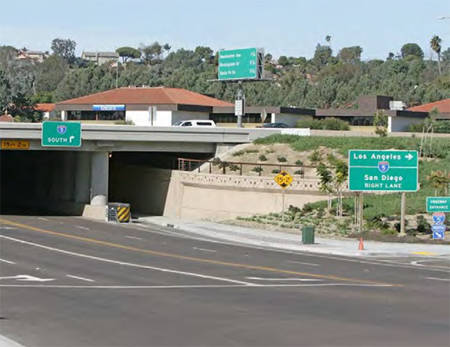
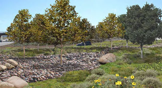
During construction of rail and highway improvements, visual impacts could include the presence of construction equipment, dismantling old structures and erecting new structures, light and glare impacts from nighttime construction work, and visual contrast impacts from newly disturbed soils along the rail corridor. These impacts would be temporary, with most occurring only during active construction periods along the corridor. Soil contrast impacts would last longer, but weathering of disturbed soils and revegetation would minimize the duration of these potential impacts. The PWP/TREP includes implementation measures within Section 5.4 that address water quality issues associated with construction staging and debris, disturbed soils, and timely revegetation/landscaping, which also address temporary construction impacts to visual resources.
5.7.4.1 Coastal Act Consistency Analysis Summary
Based on available project and environmental data, and the policies, design/development strategies and implementation measures included herein, the proposed PWP/TREP improvements would protect views to and along the ocean and scenic coastal areas, and would be visually compatible with the character of surrounding areas through employing sensitive site design, restoring and enhancing areas adjacent to and affected by corridor improvements, avoiding significant development encroachment into adjacent areas and landform alteration, and by applying measures to avoid and/or substantially reduce potential impacts to coastal visual resources; therefore, the PWP/TREP is consistent with Sections 30251 and 30253(b) of the Coastal Act.
5.7.5 Local Coastal Program Consistency
For LOSSAN rail projects included in the PWP/TREP that improve the movement of freight, the LCP policy consistency analysis provides guidance and background information for analyzing rail project consistency with Sections 30251 and 30253(b) of the Coastal Act, as appropriate and applicable (see Section 1.1.3 for additional discussion of LCP applicability to rail projects). The corridor's LCP visual resource policies are summarized with brief city-specific consistency analyses below; which also integrate and supplement the above consistency analysis for Sections 30251 and 30253(b) of the Coastal Act.
5.7.5.1 Local Coastal Program Consistency Analysis Summary
All of the LCPs include policies that mirror, in part, the requirements of Sections 30251 and 30253(b) of the Coastal Act, which require that scenic and visual qualities of coastal areas be protected, that new development be sited and designed to protect views to and along the ocean and scenic coastal areas, that natural landforms be minimally altered and be visually compatible with the character of surrounding areas, and that constructing protective devices that would substantially alter natural landforms along bluffs and cliffs not be required.
However, the certified LCPs also include a range of additional, detailed, and city-specific policies and development standards that address potential impacts to visual resources. Common policy requirements within the LCPs include:
- Minimizing grading and removal of vegetation.
- Revegetating graded and disturbed areas with native, drought-tolerant plant species.
- Moving utilities underground.
- Avoiding grading and development on steep slopes or unique topographic features, where feasible.
- Ensuring that new development is subordinate to the natural environment and that adequate buffers or transition zones (such as increased setbacks, landscaped barriers, greenbelts, open space, berms, and/or decorative walls) are provided between new development, and in some cases, particularly for transportation corridors, and adjacent open space and community areas.
- Protecting significant natural features including bluffs, rock outcroppings, natural drainage courses, wetland and riparian areas, steep topography, trees, and views, where feasible.
- Protecting views of the ocean, coastline and significant coastal resources.
- Protecting open space areas.
- Locating and designing site amenities such as fencing, retaining walls, signs, and lighting such that they do not obscure public viewsheds and are visually compatible with surrounding land uses.
City of San Diego
The City of San Diego LCP contains an extensive set of visual resource protection policies in the North City Land Use Plan, in addition to each of the five individual Community Plans affected by the proposed PWP/TREP improvements. The City's LCP includes several policies that address potential visual resource impacts associated with grading by requiring and/or recommending special grading techniques that minimize the appearance of substantial landform alteration (sculptured techniques, restoring previously graded or scarred hillsides, following natural contours, etc.). The LCP policies also focus heavily on buffer and landscape treatments to ensure development compatibility with existing land uses. The LCP, with its collective plan components, includes visual resource policies that are particularly unique to this portion of the corridor as follows:
- North City Land Use Plan
- Encourage preserving Torrey Pine trees in private as well as public areas.
- Encourage planting Torrey Pine trees in roadways and other landscaped areas.
- Promote street tree planting and beautification programs. Existing street trees should be protected.
- Prevent the destruction or removal of any tree, the trunk of which exceeds six inches in diameter, whether situated on public or private property. Where removal of any such tree is unavoidable under the circumstances (e.g., a diseased tree), adequate replacements should be required.
- University Community Plan
- Protect and take maximum advantage of the Torrey Pines Subarea's topography and unique natural vegetation.
- Ensuring that developments do not intrude into the designated open space areas.
- Preserving existing mature trees. When feasible, development should occur around and in between mature trees. If that is not feasible, consideration should be given to moving trees into temporary nurseries during construction. Transplanting is usually less expensive than buying new trees of equal size for the site.
- Planting trees in dense clusters to preserve and enhance the existing wooded character of this subarea.
- Preserve the natural finger canyons, which characterize the Miramar Subarea.
- Protect Rose and San Clemente canyons as natural regional resources, and preserve the open space character of the various finger canyons that traverse the subarea.
- Torrey Pines Community Plan
- Future development adjacent to the Torrey Pines Reserve Extension, San Dieguito Lagoon, and Crest Canyon areas shall provide for adequate buffer areas.
- Those disturbed areas of the Carroll Canyon Creek Corridor shall be revegetated and planted with a combination of native trees, primarily riparian woodlands species and native shrubs.
- All mature trees and other significant existing vegetation in this system (Carroll Canyon) shall be protected, including the riparian habitat located in the existing concrete-lined channels.
- The Plan recommends preserving Torrey Pines trees in private as well as public areas and encourages planting Torrey Pines trees in roadways and other landscaped areas. Should Torrey Pines trees require removal, relocating or replacing the trees shall occur whenever feasible.
- Torrey Hills Community Plan
- Prohibit encroachment and impacts of adjacent development, both private and public, on areas designated open space.
- The visual impact of all hillside development shall be minimized, with buildings, retaining walls and other improvements approximating to the natural landforms.
- Plant materials placed on any ridges or edges shall reinforce its natural profile and character.
- Slopes that are visible from surrounding communities shall be treated to imitate the natural topography.
- The top and toe of manufactured slopes should be rounded to make a natural transition to pad areas.
- Where soils and geologic conditions permit, utilize variable slope ratios to aid in achieving a more natural topography.
- Decorative/enhanced paving should be used at major intersections, monuments, and points of interest.
- Planting shall be designed in a manner that effectively enhances existing views or provides new view corridor opportunities into the open space corridor, major landforms or other visual amenities within the project.
- Within perimeter areas of development, landscaped buffers shall be provided to screen views of development from Los Peñasquitos Canyon Preserve.
- Landscaping in areas adjacent to Los Peñasquitos Canyon Preserve shall utilize native and/or drought-tolerant, non-invasive plant material.
- North City Future Urbanizing Framework Plan
- Outside the compact communities, the street edge should be designed to retain existing natural features and limit site improvements to landscape elements.
- Retain existing landforms, mature trees, and important rock outcroppings. The locations of driveways and utilities should avoid destroying important natural features.
- Where streets cross the open space system, bridge structures should be used to cross canyons.
- Minimize the use of sound attenuation walls by careful site planning that employs grade changes, berms, and landscape elements to provide acoustical and visual privacy.
- When sound attenuation walls must be used, they should not be visible from major arterial and collector streets. This may be accomplished by use of grade changes, berms and/or planted buffers between the wall and street, with a width of 50-100 feet recommended for the buffer.
- Development adjacent to ridges and bluffs shall minimize visual impacts to these topographic features through setbacks and landscaping, especially near major canyons or valleys.
- Structures located within the view of the park, if within 200 feet vertically and 50 feet horizontally of a ridgeline, shall be set back and below in profile so as not to be visually prominent from the future park.
PWP/TREP improvements would protect views to and along the city's most significant viewsheds including Torrey Pines Reserve, San Dieguito Lagoon, and the large adjacent canyons in this area. In addition, with sensitive site design, and adherence to the policies, design and development strategies and implementation measures included in the PWP/TREP, rail and highway development would be compatible with adjacent developed and open space areas. In addition, community enhancement projects included in the PWP/TREP would provide opportunities, in cooperation with the City, to enhance visual access to the city's significant natural resources via improved trail facilities to and from Peñasquitos Creek and Lagoon.
Proposed highway improvements would generally be designed and implemented consistent with the City's visual resource protection policies; however, the City's LCP, with its collective Community Plan components require that new development does not intrude into designated open space areas, as specified within the University Community Plan, and that all mature trees and other significant existing vegetation in Carroll Canyon be protected, as specified in the Torrey Pines Community Plan. In addition, the City's LCP prohibits encroachment and impacts of adjacent development, both private and public, on areas designated as open space within the Torrey Hills Community Plan. These visual resource policies do not include variance for special project features or circumstances. As such, although proposed highway improvements have been designed to limit encroachment into areas containing open space, mature trees, and significant vegetation, it is not feasible to completely avoid these resources as required by the City's LCP. As such, these policy requirements present conflicts that require an amendment to ensure consistency of the PWP/TREP improvements with the certified LCP. SANDAG and Caltrans are seeking amendments to the City of San Diego LCP, for which the standard of review would be Sections 30251 and 30253(b) of the Coastal Act. As discussed in the Coastal Act consistency analysis above, the proposed improvements would be consistent with Sections 30251 and 30253(b) of the Coastal Act; therefore, if required, LCP amendments would provide for consistency of the PWP/TREP improvements with the City's LCP.
City of Del Mar
The City of Del Mar LCP includes policies that address visual resources associated with views to and along the shoreline, and, particularly the city's coastal bluffs, and views of wetland areas including Los Peñasquitos and San Dieguito Lagoons. In addition, the city's visual resource policies speak often to ensuring that new development preserves the small-town character of the community. The following policies provide guidance in analyzing potential visual resource issues associated with proposed rail improvements that fall under PWP requirements:
- Preserve Del Mar's fragile coastal bluffs as a visual resource and avoid the risks to life and property associated with bluff failure and shoreline erosion.
- The BSC (Bluff, Slope, and Canyon) Overlay Zone is designed… to preserve the scenic sandstone bluffs and related canyons and steep slopes, which characterize the area within the zone. These unique landforms provide visual relief and diversity within the city, and they define and separate neighborhoods and communities physically, thereby enhancing the overall quality of Del Mar's coastal environment.
- Enhance public improvements along appropriate bluff top areas, which provide significant scenic vistas when such improvements are not in conflict with bluff preservation policies. Improvements shall include installing benches for scenic viewing at the western terminus of 11th, 8th, and 4th Streets and along the upper bluff area south of Del Mar Canyon.
- Retain the bluff top areas west of the railroad right-of-way between the southern border of the city and 15th Street in an open space condition to provide panoramic ocean views; to provide lateral access along the coastal bluff top, and to preserve and protect the adjacent fragile and scenic bluffs.
- Preserve views of the Pacific Ocean from Camino Del Mar through applying scenic view easements and related view preservation restrictions.
- Preserve views of the Los Peñasquitos Lagoon and the Pacific Ocean from Carmel Valley Road through applying scenic view easements and related view preservation restrictions.
- Retain and enhance the views of San Dieguito Lagoon along Jimmy Durante Boulevard and San Dieguito Drive through applying scenic view easements and related view preservation restrictions.
- Park and open space systems should be protected from adjacent land use that may infringe on scenic views.
- New or redevelopment projects within the Lagoon Overlay Zone shall include retaining the maximum amount of native vegetation on the site. Revegetation of sites within the Lagoon Overlay Zone shall include the use of non-invasive, drought-tolerant species native to the San Diego coastal region and which are compatible with adjacent wetland habitat species. Landscape plans including their associated berms, planters, and fences shall also be designed to minimize the disruption of view corridors from public roadways and parks.
- The viewsheds of the San Dieguito and Los Peñasquitos Lagoons shall be preserved and protected through applying the following criteria into the design of new and redevelopment projects within the viewshed areas of the San Dieguito and Los Peñasquitos Lagoons, respectively. - Compatibility of design with the existing and desired character of the surrounding area;
- Design of buildings to be subservient to the natural terrain; and
- Considering views from the lagoon and the surrounding roadways in the landscape and structure design.
- The review of projects within the specified viewsheds shall be conditioned to ensure continued conformity with the criteria listed herein. Such conditions shall include but are not limited to recorded view corridor easements or restrictions.
- The improvement or establishment of alternative transportation modes shall be designed to protect sensitive resources and retain the small-town scenic qualities of Del Mar.
As discussed in detail in the Coastal Act consistency analysis above, some proposed rail improvements would provide the opportunity for overall enhancement and restoration of visual resources in the corridor by placing facilities below ground, thus eliminating visibility of right-of-way structures from public viewsheds in the coastal bluff area of Del Mar and portions of Los Peñasquitos Lagoon.
The proposed rail improvements as part of future, project-specific environmental and/or phased federal consistency reviews would reference and adhere to, as applicable, the policies, design, and development strategies and implementation measures that protect views to and along the shoreline, Los Peñasquitos and San Dieguito Lagoons, and would ensure rail development compatibility with surrounding land uses within Del Mar. Guiding measures include minimization of grading, landform alteration and vegetation removal (in consideration of chosen alignment options), providing landscape treatments, and considering local design objectives, in consultation with local agencies, for developing specific design measures during project-level analyses to provide consistency, wherever feasible, with local urban design goals. These analyses would serve to guide proposed station architecture, parking lots, lighting systems, and other features to blend with the character of Del Mar.
The visual resource protection policies of the City of Del Mar LCP do not present policy conflicts for the proposed PWP/TREP improvements and therefore would not require that these policies be amended to implement the proposed transportation facility improvements.
City of Encinitas
The City of Encinitas LCP designates I-5 as a scenic highway and identifies a visual corridor on I-5 at San Elijo Lagoon. Unique to the City's LCP are policies that specifically address visual resources along the I-5 corridor that discourage urbanization and further include:
- Preserve the existence of present natural open spaces, slopes, bluffs, lagoon areas, and maintain the sense of spaciousness and semirural living within the I-5 View Corridor and within other view corridors, scenic highways and vista/viewsheds as identified in the Resource Management Element.
- Discourage development that would infringe upon scenic views and vistas within the I-5 corridor.
- Where it is necessary to construct retaining or noise-attenuating walls along the I-5 corridor, they should be constructed with natural-appearing materials and generously landscaped with vines, trees, and shrubbery.
The City's LCP also addresses development along major arterials and includes policies to enhance, harmonize with, and not detract from the natural features of the surrounding area including the following:
- Design roads to enhance scenic areas.
- Promote and encourage roadside and median landscaping.
- The City will initiate and pursue the landscaping of appropriate median and parking areas with trees on all new and existing arterial streets.
- The type and physical characteristics of the roadway should be compatible with the natural character of the corridor, and with the scenic highway function.
In addition, the City of Encinitas LCP includes special visual resource protection policies for the following vista points that provide views to coastal and inland viewsheds:
- Orpheus Street Park site
- Oak Crest Park site
- West end of "0" Street
- West end of "F" Street
- West end of "J" Street
- Leucadia Beach State Park
- West end of "I" Street
- Moonlight State Beach
- Swami's City Park
- Existing Vista Point on southbound 1-5
- Cardiff Beach State Park (south parking lot)
The City's visual resource policies speak often to ensuring that new development preserves the semirural character of the community. Additional policies included in the City's LCP address preserving natural features and mature trees to protect visual resources:
- Significant natural features shall be preserved and incorporated into all development. Such features may include bluffs, rock outcroppings, natural drainage courses, wetland, and riparian areas, steep topography, trees, and views.
- Preserve the existence of present natural open spaces, slopes, bluffs, lagoon areas, and maintain the sense of spaciousness and semirural living within the I-5 view corridor and within other view corridors, scenic highways and vista/viewsheds as identified in the Resource Management Element.
- The City will make every effort possible to preserve significant mature trees, vegetation, and wildlife habitat within the Planning Area.
- Mature trees shall not be removed or disturbed to provide public right-of-way improvements if such improvements can be deferred, redesigned, or eliminated. This policy is not meant to conflict with the establishment of riding/hiking trails and other natural resource paths for the public good, or with the preservation of views.
- The City will develop a program to preserve views that also preserves the appropriate vegetation and removes obstacles that affect views. Trees and vegetation, which are themselves part of the view quality along the public right-of-way, will be retained.
PWP/TREP improvements would protect views to and along the ocean and San Elijo Lagoon, and would not adversely affect the city's designated vista points that provide views to coastal and inland viewsheds. In addition, applying sensitive site design through adherence to the policies, design and development strategies and implementation measures included in the PWP/TREP, rail and highway development would be compatible with surrounding developed and open space areas within Encinitas. In addition, community enhancement projects included in the PWP/TREP would provide opportunities, in cooperation with the City, to enhance visual resources and create new scenic viewing areas by constructing trail and sidewalk improvements that would provide continuity in physical and visual access to and around San Elijo Lagoon.
Proposed highway improvements would generally be designed and implemented consistent with the City's visual resource protection policies that specifically apply to I-5 and/or transportation facilities; however, the City's LCP requires that new development preserve and incorporate significant natural features, such as bluffs, rock outcroppings, natural drainage courses, wetland, and riparian areas, steep topography, trees, and views. In addition, the City's LCP specifically states that "mature trees shall not be removed or disturbed to provide public right-of-way improvements if such improvements can be deferred, redesigned, or eliminated". Although proposed highway improvements have been designed to limit encroachment into areas containing natural drainage courses, wetlands, and riparian areas, steep topography and mature trees to the maximum extent feasible, it is not feasible to completely avoid these resources as required by the City's LCP policies. As such, these policy requirements present conflicts that require an amendment to ensure consistency of the PWP/TREP improvements with the certified LCP. SANDAG and Caltrans are seeking amendments to the City of Encinitas LCP, for which the standard of review would be Sections 30251 and 30253(b) of the Coastal Act. As discussed in the Coastal Act consistency analysis above, the proposed improvements would be consistent with Sections 30251 and 30253(b) of the Coastal Act; therefore, if necessary, LCP amendments would provide for consistency of the PWP/TREP improvements with the City's LCP.
City of Carlsbad
The City of Carlsbad LCP incorporates Sections 30251 and 30252 of the Coastal Act into the LCP and recommends several actions to address visual resource issues within the City, including:
- Sign control
- Parking requirements
- Implementing the Scenic Preservation Overlay Zone of the City of Carlsbad on the Occidental Land, Inc. property and throughout the Agua Hedionda Land Use Planning area
- Preserving natural vegetation on steep slopes
The City's Scenic Preservation Overlay Zone is applied throughout the Carlsbad Coastal Zone, including the Agua Hedionda Land Use Planning area to assure the maintenance of existing views and panoramas. The LCP indicates that development should undergo individual review to determine if the proposed development will obstruct views or otherwise damage visual resources of the area by considering appropriate height limitations and see-through construction, and by minimizing alterations to topography.
The LCP identifies I-5 as a major coastal access route and notes that visual resources of property adjacent to I-5 are of particular concern. The LCP indicates that visual access to over more than 80% of the Carlsbad coastline is unobstructed because of public ownership and the LCP strictly prohibits public improvements that would obstruct visual access to the coastline.
The LCP also identifies Batiquitos Lagoon as an important visual resource and requires that the visual quality of the lagoon be protected by ensuring that new development provides for adequate setbacks, preservation of slope areas, preservation of lagoon and riparian habitats, enhancement of the lagoon environments, and controlled grading. In addition to these provisions, the LCP further notes that the following measures should be implemented to further address the scenic and visual character of Batiquitos Lagoon:
- La Costa Avenue should be established as a scenic corridor pursuant to the City of Carlsbad General Plan Scenic Highway Element.
- Scenic corridor status shall be pursued for any public roadway to be established along a part or the entire lagoon north shore.
- Existing, mature, healthy vegetation, such as eucalyptus stands, shall be preserved where possible.
- Off-site signing along public roadways shall be prohibited.
- Viewpoints shall be established along the north and south shore areas (if and where environmentally sound and physically possible) to provide varied visual access to the lagoon.
- The development shall be clustered to preserve sensitive habitat areas and maintain the maximum amount of permanent open space feasible. At a minimum, the following policy shall regulate development in areas adjacent to the lagoon: - Existing mature trees shall be preserved.
PWP/TREP improvements would protect views to and along the ocean and other scenic coastal areas, including Buena Vista and Batiquitos Lagoon, and would ensure rail and highway development compatibility within the City of Carlsbad through sensitive site design, and by applying the policies, design and development strategies and implementation measures of the PWP/TREP to avoid and/or minimize potential visual resource impacts.
In addition to protecting existing visual resources in the city, community enhancement projects included in the PWP/TREP would provide opportunities, in cooperation with the City, to enhance visual resources and create new scenic viewing areas. A new trail facility would be constructed at Agua Hedionda Lagoon, which would greatly enhance viewing opportunities around the lagoon. Viewing opportunities at Batiquitos Lagoon would also be enhanced by adding new and/or improved trails, landscaping, and lighting.
However, the City's LCP requires that new development adjacent to Batiquitos Lagoon shall be regulated such that existing mature trees are preserved. While proposed highway improvements have been designed to limit encroachment into areas containing mature trees adjacent to Batiquitos Lagoon to the maximum extent feasible, it is not feasible to completely avoid removal of some nonnative woodland areas (generally consisting of eucalyptus, pine trees, and/or pepper trees) in this area. As such, this policy requirement presents a conflict that requires an amendment to ensure consistency of the PWP/TREP improvements with the certified LCP. SANDAG and Caltrans are seeking amendments to the Carlsbad LCP, for which the standard of review would be Sections 30251 and 30253(b) of the Coastal Act. As discussed in the Coastal Act consistency analysis above, the proposed improvements would be consistent with Sections 30251 and 30253(b) of the Coastal Act and therefore, if necessary, LCP amendments would provide for consistency of the PWP/TREP improvements with the City's LCP.
City of Oceanside
The City of Oceanside LCP includes policies that address the San Luis Rey River as a significant visual resource and requires new development to be sited and planned in a manner that retains the aesthetic values of the environment and to include design themes that complement the natural setting and history of the area (rustic, Spanish or Early California Mission design). The LCP seeks to establish viewing opportunities of the river and regulate on-site signs that would detract from the visual quality of the area and cause excessive glare or annoyance to surround properties.
The City of Oceanside LCP also protects visual resources by maintaining existing view corridors through public rights-of-way. The LCP encourages development of viewing areas at the Pacific Street Linear Park, the Buena Vista Lagoon Fishing area (provided by Eaton Hill developers) and from the frontage road between Highway 78 and the inland portion of Buena Vista Lagoon, and identifies the city's visual orientation to the Pacific Ocean as a major identity factor for the City of Oceanside. The LCP further addresses the protection of view corridors and overall visual resources through the following policies:
- Removing Obstructions
- No fencing, signage, planting, or structures should be placed in a way that will obstruct a view corridor. (Maintain existing view corridors through public rights-of-way.)
- Visibility of major destination and other orientation points should be enhanced through signage, planting, and upgrading of site and structure design.
- Proposed new development should consider surrounding views when designing building height.
- Framing/Directing Views
- Fencing, signage, planting, and structures shall be placed in a way that 'frame' a view and enhance it, directing the observer's eye to the view.
- Street rights-of-way carried through to the water and views along the waterfront provide a desirable sense of contact with the water.
- Screening of Unpleasant Views
- Trash bins, utility equipment, parking lots should be screened or softened by attractive fencing and/or planting.
- Remove or obscure distracting, cluttering elements.
PWP/TREP improvements would protect views to and along the San Luis Rey River, the ocean and other scenic coastal areas, and would ensure rail and highway development compatibility within the City of Oceanside through sensitive site design, and by applying the policies, design and development strategies and implementation measures of the PWP/TREP to avoid and/or minimize potential visual resource impacts. In addition to protecting existing views to and along the San Luis Rey River, community enhancement projects included in the PWP/TREP would provide opportunities, in cooperation with the City, to enhance visual resources and create new scenic viewing areas along the river. These opportunities would include constructing a new parking area, trailhead staging area, and other support amenities that would support the existing San Luis Rey bike path; enhancing the existing underpass under I-5 at San Luis Rey Drive with pedestrian access improvements; improving lighting and plantings, and installing public artwork.
The visual resource protection policies of the City of Oceanside LCP do not present policy conflicts for the proposed PWP/TREP improvements; therefore, these policies would not need to be amended to implement the proposed transportation facility improvements.
5.7.6 Visual Simulations
A series of visual simulations demonstrating existing conditions and potential changes from project implementation at key viewpoints along the I-5 corridor are included in this section. The following visual simulations include areas of enhanced landscape treatment, which would require an agreement from the subject City for future maintenance; therefore, these simulations do not depict baseline conditions. Photo-documentation of additional, existing vantages located throughout the NCC has also been conducted and is included in Appendix B for further reference.
Figures 5.7-4A through 5.7-4F are keymaps identifying the locations of each simulation within the NCC. The simulations begin with Figure 5.7-5A.
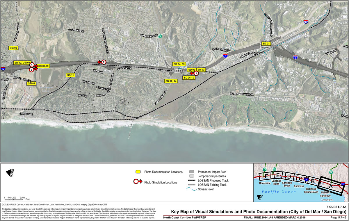
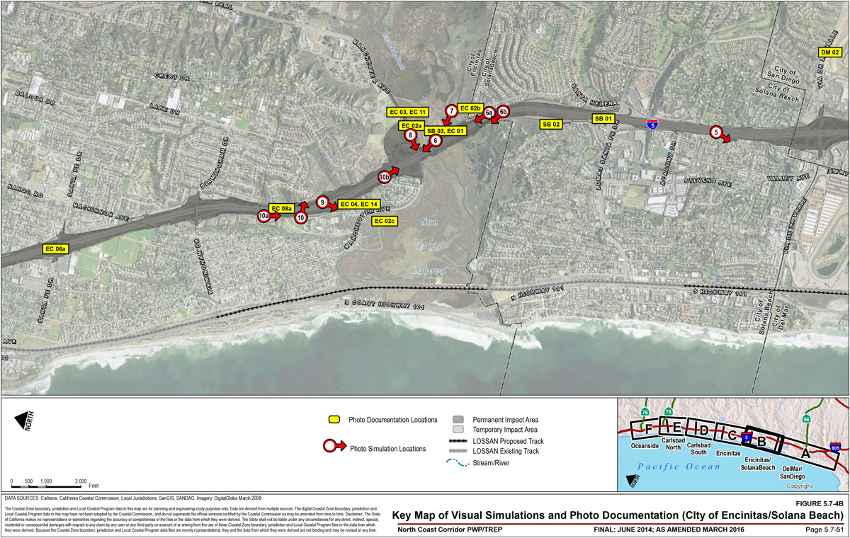
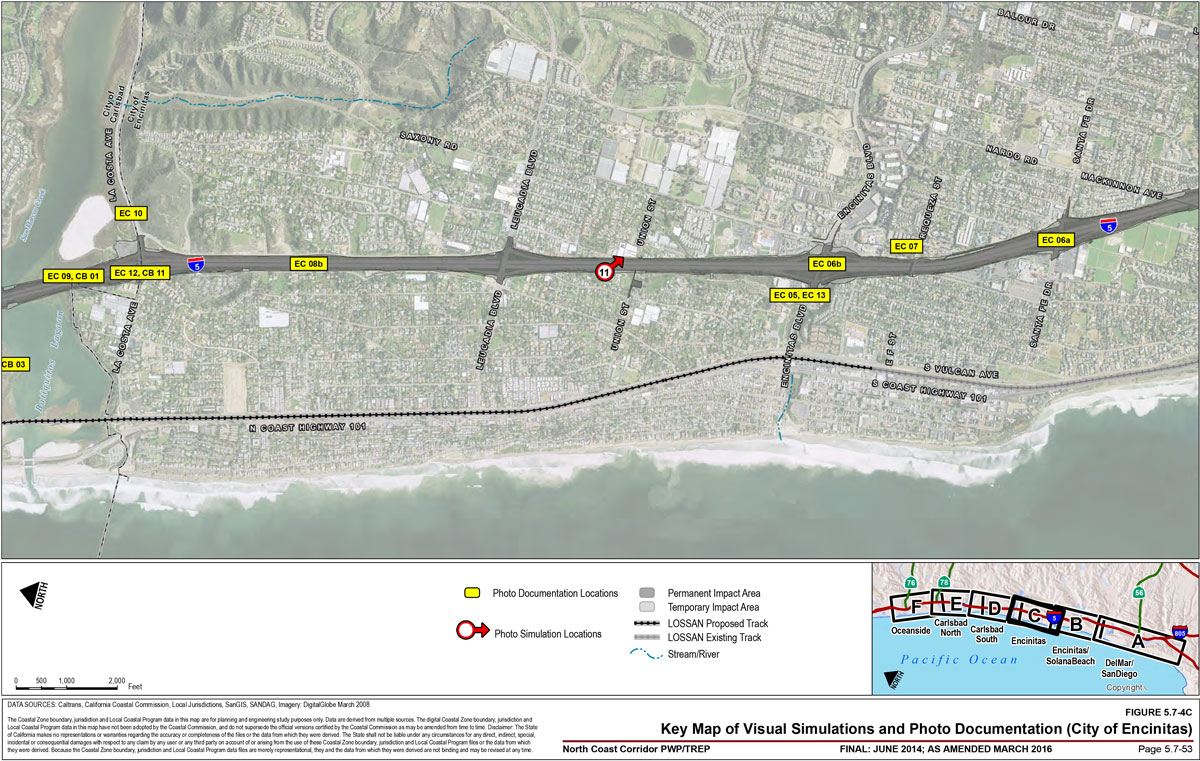
![Figure 5.7-4D – Key Map of Visual Simulations and Photo Documentation (City of Carlsbad [South]). For more information call (619) 688-6670 or email CT.Public.Information.D11@dot.ca.gov](/-/media/dot-media/district-11/images/pwp/fig5-7-4d-lg.jpg)
![Figure 5.7-4E – Key Map of Visual Simulations and Photo Documentation (City of Carlsbad [North]). For more information call (619) 688-6670 or email CT.Public.Information.D11@dot.ca.gov](/-/media/dot-media/district-11/images/pwp/fig5-7-4e-lg.jpg)