Westport Landslide Complex
Background
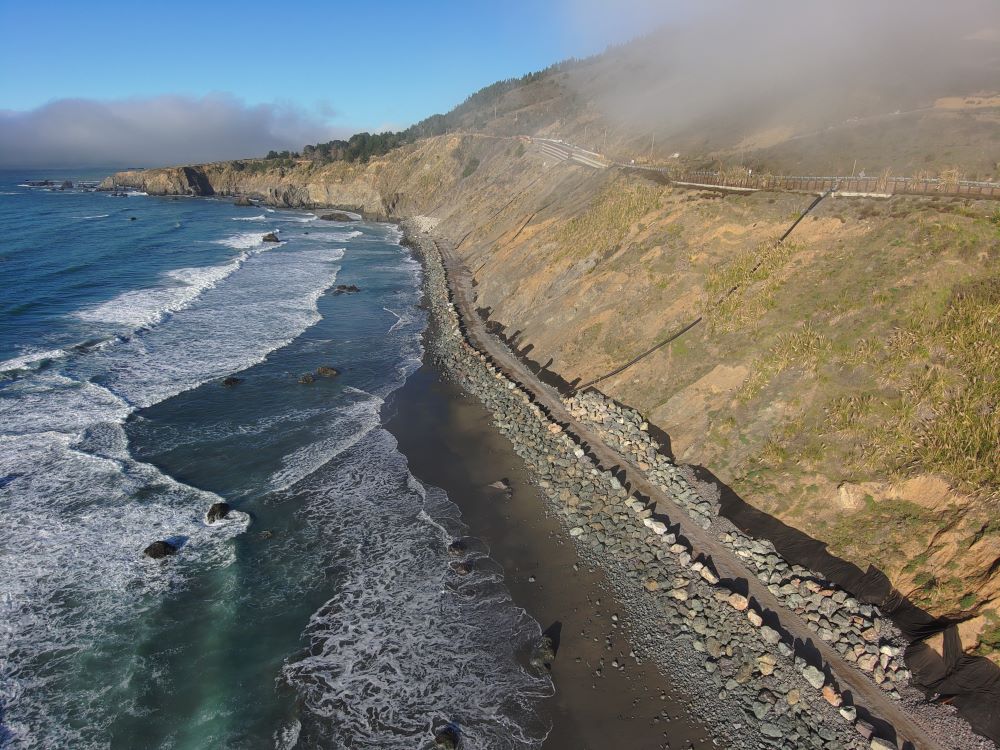
The Westport landslide complex is located on the Mendocino County coast approximately 1.3 miles southof the community of Westport. State Route (SR) 1 traverses the main landslide at an elevation of roughly 250 feet above the coastline. The width of the landslide at the roadway elevation is approximately 1,400 feet. In addition to the large, deep-seated landslide, there is also a series of nested landslides that encroach on the roadway from below, triggered by wave action and erosion along the coastline.
This landslide complex has a long history of movement, resulting in damage to the roadway prism and sometimes long-term lane closures while emergency repairs are undertaken. Without additional stabilization measures, future storm events are expected to contribute to additional roadway loss. Stabilization of the roadway is important because SR1 is a Minor Arterial route that provides mobility and access to the cities and unincorporated communities along the Mendocino coast.
Project Description
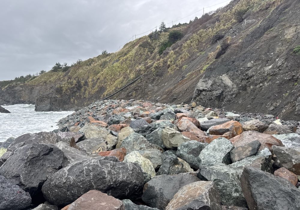
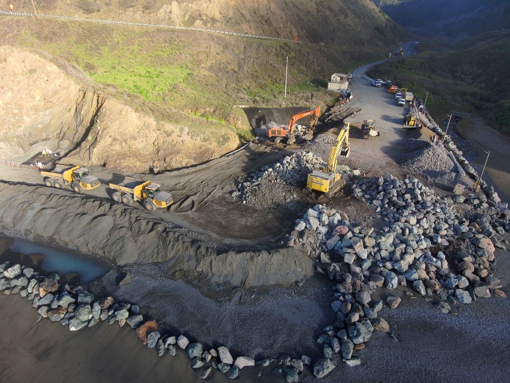
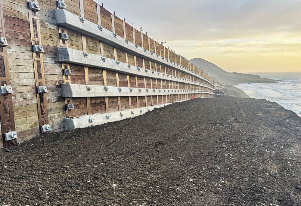
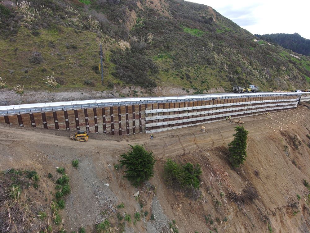
As a result of the winter storms of 2022/2023, a Director’s Order (project 01-0N4404) was issued for $110 million of repairs. The scope of this project includes geotechnical investigation and monitoring, extension of the existing northern soldier pile ground anchor (SPGA) wall, placement of rock revetment at the toe of the slope, and installation of horizontal drains. Based on results of the geotechnical monitoring, future work may include installation of a subsurface drainage system (to slow landslide movement) and additional retaining structures.
Construction Update
Caltrans and Myers and Sons Construction completed revetment work for the Westport Landslide Emergency project in March 2026, transporting 190,000 tons of rock to the site south of Westport. The project involved emergency repairs to Route 1, including coastal revetment for erosion control, a soldier pile ground anchor wall to maintain the road foundation, and horizontal drains to reduce ground water levels. These measures are designed to improve resiliency and long-term maintenance of the roadway.
Timeline
March 2024 through December 2026 – Emergency work via Director’s Order (project 01-0N4404). The project scope is to extend the existing SPGA wall north, place rock revetment at the base of the slope, and install horizontal drains. 
Budget Estimates
Director’s Order (01-0N440) budget $110 million
Travelers should anticipate delays of up to 30-minutes with 24/7 one-way traffic control in place on Route 1 south of Westport from the Blues Beach Trailhead to the Overlook.
Limited Access at Blues Beach during Emergency Project
Pedestrian access to the beach is permitted by using the designated public path and footbridge along Blues Beach Road.
Vehicle access is restricted to the designated parking area at the entrance of Blues Beach Road.
Contact Information
Project Manager
Trevor Goff
Public Information Officer (Media Inquires)
Manny Machado
(707) 496-6879, TTY 711
Last reviewed: April 2026
Westport Construction