
District: Headquarters
Contact: Will Arnold
Phone: (916) 956-0633
SACRAMENTO — With California making unprecedented investments to improve and expand safe options for pedestrians and bicyclists, the California Department of Transportation (Caltrans) unveiled potential project locations statewide to enhance safety and create a more interconnected system for people who use active means of transportation, such as walking and biking.
The Caltrans Active Transportation Plans website contains links to interactive localized plans and maps that detail current conditions and identifies areas for potential improvement as the state invests in these projects like never before. The current state budget includes $1.05 billion to create safer and more connected walking and biking options that reduce dependence on driving – a key strategy to reduce pollution from the transportation sector.
“Caltrans is working to create safer, more equitable transportation options for all Californians. These plans will guide the department’s investments to support walking and biking and connect people with jobs and services.”
Safety is Caltrans’ top priority and a key component of the Active Transportation Plans. At least two pedestrians or cyclists are killed on California's transportation system each day. Between 2010 and 2019, pedestrian fatalities increased more than 40 percent and bicyclist deaths went up more than 60 percent. Reducing the rate and severity of bicycle and pedestrian-involved collisions are critical to Caltrans’ goal of reaching zero fatalities and serious injuries on state highways by 2050.
The Caltrans Active Transportation Plans further the goals set out in the 2017 State Bicycle and Pedestrian Plan, Toward an Active California, which established statewide policies, strategies, and actions to advance active transportation and transit safety, mobility, preservation, and equity. In December 2021, Caltrans announced a policy requiring all new transportation projects to include safe and accessible options for people walking, biking and taking transit.
For more information on Caltrans Active Transportation Plans, visit catplan.org.

Location-based needs in Caltrans District 2, which covers the Northern California Mountains, identify where infrastructure investments would most benefit people walking and bicycling. Each Caltrans District has similar maps available at www.catplan.org.
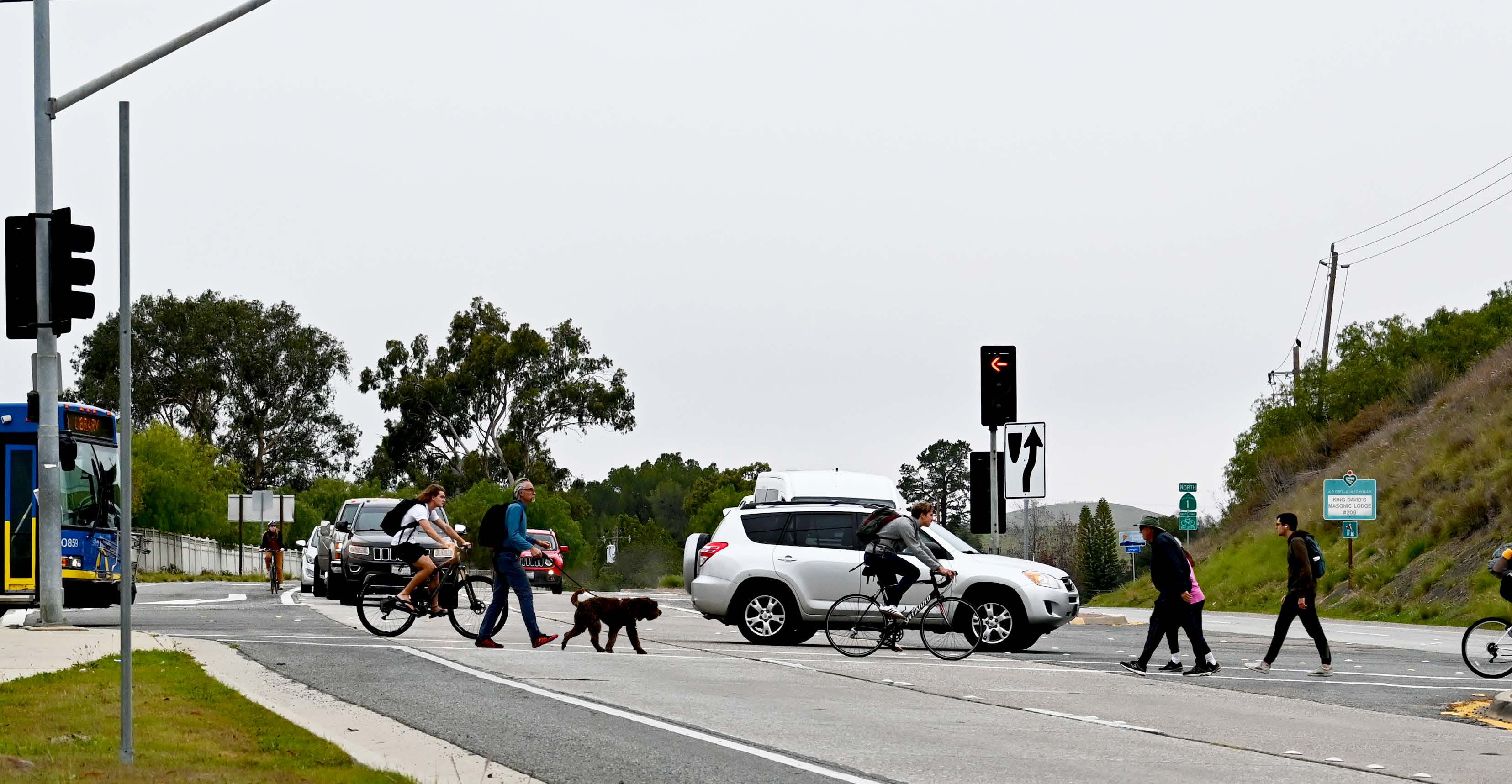
Walkers and bikers share the road with vehicles in Caltrans District 5, which covers California’s Central Coast.
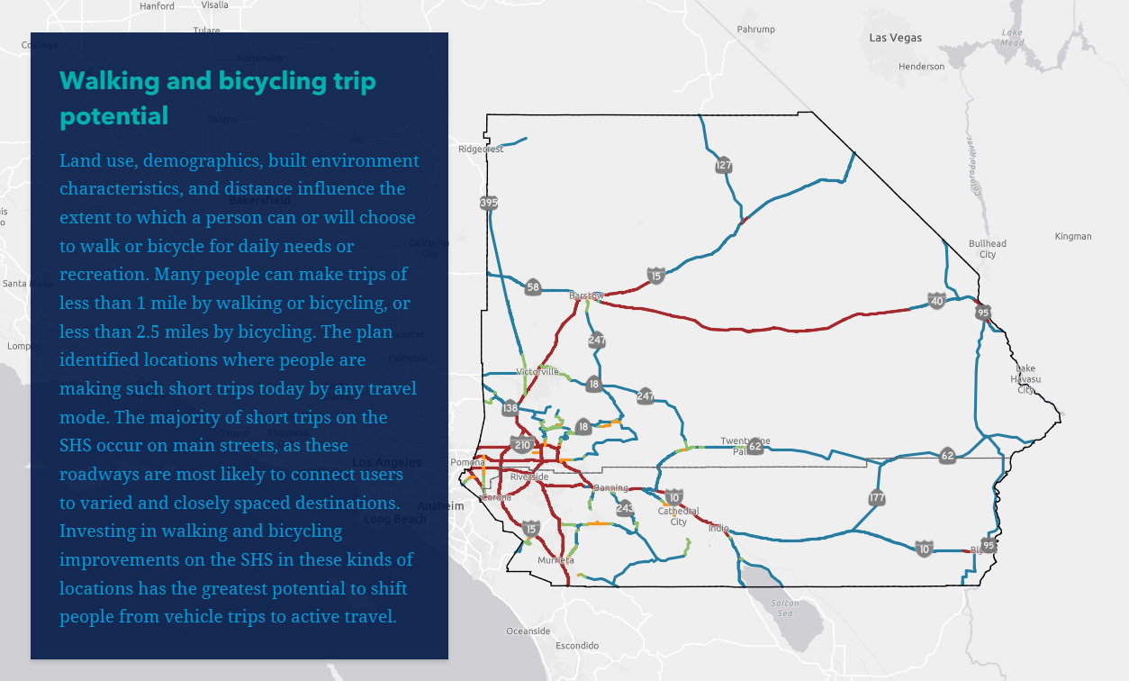
Walking and biking potential projects in Caltrans District 8, the Inland Empire. Each Caltrans District has similar maps available at www.catplan.org.
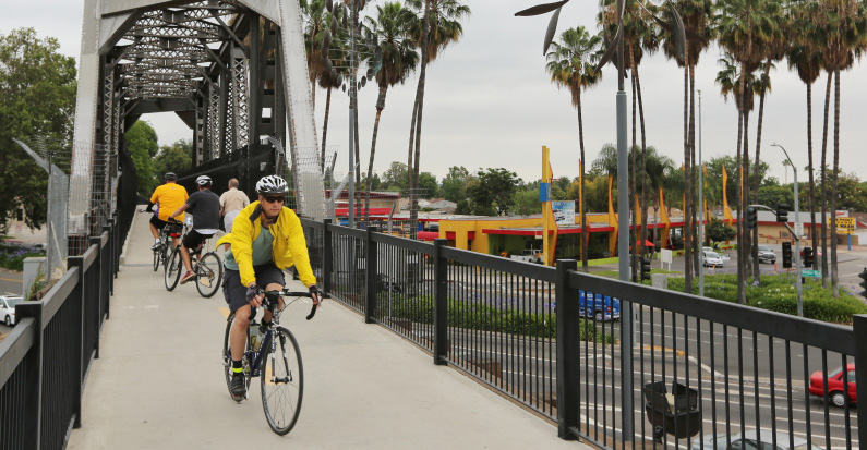
Bicyclists travel in Caltrans District 7, which encompasses Los Angeles and Ventura Counties.