Marin 101 Adaptation Planning Feasibility Study
Project Overview
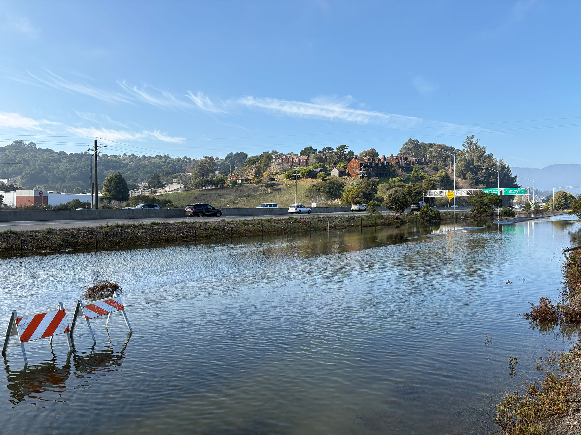
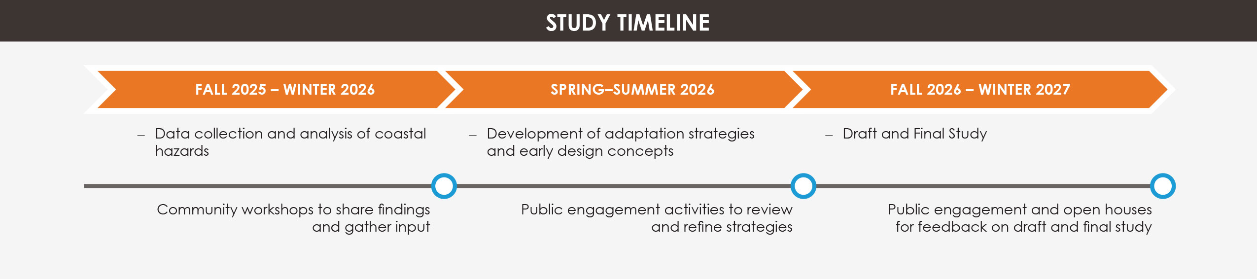
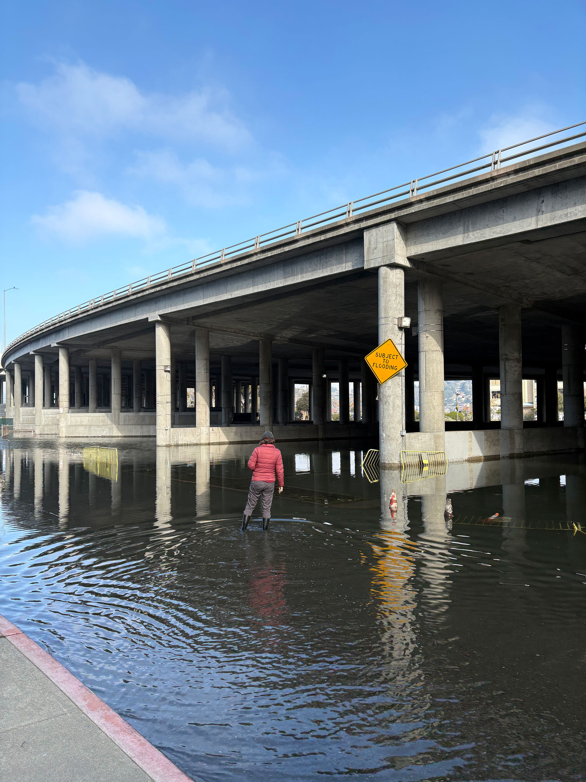
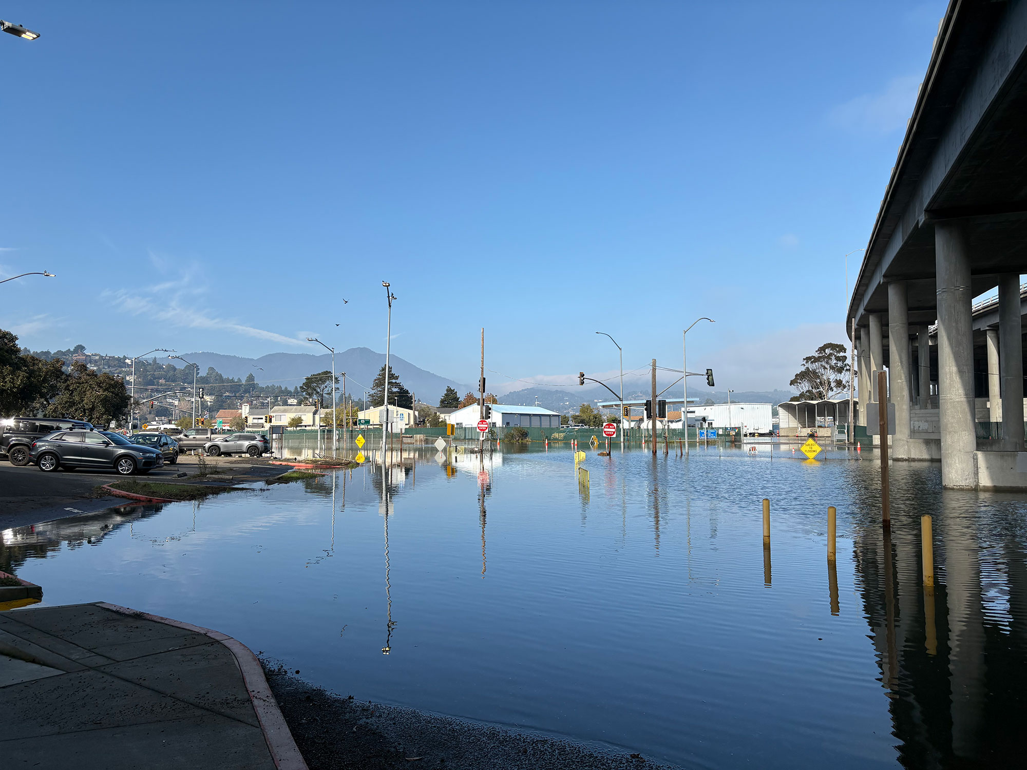
This two-year study will develop a long-term sea level rise adaptation plan for a segment of the US 101 corridor in Marin County. It will build on the Transportation Authority of Marin’s (TAM) existing sea level rise planning and previous local efforts to identify both near- and long-term adaptation strategies that improve corridor resilience. This study will include public outreach and early coordination with Caltrans and partner agencies to align on a shared vision to sea level rise and storm surge protection. Using hydraulic data and sea level rise projections, this study will recommend priority projects and strategies to support Project Initiation Document (PID) development and future investments.
Project Goals
- Develop a unified vision for climate adaptation and resilience.
- Initiate early coordination with regulatory agencies and key stakeholders.
- Reach consensus on hydrologic data, including sea level rise projections and foundational assumptions.
- Ensure robust and inclusive public engagement throughout the process.
Location
The US-101 Study Area begins in central San Rafael at the 2nd Street northbound off-ramps/southbound on-ramps and extends south to the Marin City/Sausalito interchange at Donahue Street, including a segment of State Route 1 (SR-1) that continues into Tam Valley. The Study Area segment is referred to as Marin 101. The corridor includes five study segments:
- Segment A: US-101 San Rafael Creek Bridge to Sir Francis Drake Blvd., including the I-580 interchange.
- Segment B: Sir Francis Drake Blvd. interchange to the US-101/SR-131 Interchange, including Lucky Dr. by the Corte Madera Creek.
- Segment C: US-101/SR-131 interchange to the Donahue St. on/off ramps in Marin City.
- Segment D: I-580 from the US-101/I-580 Interchange to the western approach of the Richmond/San Rafael Bridge.
- Segment E: SR-1 from Tam Junction to the US-101/SR-1/Manzanita Interchange.
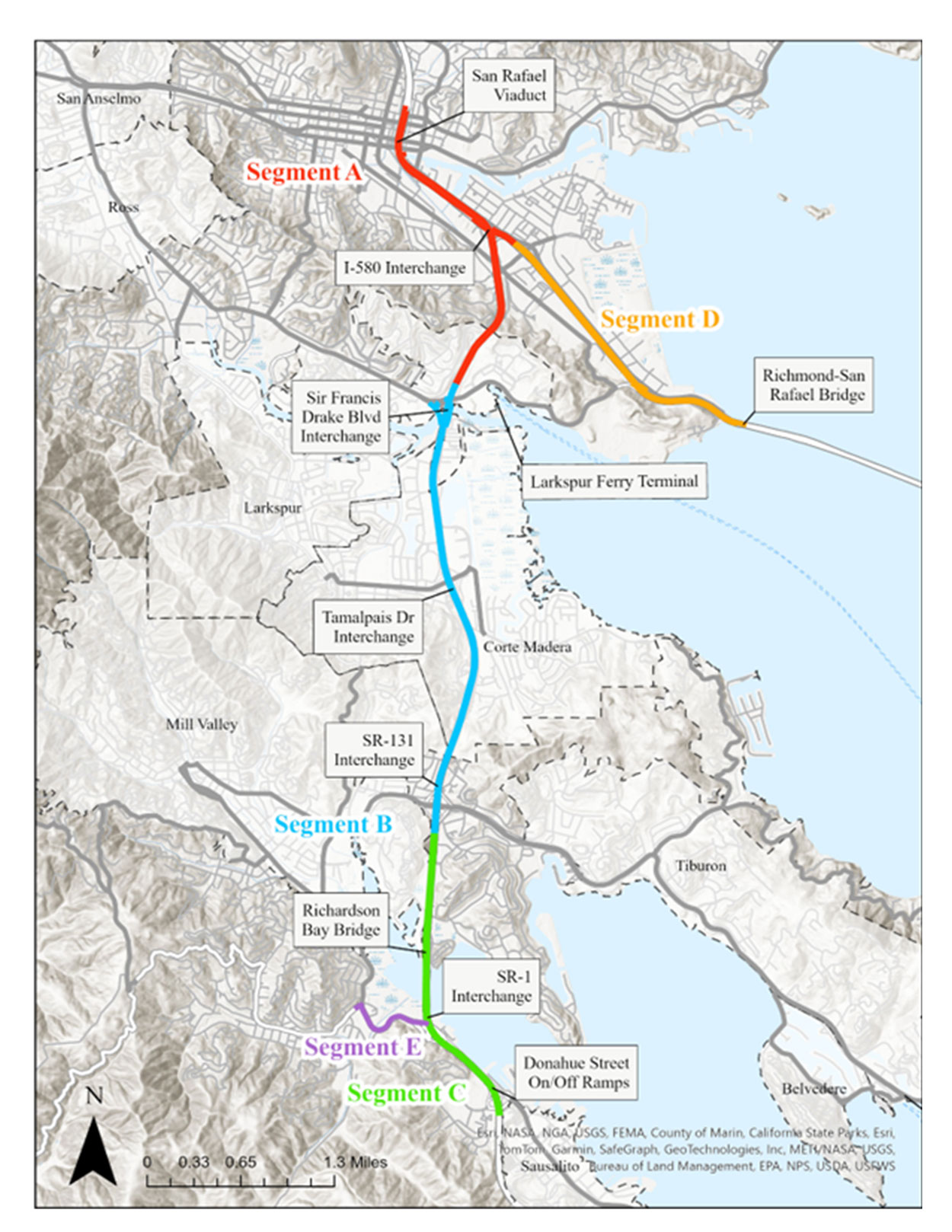
Marin 101 Adaptation Planning Feasibility Study Project Segments Map
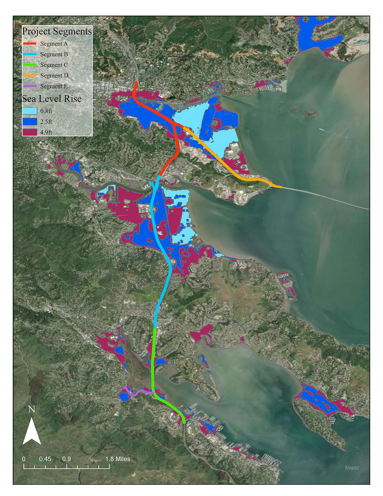
Marin 101 Adaptation Planning Feasibility Study Project Sea Level Rise Map
The Study Will Help the Community
- Plan for the future: Identify projects that will make Marin 101 more resilient to sea level rise and flooding from storms.
- Protect people and infrastructure: Explore ways to keep Marin 101 safe from flooding so drivers, bus riders, and emergency responders can travel reliably.
- Engage in the process: Provide opportunities for residents, workers, and businesses to share concerns and ideas about solutions.
- Coordinate across agencies: Bring together cities, counties, and state agencies so solutions work across communities.
The Marin 101 Adaptation Planning Feasibility Study frequently asked questions will be here.
Please check back for updated FAQs.
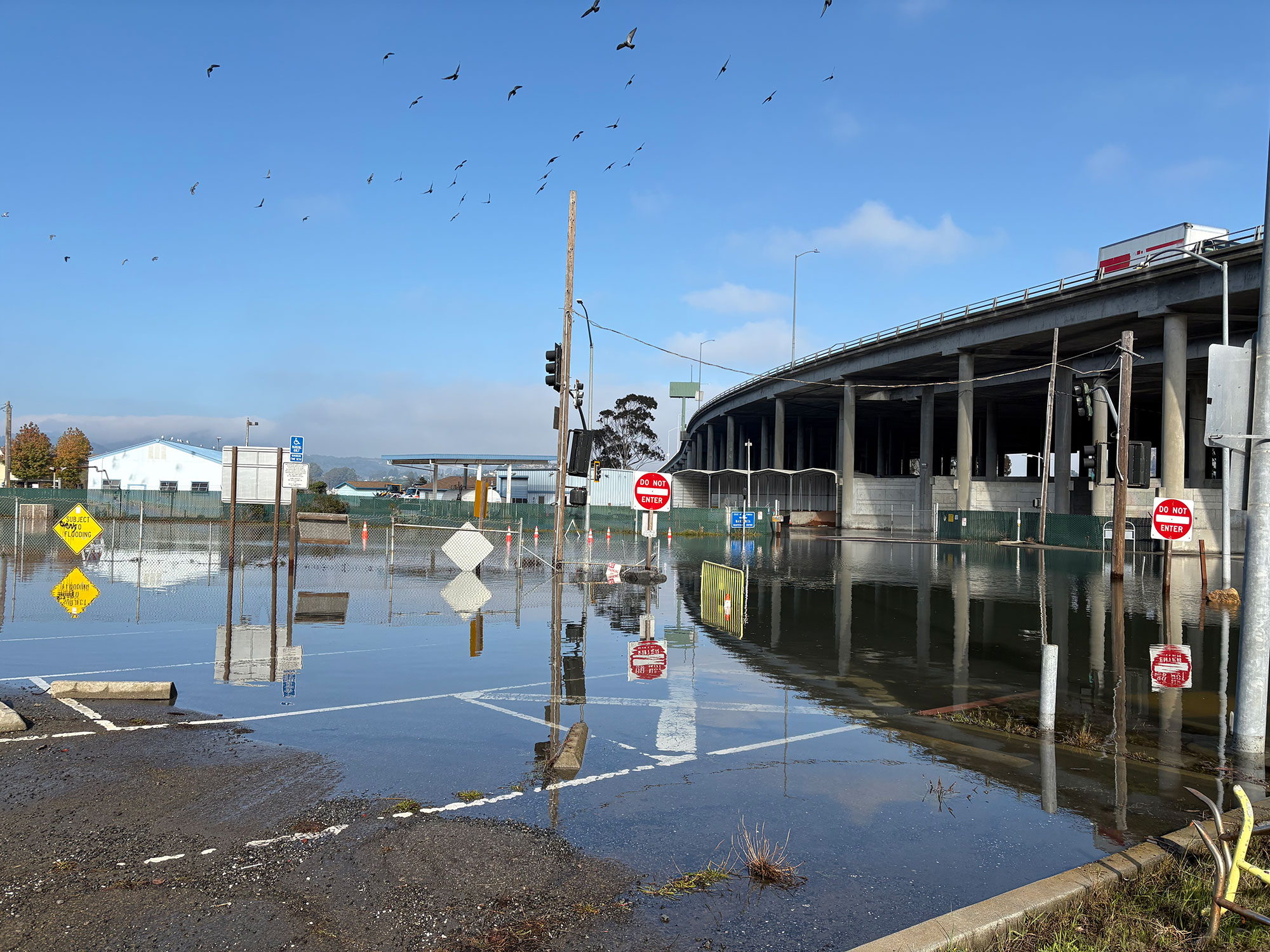
Marin 101 Adaptation Planning Feasibility Study Image Gallery
Project Contact
Please visit this webpage to stay updated of the progress of the study.
If you have questions about the Marin 101 Adaptation Planning Feasibility Study, please contact us at:
Marin101@dot.ca.gov.