
District 4 - Right of Way
Geospatial - MicroStation WMS Instructions
URL to connect to the WMS Service using the directions below:
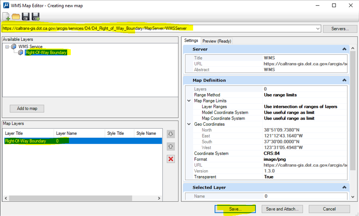
https://caltrans-gis.dot.ca.gov/arcgis/services/D4/D4_Right_of_Way_Boundary/MapServer/WMSServer
How to add RW_WMS to MicroStation:
Assign a coordinate system or open file with a coordinate system attached
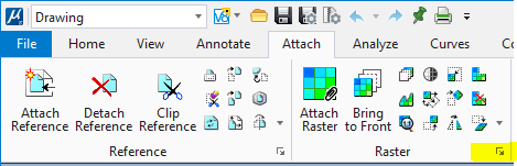
Click on the “Attach” tab
Open Raster Manager widow
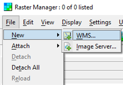
Click File > New > WMS
Copy the URL that has been provided above and paste it into the box, click "Enter"
Select the layer then click “Add to Map” click “Save”
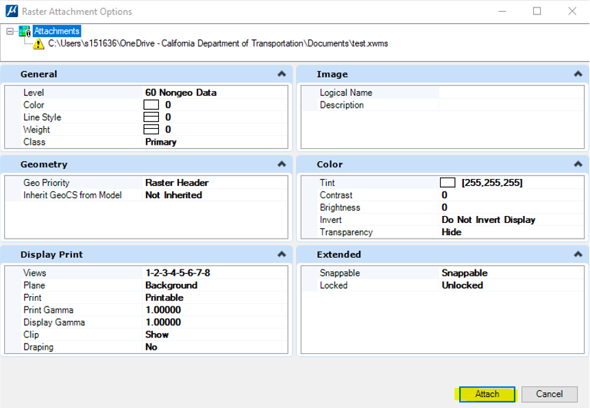
After saving the .xwms file > Click Attach Button
WMS will be attached to the drawing
Important Information before you Start
By clicking on the any of the links below, the user acknowledges that the geographic placement of the State Right-of-Way boundaries shown is approximate and subject to change. Caltrans makes no representations or warranties as to the accuracy or fitness for any particular use. Therefore, the user should NOT rely upon this system to determine the actual State Right-of- Way or for any other decision-making purposes.
The D4 WMS application is regularly updated for digital accessibility and will continue to function while updates are in progress. It is the users responsibility of the user to refresh any of the documents or maps that are in use.
For general mapping assistance or if you are using a screen reader or visualization software, click on the following link: