
Lanes scheduled to be closed from 5 a.m. to 6 p.m. starting on Wednesday, Sept. 3
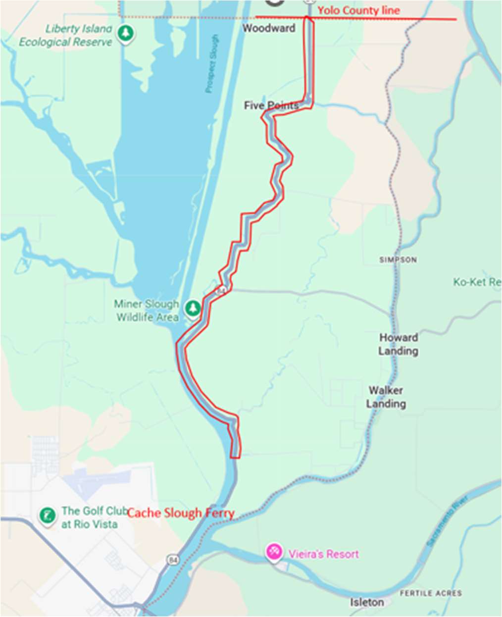
Solano County — Caltrans is scheduled to begin a paving project on State Route 84 (SR-84) from 0.4 mile north of Cache Slough Ferry to Yolo County Line in the Sacramento-San Joaquin River Delta area.
Portions of SR-84 will be closed in both directions starting on Wednesday, Sept. 3 from 5 a.m. to 6 p.m. each day and will continue through the duration of the project, scheduled to finish in about two months.
A one-way reversing traffic control will be implemented onSR-84 from 1.2 miles south ofSR-220 to the Solano/Yolo County line.
The purpose of this project is to preserve and extend the life of the existing pavement and improve the ride quality for the traveling public.
A full closure of Route-84 will be implemented from 0.4 mile north of Cache Slough Ferry to 1.2 miles south of SR- 220. During this full closure traffic will be directed to this detour:
Detour for Northbound Route-84
Drivers heading to Courtland take East Ryer Road to Route-220;Drivers will then make a left on Route 220 to Route-84;Then a right on Route-84 to continue North.
Detour for Southbound Route-84
Drivers coming south from Courtland to Antioch from Route-84;Can take a left on Route–220 to Ryer Road; Then take a right on Ryer Road toward Route-84;Then a right on Route-84 to continue south.
For 24/7 traffic updates, please visit 511.org: https://x.com/511SFBay
For real-time information, visit Caltrans QuickMap: https://quickmap.dot.ca.gov
Follow us on X: https://x.com/CaltransD4
Or call 1-800-472-7623, 1-800-427-ROAD for state highway conditions statewide.
| CleanCA.com | CleanWaterCA | #BeWorkZoneAlert | X | Facebook | YouTube |
###