
US-101/ SR-1 (MANZANITA) SEA-LEVEL RISE PROJECT
on SR-1 & US-101 in Marin City and Nearby Communities
 WHAT IS BEING PLANNED:
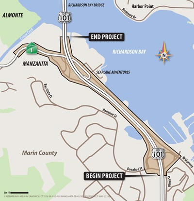
The California Department of Transportation (Caltrans) proposes to enhance access and mobility by addressing recurring flooding and sea-level rise impacts that affect State Route 1 (SR-1), US-101 and the Manzanita Park and Ride lot in the Richardson Bay area. The funding for this project has yet to be identified; however, this project is eligible for federal aid. The environmental stage is scheduled for the winter of 2024 once funding is secured, and Caltrans is scheduled to circulate the Draft Environmental Document (DED) externally in the summer of 2027.
WHY IS CALTRANS HAVING AN INFORMATIONAL MEETING NOW?
Caltrans is the lead agency and wants to inform the public of this new project that will reduce flooding and address sea-level rise in and around Marin City.
WHAT IS AVAILABLE:
If you have a question or want to find out more, please come to our hybrid public meeting on Thursday, February 29, 2024, between 6 p.m. and 7:30 p.m. at the Marin City Teen Center, 640 Drake Ave. Sausalito, CA. 94965.
You can log into the meeting HERE (https://bit.ly/3ud2ovl).
You can also email our project email at ManzanitaProject@dot.ca.gov.