
State Route 49 Grass Valley Wildfire Evacuation Project
Project Description:
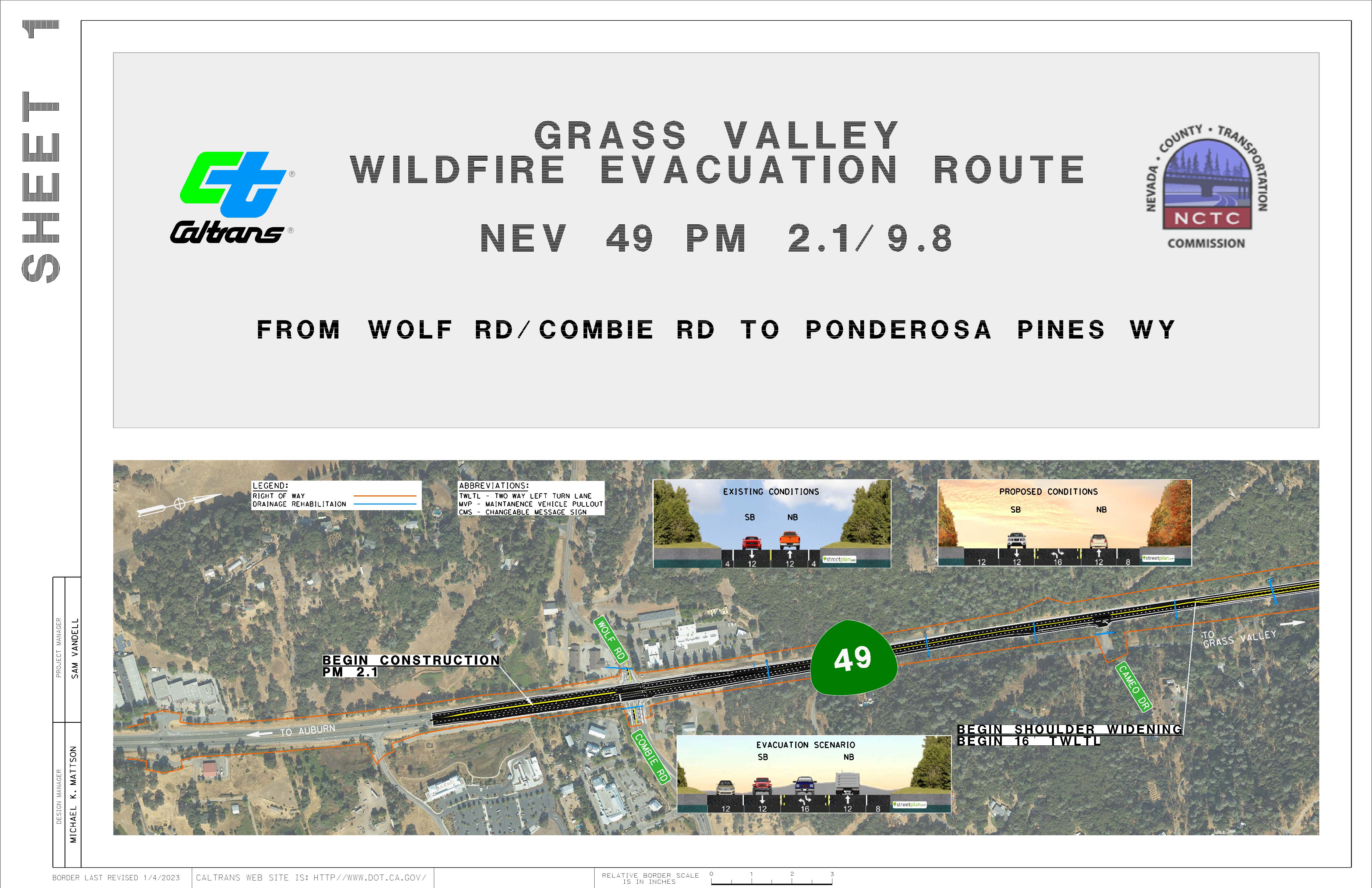
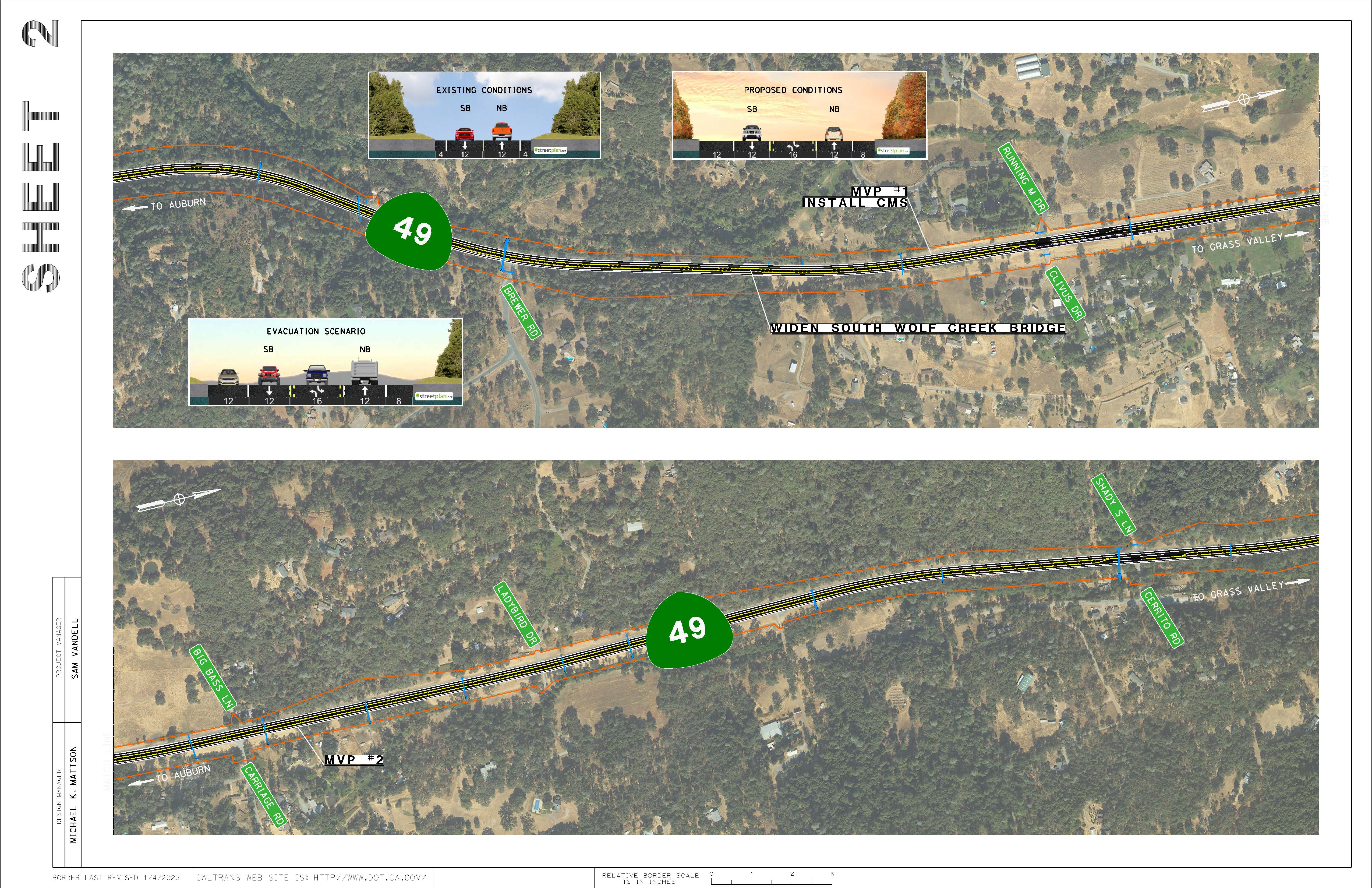
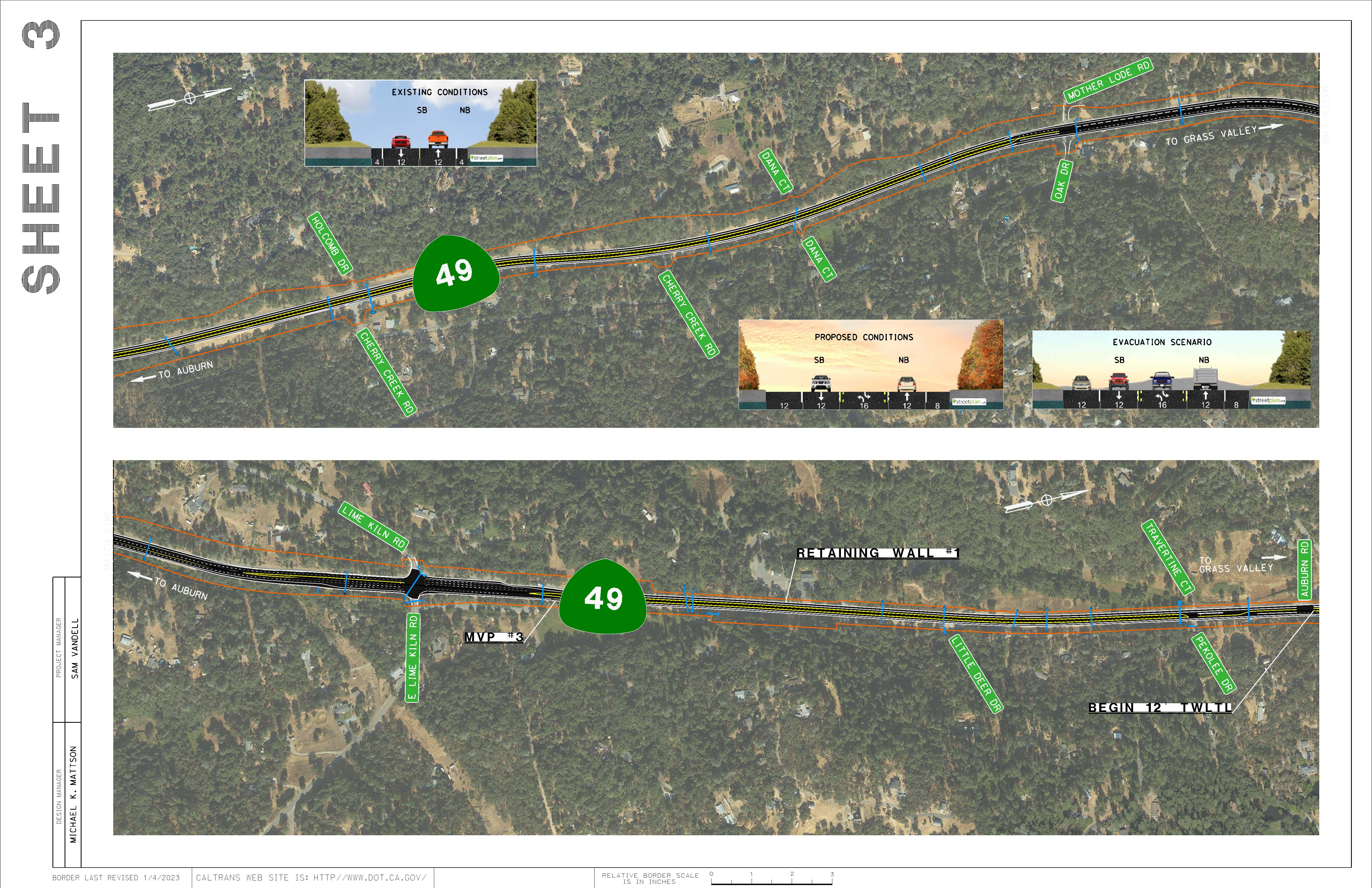
This climate resiliency project is proposed along State Route 49 (SR-49) in Nevada County between Wolf Road/Combie Road and Ponderosa Pines. The project proposes to widen shoulders, construct a continuous two-way left turn lane and realign the roadway. Additionally, this project will extend and/or replace drainage systems, widen the existing bridge at South Wolf Creek, construct retaining walls and replace and/or relocate lighting and signage. New traffic management system elements will also be installed, as well as the replacement of guardrails that do not meet current standards and provide concrete vegetation control under guardrails.
Project Map:
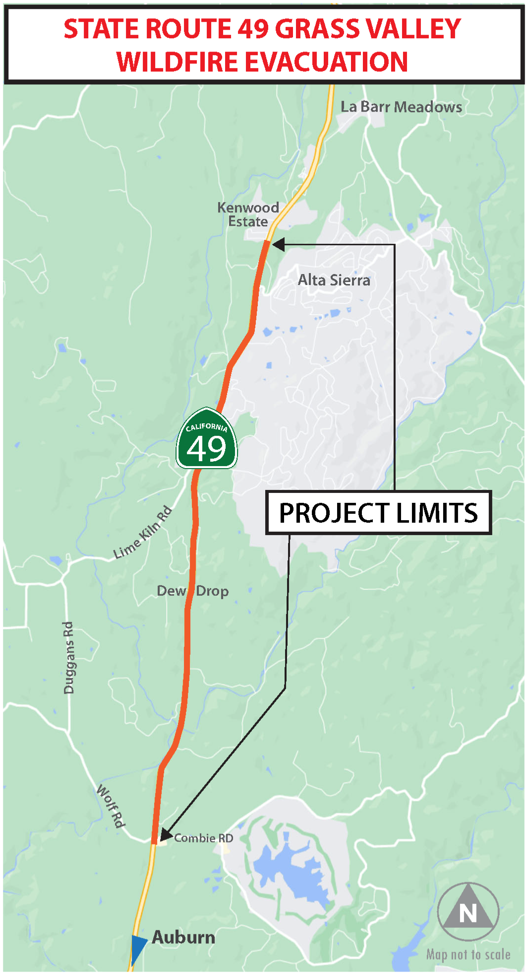
*Click to enlarge, hit back arrow to return to page.
Purpose and Need:
The purpose of this project is to address existing evacuation barriers identified at bottleneck locations along an eight-mile stretch of SR-49 within Nevada County. This project will widen the existing shoulders and create a two-way left turn lane to enhance traffic flow during emergencies. The project also aims to improve mobility, safety, equity, and climate resiliency.
In an effort to address the effects of climate change, SR-49 requires resiliency improvements to safely evacuate communities, provide safe and adequate access for emergency responders and recovery resources, provide the ability to implement contraflow operations, and remove existing evacuation barriers.
Notice of Determination, Final Environmental Document
Existing Photos vs. Proposed Simulations:
*Click to enlarge, hit back arrow to return to page.
Partners:
This project was development in partnership with the Nevada County Transportation Commission (NCTC). For additional information on their efforts please visit the NCTC website.
Project Costs
| Support Cost | $16.7 million |
| Capital Cost | $90.6 million |
| NCTC Contribution | $35 million |
| Total Project Cost | $107.4 million |
Project Schedule
| Project Approval & Environmental Document | January 2026 |
| Right of Way | April 2026 |
| Ready to List | May 2027 |
| Advertise Project | July 2027 |
| Begin Construction | October 2027 |
| Finish Construction | December 2030 |
Project Contacts
Sam Vandell, Project Manager, (530) 682-6478; sam.vandell@dot.ca.gov
Jeremy Linder, Public Information Officer, (530) 701-5209; jeremy.linder@dot.ca.gov