
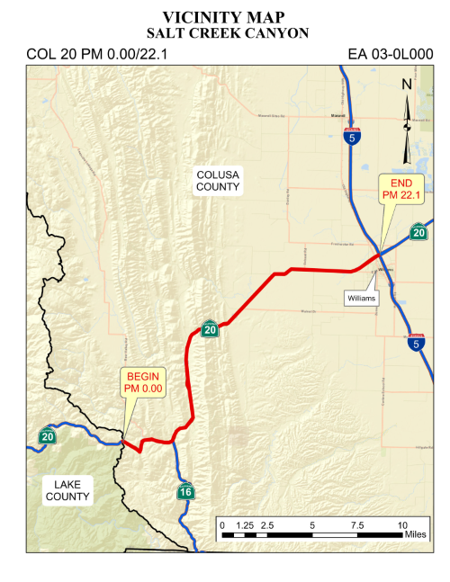
State Route 20 Salt Creek Canyon
Project Description:
The California Department of Transportation proposes a safety improvements project in Colusa County on State Route 20 extending from the Colusa/Lake County line, Post Mile 0.0 to Interstate 5 Intersection, Post Mile R22.1.
The project aims to enhance safety for the traveling public along this segment of SR 20 by widening nonstandard shoulders, improving sight distance/clear recovery zone(s), pavement rehabilitation, construction/repair/extension of earth retaining systems (ERS), and installation of shoulder backing and pavement edge treatment. Proposed project work includes drainage rehabilitation or replacement, installation and replacement of rock slope protection (RSP), installation of bioswale or bio strip for stormwater treatment, upgrade and installation of guardrail and end treatment to Manual of Assessing Safety Hardware (MASH) approved devices, addition of shoulder and centerline rumble strips, removal and/or trimming of existing trees and vegetation, and upgrade and installation of signing and striping.
Public Notice:
Notice of Preparation & Virtual Public Meeting State Route 20 Safety Improvement Project (pdf)
A virtual public scoping meeting will be held on Tuesday, June 9, 2026 from 5:30 p.m. to 6:30 p.m. on Webex at http://bit.ly/4uhSD95.
Please submit your comments via e-mail to 03-0l000.public@dot.ca.gov or by mail to the following address:
All comments must be received by 5 p.m. on July 7, 2026.
Project Map Location:
Purpose
The project aims to enhance safety for the traveling public and reduce the severity of collisions along this corridor.
Cost Estimate:
The project is programmed in the 2024 State Highway Operation and Protection Program (SHOPP) and is funded under the 20.XX.201.010 Safety Improvements Program.
| Support Cost | $12,080,000 |
| Capital Cost | $34,540,000 |
| Total Project Cost | $46,620,000 |
Schedule:
| Draft Environmental Documents | April 2027 |
| Project Approval & Environmental Document | November 2027 |
| Design Completed |
February 2029 |
| Advertise Project | April 2029 |
| Begin Construction | June 2029 |
| Complete Construction | Fall 2030 |
Project Contacts:
Mary Fesliyan, Project Manager, (530) 821-8265; Mary.Fesliyan@dot.ca.gov
Megan Reese, Public Information Officer, (530) 682-6145 megan.reese@dot.ca.gov