

District:
District 3 - Marysville
Sergio Aceves, District 3 Director
Contact:
Jeremy Linder (530) 701-5209
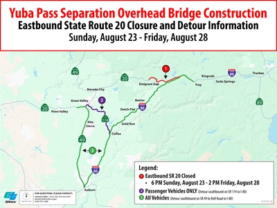
Placer/Nevada Counties – Caltrans is alerting motorists of a scheduled closure of eastbound State Route 20 (SR 20) this month between the Omega Scenic Overlook and the Interstate 80 (I-80) junction as part of the $112 million Yuba Pass Separation Overhead Bridge Project.
Eastbound SR 20 is scheduled to be closed from 6 p.m. Sunday, August 23 through 2 p.m. Friday, August 28 for falsework installation, which is the temporary support structure used to construct the new westbound I-80 bridge.
The eastbound I-80 off-ramp to SR 20 will also be closed during this time. Westbound SR 20 will remain open for travel between the I-80 junction and Nevada City.
The following detours are available for motorists:
- Motorists in the Nevada City/Grass Valley area looking to connect to I-80 will detour southbound on State Route 49 (SR 49) to connect with I-80 in Auburn or southbound on State Route 174 to connect with I-80 in Colfax. Large trucks are directed to only use SR 49.
- Eastbound I-80 motorists looking to connect to SR 20 will detour to Eagle Lakes Road and head back on westbound I-80 to reach the westbound SR 20 off-ramp.
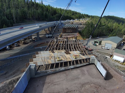
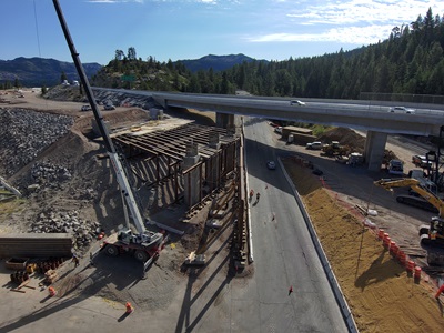
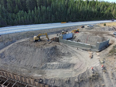
The extended lane closures will help minimize the duration of the work and improve worker safety. Additional closures are scheduled through October. The schedule is subject to change or be delayed due to weather, availability of materials or other unexpected events.
Flatiron Dragados of Concord is the prime contractor. The project will replace the existing bridge and improve freight efficiency along I-80 by increasing the load-carrying capacity for extra-legal load trucks. The project will also include construction of median barriers, upgrade drainage and installation of roadway weather information systems. Work is expected to be completed by winter 2027.
Caltrans District 3 is responsible for maintaining and operating 4,385 lane miles in 11 Sacramento Valley and Northern Sierra counties. Caltrans reminds motorists to “Be Work Zone Alert” and slow in construction zones for the safety of travelers and crews performing these improvements.
The department issues construction updates on X @CaltransDist3 and on Facebook at CaltransDistrict3. For real-time traffic, click on Caltrans’ QuickMap or download the QuickMap app from the App Store or Google Play.