
![]()
District: District 3 - Marysville
Contact: Raquel Borrayo
Phone: (530) 701-5209
FOR IMMEDIATE RELEASE
AUBURN — Caltrans announced today completion of a State Route (SR) 49 roadway rehabilitation and complete streets project in Auburn. The $47.4 million project included $4.7 million in funding from Senate Bill (SB) 1, the Road Repair and Accountability Act of 2017.
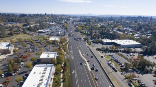 “This important SB 1 project will improve the road for the more than 42,000 motorists who travel this corridor daily between Auburn and Grass Valley,” said Caltrans District 3 Director Amarjeet S. Benipal. “This road rehabilitation and complete streets project provides a smoother ride for motorists and establishes a foundation for further upcoming pedestrian improvements from our local agency partners.”
Caltrans began construction on the rehabilitation project in August 2019 and improved a 4.4-mile segment of SR 49 between the Interstate 80/SR 49 separation and Dry Creek Road. Crews rehabilitated pavement and drainage, installed new traffic signals at Shale Ridge Road and Locksley Lane, and upgraded pedestrian and Class II bicycle facilities. Sidewalks and curbs along the project route were also upgraded to meet current Americans with Disabilities Act standards.
Flatiron West, Inc. of Benicia was the prime contractor for the project.
SB 1 provides $5 billion in transportation funding annually split between the state and local agencies. Road projects progress through construction phases more quickly based on the availability of SB 1 funds, including projects that are partially funded by SB 1. More information about other transportation projects funded by SB 1.
Caltrans District 3 is responsible for maintaining and operating 4,385 lane miles in 11 Sacramento Valley and Northern Sierra counties. For project updates, follow Caltrans District 3 on Twitter @CaltransDist3 and on Facebook at CaltransDistrict3. For real-time traffic, click on Caltrans’ QuickMap or download the QuickMap app from the App Store or Google Play.
###
State Route 49 northbound near Hulbert Way and the railroad overcrossing.
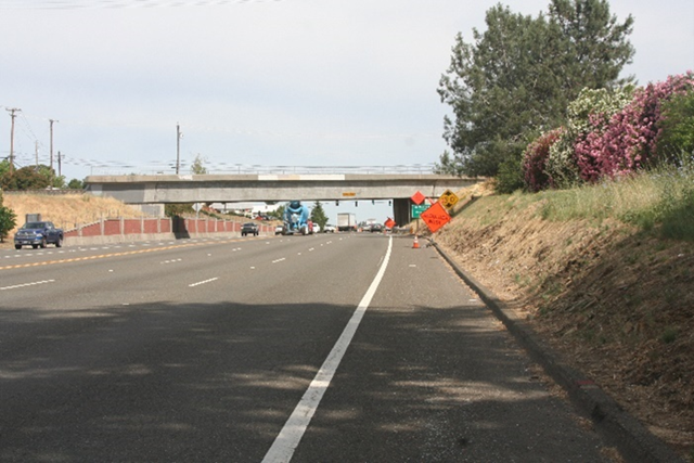
Photo taken before Caltrans installed a sidewalk and widened shoulders to improve pedestrian and bicycle movement.
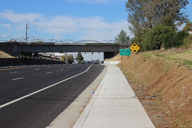
Photo taken after Caltrans installed a sidewalk and widened shoulders to improve pedestrian and bicycle movement.
State Route 49 (facing south) between Palm Avenue and Marguerite Mine Road.
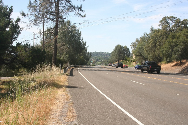
Photo taken before Caltrans constructed a sidewalk, widened shoulder and retaining wall with concrete barrier for improved pedestrian and bicycle movement.
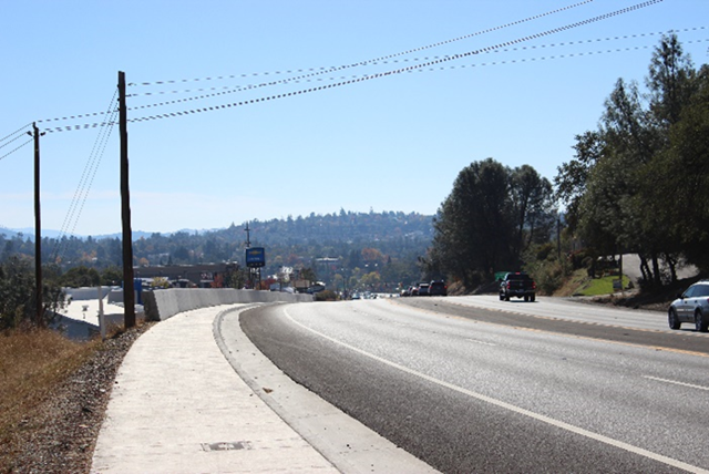
Photo taken after Caltrans constructed a sidewalk, widened shoulder and retaining wall with concrete barrier for improved pedestrian and bicycle movement.