District-10 Office of System Planning and Goods Movement
System Planning is the long-range transportation planning process for Caltrans. The System Planning process fulfills Caltrans’ statutory responsibility as owner/operator of the State Highway System (SHS) by evaluating conditions and proposing enhancements to the SHS. Through System Planning, Caltrans focuses on developing an integrated multimodal transportation system that meets Caltrans’ goals of safety and health; stewardship and efficiency; sustainability, livability and economy, system performance, and organization excellence. System Planning evaluates current and future need on the SHS utilizing analysis that considers multimodal traffic behavior, as well as the effects of planning on environmental and social justice.
Statute defines System Planning’s role in Caltrans’ stewardship of state highways. According to California Government Code Section (CGCS) §65086:
The Department of Transportation, in consultation with transportation planning agencies, county transportation commissions, counties, and cities, shall carry out long-term state highway system planning to identify future highway improvements.
Plans and Reports

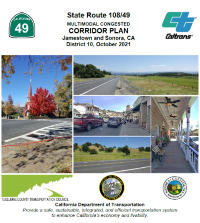
The 2021 SR 108/49 Multimodal Congested Corridor Plan (MCCP) is a collaborative effort between the Caltrans District 10 Office of System Planning and Goods Movement and the Tuolumne County Transportation Council (TCTC) to develop a corridor plan for SR 108/49 through Jamestown and SR 49 through Sonora. The purpose of the study is to prioritize for potential funding strategies that improve the multimodal performance of the highway in the more congested areas of Tuolumne County, as well as identifying active transportation enhancement strategies in compliance with California's Climate Action Plan for Transportation Infrastructure (CAPTI). Please contact Charles Carroll at charles.carroll@dot.ca.gov to request a copy of a PDF version of the MCCP and/or its appendix.

Caltrans District 10 prepared an active transportation plan to identify needs for bicycle and pedestrian improvements on, across, and near state highways. Criteria based Toward an Active California, along with weighting and location-based needs, led to a prioritization map that helps Caltrans better evaluate which gaps and location-based needs may be best suited to move into Caltrans project development phases over time. The public played a critical role by participating in map-based surveys. The surveys allowed people to tell Caltrans where they had bicycling and walking concerns on, across, and near the State Highway System. To learn more about the plan, you can access the website with the link below:

