District: District 3 - Marysville
Contact: Raquel Borrayo
Phone: (530) 701-5209
FOR IMMEDIATE RELEASE
Roseville — Caltrans is scheduled to close the westbound Interstate 80 (I-80) on-ramp at Atlantic Street and the nearby I-80 westbound #5 (right) lane tonight for construction activities.
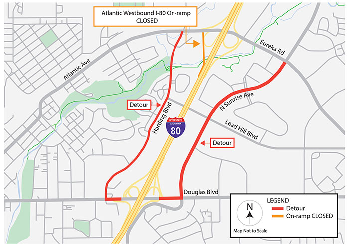
 Between 8 p.m. tonight and 5 a.m. Wednesday, the westbound I-80 on-ramp and the #5 (right) lane are scheduled to be closed for the removal of concrete barriers, known as k-rail, which will be replaced with orange traffic drums. Westbound I-80 motorists will be detoured along Harding Boulevard or North Sunrise Avenue to Douglas Boulevard during the overnight ramp closure. Weather or unexpected events may delay or prolong the work.
Overnight on-ramp closures may also be required April 24 through April 29. However, the schedule is still tentative with more details to be released once confirmed.
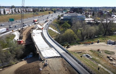
Construction activities are part of a $12 million project to expand the width of the existing single-lane Atlantic Street/Eureka Road/Interstate 80 westbound on‐ramp to three lanes and to replace the existing Miner’s Ravine Bridge to support the newly widened roadway. The project will reduce significant traffic backup and improve the operation of local streets and intersections.
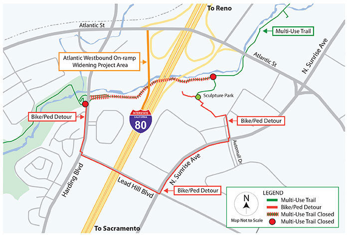
For the safety of bicyclists and pedestrians, a portion of the nearby Miner’s Ravine Multi-Use Trail remains closed for construction activities through mid-May. A bicycle and pedestrian detour on local streets is available during the trail closure.
Caltrans reminds motorists to Be Work Zone Alert and slow in construction zones for the safety of travelers and crews performing these improvements. The department will issue construction updates on Twitter @CaltransDist3 and on Facebook at CaltransDistrict3. For real-time traffic, click on Caltrans’ QuickMap or download the QuickMap app from the App Store or Google Play.
###
Westbound I-80 Atlantic Street On-ramp Detour
Miner’s Ravine Multi-Use Trail Detour