
Visual Impact Assessment (VIA) for Projects on State Highway System
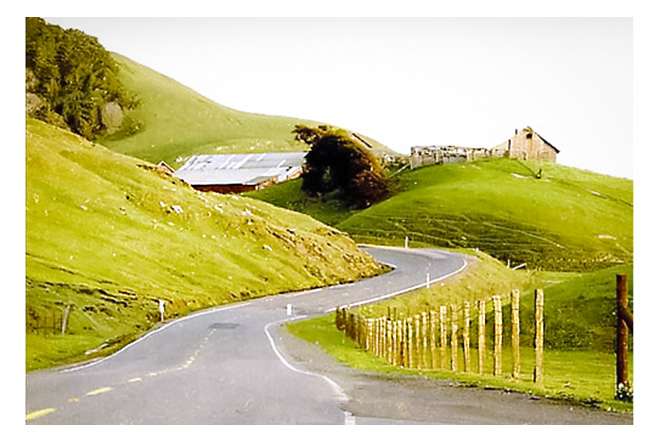
As seen in the above photo, landscape architects minimize visual impacts to California's cultural and scenic resources. This featured cultural landscape is located on Route 1 in Sonoma County.
Introduction
A Visual Impact Assessments (VIA) is a technical study required by the National Environmental Policy Act (NEPA) and the California Environmental Quality Act (CEQA) to assess potential impacts to the visual environment that can accompany highway improvements.
VIAs document the existing visual quality of the surrounding environment, include photo simulations and other visualization exhibits that illustrate the proposed project alternatives, evaluate the expected visual change caused by a project, assess public reaction to the expected change, identify visual impacts, and recommend measures to avoid, minimize or mitigate adverse visual impacts.
Caltrans landscape architects provide design expertise to protect and preserve California's scenic, aesthetic, and environmental resources. They also help protect the scenic quality of the highway corridor by performing VIAs as part of the environmental process for all transportation projects. California Department of Transportation policy requires that VIAs be performed by licensed landscape architects for all internal and external developed projects.
Caltrans VIA Handbook
Below you will find a new VIA Handbook. This is a comprehensive guide to understanding the VIA process when working on Caltrans projects. Within the Handbook, you will find guidance to understand what level of VIA document is recommended, what to consider and why, instructions for entering data into tables, explanation of terminology especially as it relates to FHWA, NEPA and CEQA terms along with a glossary, links to referenced material and links to the appropriate VIA level form or report that is needed.
Caltrans VIA Document Preparation
The following four sections correspond to the VIA level to be used. These four levels are: VIA Questionnaire, VIA Memorandum, VIA Standard Report and, VIA Advanced Report. Each section has links to an online training module and a word version of the form/memo/report (in annotated outline format) that is to be completed.
VIA Introduction and Questionnaire
Use the VIA Questionnaire Form and subsequent score as a guide to help determine a thorough, concise, and defensible level of VIA documentation.
- VIA Introduction and Questionnaire Training (Training Module 1 - online, run time: 35 minutes)
- VIA Questionnaire Form (Annotated outline, Word download)
VIA Memorandum Preparation
- VIA Memo Preparation Training (Training Module 2 - online, run time: 14 minutes)
- VIA Memo Document (Annotated outline, Word download)
VIA Standard Report Preparation
- VIA Standard Report Preparation Training (Training Module 3 - online, run time: 46 minutes)
- VIA Standard Report Document (Annotated outline, Word download)
VIA Advanced Report Preparation
- VIA Advanced Report Preparation Training (Training Module 4 - online, run time: 65 minutes)
- VIA Advanced Report Document (Annotated outline, Word download)
Additional VIA Guidance and Links
FHWA
Environmental
Landscape Architecture
Feedback and Support
Daniel Tillson-Rodriguez
Email: daniel.tillson-rodriguez@dot.ca.gov
Office: (916) 591-3912